
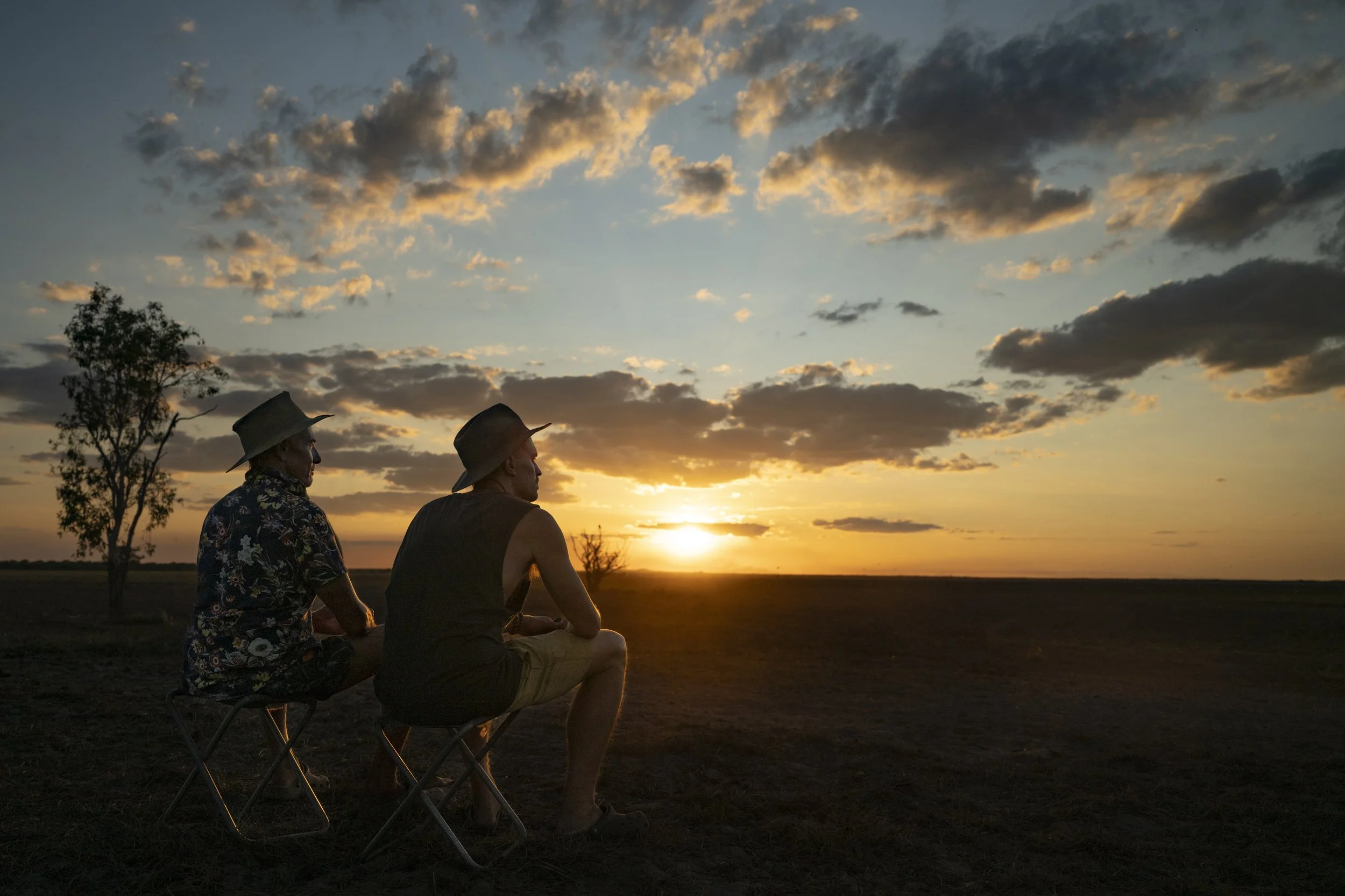
17. Whitsundays and K’gari
We moved down from the northernmost part of the east coast to see Whitsundays and K’gari (Fraser Island). We had a few days relaxing in Airlie Beach before joining a sailing trip for two nights around the Whitsundays. We then headed south from there to Hervey Bay and caught the ferry to K’gari which is the largest sand island in the world.

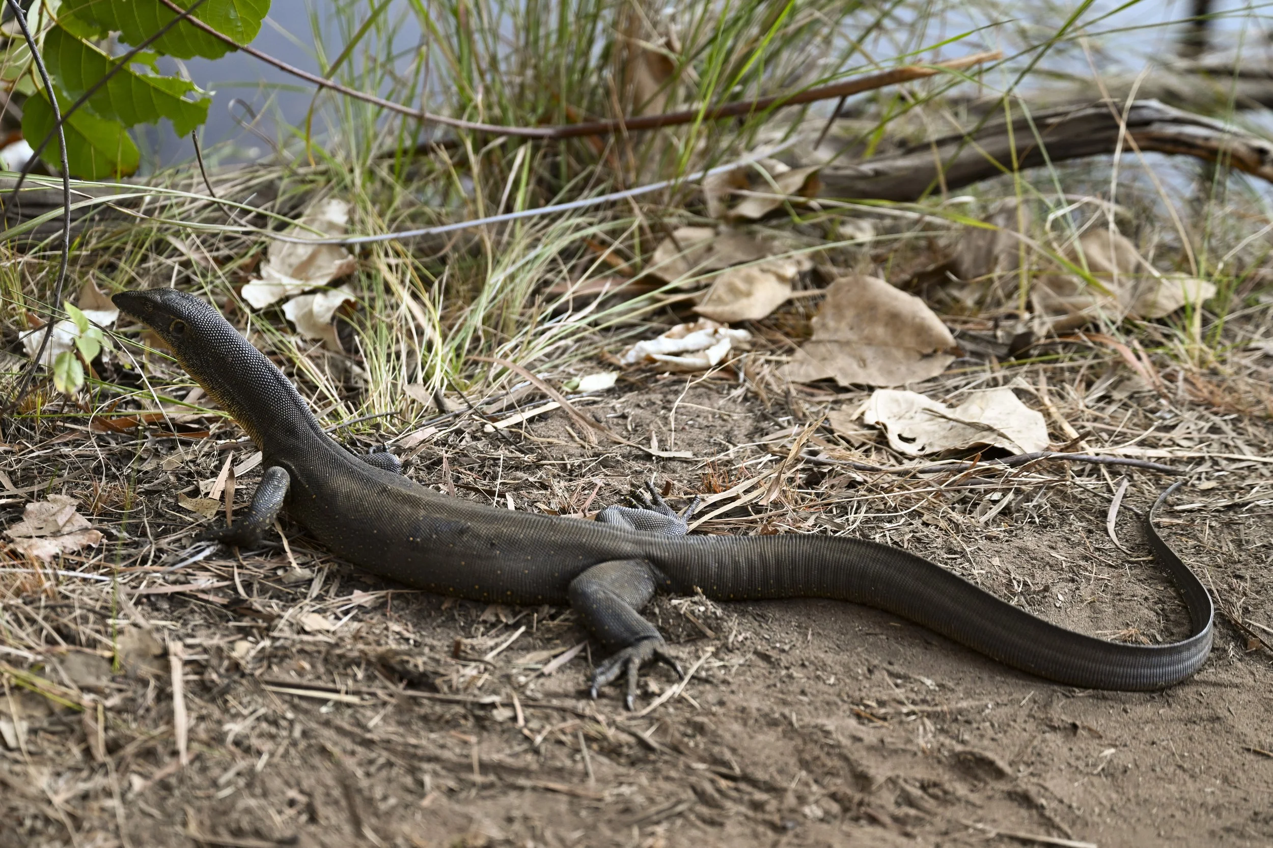
Clairview: We stopped overnight at Clariview on the drive south. I went for a walk along the beach in the morning and nearly stood on this fella

Magnetic Island: We stopped over at Townsville for two nights on our way south. We caught the ferry over to Magnetic Island which is a popular holiday island just off the coast. We rented a car to get around the small island. While it was fun to drive, the car was appalling. The steering did not engage properly - it was like trimming a sailing boat in a storm. Because there was so much loose movement in the steering, the car would just veer off to the side without any warning. There were other issues with such a wreck of a car but the steering was the highlight.

Hamilton Island: We took a day trip from Airlie Beach over to Hamilton Island. It is a very nice holiday island

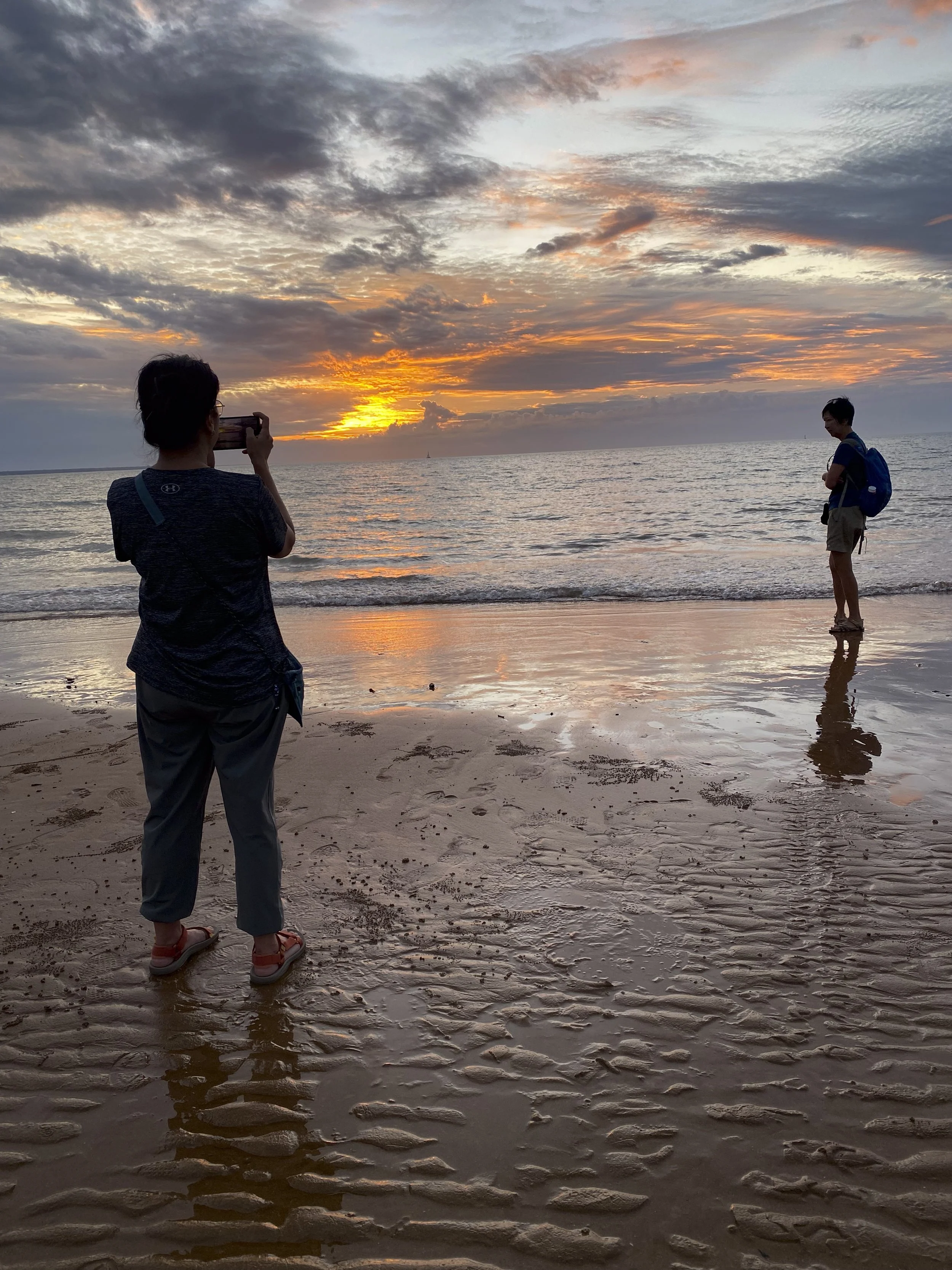
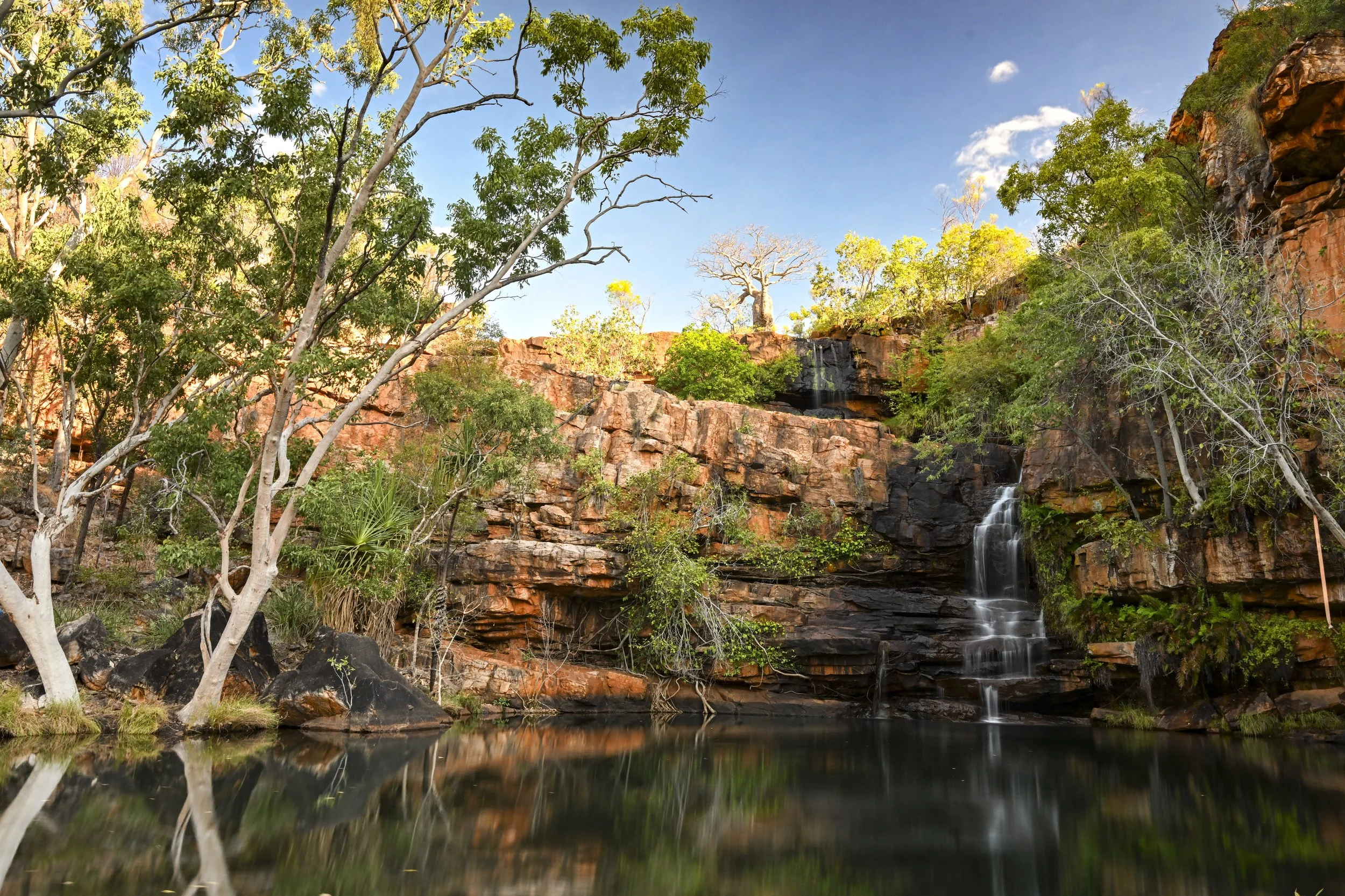
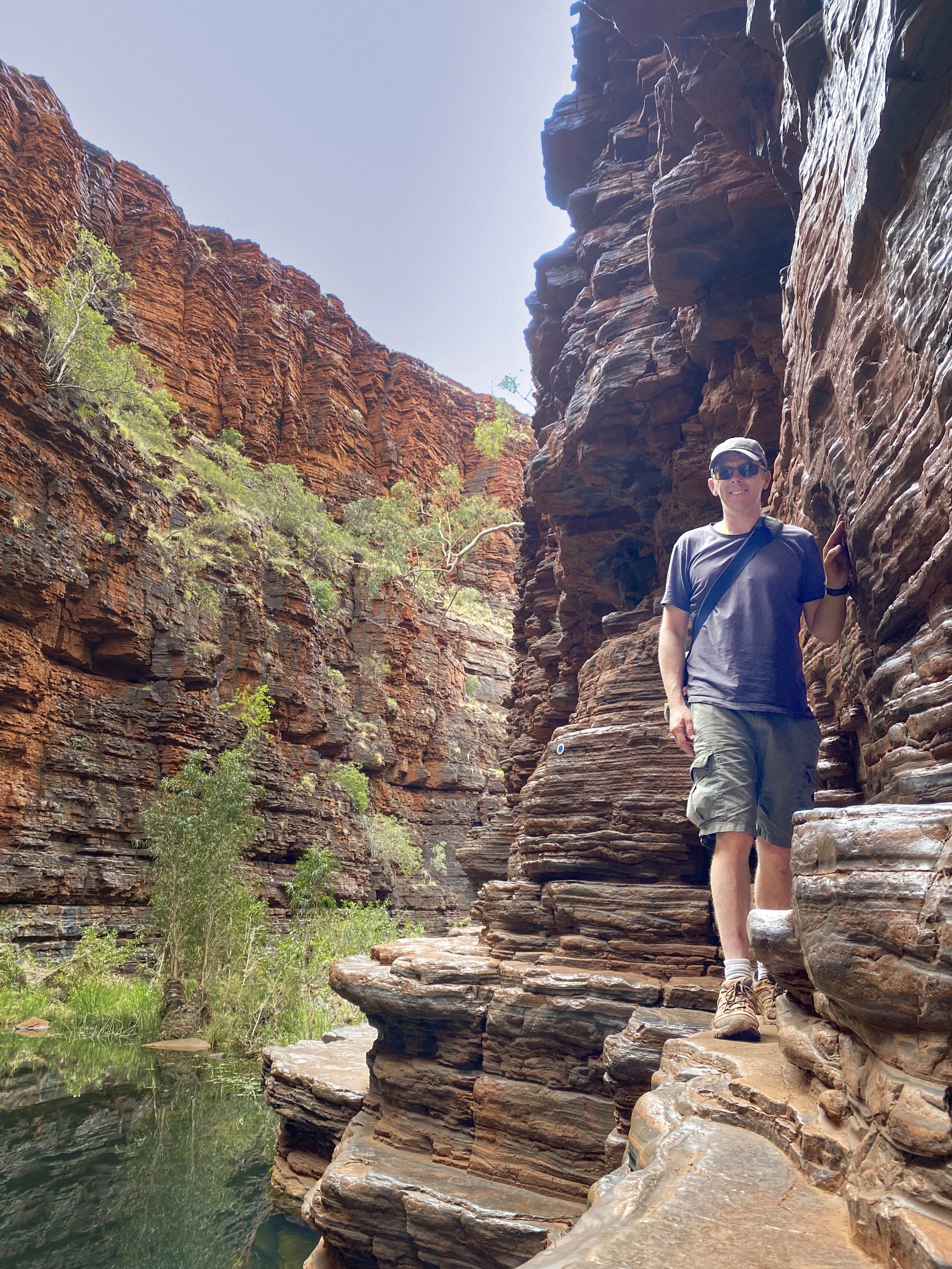
Whitsunday Island: The view from a look out on Whitsunday Island. There are worse places…

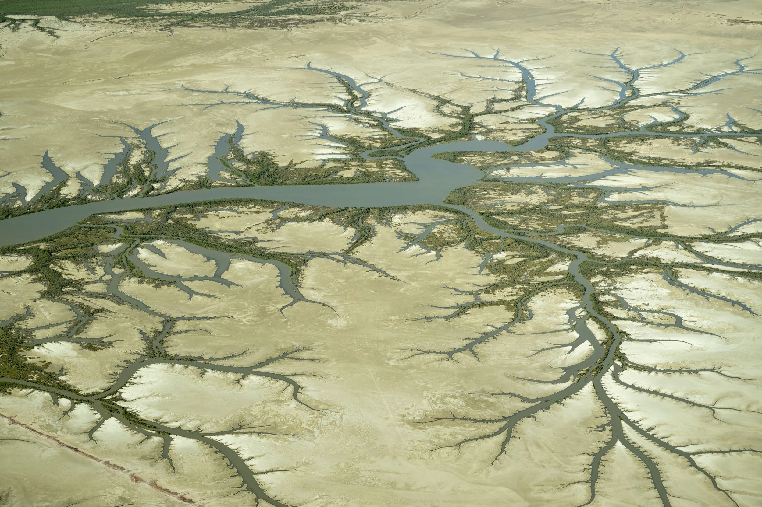
Whitsunday Island: Aerial view of Whitehaven beach on Whitsunday Island. If you look closely you can see all the dots of people near the mouth of the channel (on the right). There is a fallen tree here which is a popular instagram photo. Most people do not seem to move far along the beach but rather hang around that spot

Whitsunday Island: Here is the tree…

Whitsunday Island: The instagramers left and the Gen X got a photo

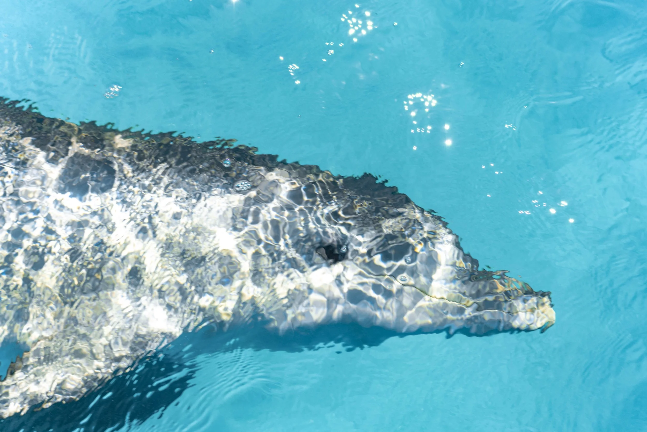
Whitsunday Island: There were a lot of stingrays in the water

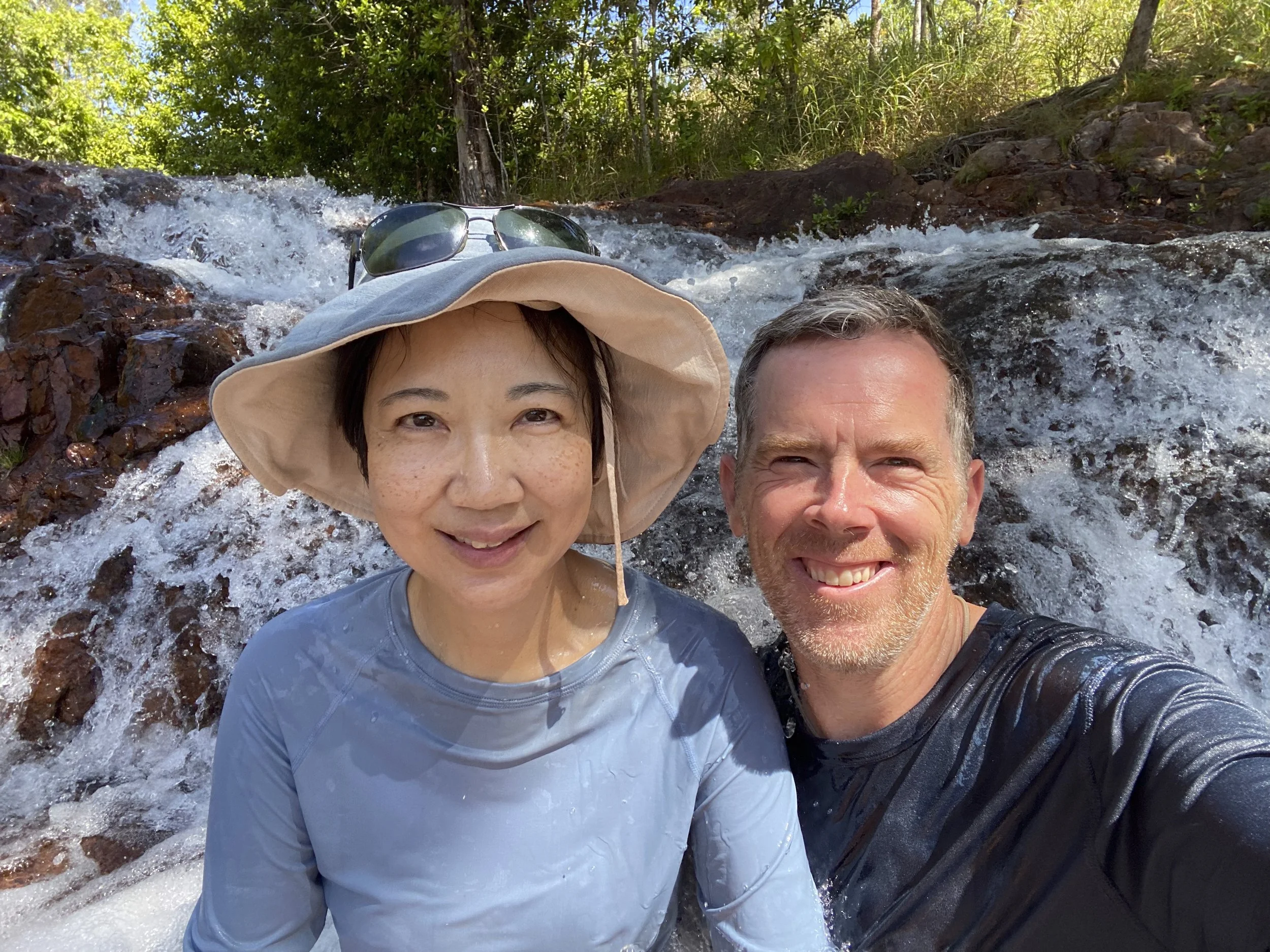
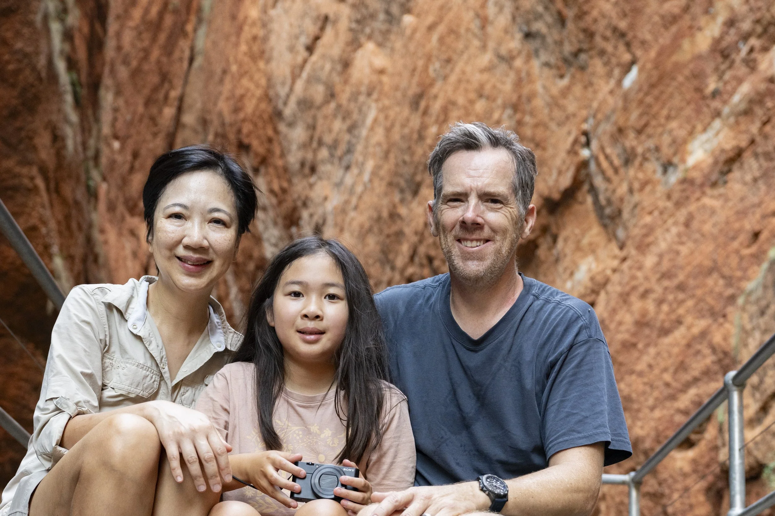
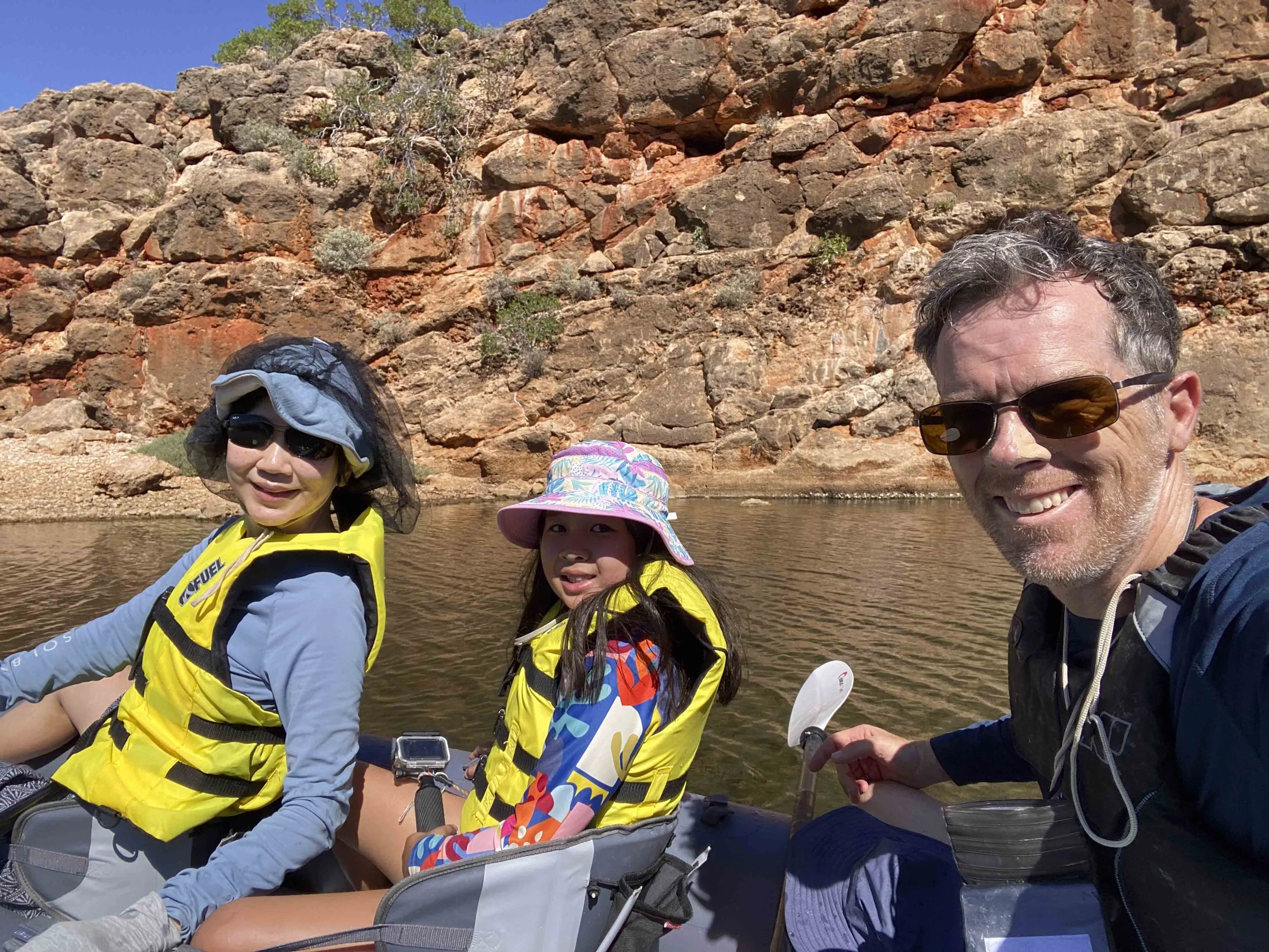
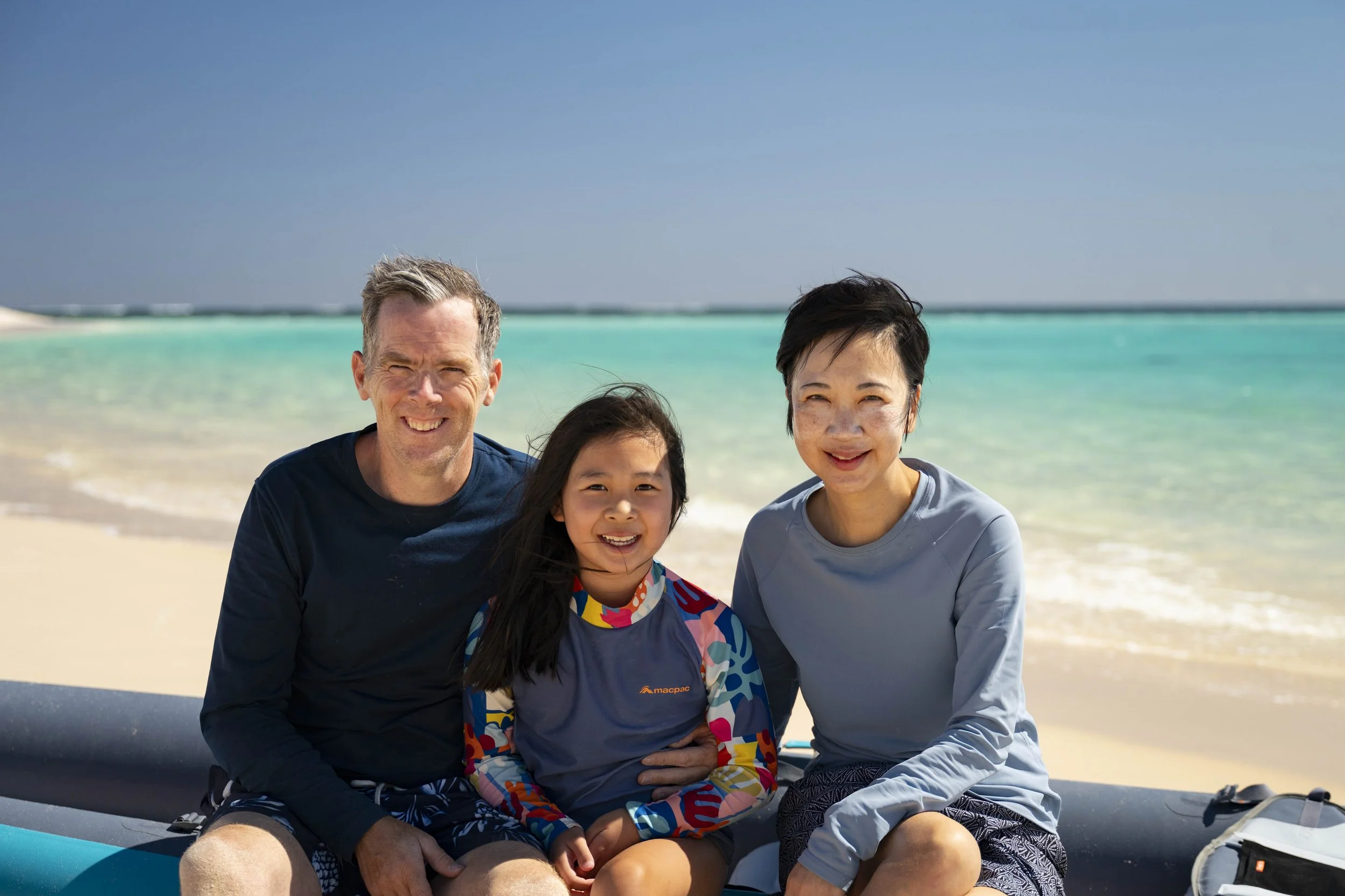
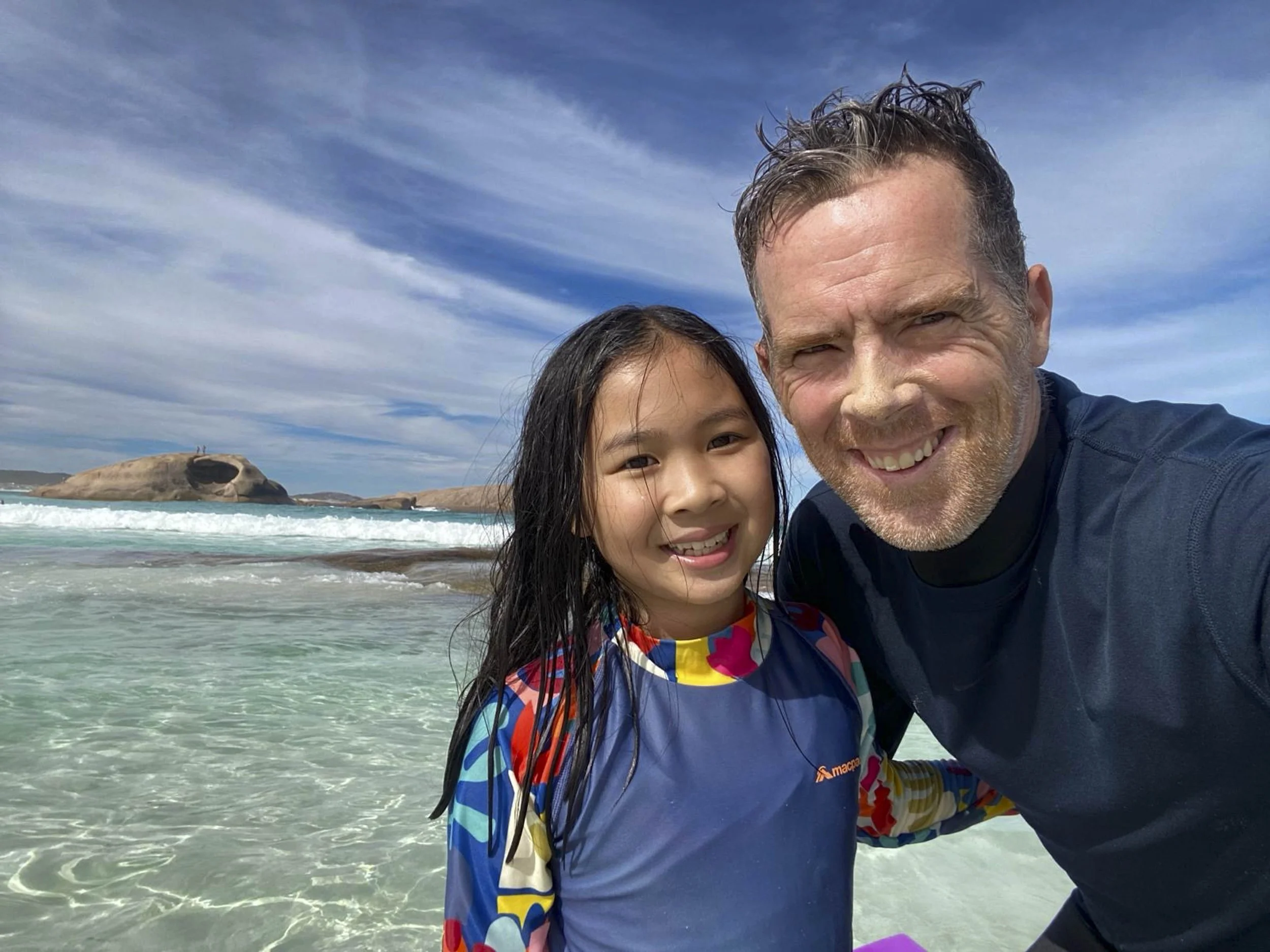
Whitsunday Island: Family photo

Whitsunday Island

Whitsunday Island: On more panorama

Whitsundays: Our yachts mored for the night
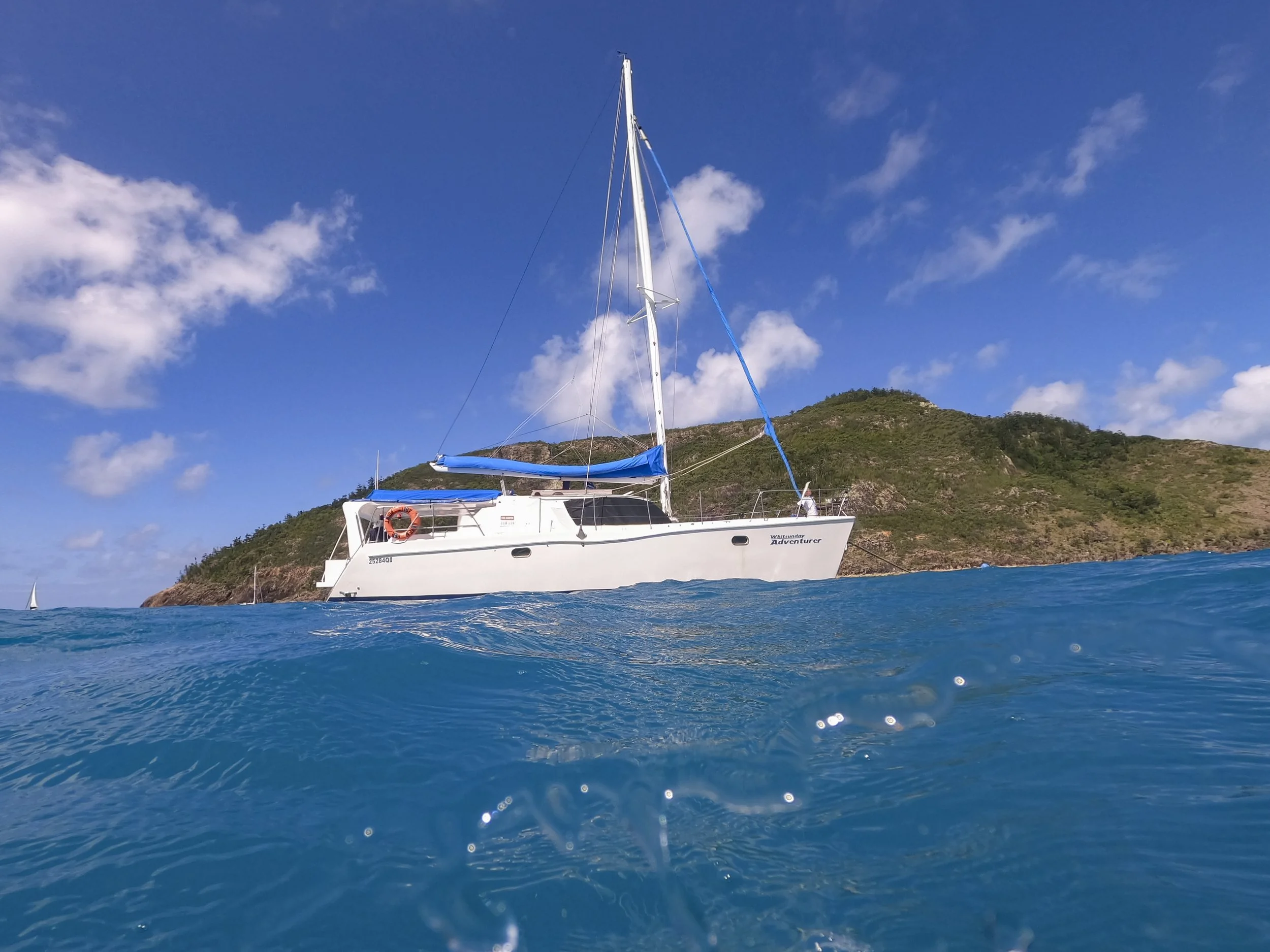
Whitsundays: Our boat from the water

Whitsundays: Family heading to shore

Whitsundays: Heading to shore from the yacht

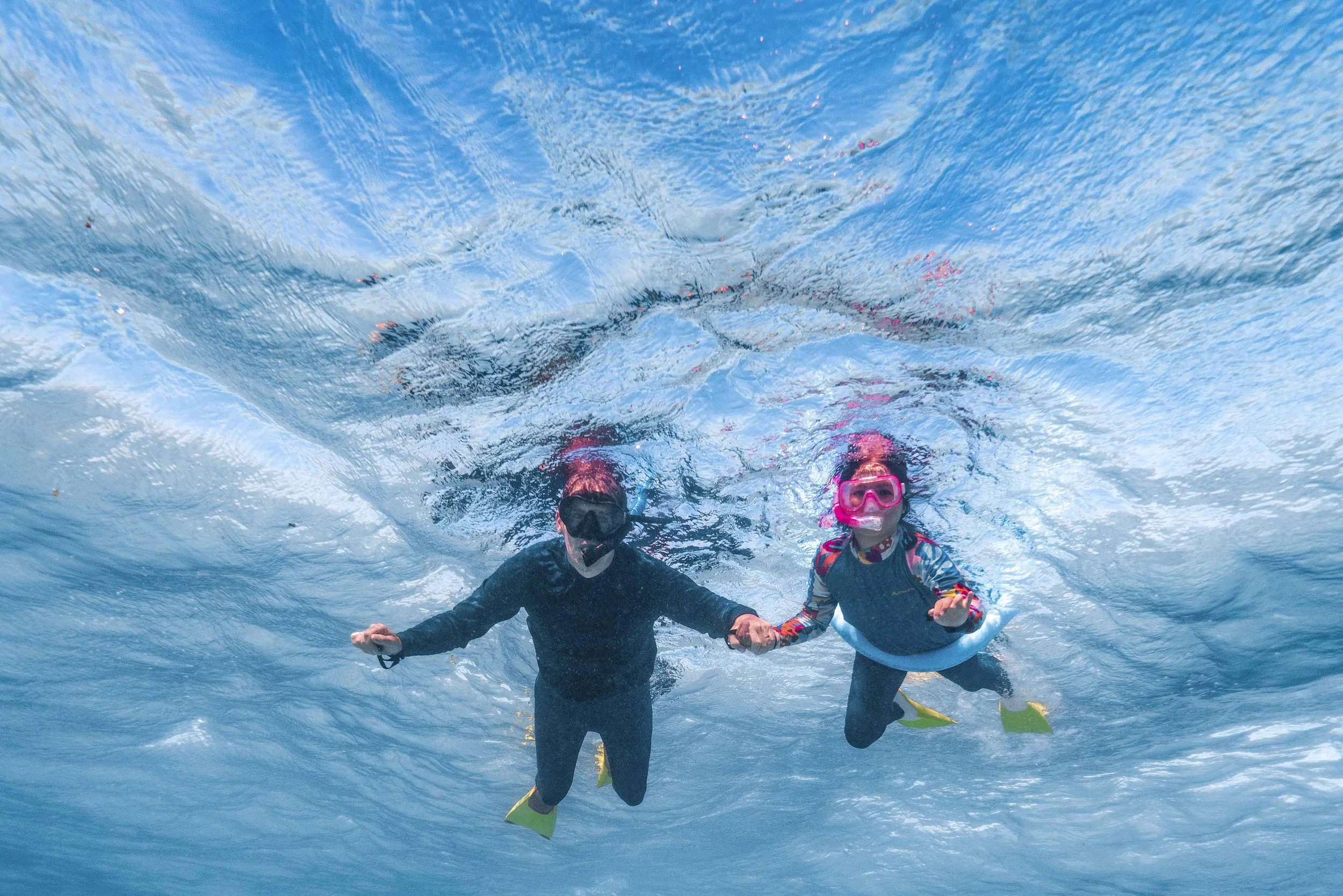
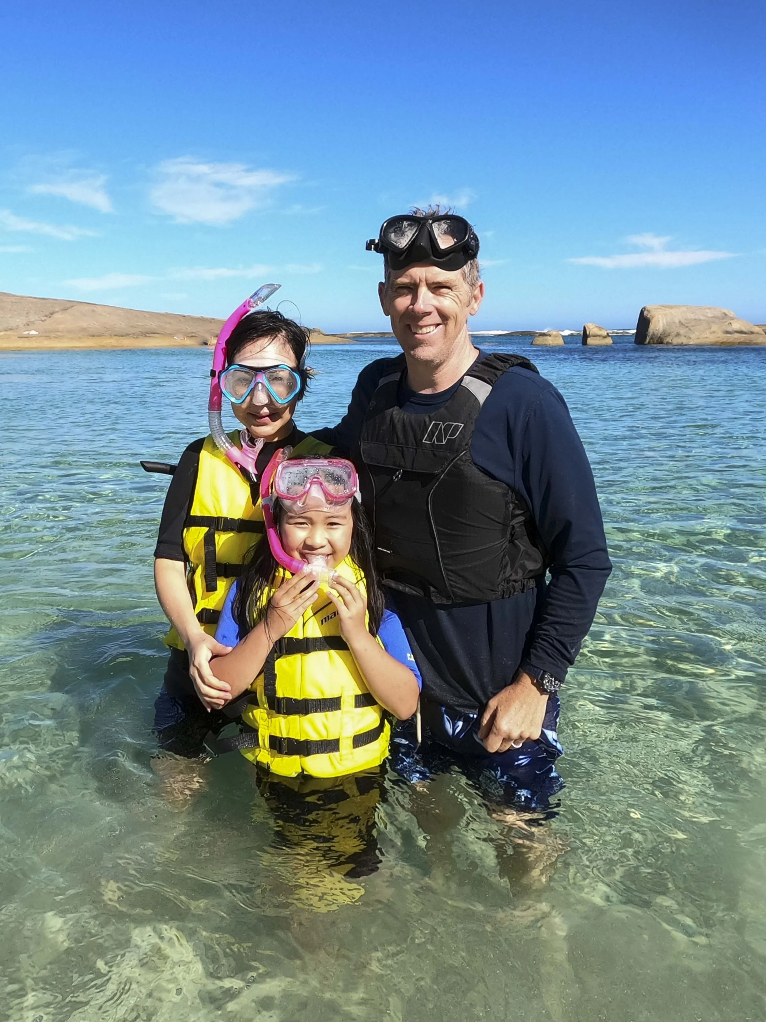
Whitsundays: Going snorkelling

Whitsundays: Coral

Whitsundays: Coral
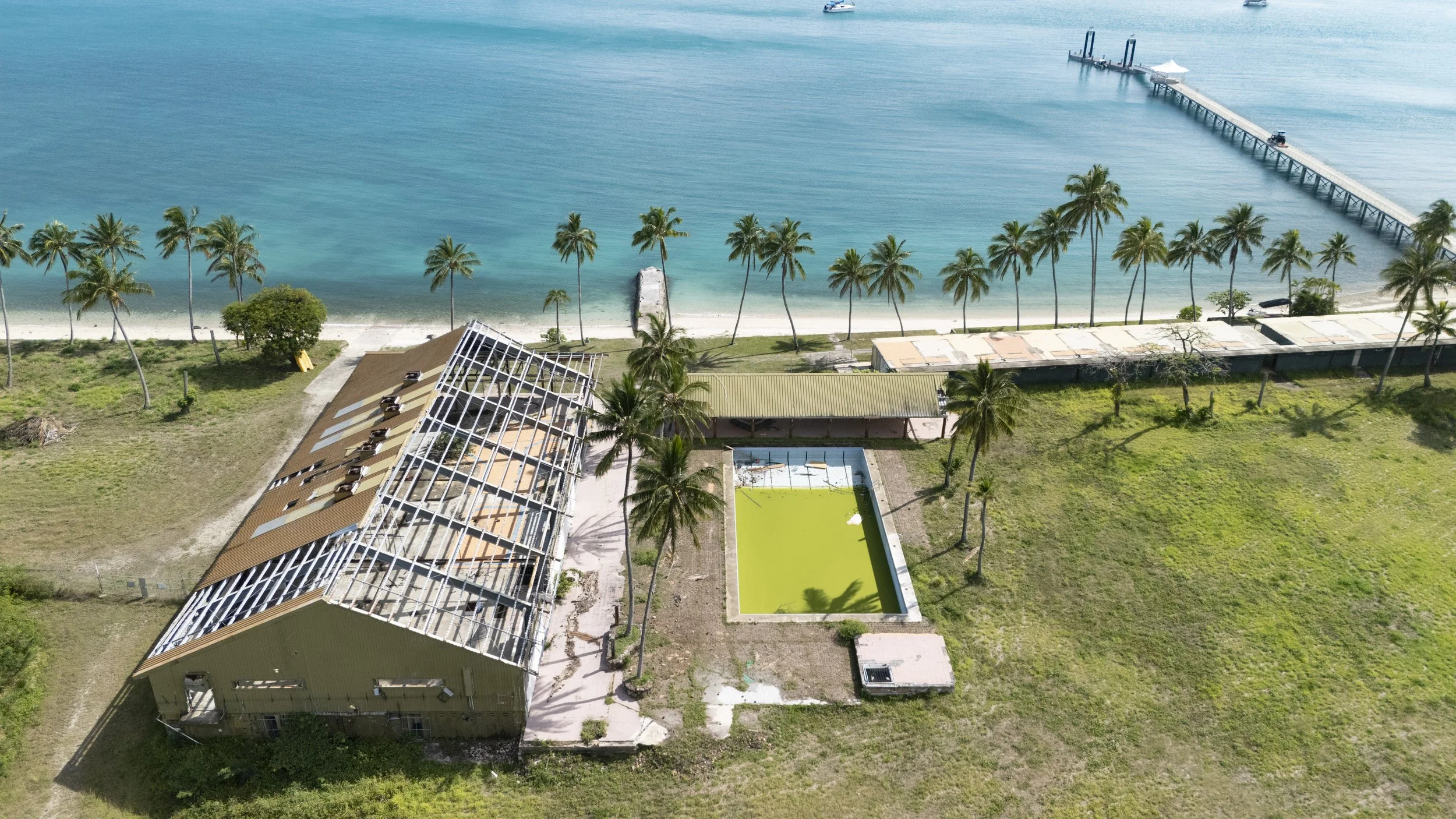
Whitsundays: South Molle Island is a resort that was destroyed by Cyclone Debbie in 2017

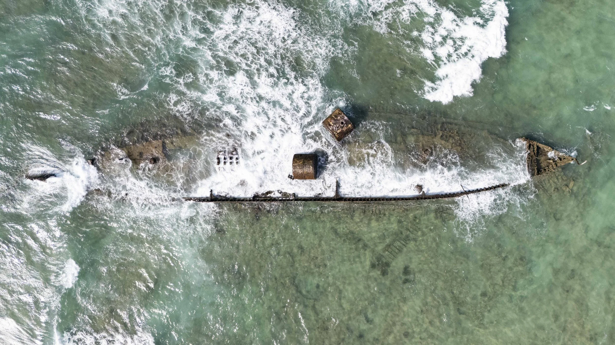
K’gari: Wreck of the S.S. Maheno

K’gari: Wreck of the S.S. Maheno

K’gari: Wreck of the S.S. Maheno
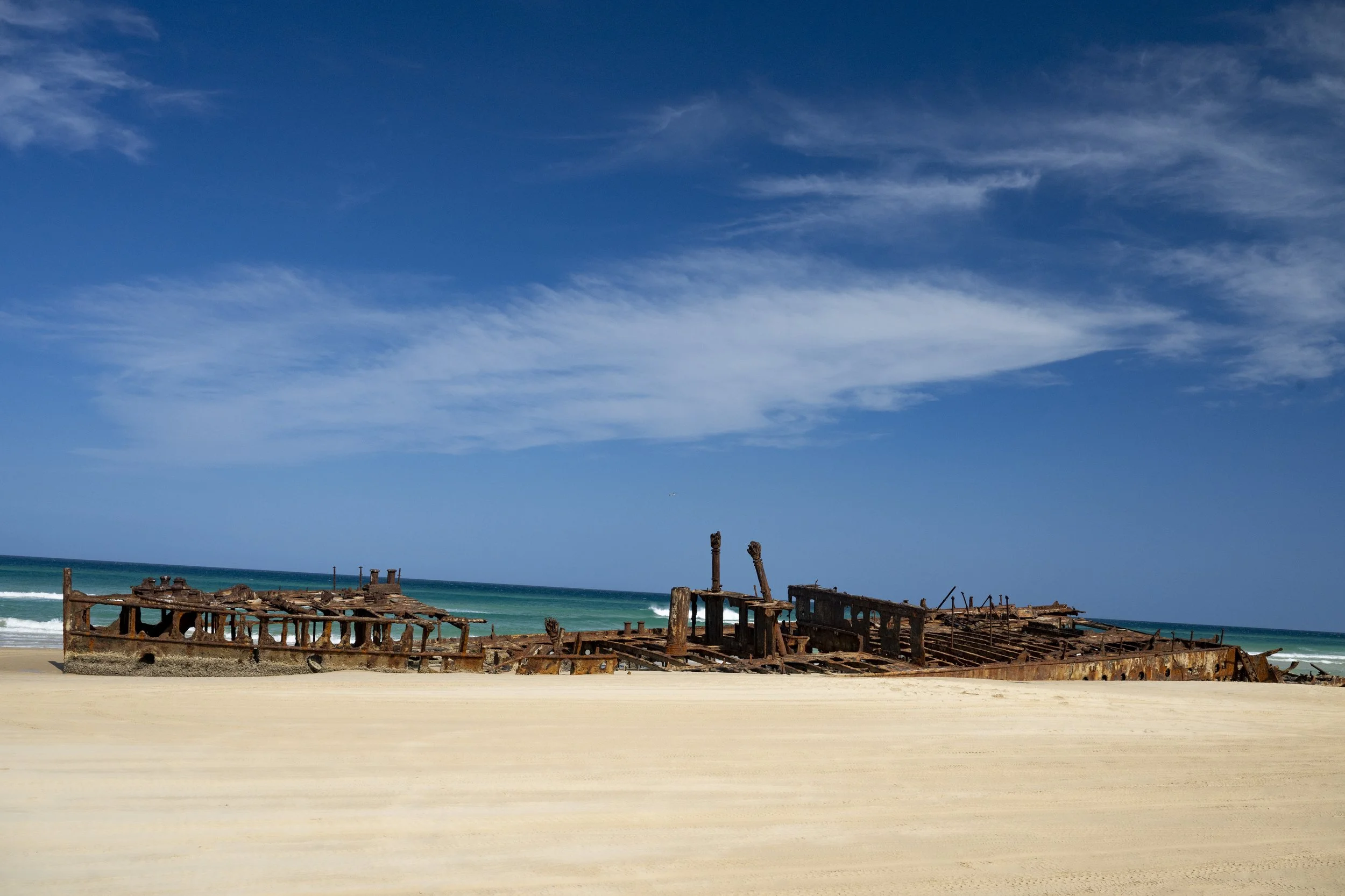
K’gari: Wreck of the S.S. Maheno
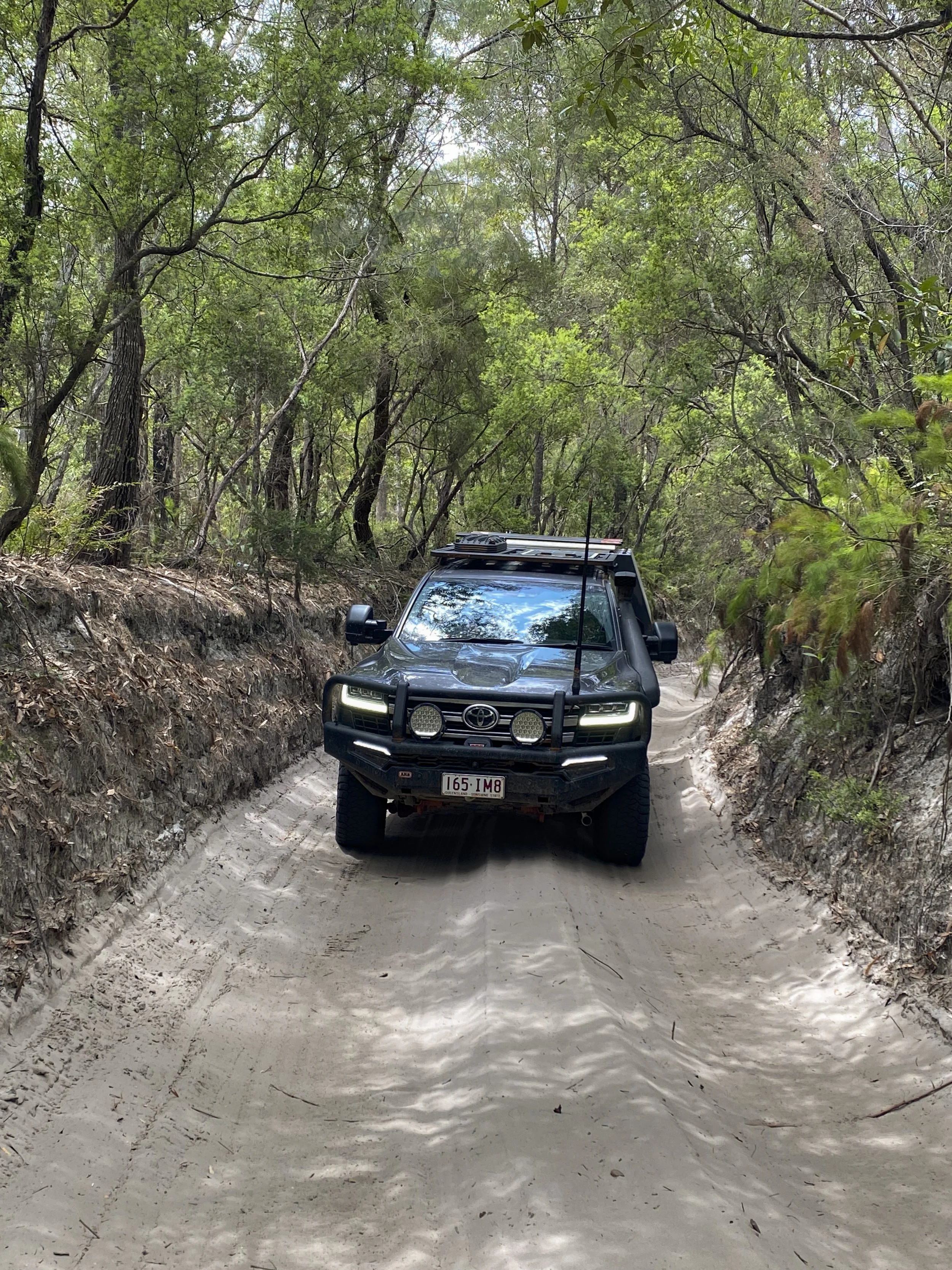
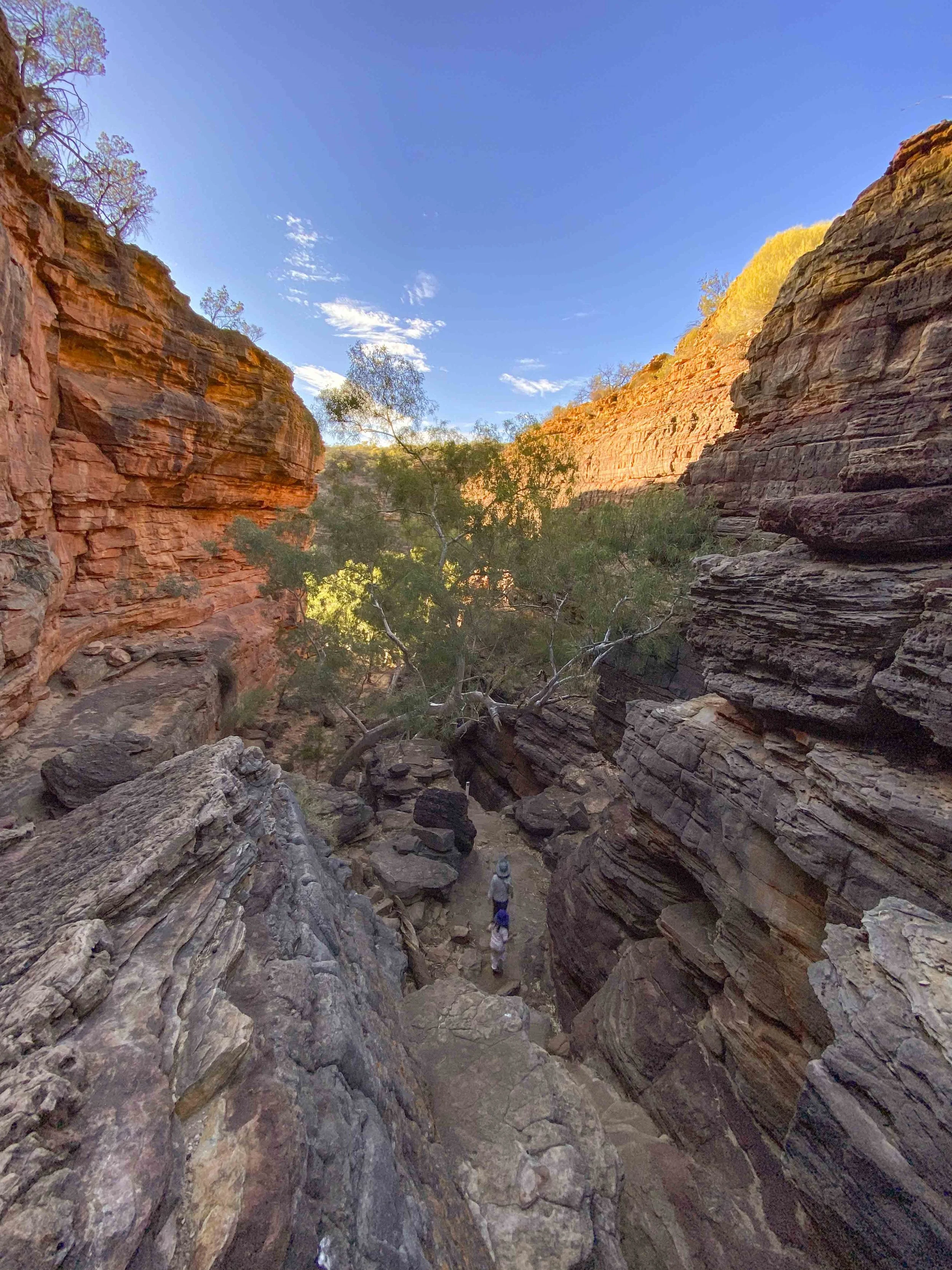
K’gari: You need a 4WD to visit K’gari. The tracks are all sandy. This is a two-way track, which makes passing a vehicle coming in the opposite direction is a bit tricky (all the tracks are just one vehicle wide but are two-way tracks)

K’gari: Just driving around the island is a pleasure

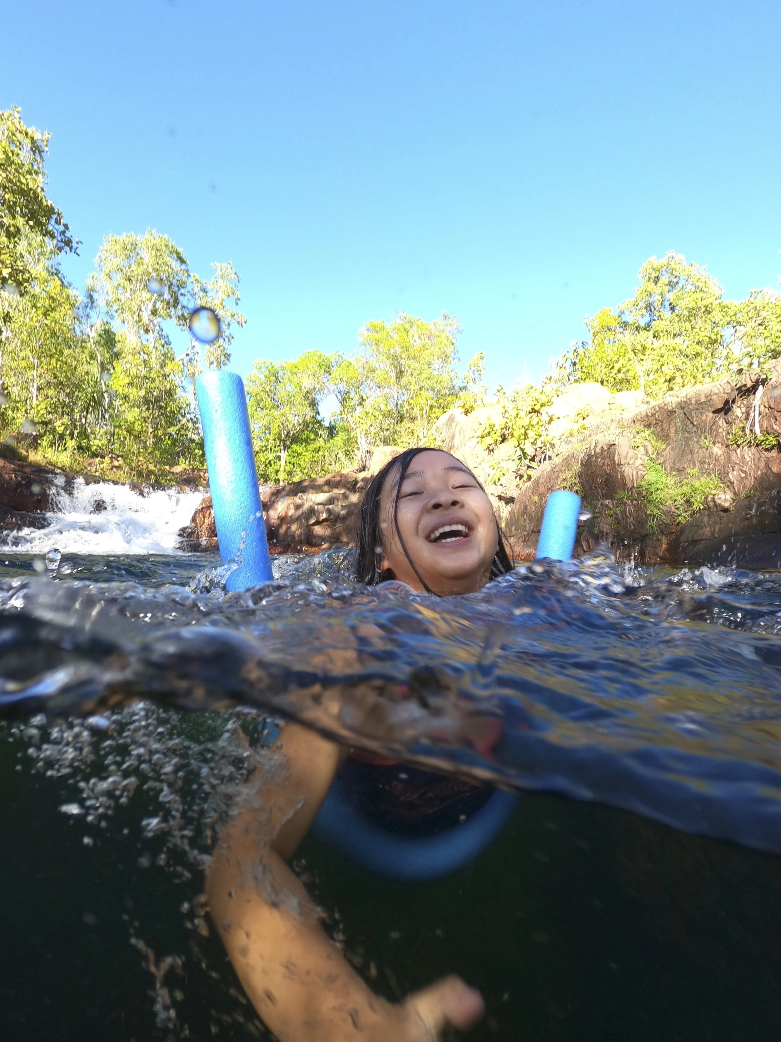
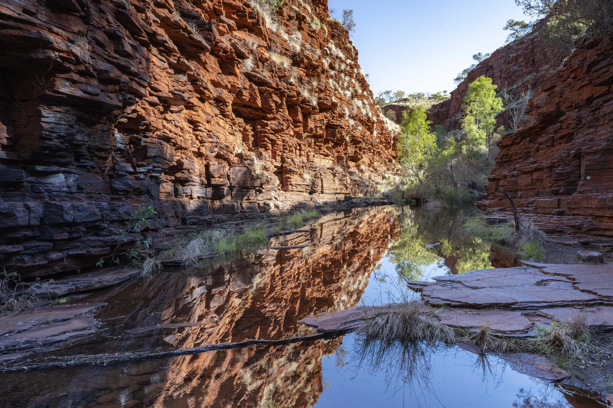
K’gari: Lake McKenzie

K’gari: Lake McKenzie - One of us took a swim…

K’gari: Lake McKenzie
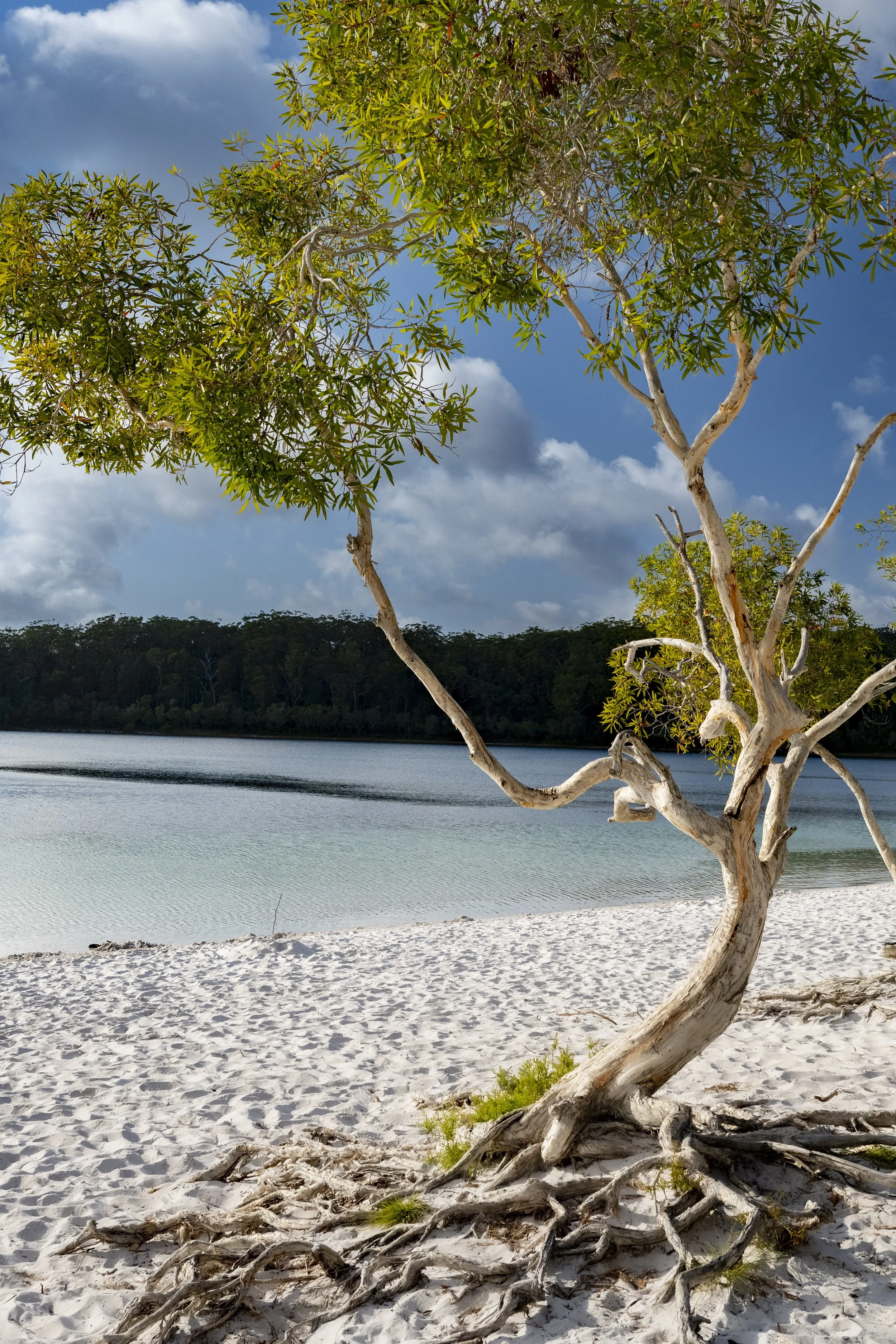
K’gari: Lake McKenzie

16. FNQ and The Tip
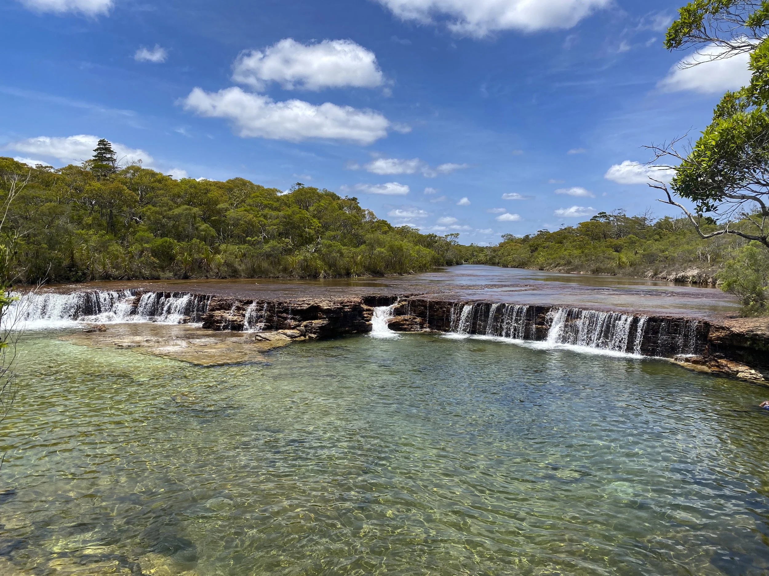
We headed east from Burke and Wills’ last camp near Normanton to Cairns. We then drove north to the ‘tip’ of Australia, visiting some highlights of Far North Queensland (FNQ) on the way. Again there was a bit of colonial history as we stayed at Cape Tribulation where Lieutenant James Cook’s ship HMS Endeavour ran aground on the coral and almost sunk. We also visited Cooktown where Cook and his crew came to shore for nearly seven weeks to beach and repair their ship. The road north from Cooktown to the northern most point of Australia is renowned for being very rough. So, we decided to leave our caravan behind to save it being shaken apart. In the end, the road north was in good condition and we had a smooth run to the top.

Undara Volcanic National Park: The caves are known as 'lava tubes' and were formed by the lava flows from many of the nearby volcanoes

Undara Volcanic National Park: Shining the torch down the lava tube cave as we walk along

Undara Volcanic National Park: Detail of the wall

Cape Tribulation: Cape Tribulation is known as the place where the rainforest meets the reef. It was named by James Cook because it is where their ship ran aground on the coral reef and almost sunk. Cook is not the only one who had trouble getting in and out of Cape Tribulation - the road up from Cairns was the most difficult drive of the whole trip. It is only 30 kilometres from the barge across the river to Cape Tribulation, but it took more than an hour to drive. It is very tight and very windy.

Cape Tribulation: Where the rainforest meets the reef

Cape Tribulation: Where the rainforest meets the reef

Cooktown: We liked Cooktown. It is a small and pleasant town north of Cairns named for James Cook due to it being the place he and his crew came ashore to repair their ship

Cooktown: The anchor from HMS Endeavour

Cooktown: There was a gold rush in Palmer River in the 1870s. Cooktown became the gateway to the goldfields. At its peak, there were estimated to be 30,000 people at the goldfields and 4,000 people living in Cooktown (it is now less than 3,000). The Sisters of Mercy order in Ireland sent out five nuns in 1888 to set up a convent and school. Goodness knows how they managed with the massive change from Ireland to the mosquito infested humidity of FNQ. Cooktown suffered a decline and the convent was shut down before WWII. The building was later saved and now houses the Cooktown Museum

Coen: Driving north to the tip we stopped at a couple of different local hotels for the night. This is the Exchange Hotel in the small town of Coen. Someone added an 'S' to the front of the name a long time ago. That's Millie on the left keeping a wary eye on one of the numerous dogs that wander about the town

The Drive North: The drive is a lot of orange dusty roads which are often surrounded by lush trees. You can get lucky if the road has been graded recently and have a smooth run. Or, you can get unlucky and have a very corrugated road. We got lucky

The Drive North: We crossed over the Jardine River on the ferry. They charge $130 just to get across that river and back. That works out at about $30 per minute that you are on the ferry. When you have a monopoly, you can do that

The Drive North: Our car on the Jardine River ferry
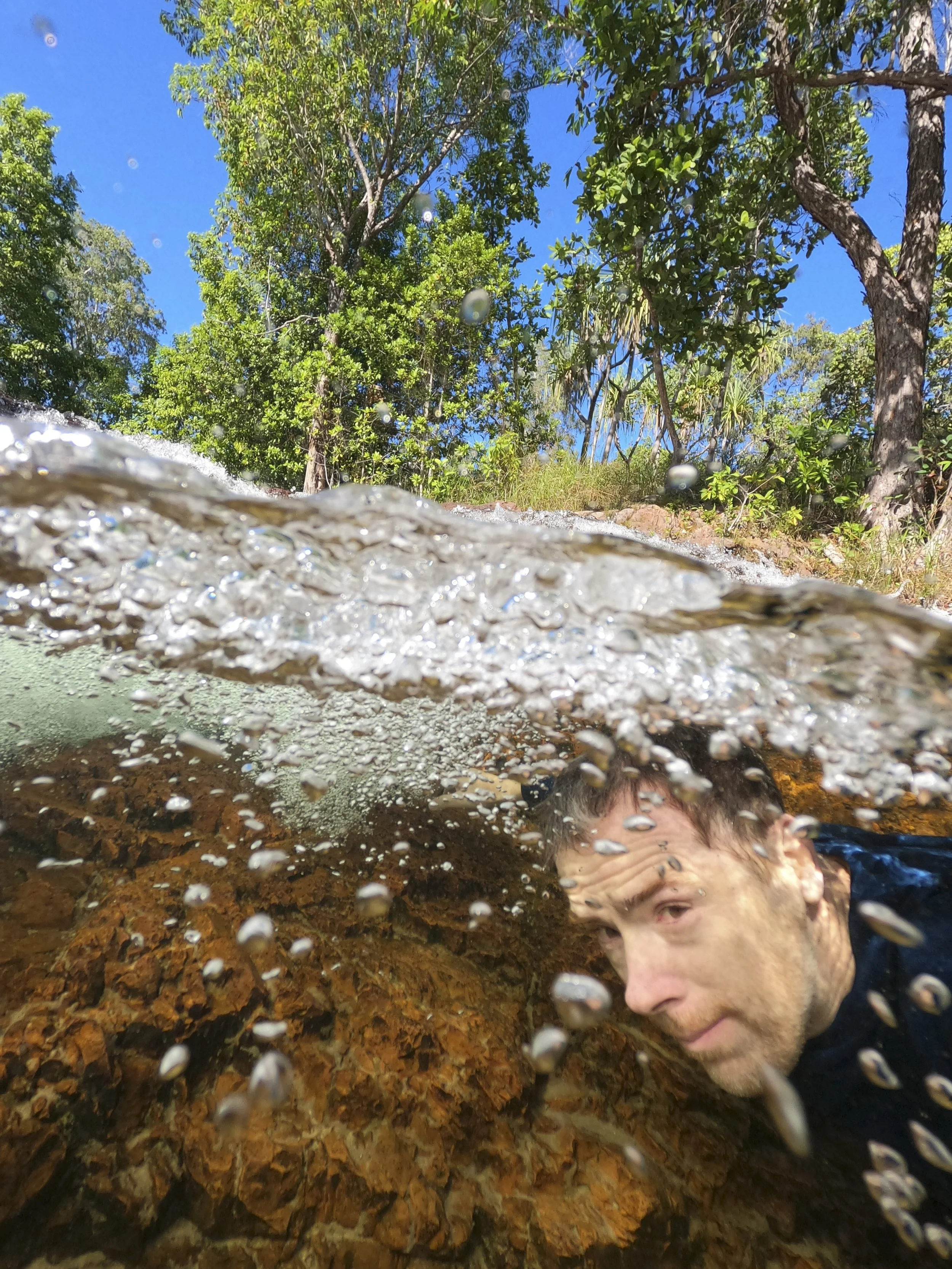
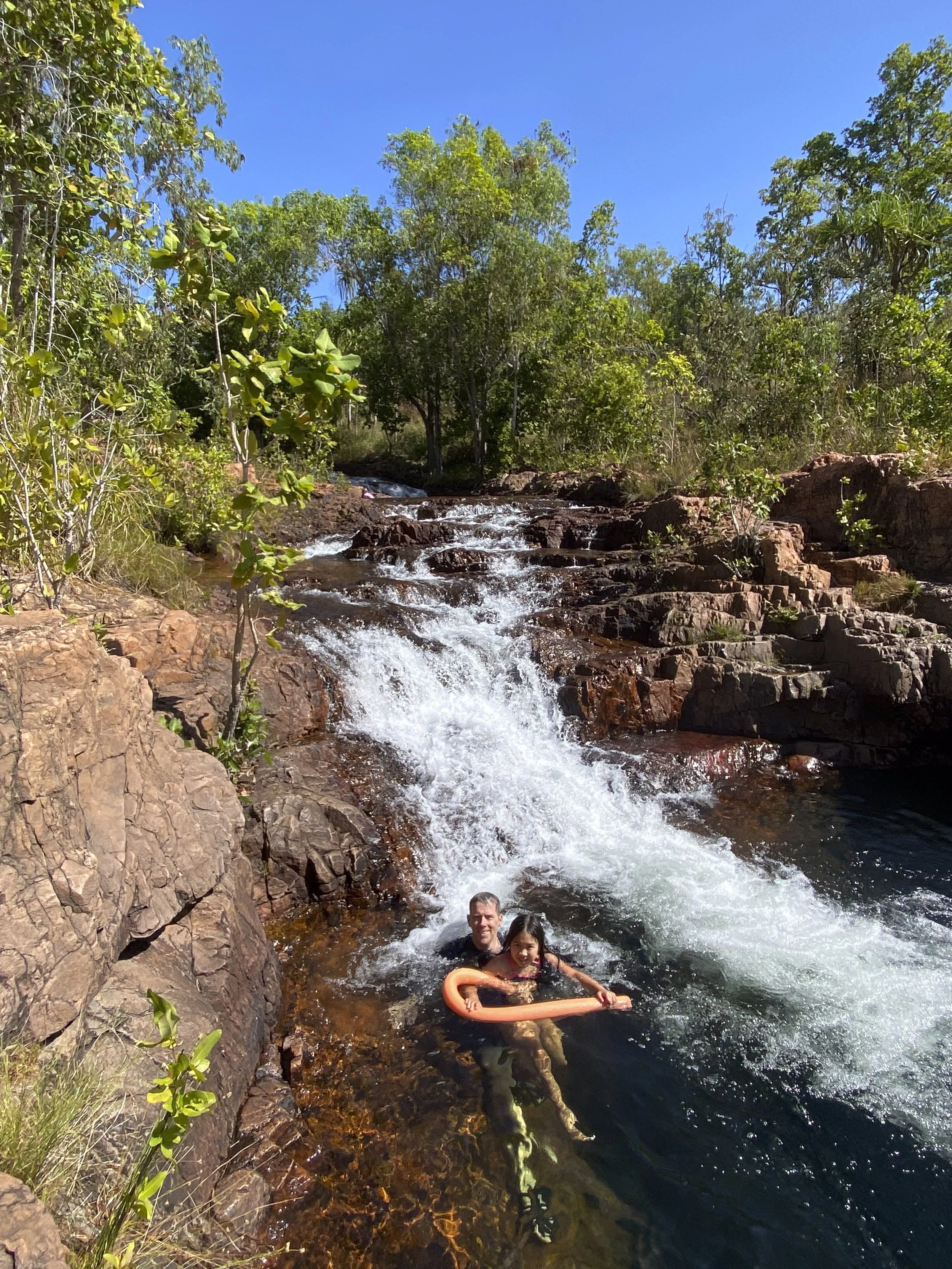
The Drive North - Fruitbat Falls: This is a lovely swimming spot on the way north. Unusually for the area, there are no crocodiles in the water. And, as a bonus, the water was a pleasant temperature (so many of the swimming spots have been freezing)

The Drive North - Fruitbat Falls: Enjoying a swim
The Drive North - Fruitbat Falls: Sumy looking after Millie and Justin by making lunch before we leave (the car park filled up - we had got there at a good time to not have too many people)

Seisa: There are several small towns at the top of the Cape York Peninsula. We stayed in a 'donga' at a caravan park in Seisa. The accommodation is basic and overpriced. But, this is right outside the door of our donga and you can't complain about that. The only downside is that you cannot swim in the water due to crocodiles

Siesa: A game of backgammon
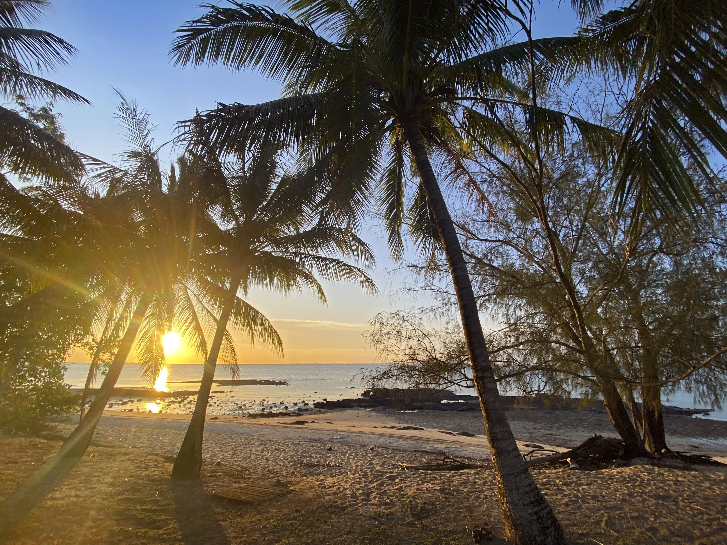
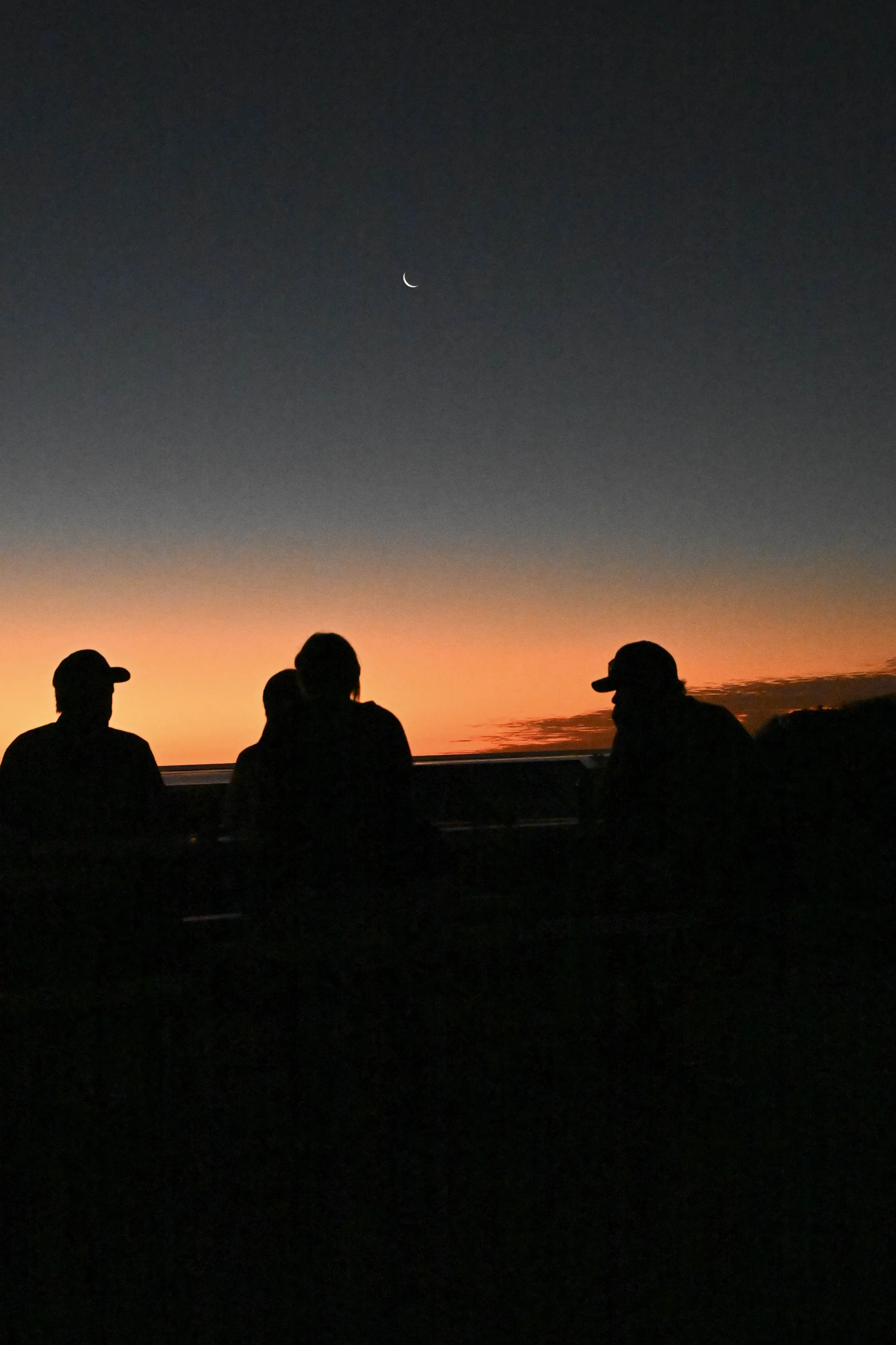
Seisa: The sun goes down

The Tip: Walking towards the tip of Australia. The scenery was perfect

The Tip: Walking towards the tip of Australia
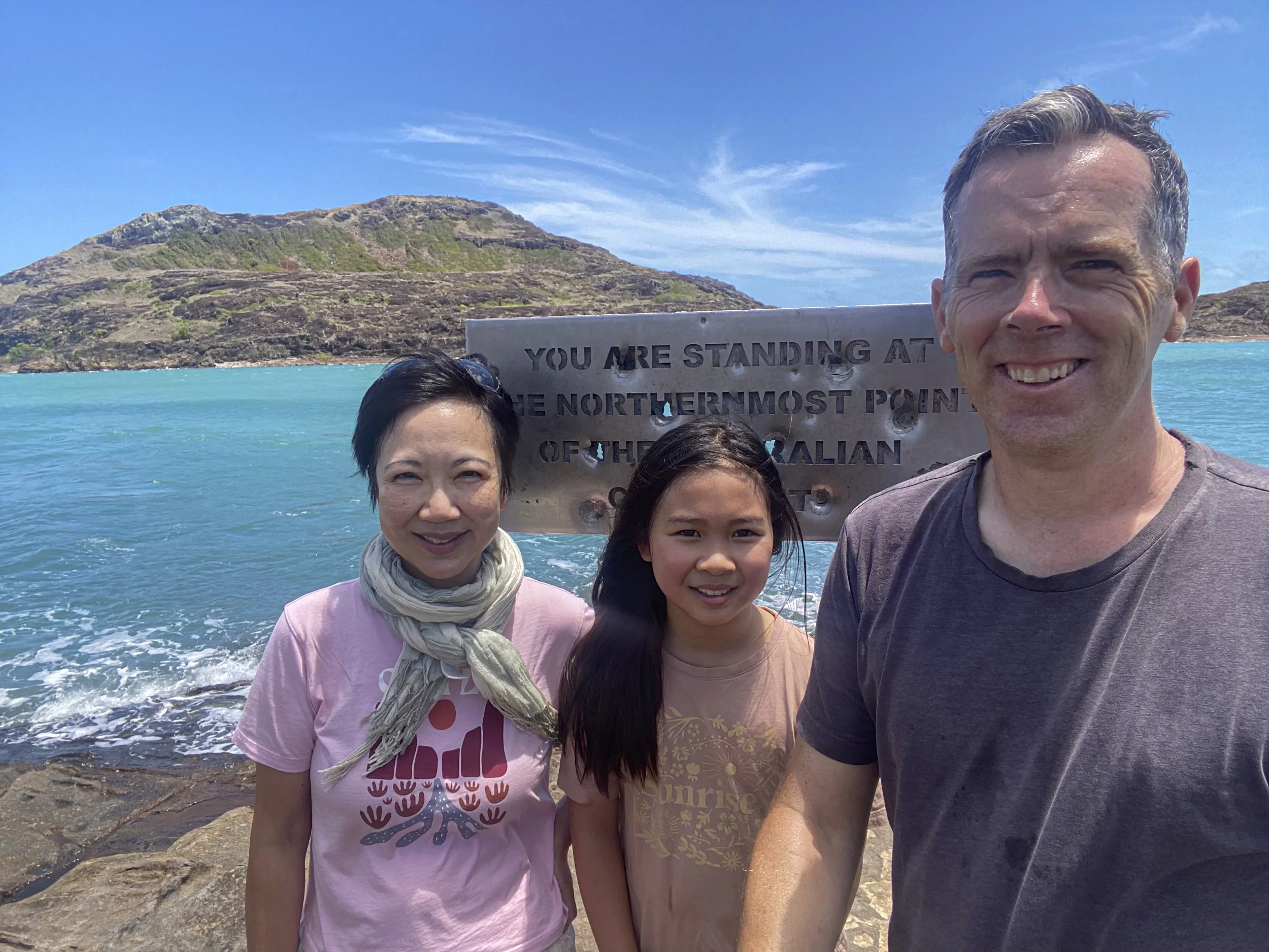
The Tip: Standing at the northernmost point of the Australian mainland. Someone decided to shoot some holes in the sign
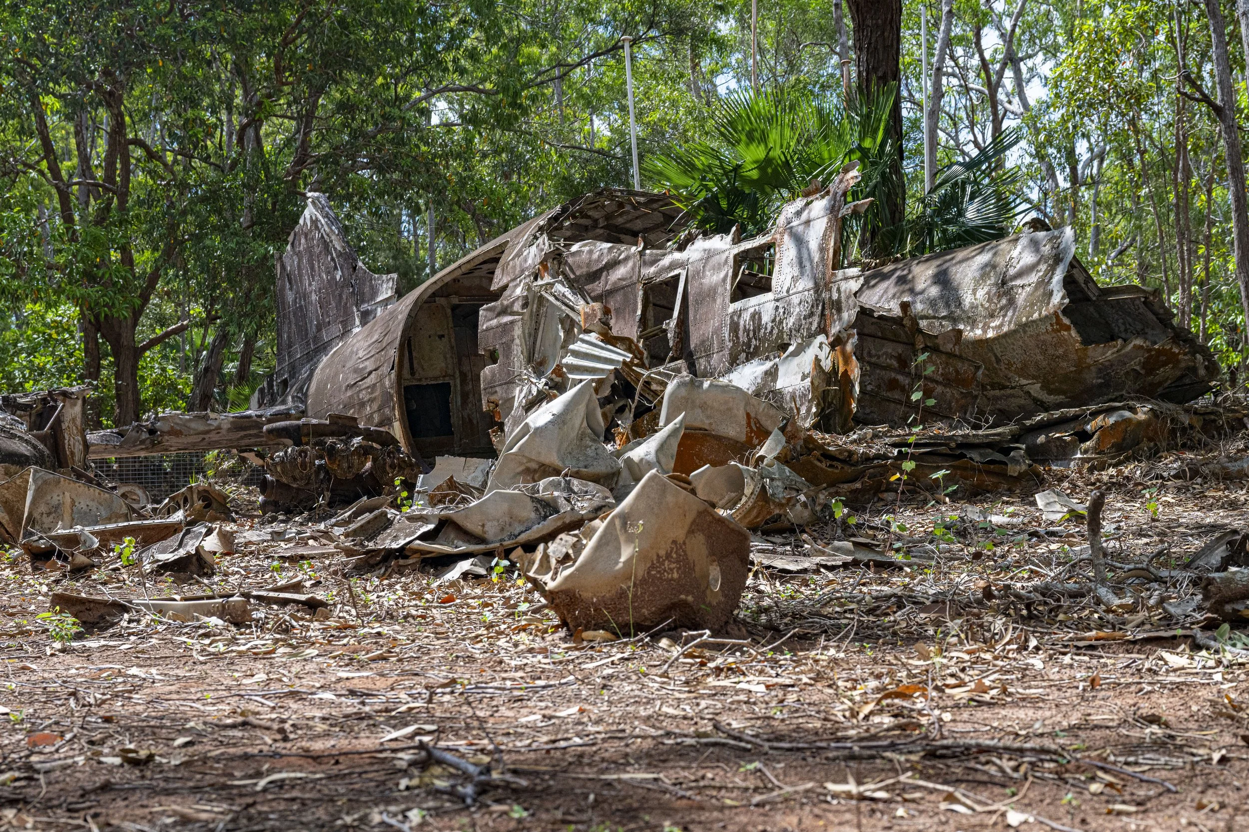
Cape York - WW2 Plan Wreck: The north of Australia had many airfields during WW2. There are a number of crash sights around the peninsula
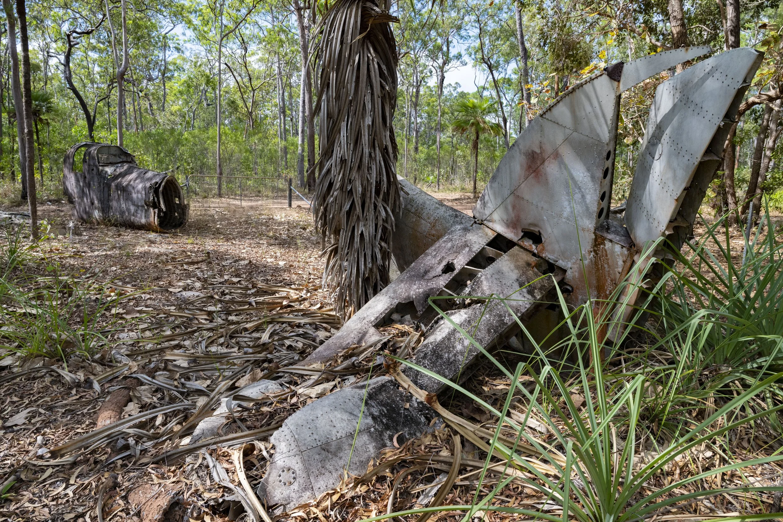
Cape York - WW2 Plan Wreck: The tail of the plane is quite far away from the rest of the fuselage (another large part of the plane is out of picture)

Cape York - WW2 Fuel Dump: There are a lot of 44 gallon fuel drums left behind from the war in the bushes

Thursday Island: Thursday Island is off the north coast of Australia. It is a small island with less than 3,000 people. Here we are on the ferry on the way there
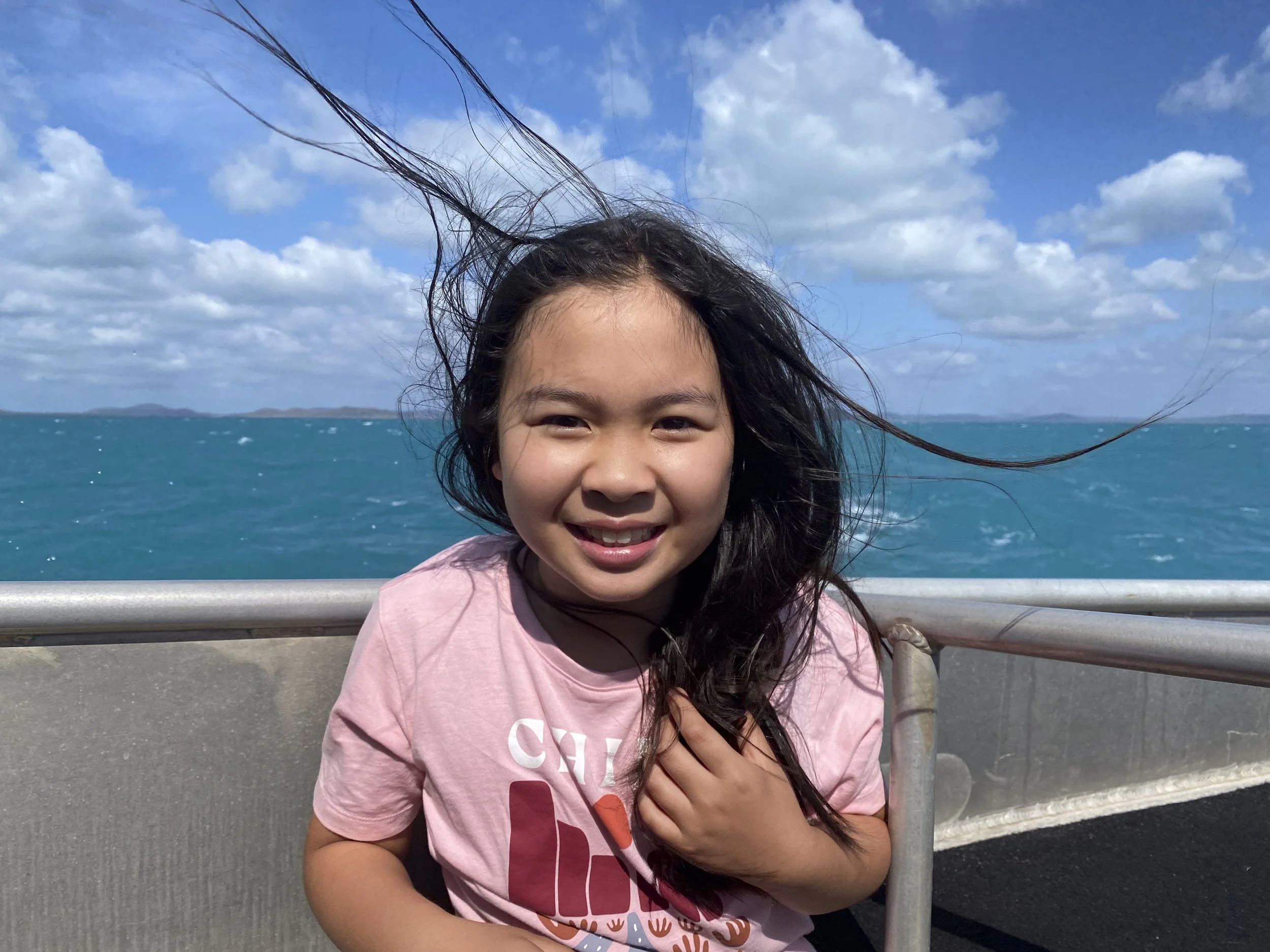
Thursday Island: It was windy on the ferry...

Thursday Island: The cemetery is expansive. In this part are the graves of many Japanese people who came to Thursday Isand for the pearling industry

Heading South: We were planning to stay at Lockhart River (east side of Cape York Peninsula) on our way back down. There is one road in and out. The road here is a reasonably steep section coming up out of a river crossing. The truck, with two long trailers, had an engine failure and the rolled back down the hill and ended up across the road. We could not get past in our car. After some time, we decided to leave and give Lockhart River a miss. Maybe its good to leave something for next time...

15. Back to the Top
After leaving Coober Pedy we headed south to Point Pirie to get the wheel alignment done for the caravan. After that, we made a long one-eighty-degree turn which took us briefly back into Victoria before heading north again. Along the way north we visited some places in NSW (Lake Mungo and Broken Hill) and zig-zagged across outback Queensland before hitting the Gulf of Carpentaria.
It was hard at the bottom of our long u-turn when we passed back into Victoria. We were only one day’s drive from home and we were all feeling a little tired. It would have been easy to just end the trip then and there. What made it tempting was that we had the issue with the caravan wheel alignment followed by the air compressor breaking in the car - the impact of this being that the rear suspension in the car had no air in its airbag (which sits within the rear coil suspension) and so we could not tow safely. These issues made it feel like it would be just easier to go home.
We managed to get our van and car issues sorted. The truck maintenance place in Port Pirie did a great job correcting the wheel alignment. Then, for the rear suspension, I was not able to get a replacement compressor in Broken Hill. After trying to work out how to address it on my own (hopeless) I went all over town looking for a mechanic who could help come up with a workaround to get air into the suspension airbags. After several conversations I landed on a mechanic who came up with a workaround and then called his friend to see if he had the requisite parts to make it all happen. The friend had the parts and he made up the workaround. The mechanic did not even charge me for his help. We were on the road again due to the kindness of strangers.
I really enjoyed seeing Lake Mungo and Broken Hill and then the small towns through outback Queensland. I especially enjoyed visiting some historical sites associated with the ill-fated Burke & Wills expedition to cross Australia in 1860.
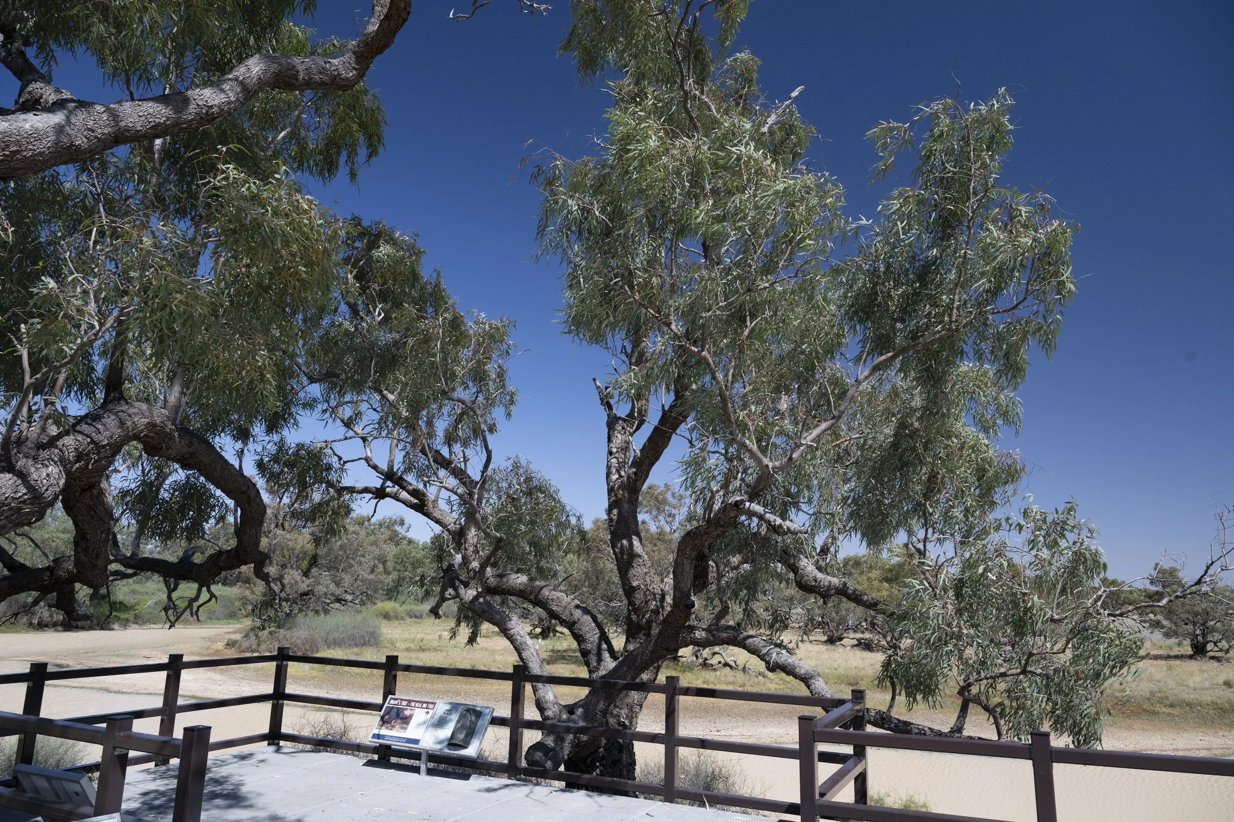
As a quick background for anyone that may read this and who is not from Australia, the Burke & Wills expedition set off from Melbourne in 1860 to reach the Gulf of Carpentaria in the north of Australia. The expedition was successful in the sense that they reached the gulf, but a failiure in the sense that three of the four men who travelled the last part from the expedition’s major base camp at Coopers Creek to the gulf died. The three men (one had already died) arrived back at the base camp in Coopers Creek absolutely exhausted and dying from starvation. They found that their companions had only left the camp nine hours earlier. Their companions had left some supplies buried in the camp - the famous ‘Dig Tree’ had a message carved in it for the men to dig for the supplies should they turn up. The three men were in no condition to chase the main group. Two of the three died shortly afterwards, with the lone survivor being saved by the local indigenous people. We visited the Dig Tree, the tree under which the expedition leader (Robert O’Hara Burke) died, and the site of their camp at the Gulf of Carpentaria (their target).

Woomera Rocket Park: Where the British tested their missiles

Woomera Rocket Park: Where the British tested their missiles

Woomera Rocket Park: Where the British tested their missiles
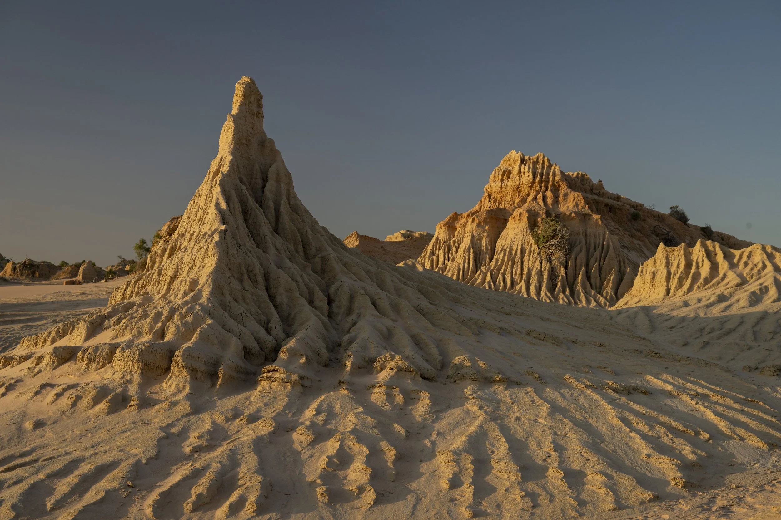
Lake Mungo: The lunette

Lake Mungo: The lunette
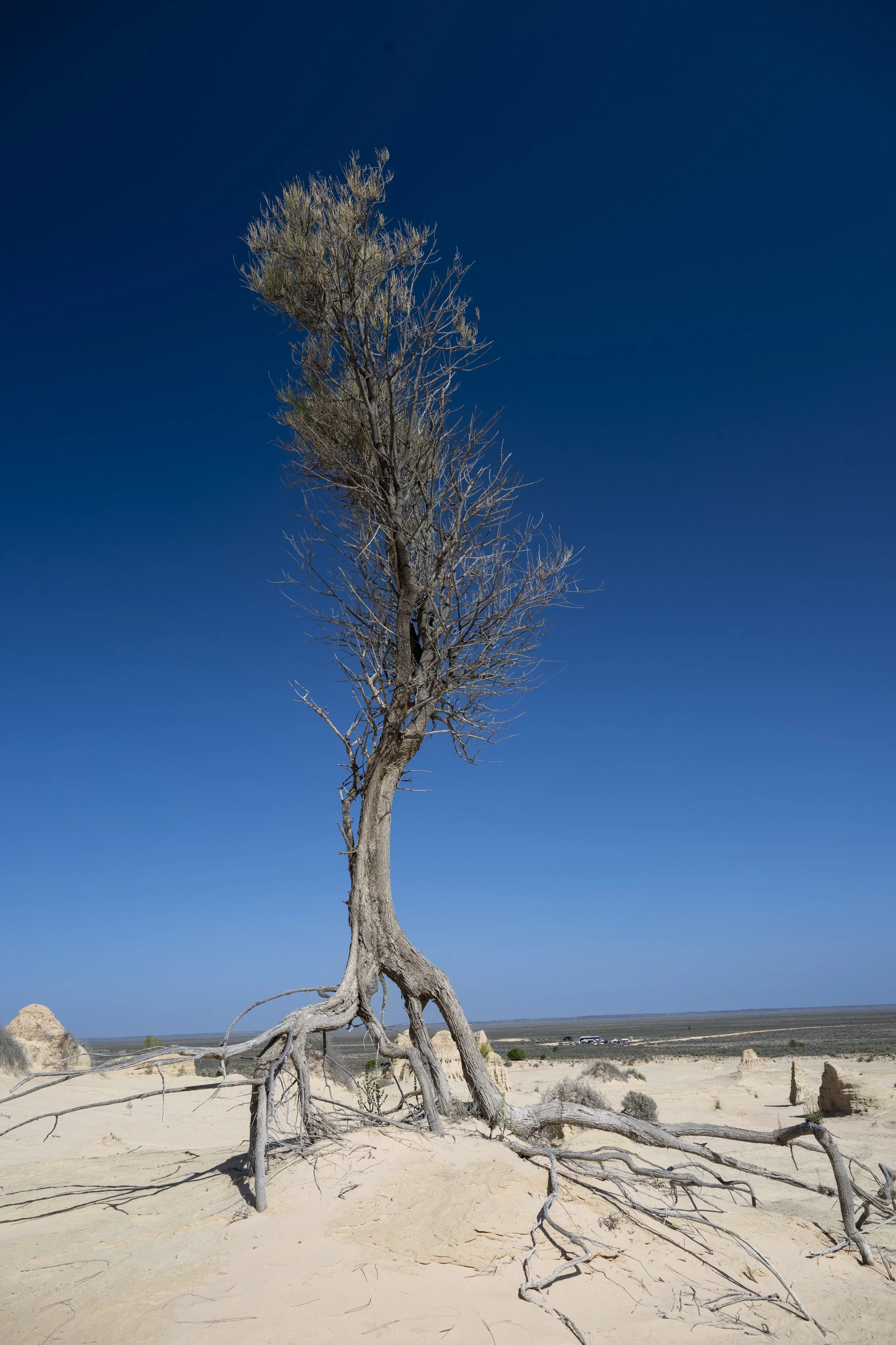
Lake Mungo: The tree roots are exposed by the shifting of the sand
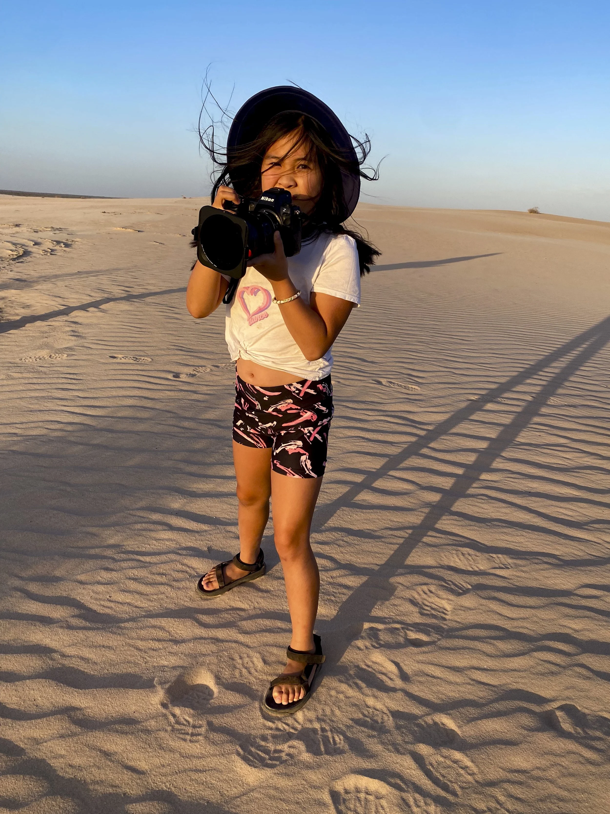
Lake Mungo: Millie taking photos

Lake Mungo: The lunette

Lake Mungo: Heading back from the lunette

Lake Mungo: Ruins of the historic shearing shed
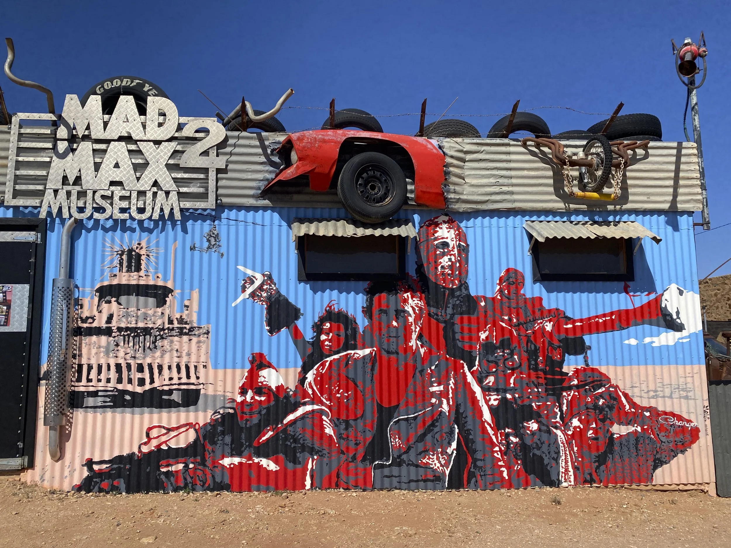
Broken Hill (Silverton): The Mad Max 2 museum

Broken Hill (Silverton): There are a lot of artists and art galleries
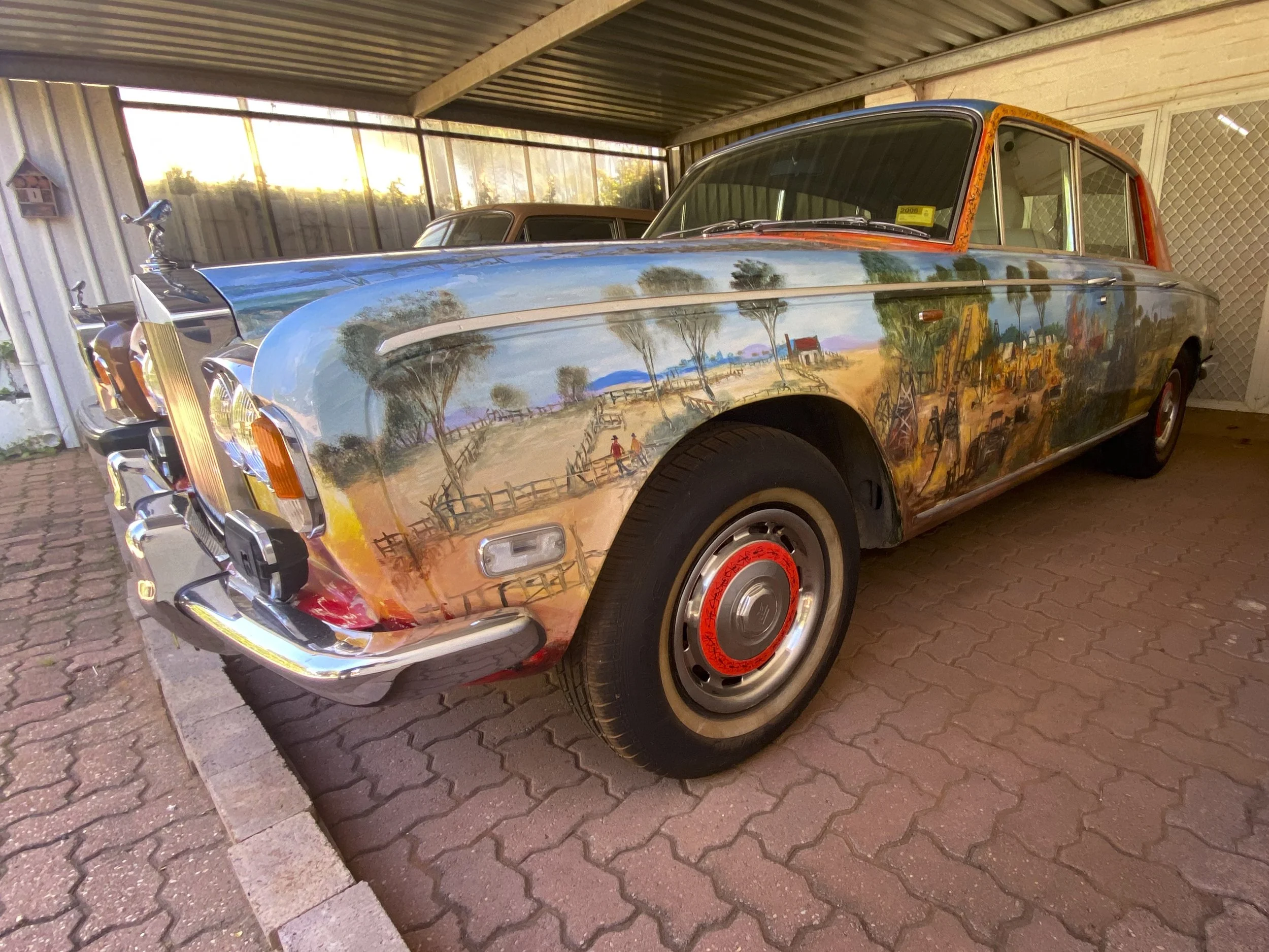
Broken Hill: The most famous artist in the area was Pro Hart. He liked the nice things - here is one of his Rolls Royces which he had painted
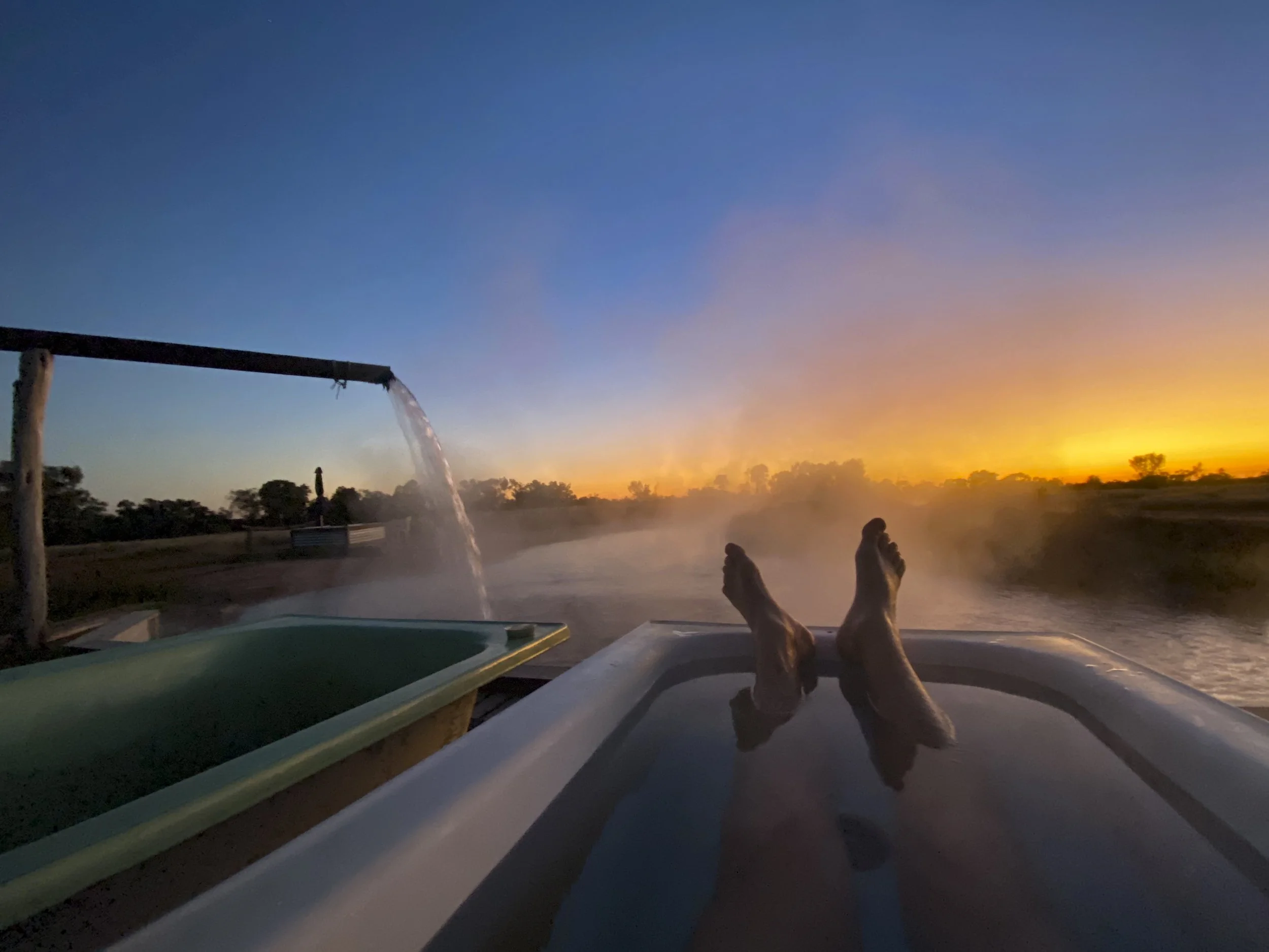
Charlotte Plains Station: I had wanted to visit and tour an outback cattle station. For different reasons we visited Charlotte Plains Station in Queensland. The station is known for its warm artesian baths. While it was lovely to sit in warm natural baths and watch the sun come up, the station was disappointing in that there is little actual station activity and while they advertise that they do tours this is not the case any more.
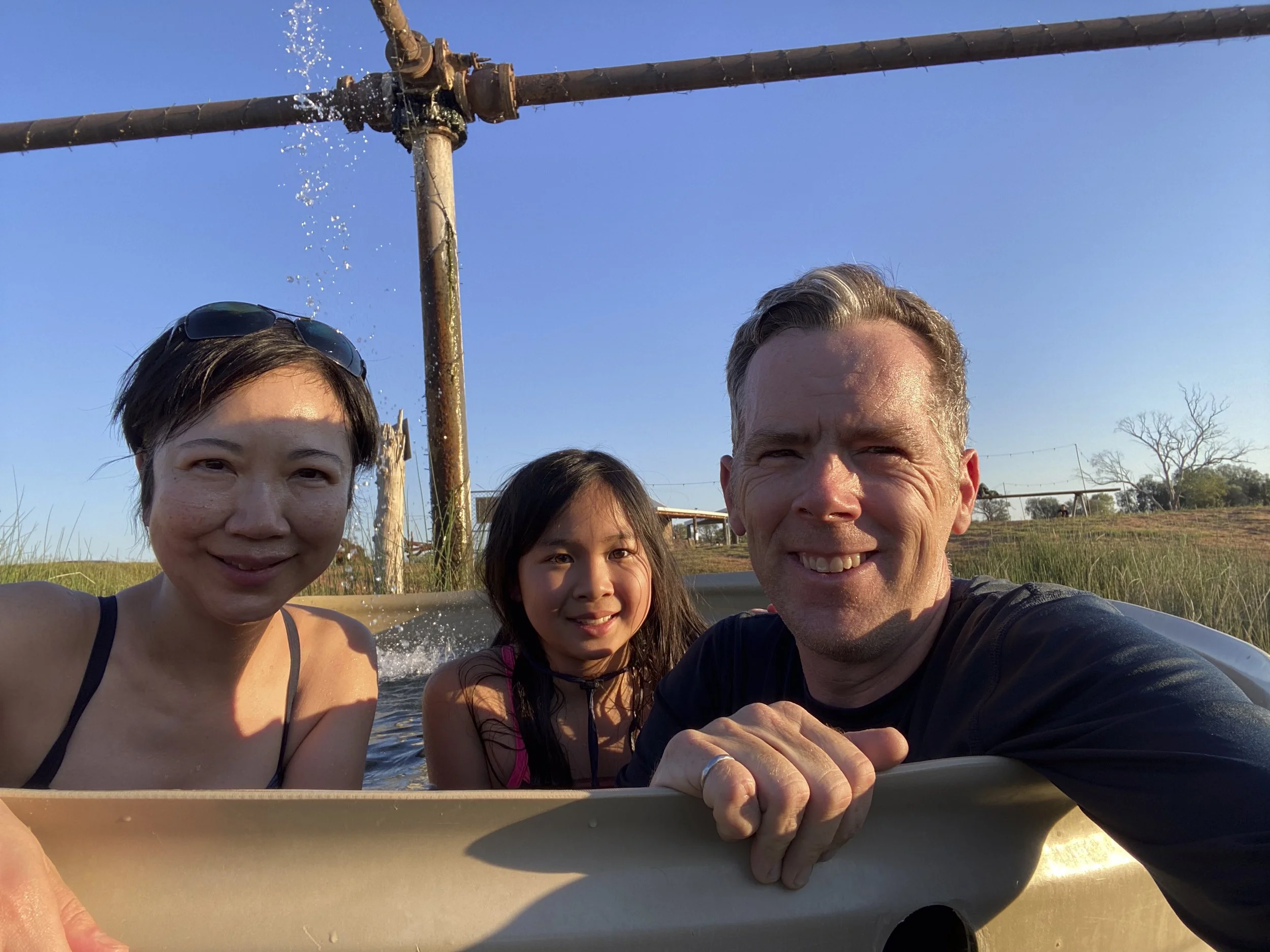
Charlotte Plains Station: Family bath time

The Dig Tree site
The Dig Tree: The carving of the words 'Dig' have long disappeared. However, it was special to visit the actual tree and reflect upon their hardship and disappointment at missing their expedition party by just nine hours

The Dig Tree: The tree into which the words 'Dig' were engraved, photographed from the Cooper Creek side

The Dig Tree: This tree is not the Dig Tree. This is an image of Robert O'Hara Burke carved into a nearby tree as a memorial in 1898. As time has gone by the 'R' and the 'B' of his initials have been covered over.

The Dig Tree: Millie in front of the Dig Tree

Burke & Wills: The sun sets on the tree under which expedition leader Robert O'Hara Burke died of exhaustion and malnutrition. The tree is near the small town of Innamincka
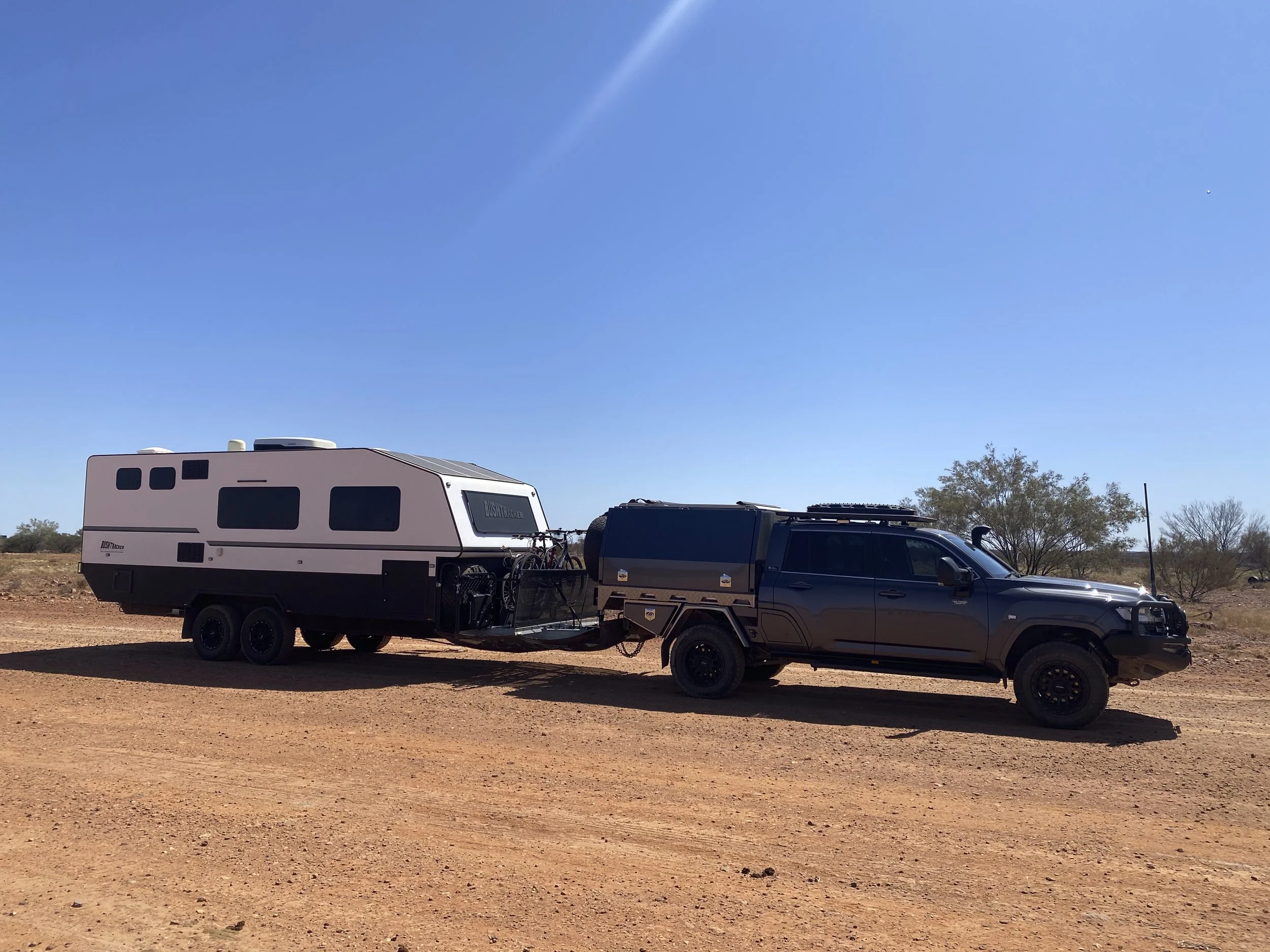
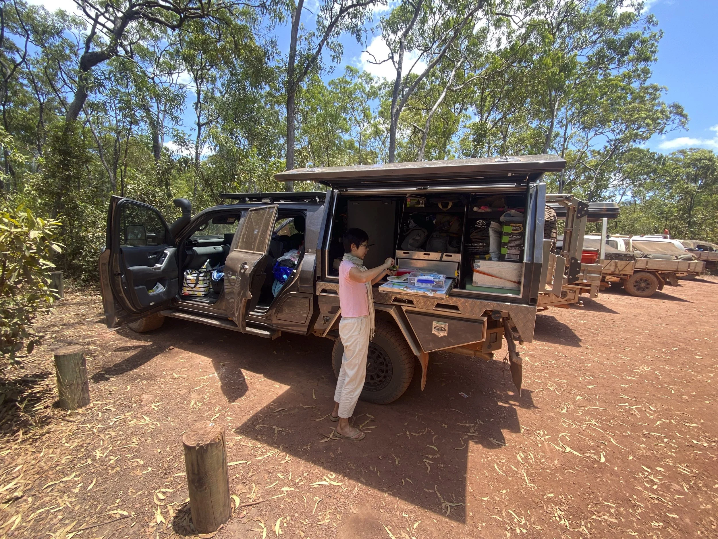
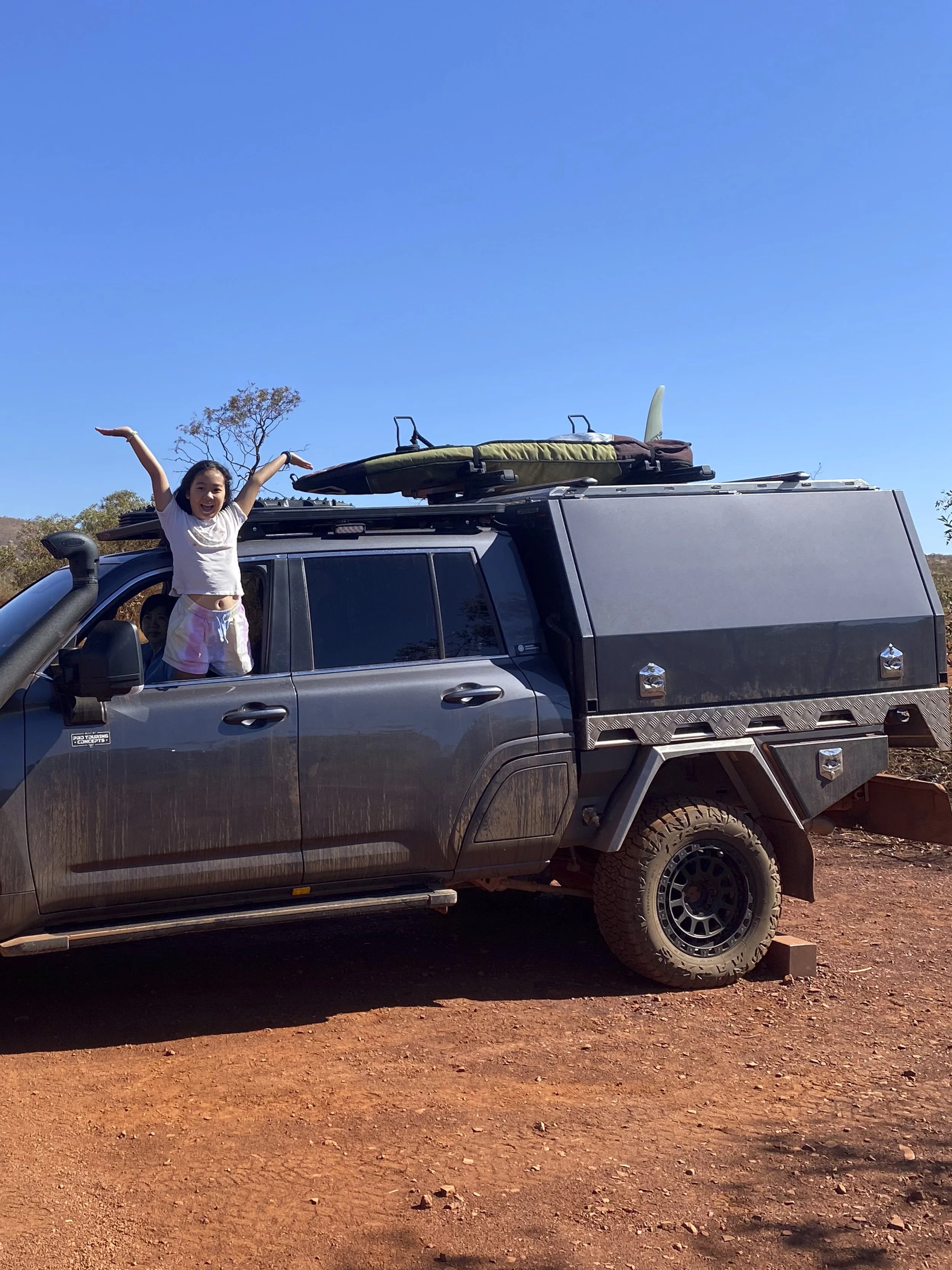
Travelling in outback Queensland: I have not included a photo of our car and caravan for some time. We are driving about 500km each time we go between towns out here.
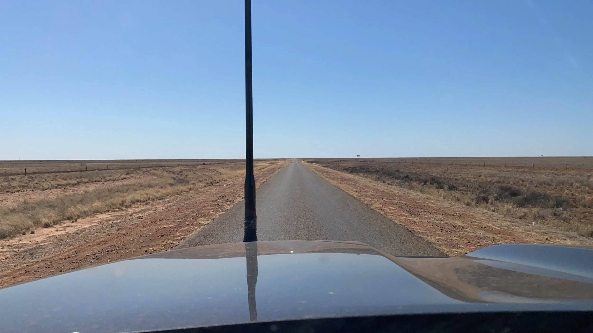
Travelling in outback Queensland: The roads are often one lane wide of sealed road. When road trains come the other way, you have to get right off the bitumen

Travelling in outback Queensland: The roads are not fenced. You do not want to hit a cow - the picture gives a sense of who will lose. There was a fatality only a couple of weeks ago when someone travelling Australia hit a cow while driving in the dark. We just do not travel in or near the dark
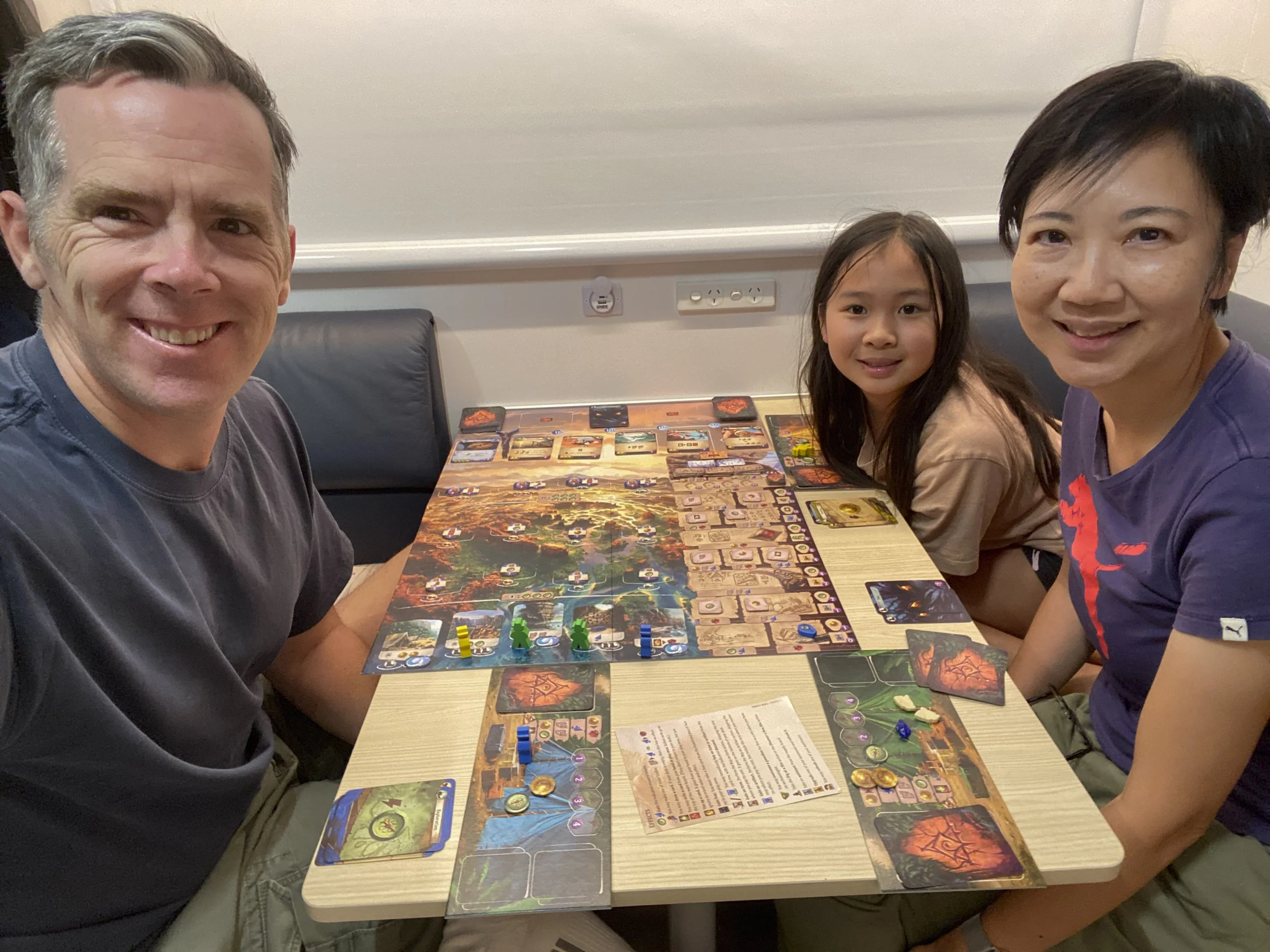
Travelling in outback Queensland: We bought some new games in Darwin and have finally got around to learning this one called The Lost Ruins of Arnak

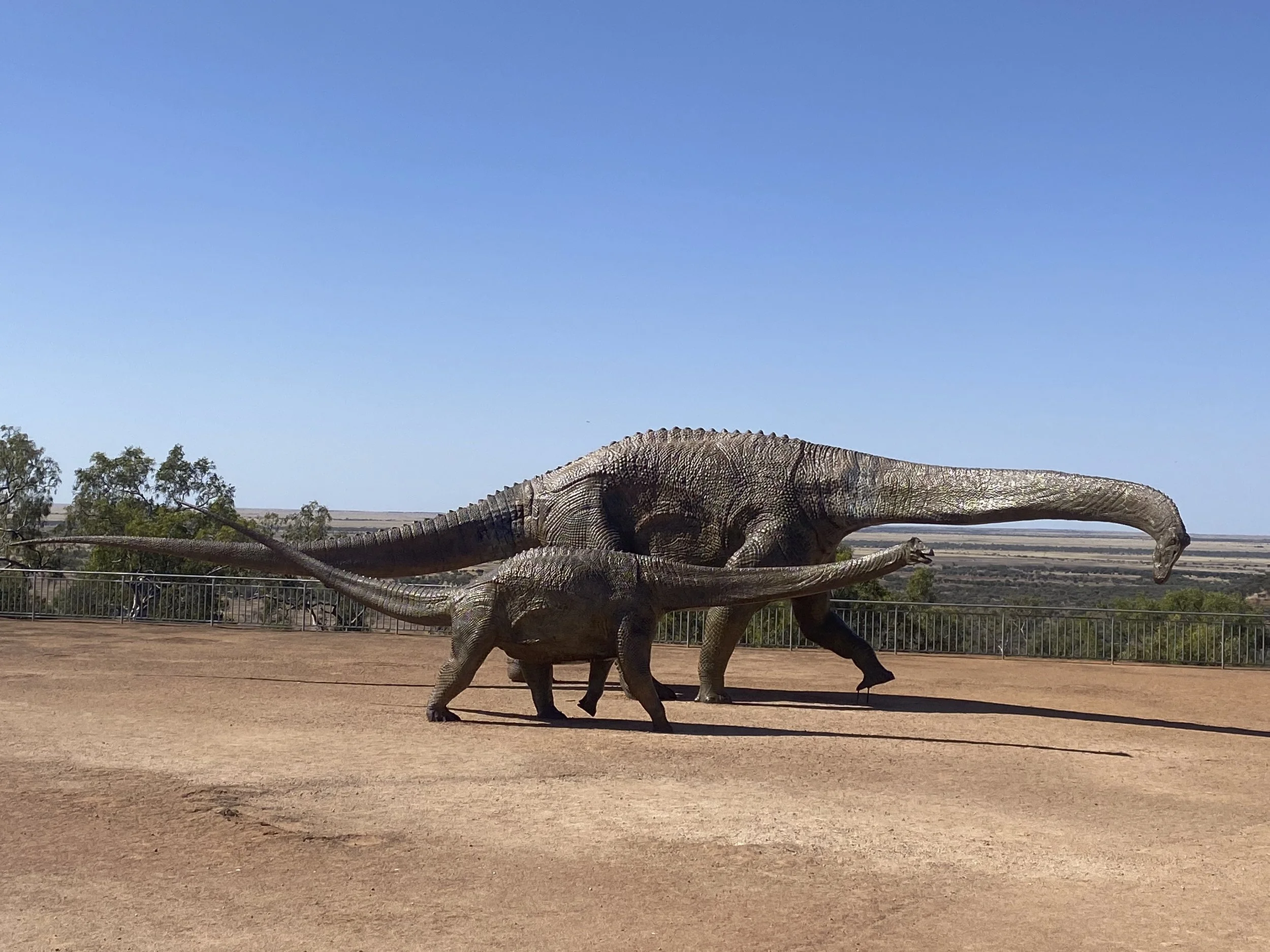
Eromanga: This is a very small town in Queensland. Some years ago they found some dinosaur bones. They have followed the lead of Winton and leant into dino-tourism. This is their museum in Eromanga

Eromanga: Holding a piece of dinosaur bone which is about 90 millions years old
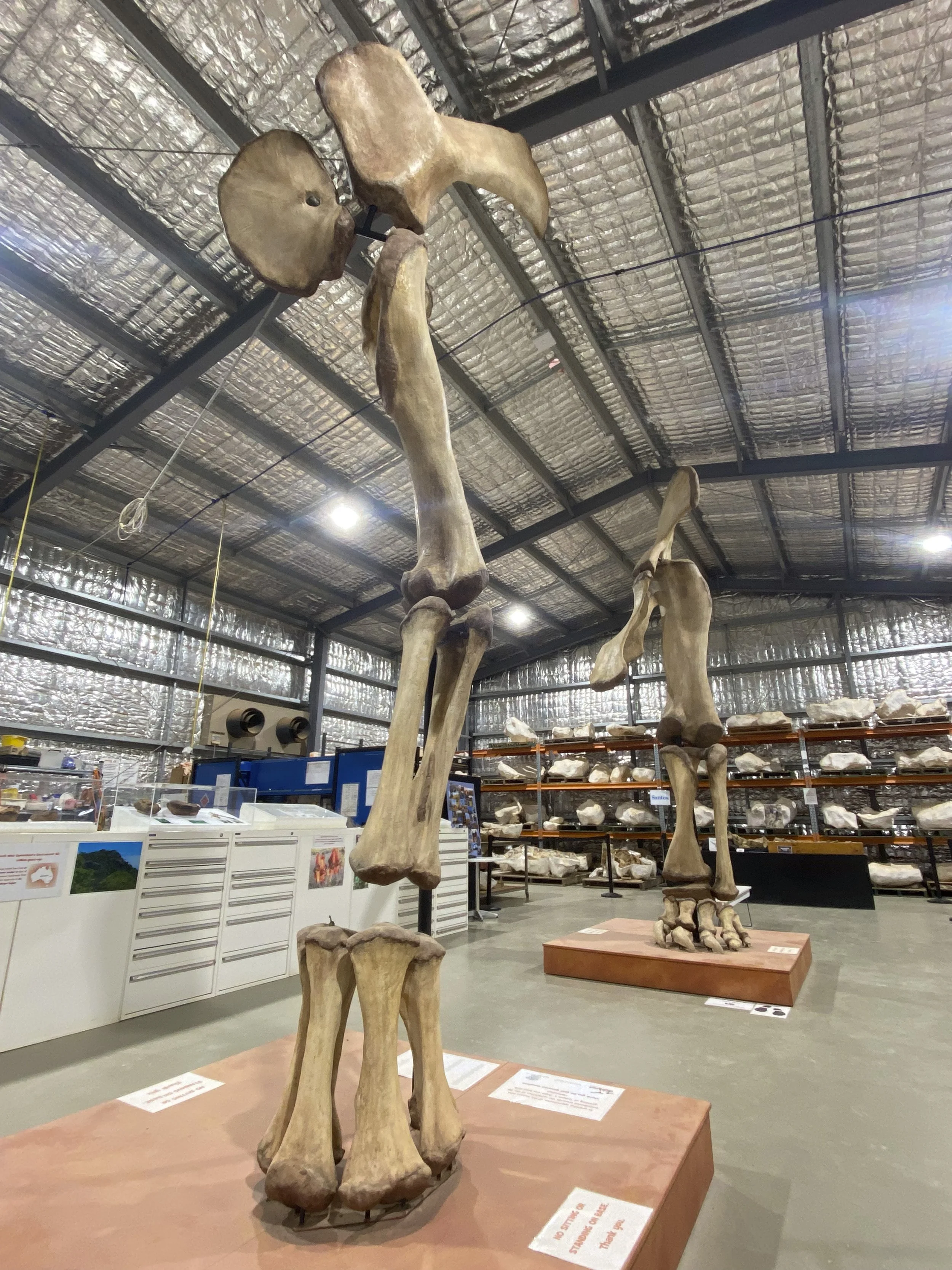
Eromanga: They are building a scale model of their poster dinosaur named Cooper
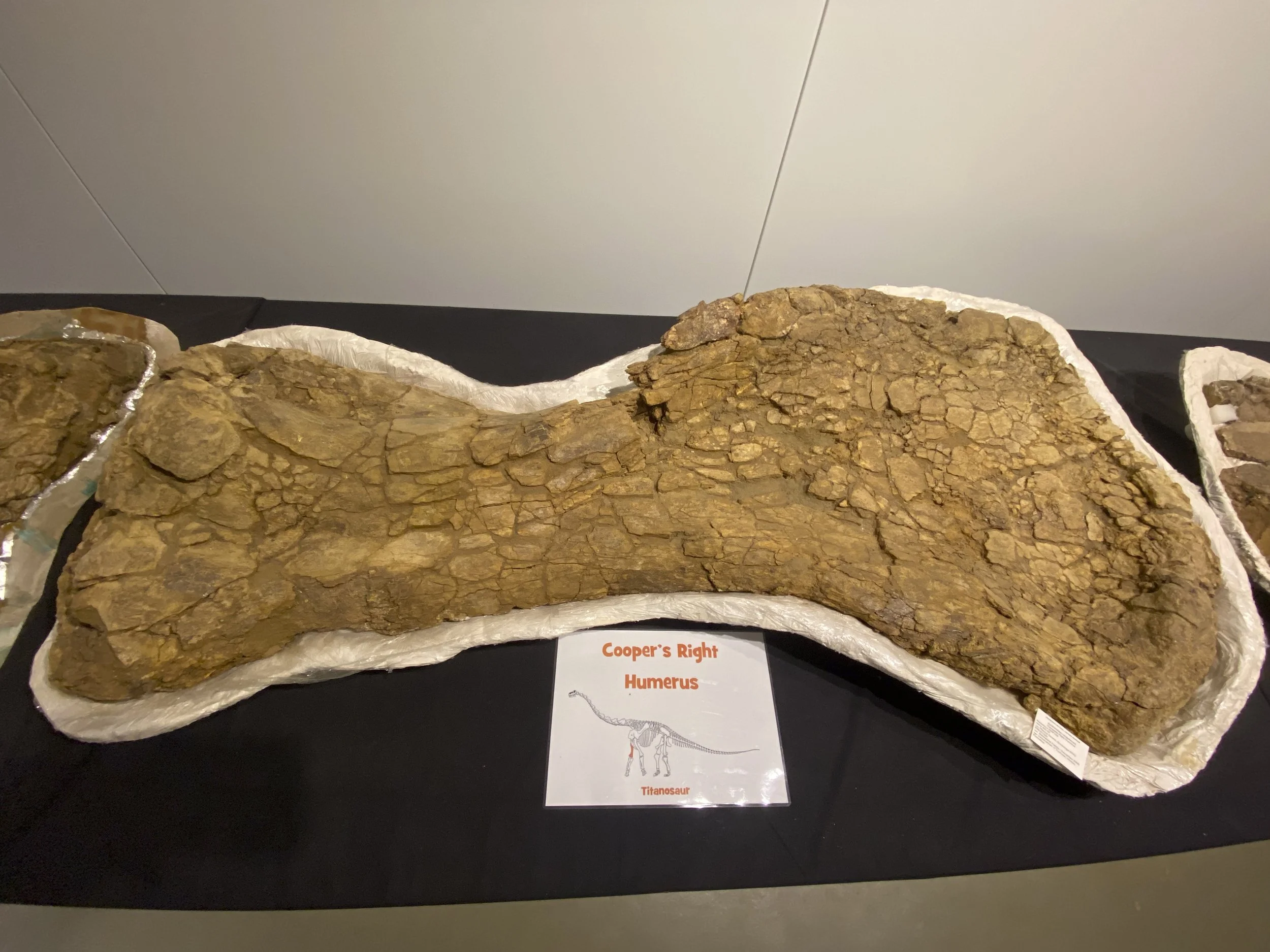
Eromanga: Cooper's thigh bone
Eromanga: The park has a dinosaur theme

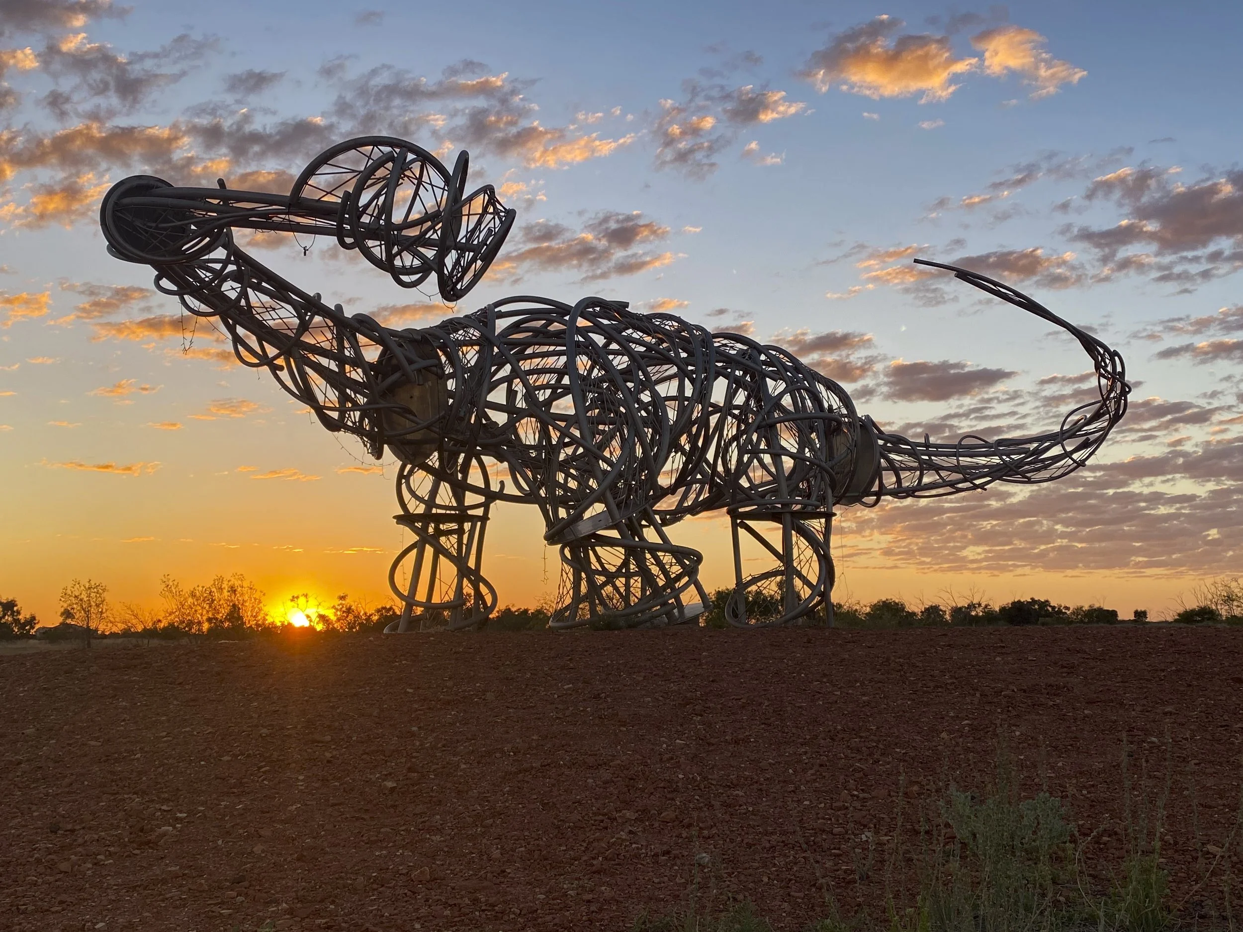
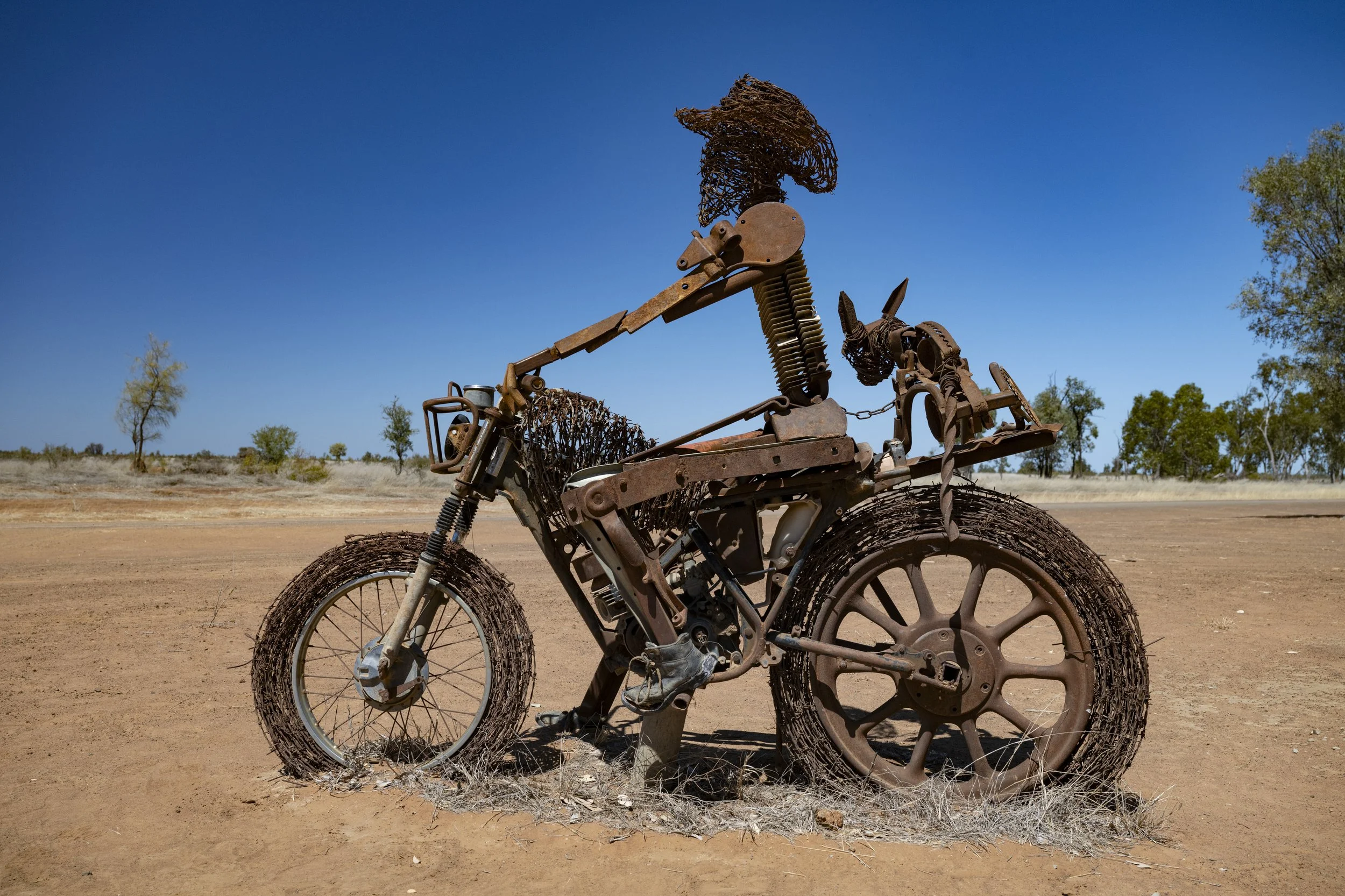
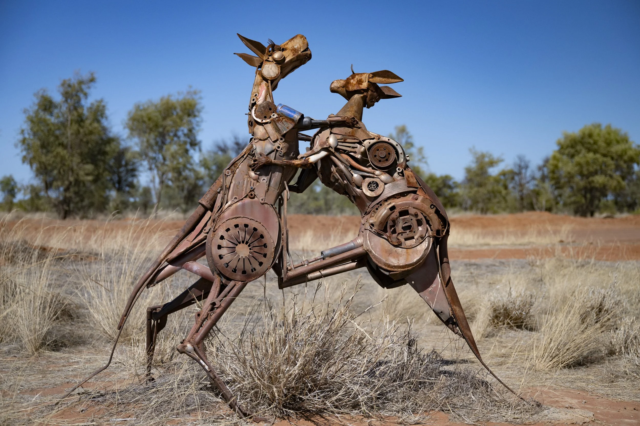
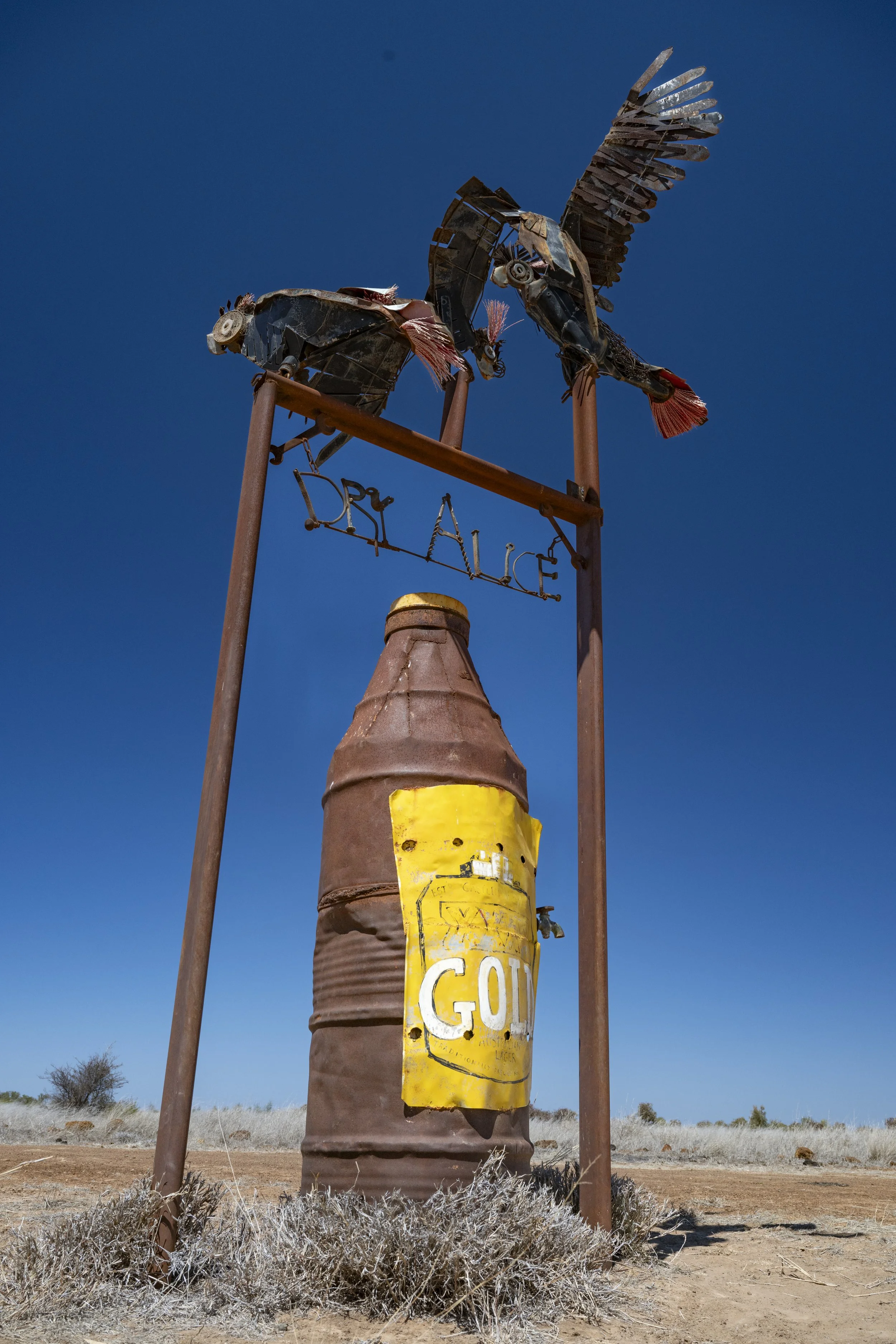
Lake Dunn Sculpture Trail: There is a 200km loop from the town of Aramaic which has 40 sculptures by local artist Milynda Rogers who lives on a station along the loop. This sculpture, called the 'Returned Soldier' sits high above the road below

Lake Dunn Sculpture Trail
Lake Dunn Sculpture Trail
Lake Dunn Sculpture Trail

Lake Dunn Sculpture Trail
Lake Dunn Sculpture Trail

Lake Dunn Sculpture Trail

Lake Dunn Sculpture Trail

Lake Dunn Sculpture Trail

Lake Dunn Sculpture Trail

Lake Dunn Sculpture Trail

Lake Dunn Sculpture Trail

Barcaldine: This is the 'Tree of Knowledge' which the shearers met under for the shearers strike in 1891. It is historical for its connection to the formation of organised labour. The tree was fatally poisoned in 2006 and then preserved.
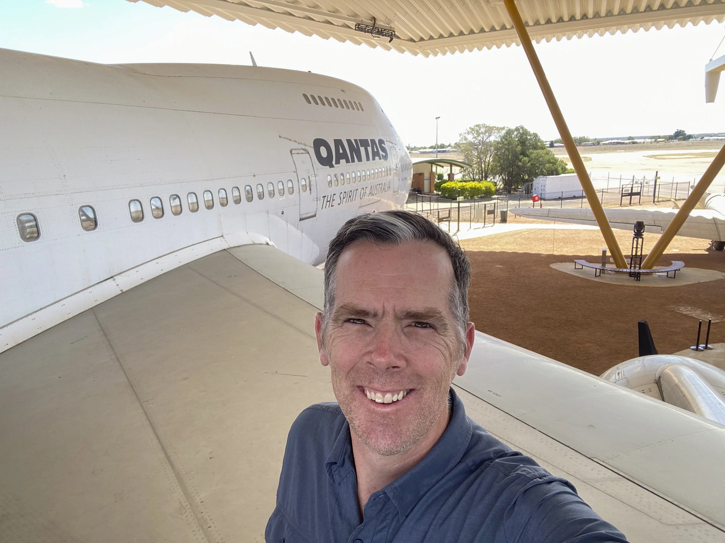
Qantas Founders Museum (Longreach): Out the wing of a 747
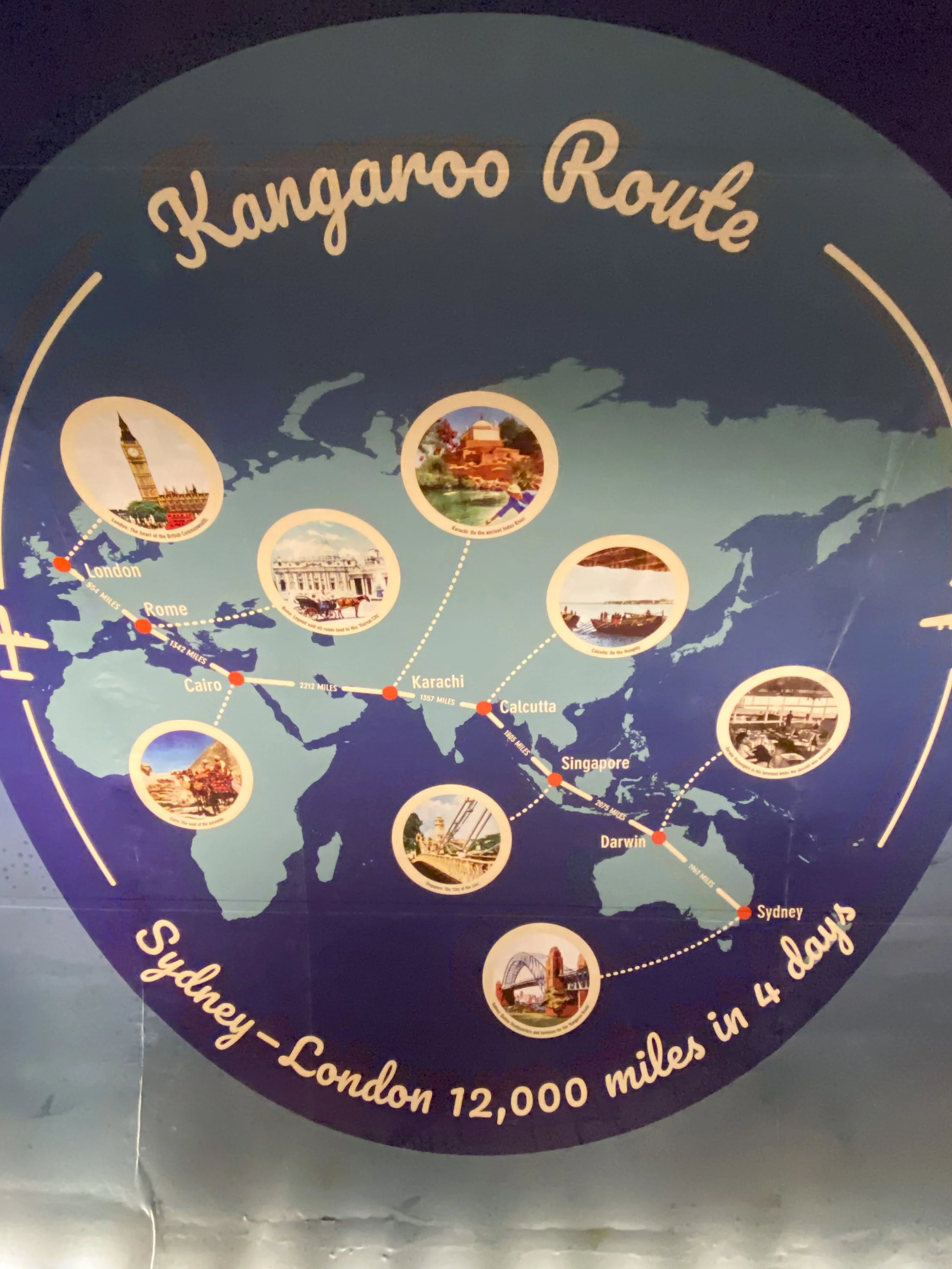
Qantas Founders Museum (Longreach): The old route to London

Qantas Founders Museum (Longreach): Flight deck of 747-200

Qantas Founders Museum (Longreach): The instrumentation panel for the engineer on a 747-200. This plane was retired in 2002. I got lucky on the tour. There were three of us doing the tour, and I was asking the guide about this and that when one of my fellow participants started answering the questions. He had flown for Qantas for 20 years, including 8 years in this plane. It was a real bonus having all of his knowledge

Winton: The Waltzing Matilda Museum. A museum dedicated to our national song (not our national anthem). A statue of A.B. 'Banjo' Paterson.
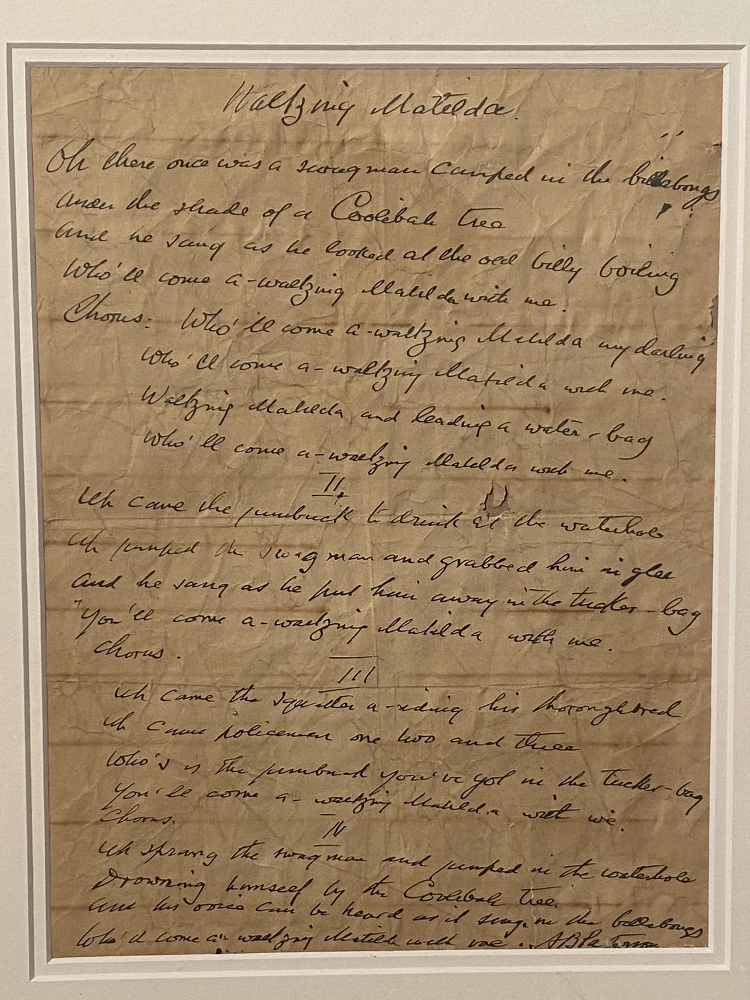
Winton: The Waltzing Matilda Museum. A copy of the original hand written lyrics by Banjo Paterson
Winton: Time for more dinosaurs. Winton bills itself as the dinosaur capital of Australia. Interestingly, it was only about 25 years ago that the first dinosaur remains were found in Australia.

Winton: We have seen many fire risk indicators, but this is the first fly level indicator. Above 'extreme' is just eating flies

Winton. They cut chunks out of the ground at the archaeological sites and encase these chunks in plaster. Back at the museum volunteers work their way through separating out the fossils
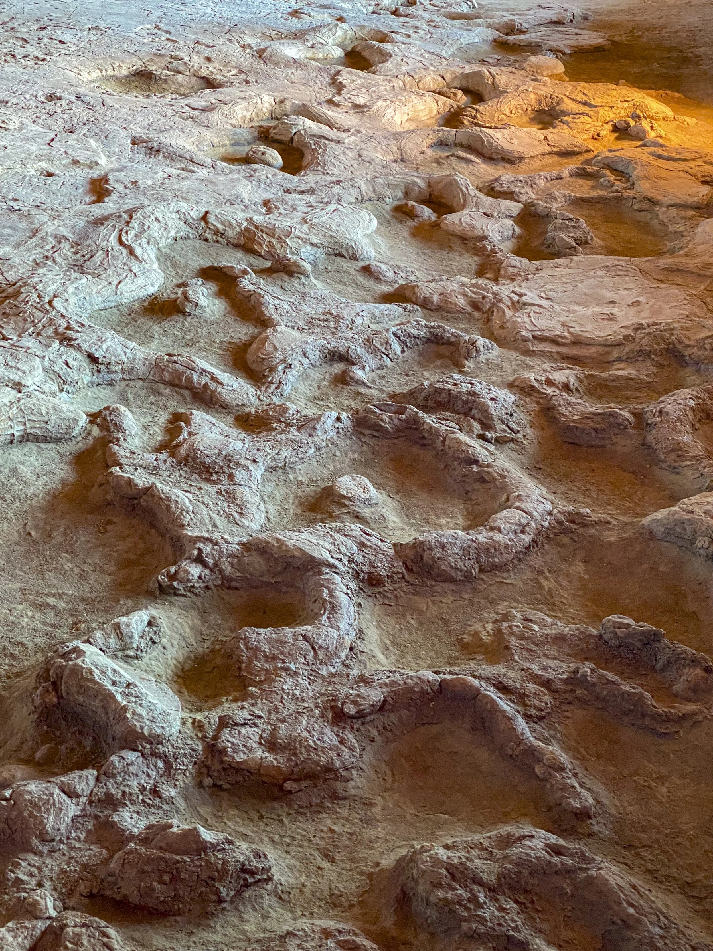
Winton: Dinosaur footprints

Mount Isa: This is a mining town in north-central Queensland. They have a tour of a working mine... Well, that is what they call it. In reality it is a mine they built next to the working mine for the sake of tourists. It was still a very good tour. Our guide has worked at the mine for 20 years, and still works at the mine 7 days on / 7 days off and so was a great source of information
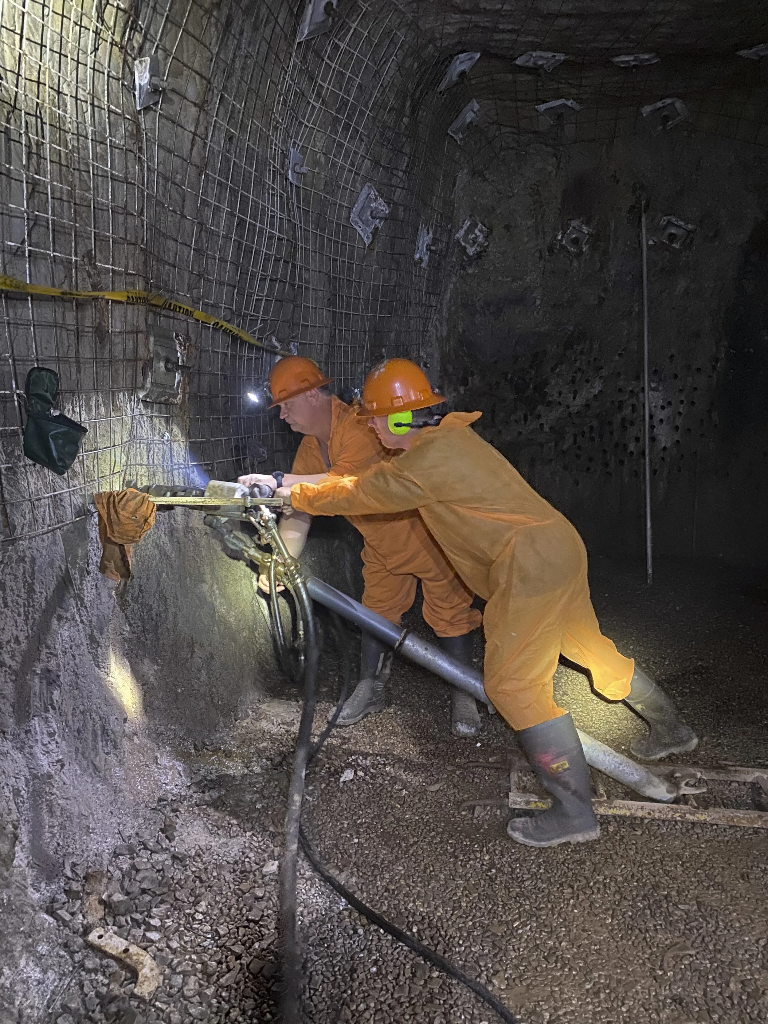
Mount Isa: Having a go at the pneumatic drill to create holes for blasting. It was so very uncomfortable. I cannot imagine doing this all day long. Though, now days, these holes are drilled by a large piece of equipment (which we got to see, and which our guide still operates)

Mount Isa: When the charges are set everyone needs to be out of the mine. The board manages where people are

Mount Isa: The underground hospital was built during WW2 but was never used
Mount Isa: The underground hospital was built during WW2 but was never used

Normanton: Is a small town on the Gulf of Carpentaria. It is near Normanton that Burke & Wills reached their target of the Gulf of Carpentaria
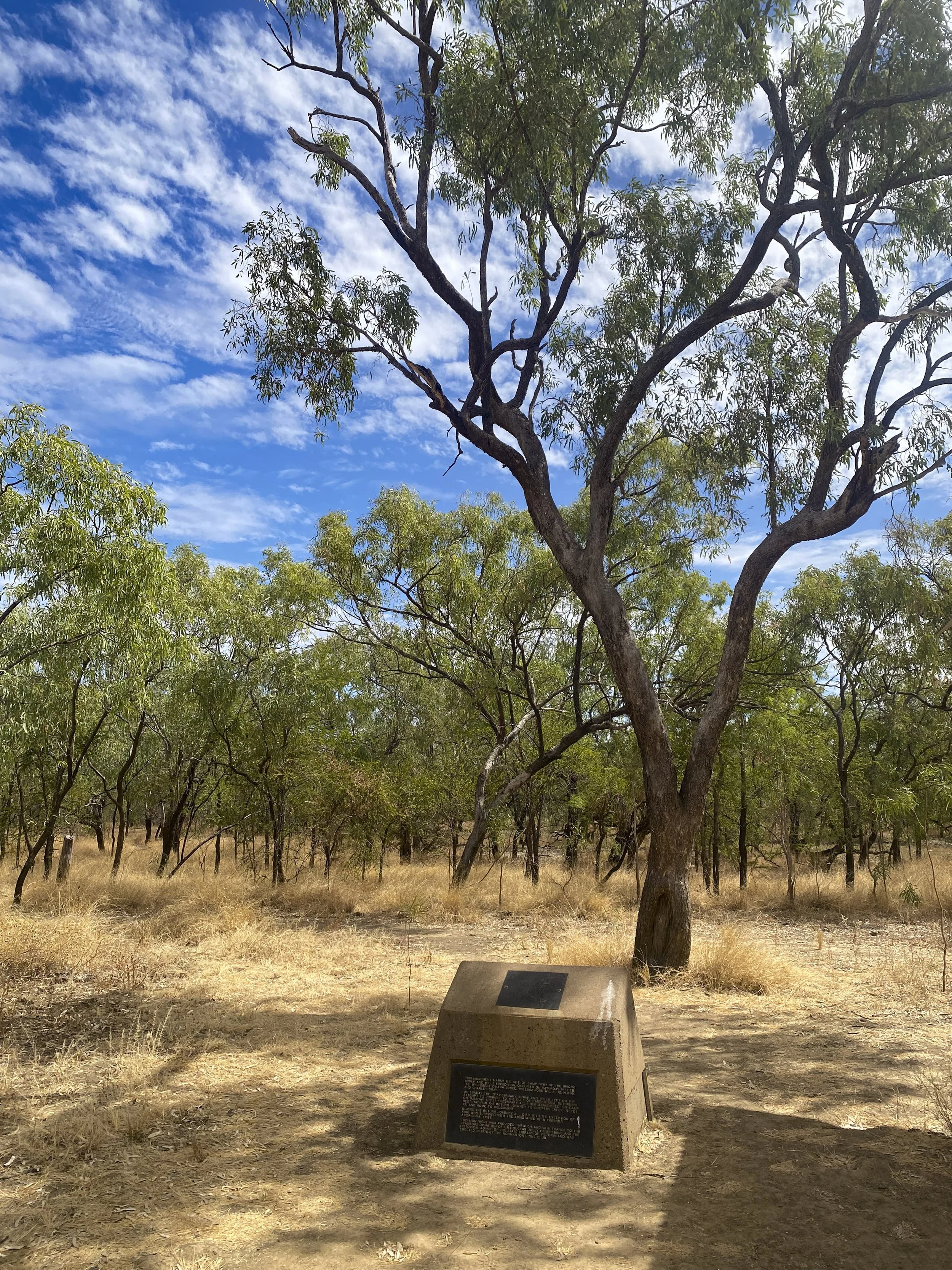
Normanton: The site of Burke & Wills most northern camp (Camp 119)

Normanton: Burke & Wills carved their mark and camp number into more than a dozen trees to prove they had made it to the gulf

14. Coober Pedy
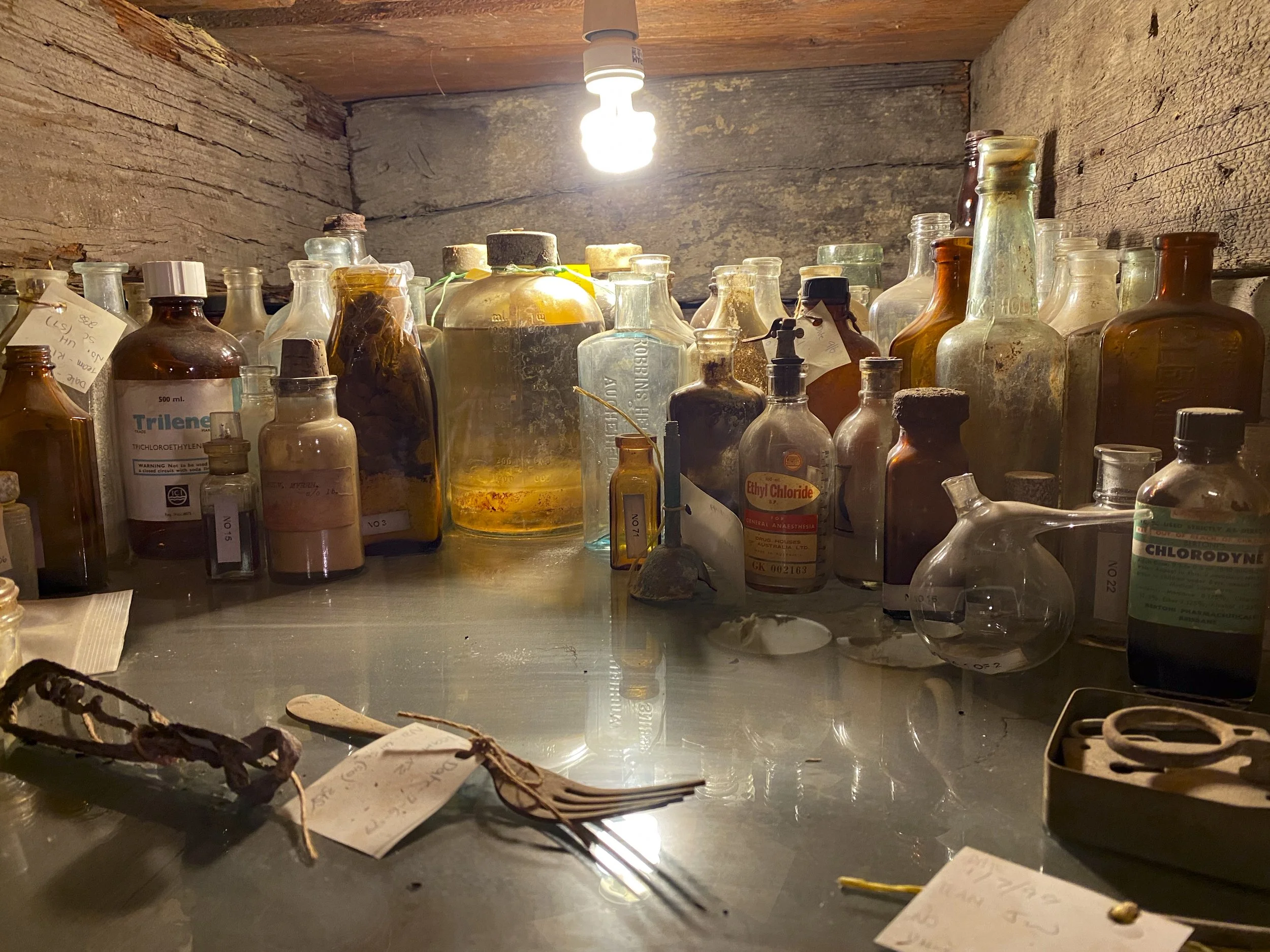
Coober Pedy is an opal mining town in South Australia. One of the things that the town is famous for is the underground houses which are called ‘dugouts’. These are houses built underground or into the side of hills. As they are underground they stay very cool in the hot summers. We were there in winter and the daytime temperature was above 30 degrees. Summer must be unbearable - no wonder they dug their houses under the ground. We had booked the caravan in for a scheduled service in Coober Pedy, and when we got there the mechanic pointed out that one of the caravan tyres was bald. This was due to an alignment issue. The mechanic in Coober Pedy did the best he could, and then we drove 640 km to the nearest centre which could perform a wheel alignment on a caravan.

Coober Pedy: They are nothing if not grand about their brand

Coober Pedy: Arriving into the 'Opal Town'
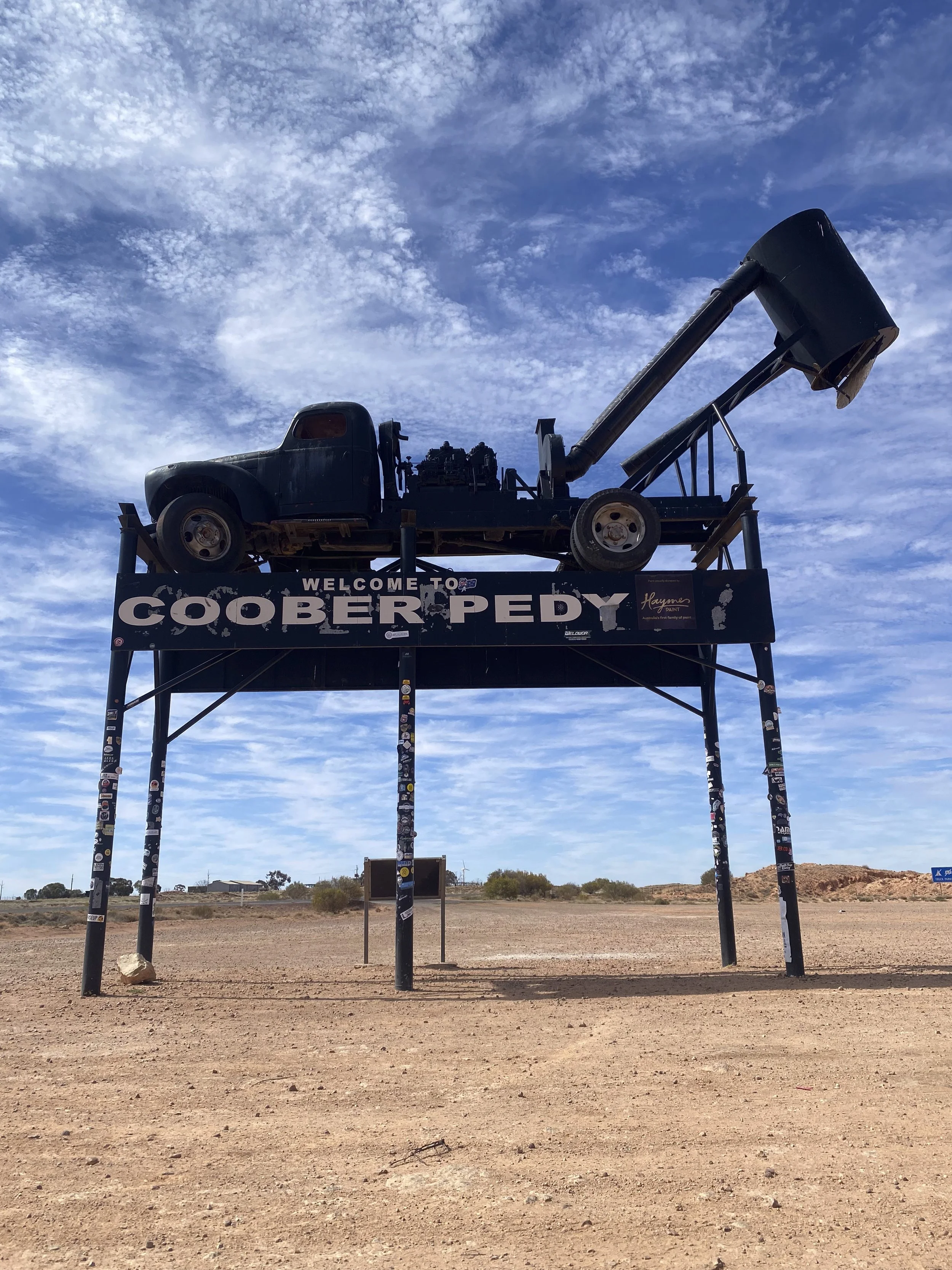
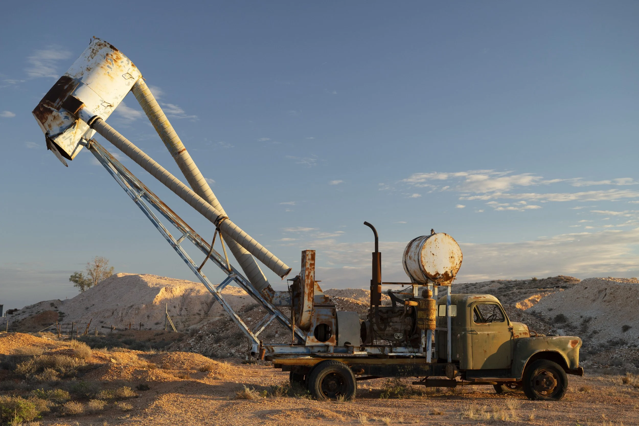
Coober Pedy: The symbol for the town is the blower truck, though, as per the photo below which explains the blower truck, it is actually a giant vacuum for extracting earth out of the mine when digging a mine
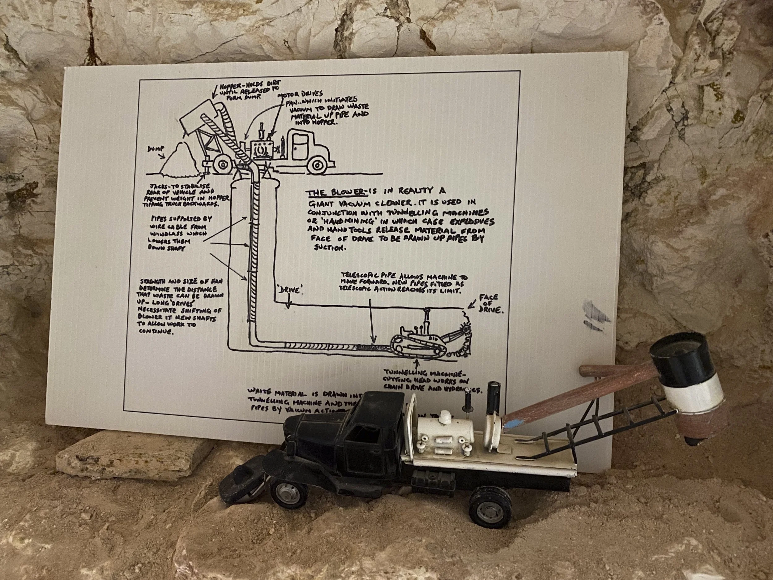
Coober Pedy: Explaining the blower truck
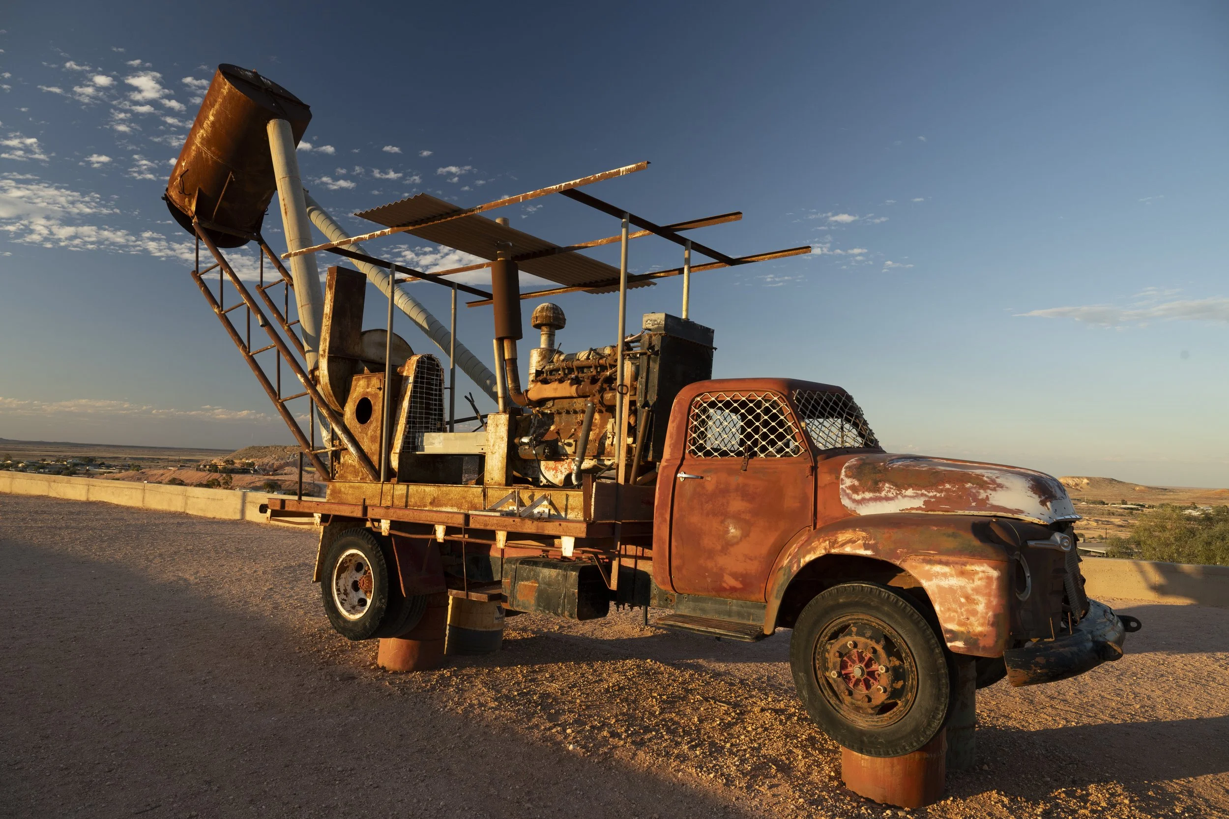
Coober Pedy: Some blower trucks around the place which look like they were extras in a Mad Max movie
Coober Pedy: Some blower trucks around the place which look like they were extras in a Mad Max movie

Coober Pedy: Surely this thing was left over from a Mad Max movie

Coober Pedy: There are numerous underground hotels

Coober Pedy: We stayed in an underground (dugout) house which we booked through Airbnb. This is our main bedroom.

Coober Pedy: The whole landscape is just piles of dirt which have been dug up in the hunt for opals. You can register a claim and go mining. There is apparently still a lot of opal to be found. There are no big mining companies, just individual and small groups of prospectors
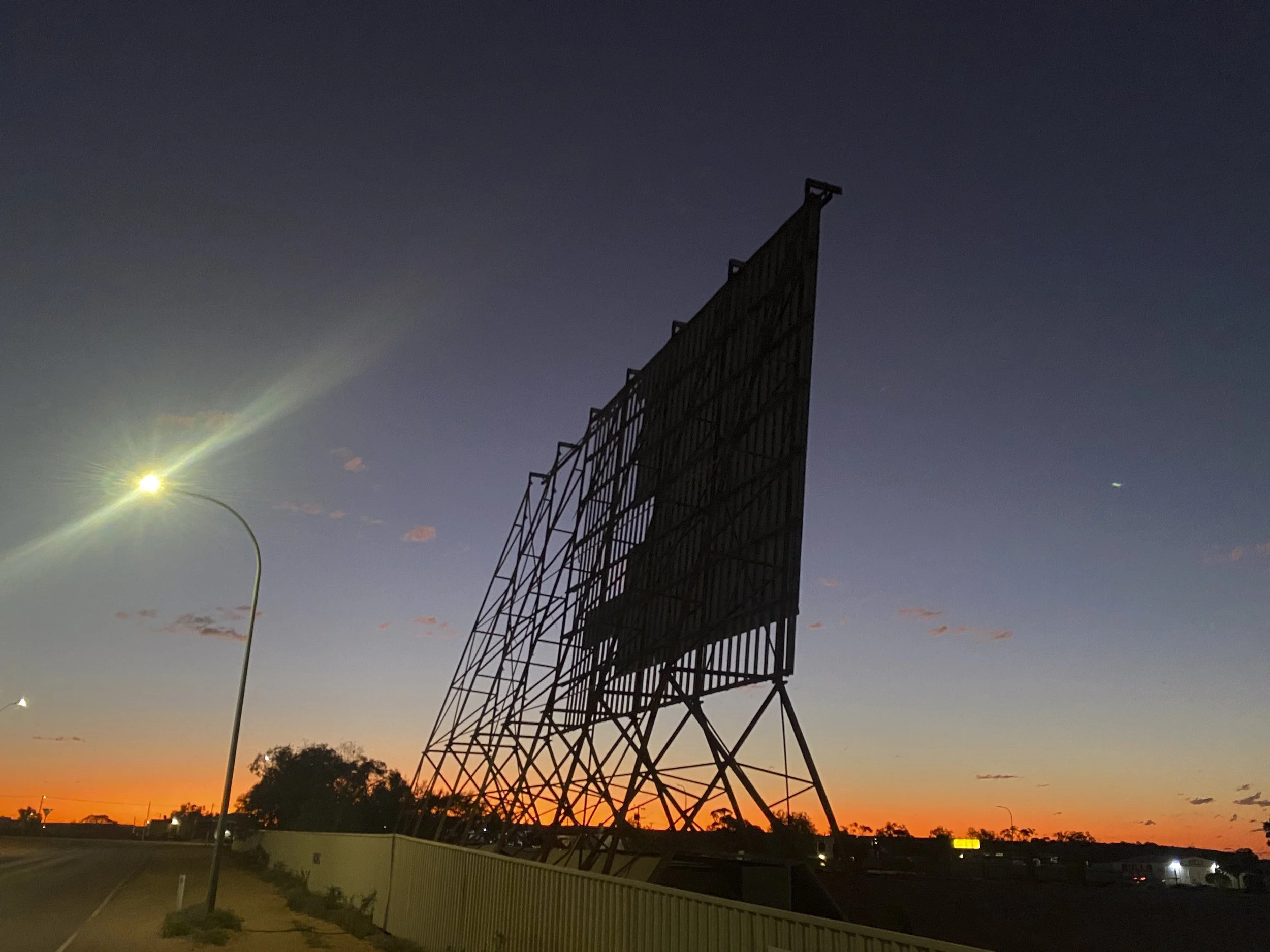
Coober Pedy: The drive in has been a central feature to community life in Coober Pedy. A few years ago the screen was blown off in a storm. They expect to have it back and operational within the year

Coober Pedy: We did a bit of 'noodling', which is fossicking through the dug up earth piles. The name comes from 'wet noodle', which is someone who is not man enough to go underground to mine...
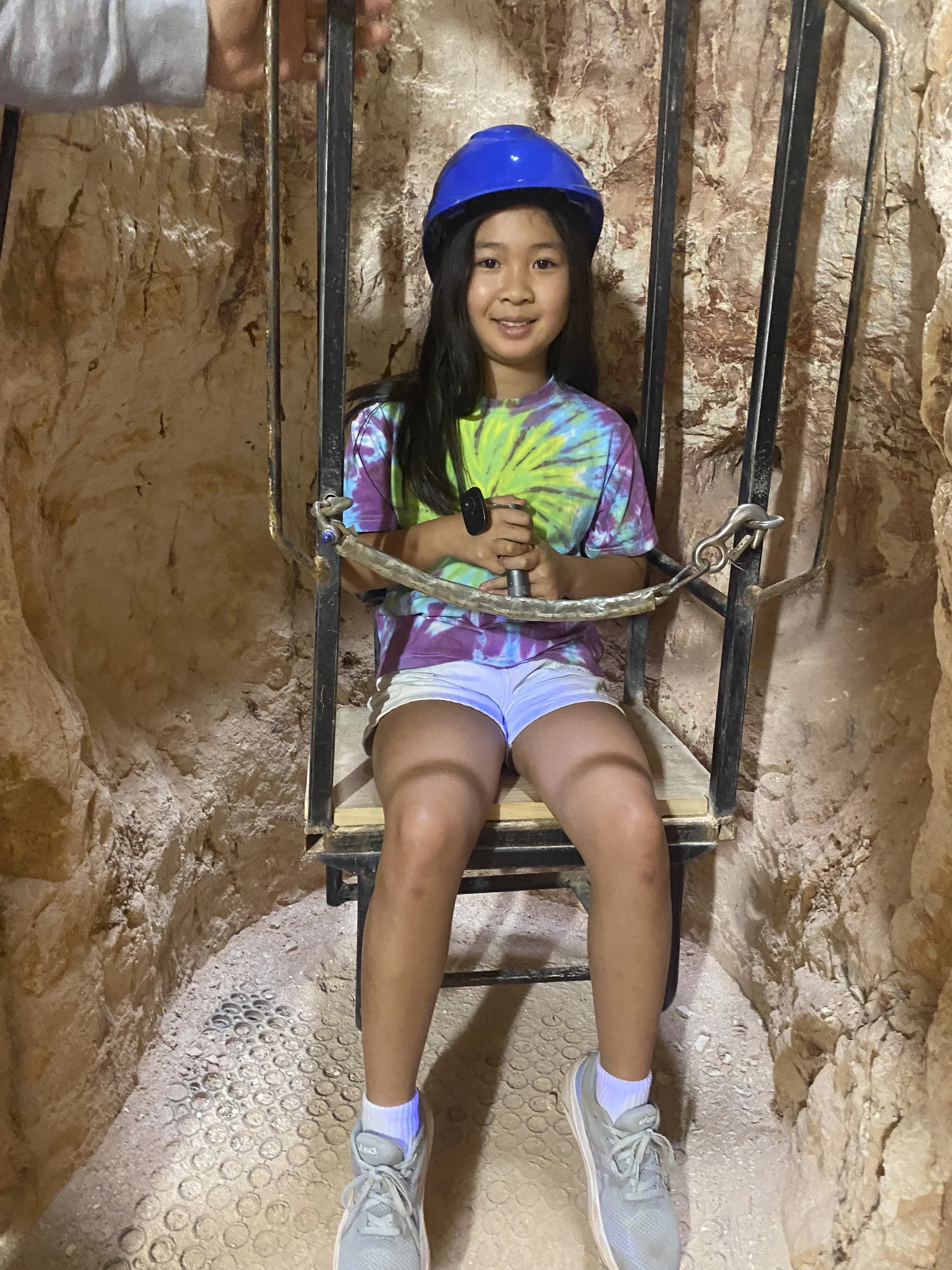
Coober Pedy: There are two very good tours in town. Here Millie is at Tom's mine which shows you through an opal mine
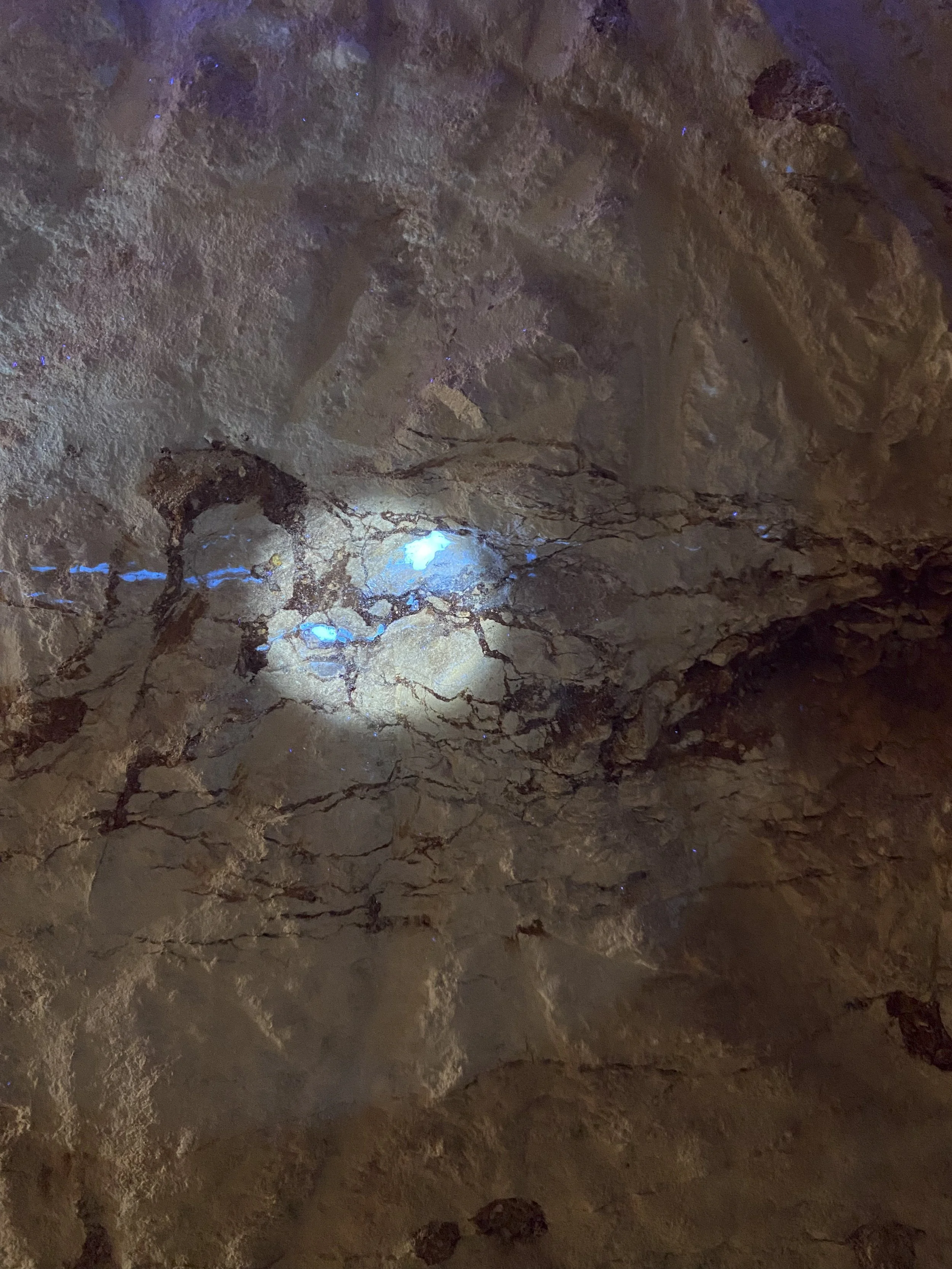
Coober Pedy: This is what opal looks like when found in a seam (level) in a wall. There is a UV light shining on the sandstone wall which helps highlight and find the opal

Coober Pedy: During the tour at Tom's mine, the children find opal along the way. At the end, the owner, Paul, trades the opals with the children. The children have to bargain with Paul (as the buyer) to sell their opals - they can bargain for a combination of money, chocolate and lollipops. I needed to sit with Millie to give her some support, but she did all of the bargaining
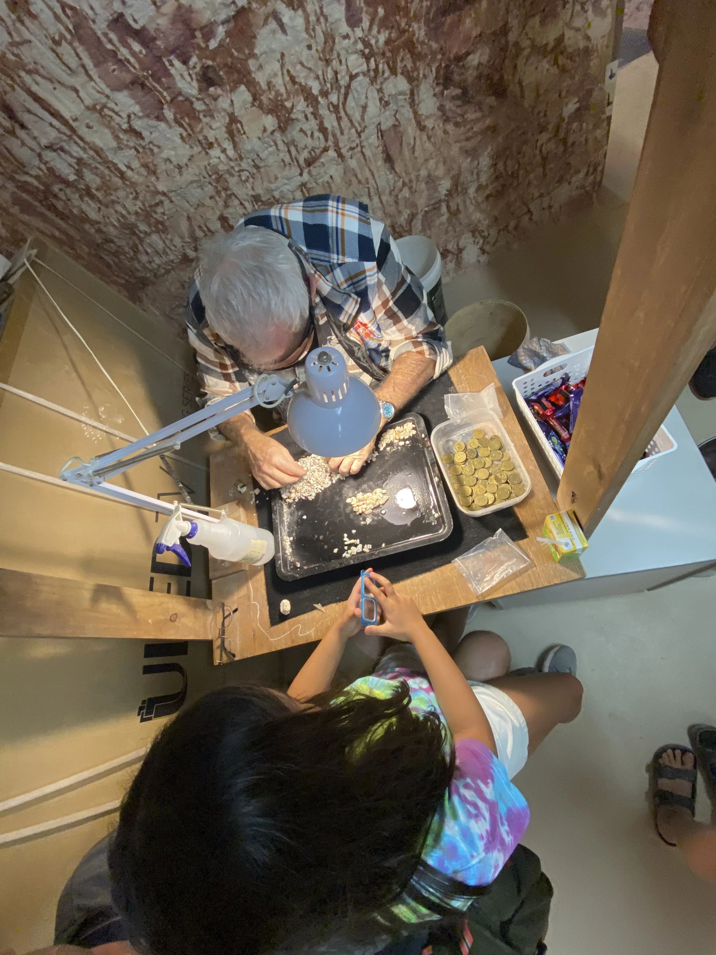
Coober Pedy: Millie bargaining with Paul for the sale of the opals that she found on the tour

Coober Pedy: This is the Old Timer's mine tour. This is an original hand dug mine and house. It is just remarkable how hard it must have been to mine like this

Coober Pedy: A common sign around Coober Pedy

Coober Pedy: One of the tires on our caravan as we arrived into Coober Pedy. We are lucky that it did not blow out. The mechanic (you can see his legs) did a great job of manually aligning the wheel so as we could get to Port Pirie (630 km away) where they have a truck wheel alignment service (needed to do an alignment for a caravan)

Coober Pedy: Goodbye Coober Pedy. Due to needing to wait a few days for the appointment in Port Pirie for the caravan wheel alignment, we ended up staying in Coober Pedy a couple of extra nights. It worked out well because it is such an interesting place

13. Uluru and Kings Canyon
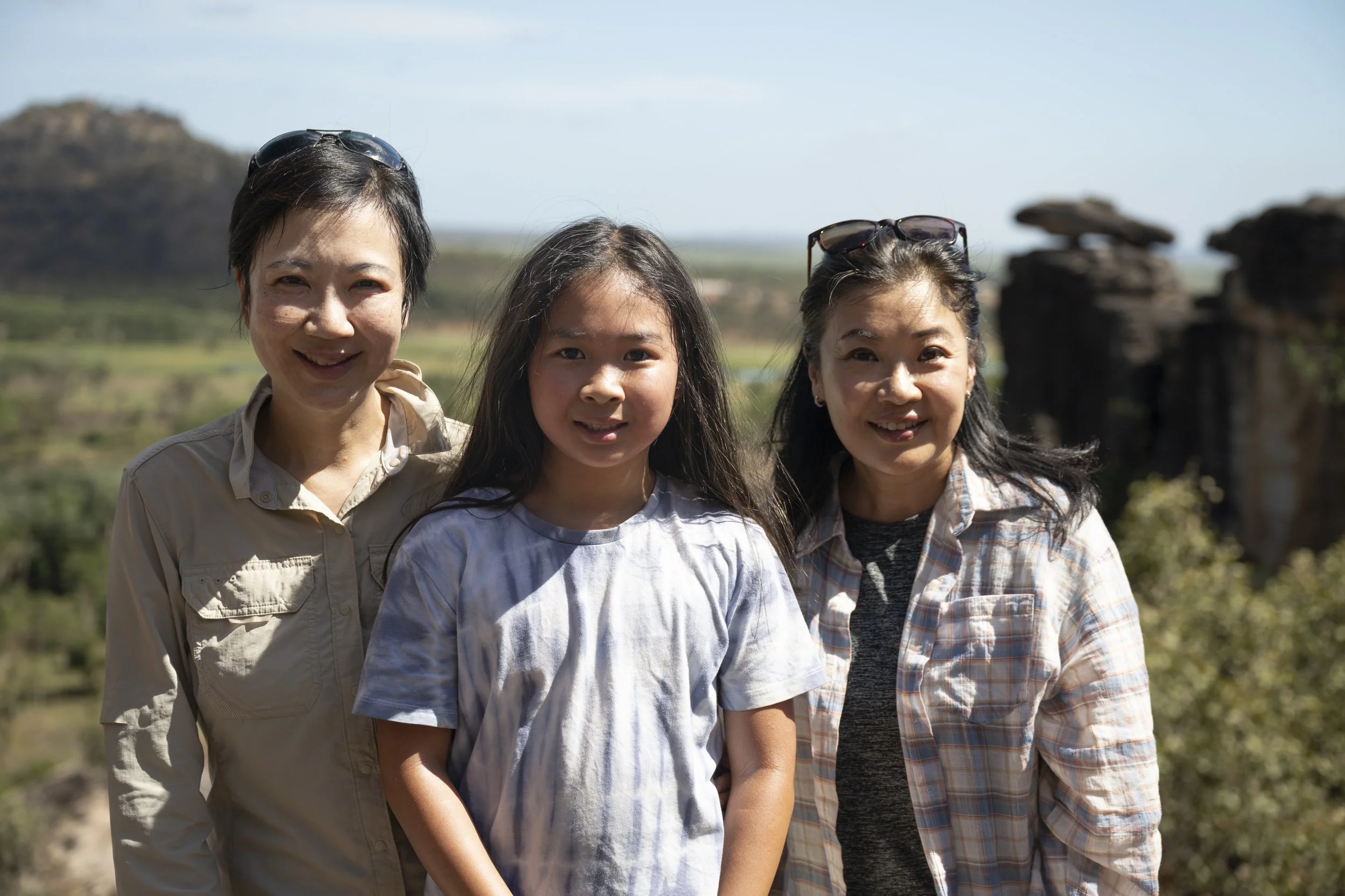
We spent two nights at Kings Canyon and did two walks - one in the valley of the canyon and one around the rim. We then went on to Uluru and spent four nights there exploring Uluru and Kata Tjuta (The Olgas). A highlight was being able to ride my bicycle around Uluru each morning. It is a lovely way to start the day. Millie made a friend in the last days and had fun creating some art and selling it in the caravan park.

Uluru: At sunset

Uluru: We are all on the roof of the car to view the sunset (and take some photos). There is a car park and viewing spot for sunset and there are quite a few people there. To get a photo over the people I got on the roof of the car. Everyone else thought that was a good idea so we all watched the sunset from there

Uluru: Before sunrise

Uluru: Sunrise

Uluru: Sunrise

Uluru: Waiting before sunrise to take photos

Uluru: Millie touching the rock

Uluru: Millie purchased a painting from an artist in Uluru. It was nice to see the artist paint and purchase direct from her

Uluru: Family ride around Uluru

Uluru

Uluru

Uluru: They are very good at coming up with ways to monetise the rock(s). We joined the dinner under the stars, which was quite nice

Uluru: Millie and Matilda's art stall at the caravan park. They made $25
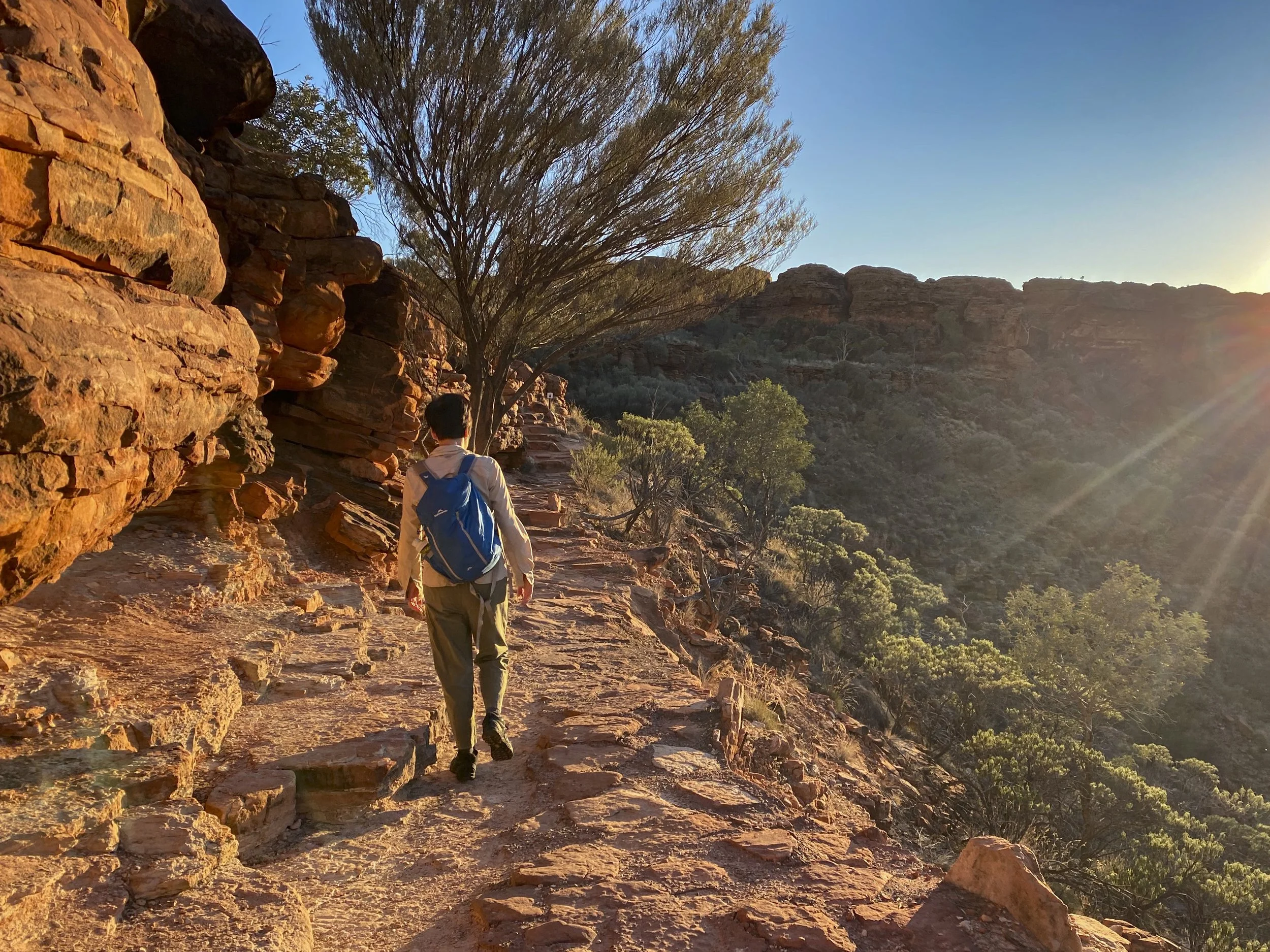
Kings Canyon: The rim walk
Kings Canyon

Kings Canyon

Kings Canyon

Kata Tjuta (The Olgas): They look small here, but the maximum height is 546 metres above the surrounding ground

Kata Tjuta (The Olgas): The walk was a favourite
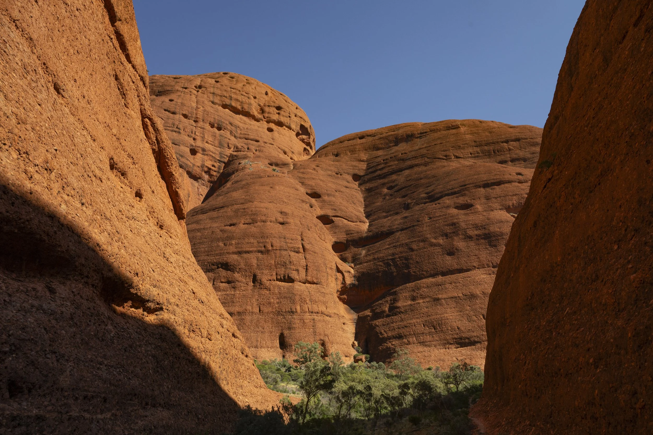
Kata Tjuta (The Olgas): The walk was a favourite

12. Darwin to Alice Springs
We spent a few days in Darwin. The intention was to rest, but quite a bit of time was taken again dealing with car and caravan maintenance. I had the car checked over by a 4WD service centre and they found that the front left suspension was broken. For the caravan, we had experienced a persistent noise when walking around the van and so had someone come out and check on that. We picked up Sumy’s cousin Grace who will be with us till Uluru. We did manage some rest in Darwin though - a couple of swims in the pool (another cold pool in a long line of cold pools on the trip), buying some new board games (‘Brass: Lancashire’ and ‘Lost Ruins of Arnak’) and eating some nice burgers.
The drive down to Alice Springs, which is the gateway to Uluru and Kings Canyon, was broken up by stopping at Mataranka, Larrimah, Daly Waters and the Devils’ Marbles (Karlu Karlu).
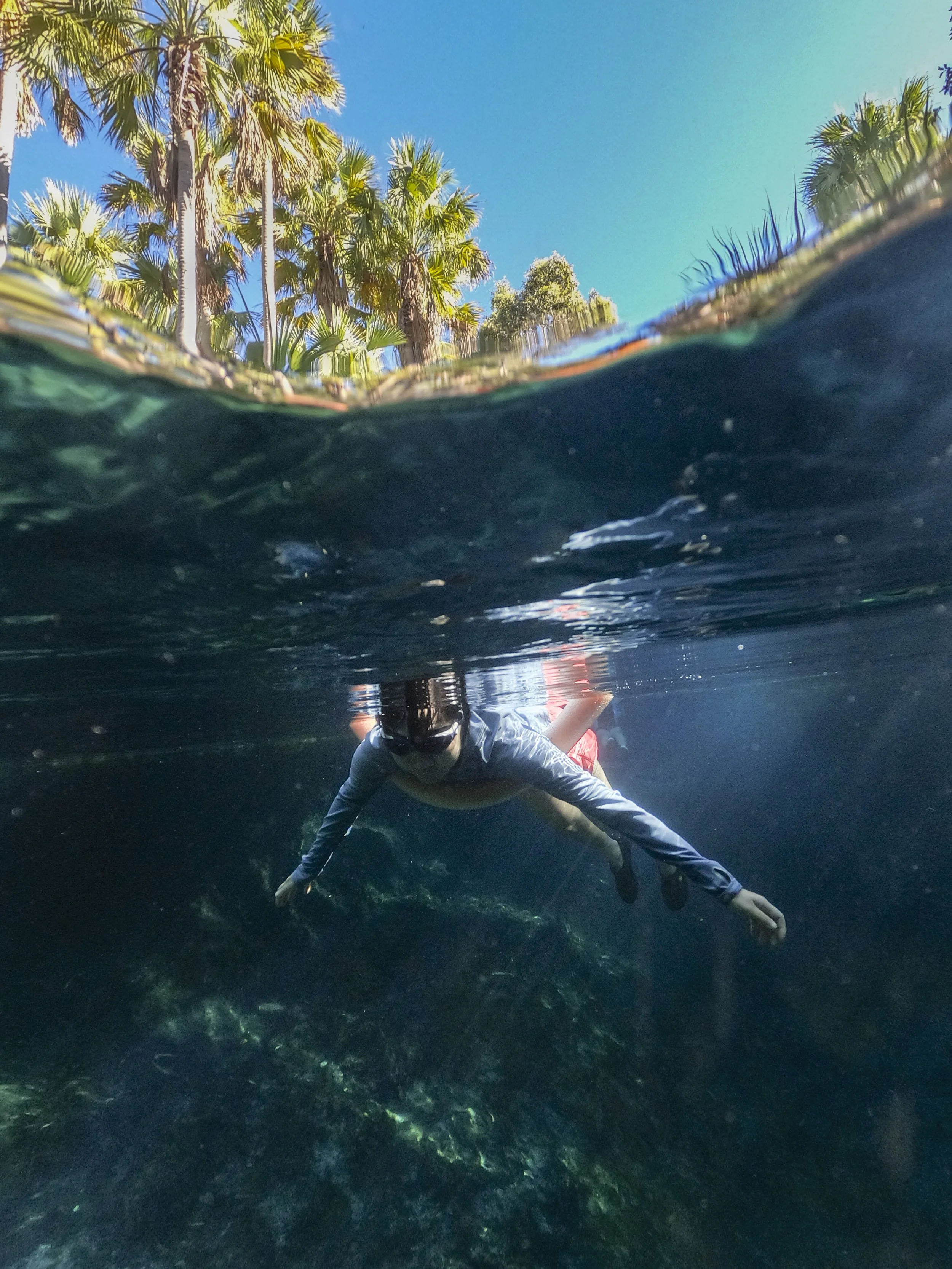
Mataranka has two famous hot springs - Mataranka and Bitter Springs. This was our second visit to Mataranka on this trip - we had taken a day trip from Katherine and decided to come back for a second time with Grace. Of the two springs, we preferred Bitter Springs. You get into the stream, which is about 32 degrees, and float downstream. When you reach a platform about 10 or so minutes later, you jump out and walk back upstream to repeat. It is one of the most relaxing things you could do.
Larrimah is famous for the disappearance (and presumed murder) of Paddy Moriarty. There were about 12 residents who lived in the town when he disappeared. The documentary ‘Last Stop Larrimah’ showcases these people, their eccentricities and their strained relationships. The police pinpointed a prime suspect but did not have sufficient evidence to charge him. The town is making the most of its notoriety with all sorts of '“Where’s Paddy” souvenirs.
Daly Waters is a famous pub in the middle of no where. It is sort of like the Kim Kardashian of pubs - famous for being famous.
The Devils Marbles is a collection of rocks within the Karlu Karlu National Park, which was a surprisingly pleasant stop over for the night.
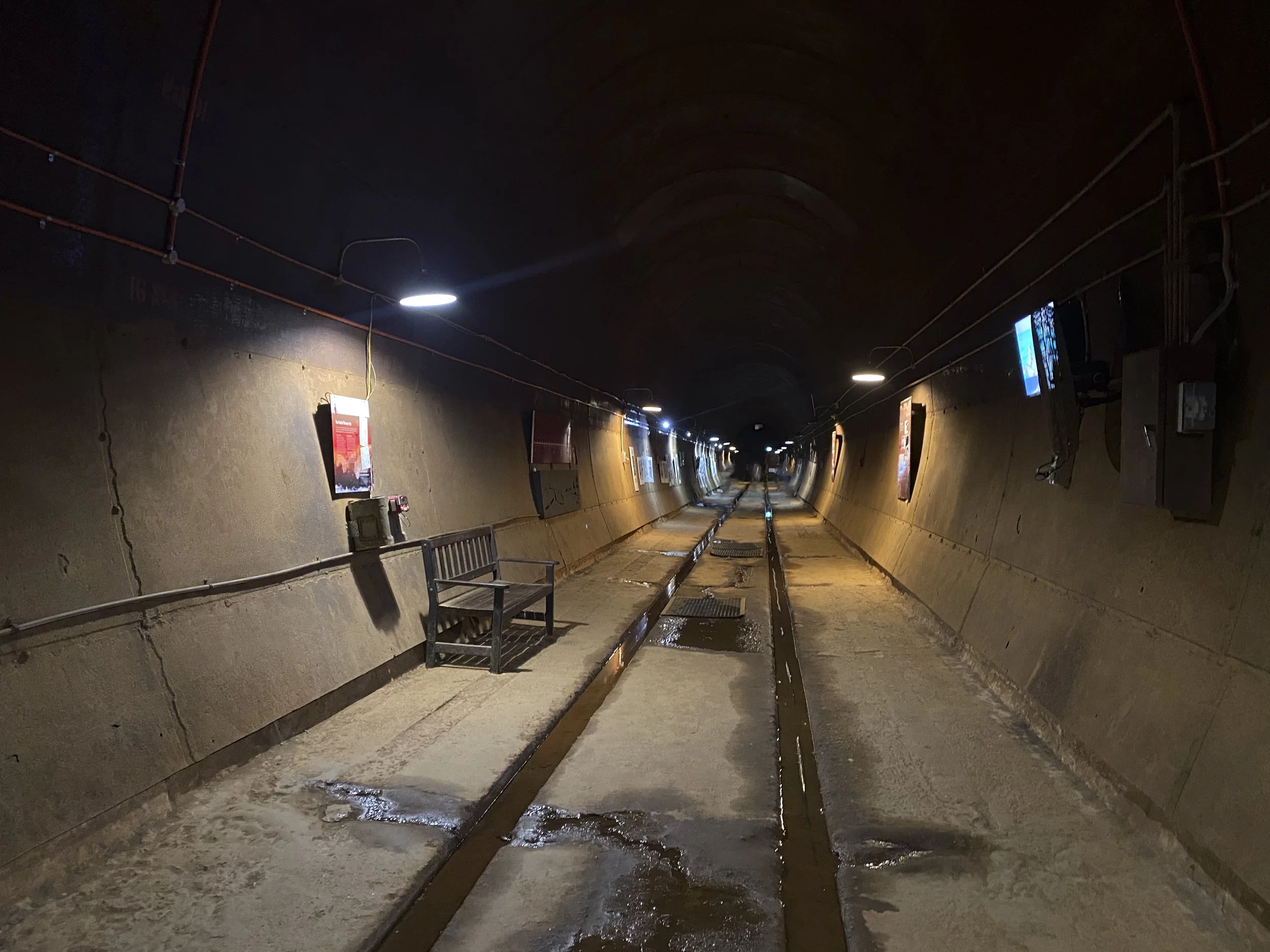
Darwin: The World War Two Oil Storage Tunnels. These were built to store oil out of reach of Japanese bombs. There were many engineering challenges and cost blow outs. All the while, it was obvious to the Japanese pilots what was going on. But, there was no need to bomb them because they were never finished and put into service.

Darwin: The World War Two Oil Storage Tunnels.

Darwin: The World War Two Oil Storage Tunnels.
Darwin: Enjoying the sunset next to the night food market
Mataranka: Bitter Springs

Mataranka: Bitter Springs

Mataranka: Bitter Springs. Sumy floating downstream

Mataranka: Bitter Springs

Mataranka: Bitter Springs

Mataranka: Bitter Springs
Mataranka: Bitter Springs

Mataranka: Bitter Springs
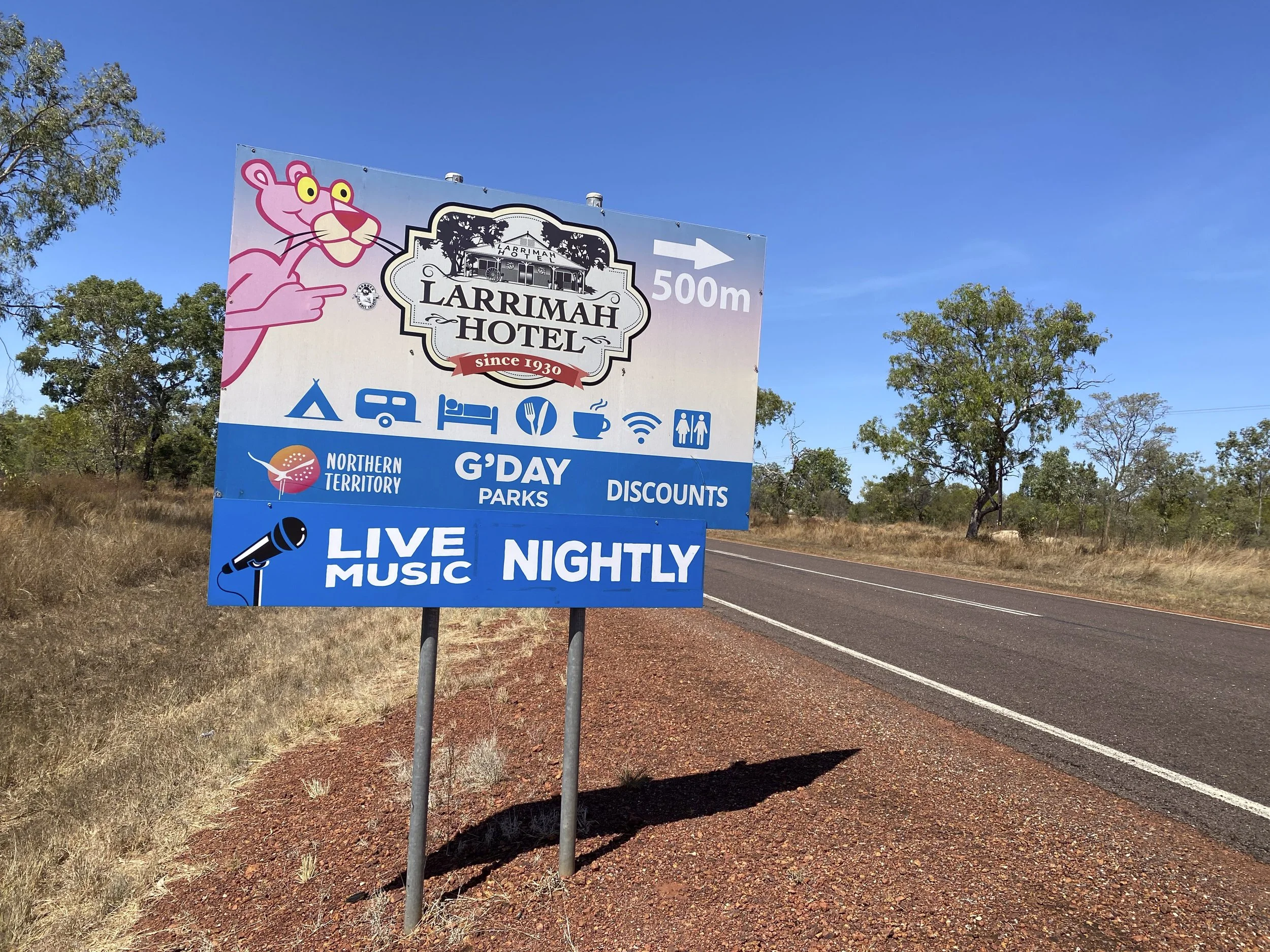
Larrimah Hotel: The heart of Larrimah. In the documentary 'Last Stop Larrimah' it seems that the only thing the residents had in common is drinking here all the time

Larrimah Hotel: The theme is the Pink Panther

Larrimah: Paddy lived just down from the hotel. This is the sign which is still outside his house (his house just sold very recently)

Larrimah: Paddy's nemesis Fran lived right over the road. She had a border who was the prime suspect

Larrimah Hotel: The hotel is shamelessly cashing in on the notoriety of Paddy's disappearance

Larrimah Hotel: The hotel is shamelessly cashing in on the notoriety of Paddy's disappearance
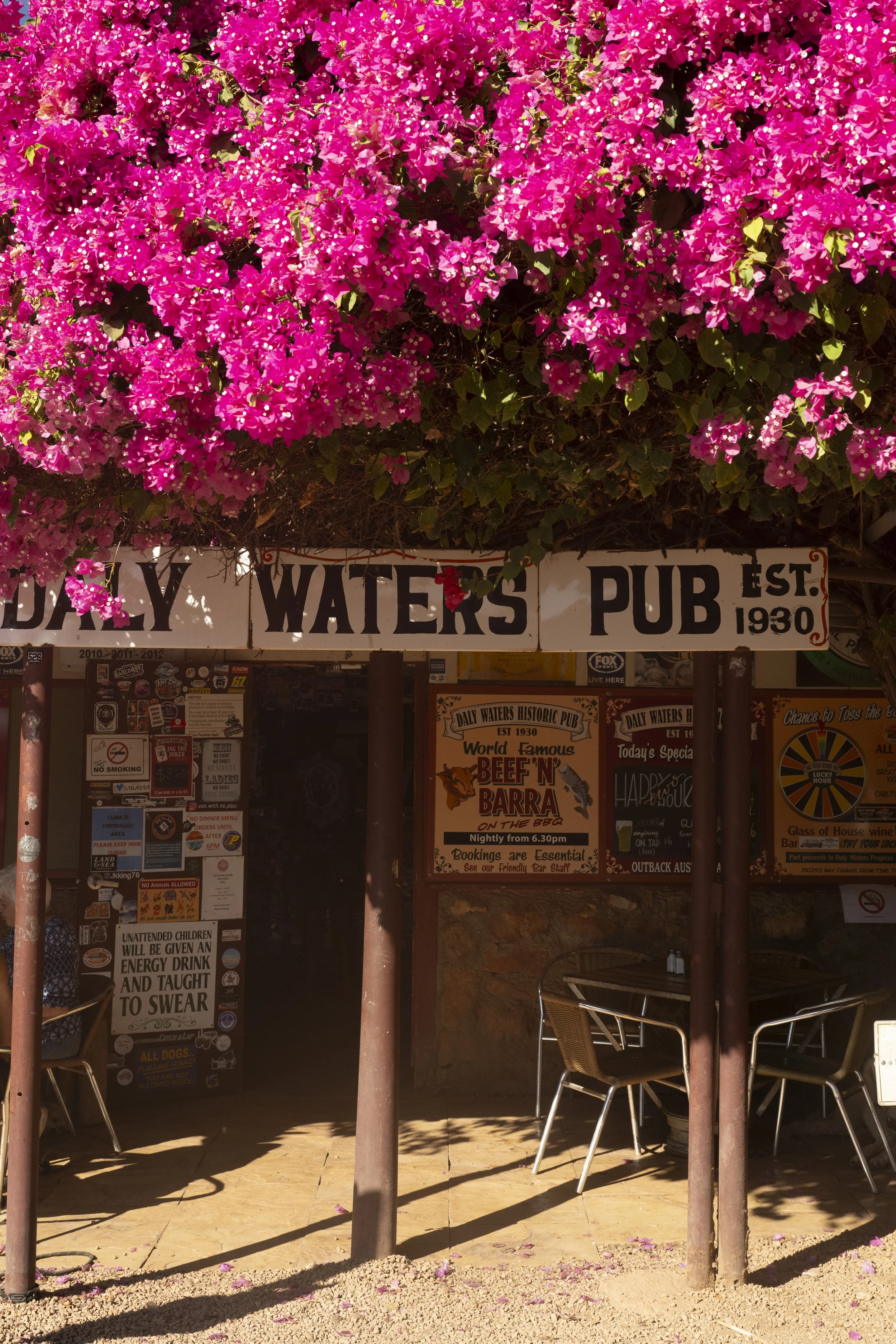
Daly Waters Pub

Daly Waters Pub: There are a couple of donkeys hanging around
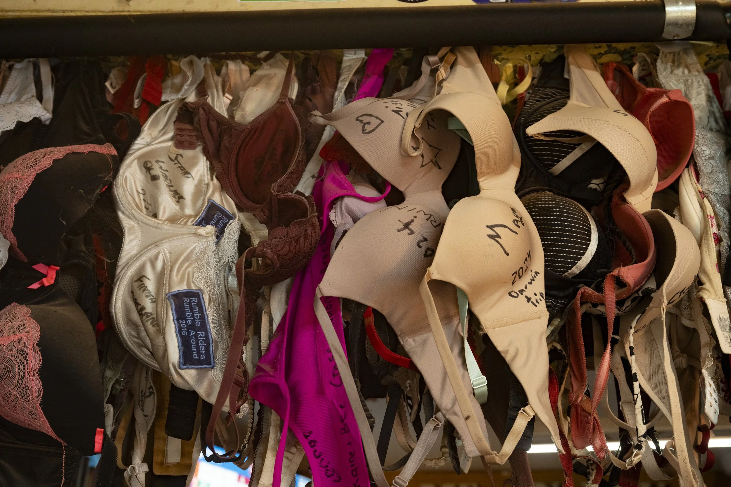
Daly Waters Pub: People leave things on the wall, including bras with messages

Daly Waters Pub: People leave things on the wall. Apparently a lot of military personnel pass through
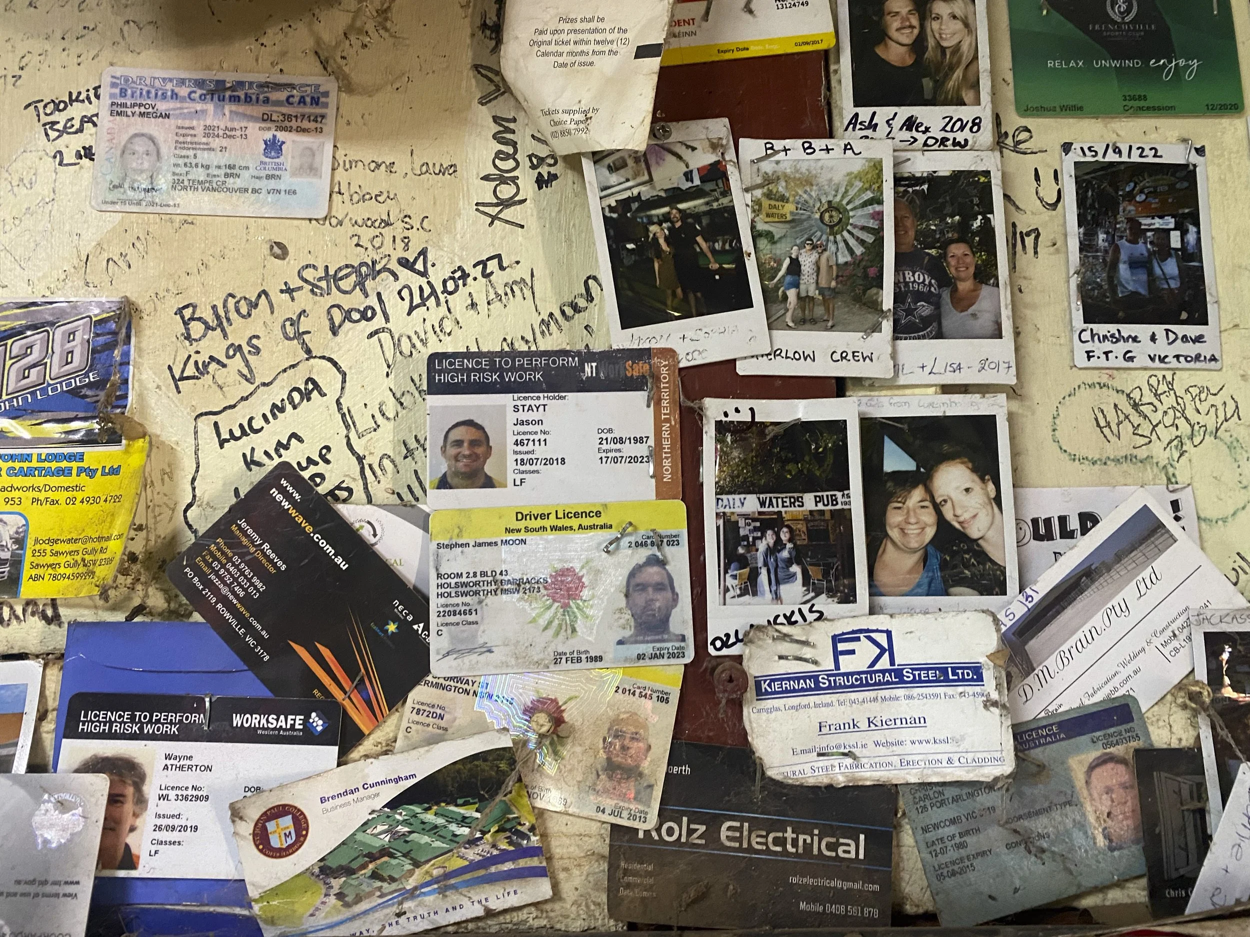
Daly Waters Pub: People leave things on the wall. Bit of identity theft?

Daly Waters Pub: Having dinner

Daly Waters: I just needed to share this one

Daly Waters: I like the rotor blades being a washing line
Devils Marbles
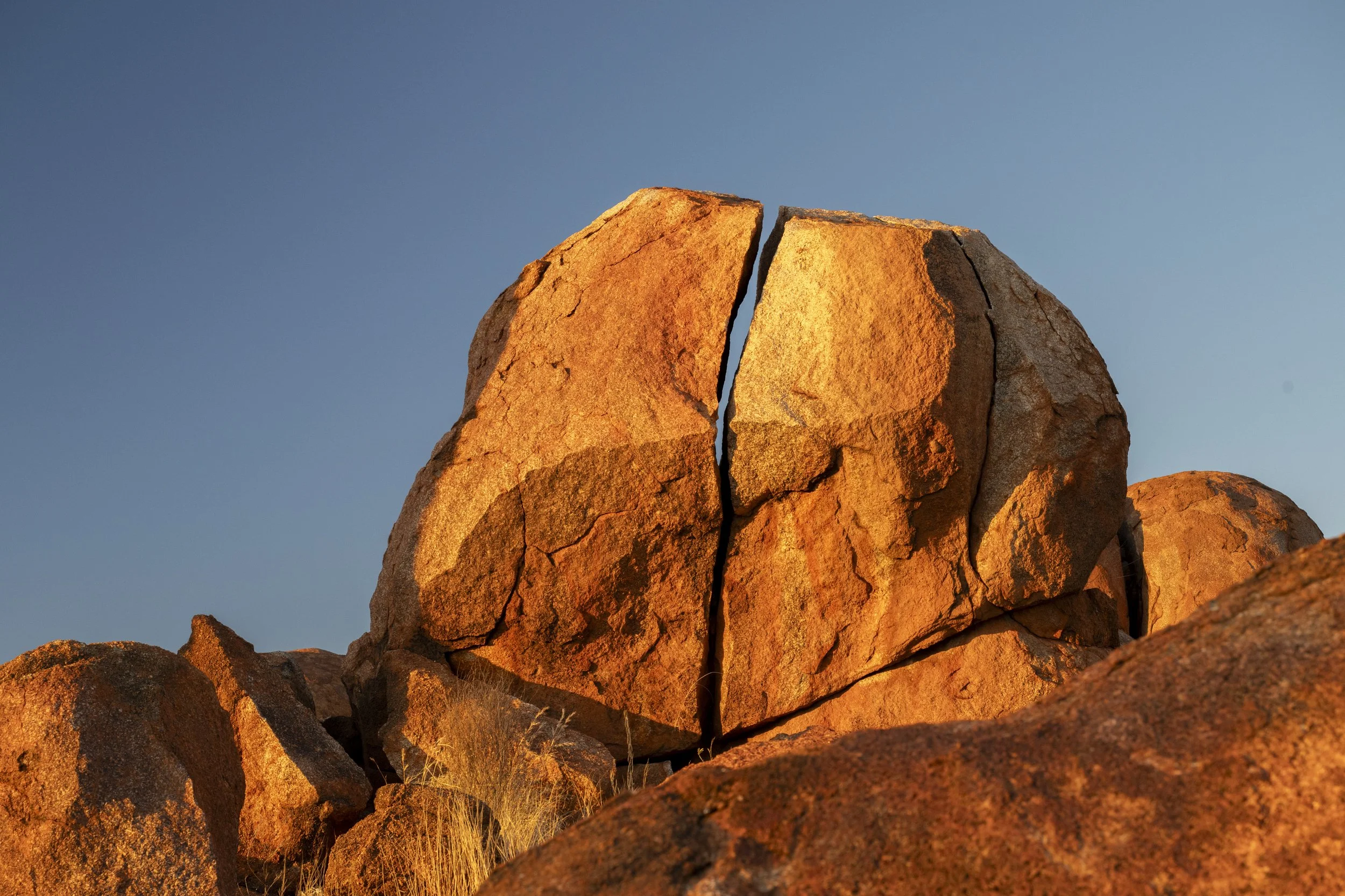
Devils Marbles

Devils Marbles

Devils Marbles

Devils Marbles

Devils Marbles
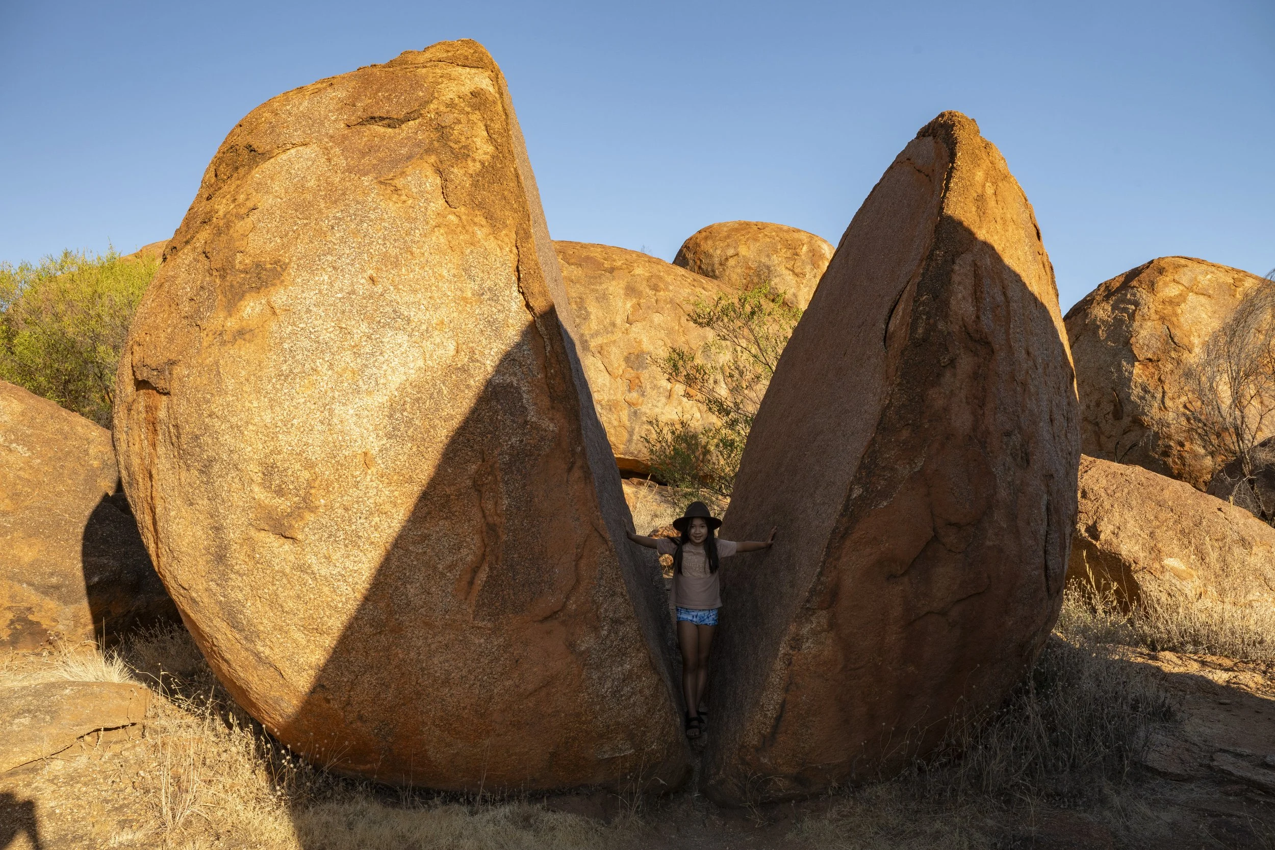
Devils Marbles: Millie splitting a rock

On the road: The car and caravan are straddling the Tropic of Capricorn

11. Kakadu
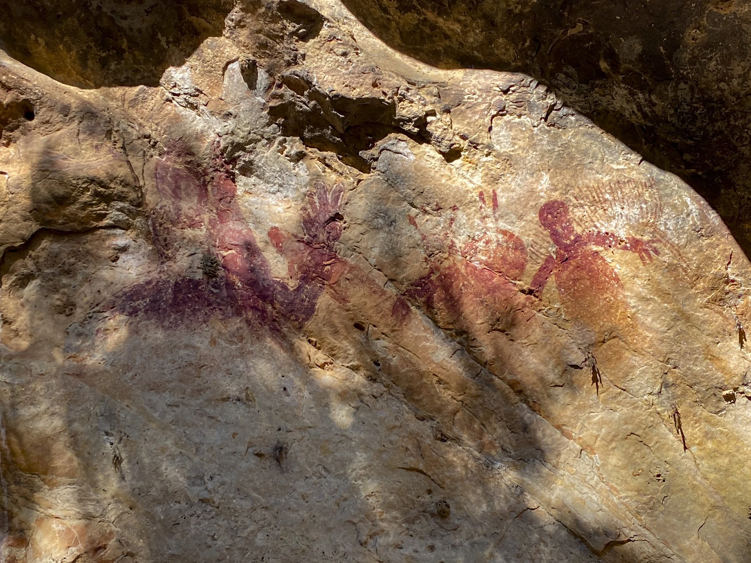
We spent a week at Kakadu National Park. There seem to be many mixed opinions about Kakadu (we heard the expression “Kaka-don’t”). I think it was a great part of the fabric of seeing Australia. We got to hear from numerous indigenous people, see a lot of rock art and marvel at the wildlife in the wetlands.
We started with a day trip to Mary River National Park to see its wetlands before heading next door to Kakadu. While at Kakadu we did a couple of tours - an indigenous food tour and a day into Arnhem Land. Both tours were a little shambolic but also definitely worthwhile. In Arnhem Land, as well as seeing a lot of rock art, our guide took us to a burial site where we were shown the remains of an elder (they are not buried, but are placed behind a rock).
For the seventh time in our trip we ran into Guy and Adam. This will be our last encounter on the trip I think as they headed back to Melbourne for a break in their trip and now our paths are diverging. They have been great company whenever we see them. They had and interesting experience since we last saw them - the brakes on their Landcruiser completely failed while coming down a hill towards a single lane bridge in an 80 km zone near Lake Argyle. They were towing their caravan which weighs more than 3.5T. Guy stayed calm and used the caravan brakes to slow the vehicle down, then the car gears and then the handbrake. Well done to Guy.
During our time in Kakadu I had to run back to Darwin to get the front right-hand suspension replaced in the car (we had been waiting for the new suspension to show up). When I was driving back from Darwin I was thinking how pleased I was that the car and caravan were all sorted when I got a flat tyre. I changed the tyre, and was fortunately able to have it repaired in Kakadu rather than having to drive to a large town and purchase a new one.
When changing the car tyre I needed some help to (a) get the spare wheel down from the bracket on the canopy, and then (b) later to put the damaged wheel up on the bracket. While I was on the open road, I had stopped near a petrol station. As usual, people were very happy to help. I think that has been a feature of the trip - people helping each other. (Even last night I was plugging in the caravan at an overnight stop and my power cable was not long enough to reach the power point. Someone noticed this, came over and gave me their spare power cable to extend mine.)

Mary River National Park: We did an airboat ride through the wetlands.

Mary River National Park: How awesome is that boat

Mary River National Park: Stopping amongst the water lilies
Mary River National Park
Mary River National Park

Mary River National Park

Mary River National Park

Mary River National Park

Mary River National Park

Mary River National Park

Mary River National Park: Folding up a flower

Mary River National Park: The buffalo is an introduced species which had a massive impact on early indigenous culture and on the food chain

Kakadu: Sunset from Ubirr

Kakadu: Sunset from Ubirr

Kakadu: Sunset from Ubirr

Kakadu: Ubirr rock art
Kakadu: Ubirr rock art

Kakadu: Ubirr rock art

Kakadu: Sunset from Ubirr

Kakadu: Ubirr rock art

Kakadu: Ubirr rock art

Kakadu: Ubirr rock art

Kakadu: Animal Tracks indigenous food tour. For the seventh time, we bump into Guy and Adam

Kakadu: Animal Tracks indigenous food tour. We had a flat tyre in the tour bus on the way over to the site. Guy cannot help himself - he was right in the thick of sorting it all out

Kakadu: Animal Tracks indigenous food tour. Dirty feet are a feature of our trip.
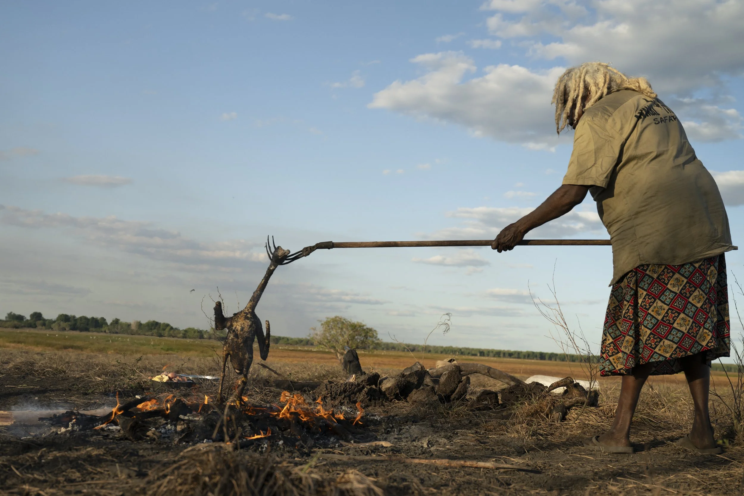
Kakadu: Animal Tracks indigenous food tour. Patsy, our indigenous host, cooking the goose

Kakadu: Animal Tracks. Adam plucking the goose (a long way from last year being in front of audiences as a principle dancer for the Australian Ballet)

Kakadu: Animal Tracks indigenous food tour. Patsy preparing the goose

Kakadu: Animal Tracks indigenous food tour. Patsy preparing the buffalo
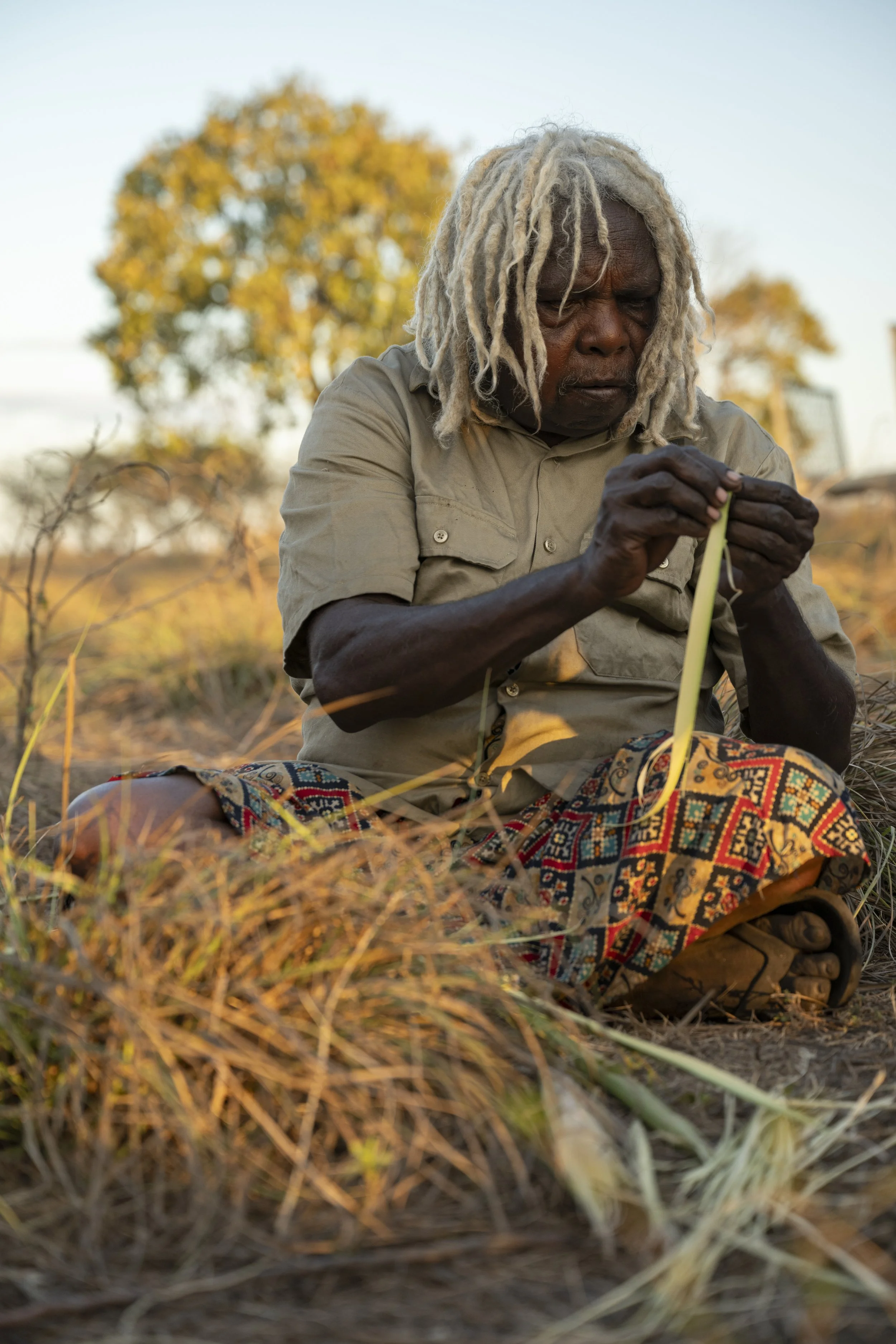
Kakadu: Animal Tracks indigenous food tour. Patsy showing how to create fibre for weaving

Kakadu: Animal Tracks indigenous food tour. Sumy and Millie trying to create fibre for weaving

Kakadu: Animal Tracks indigenous food tour. Don preparing the fire

Kakadu: Animal Tracks indigenous food tour. Cooking the meal (not a lot for the vegetarian)
Kakadu: Animal Tracks indigenous food tour. Guy and Adam enjoying the sunset

Kakadu: Animal Tracks indigenous food tour. Sunset

Kakadu: Animal Tracks indigenous food tour. Grace capturing a photo of sunset

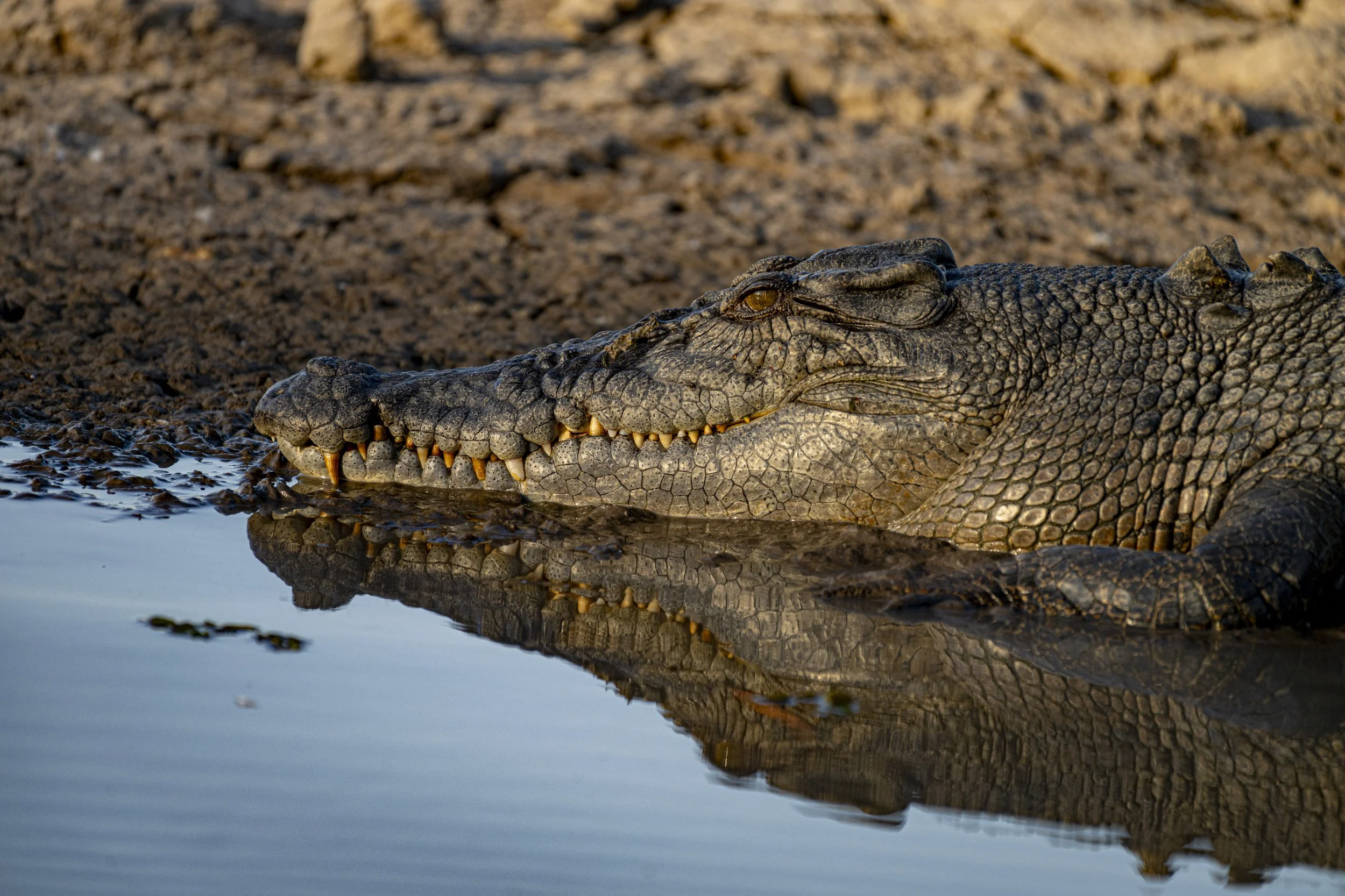
Kakadu: The famous Cahills Crossing. There is a road which is covered with water at high tide (here the tide has risen over the road but is not yet at high tide). The crocodiles come and wait for fish which are swept downstream over the road. Those small dark lines on the right are all crocodiles. I would not fancy driving across here when the water rises - if you come off the edge the crocodiles would welcome you like they would a fish.

Kakadu: Cahills Crossing. A crocodile moves over the road as the water rises

Kakadu: Cahills Crossing. A crocodile with its mouth open waiting for a fish
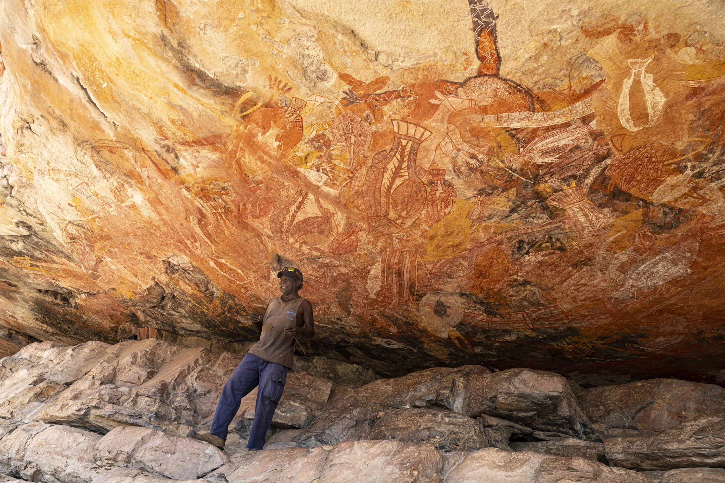
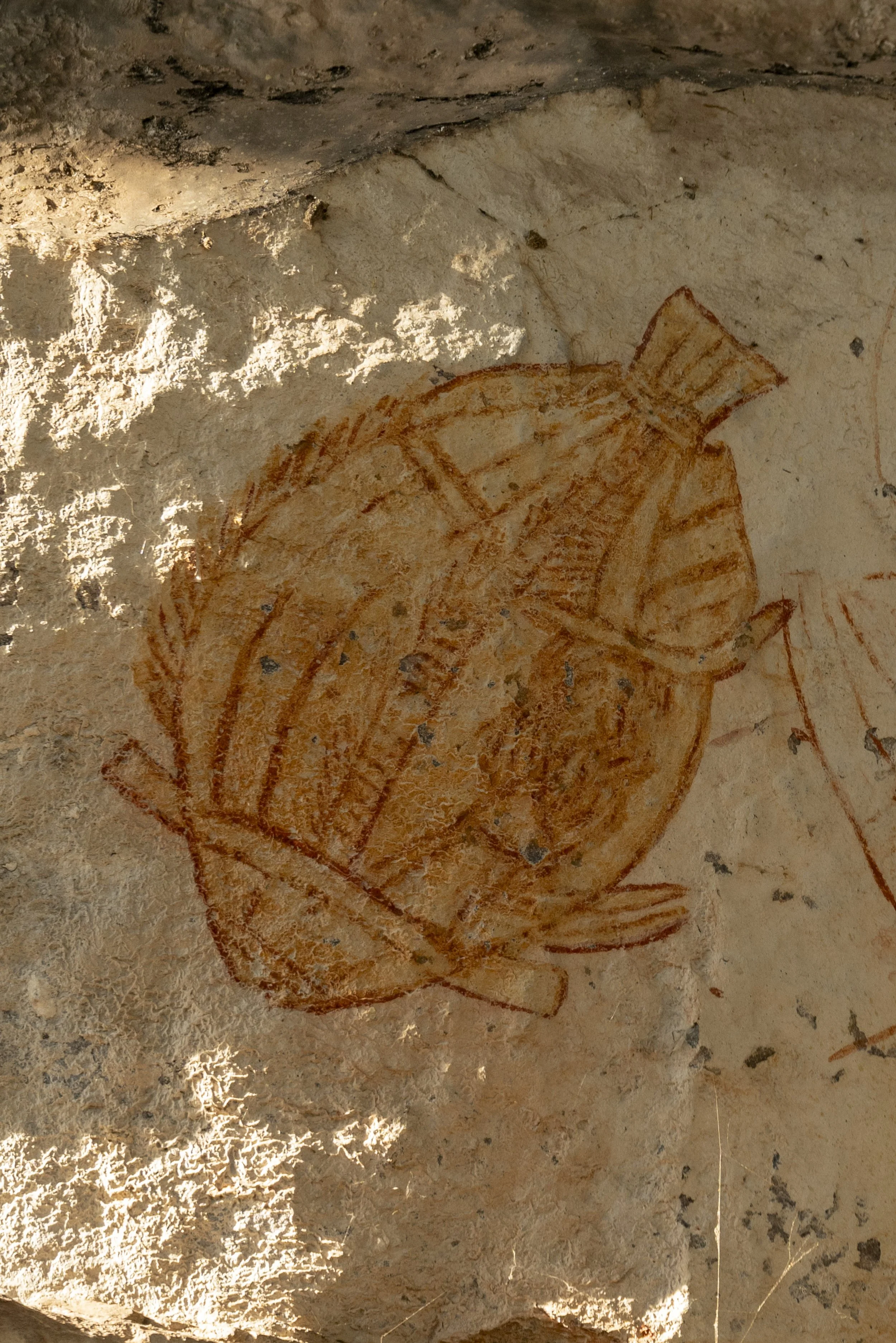
Arnhem Land: The rock art was just amazing. Here is our guide Roland explaining this large mural
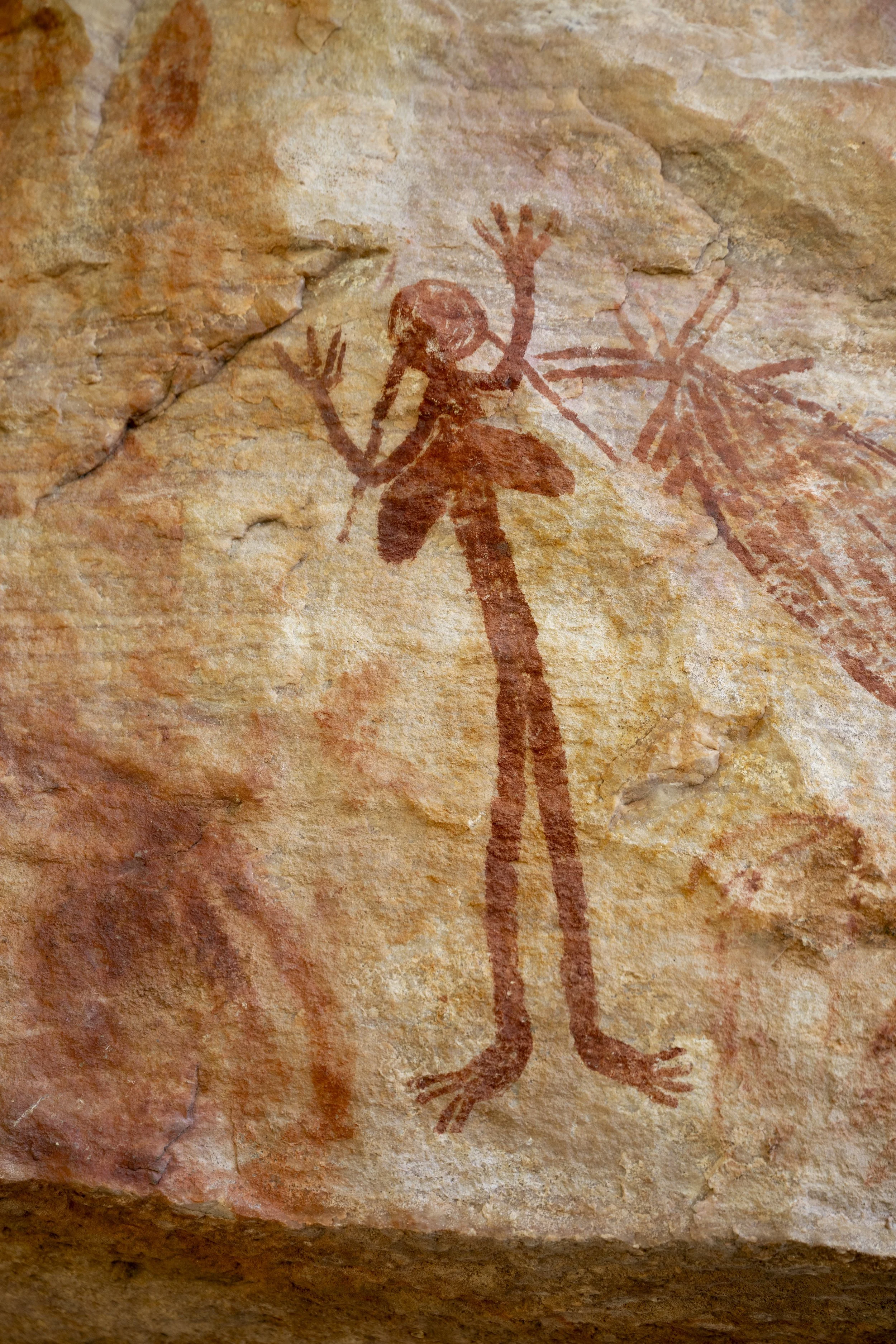
Arnhem Land: Rock art

Arnhem Land: Rock art

Arnhem Land: Rock art

Arnhem Land: Rock art

Arnhem Land: Rock art
Arnhem Land: Up on the hill where we went to see the rock art

Arnhem Land: Roland telling a story

Arnhem Land: Overlooking the landscape

Arnhem Land: Roland showed us how ochre was used for painting. Here is he and my arm with some ochre

Arnhem Land: Rock art

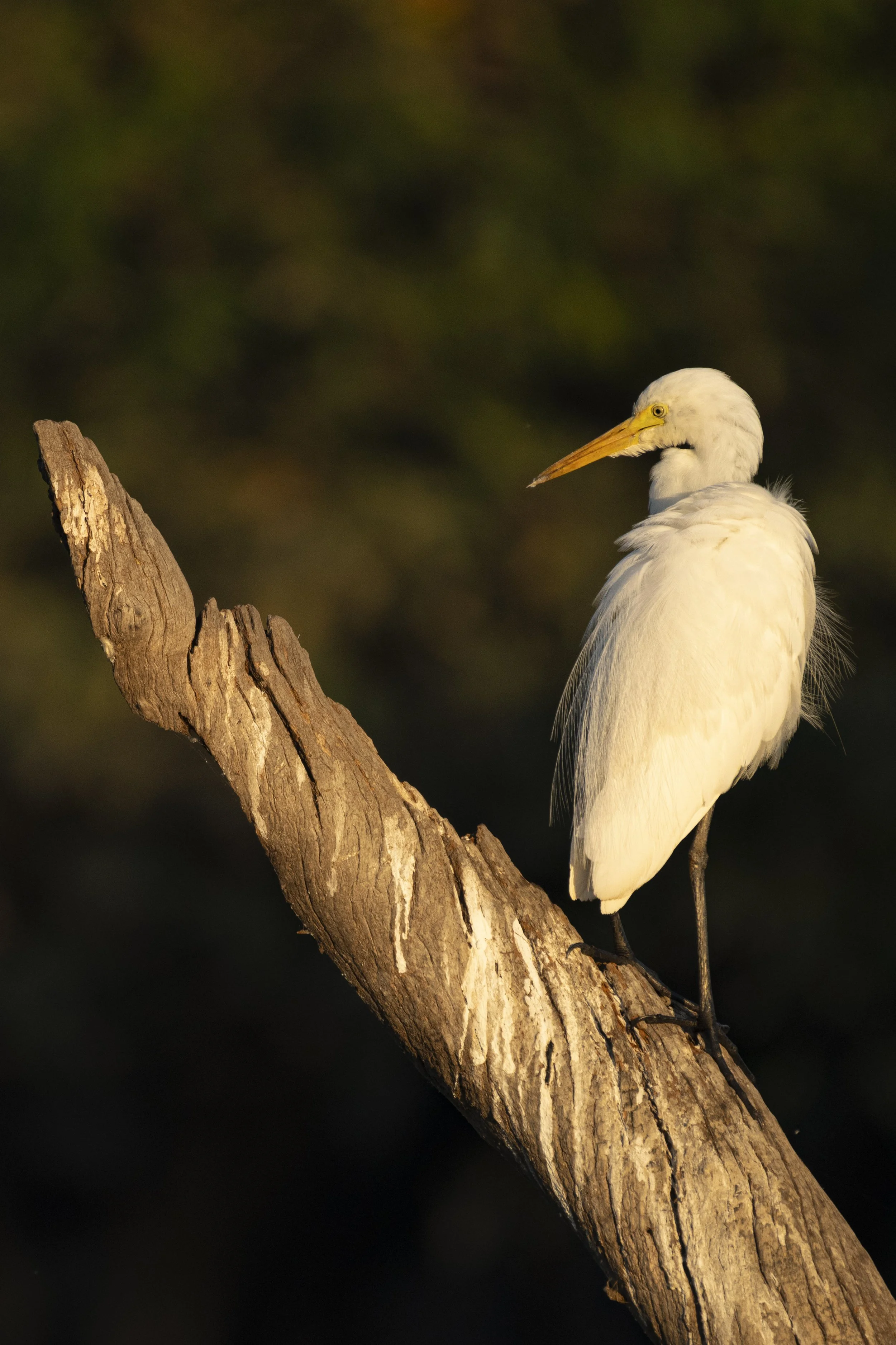
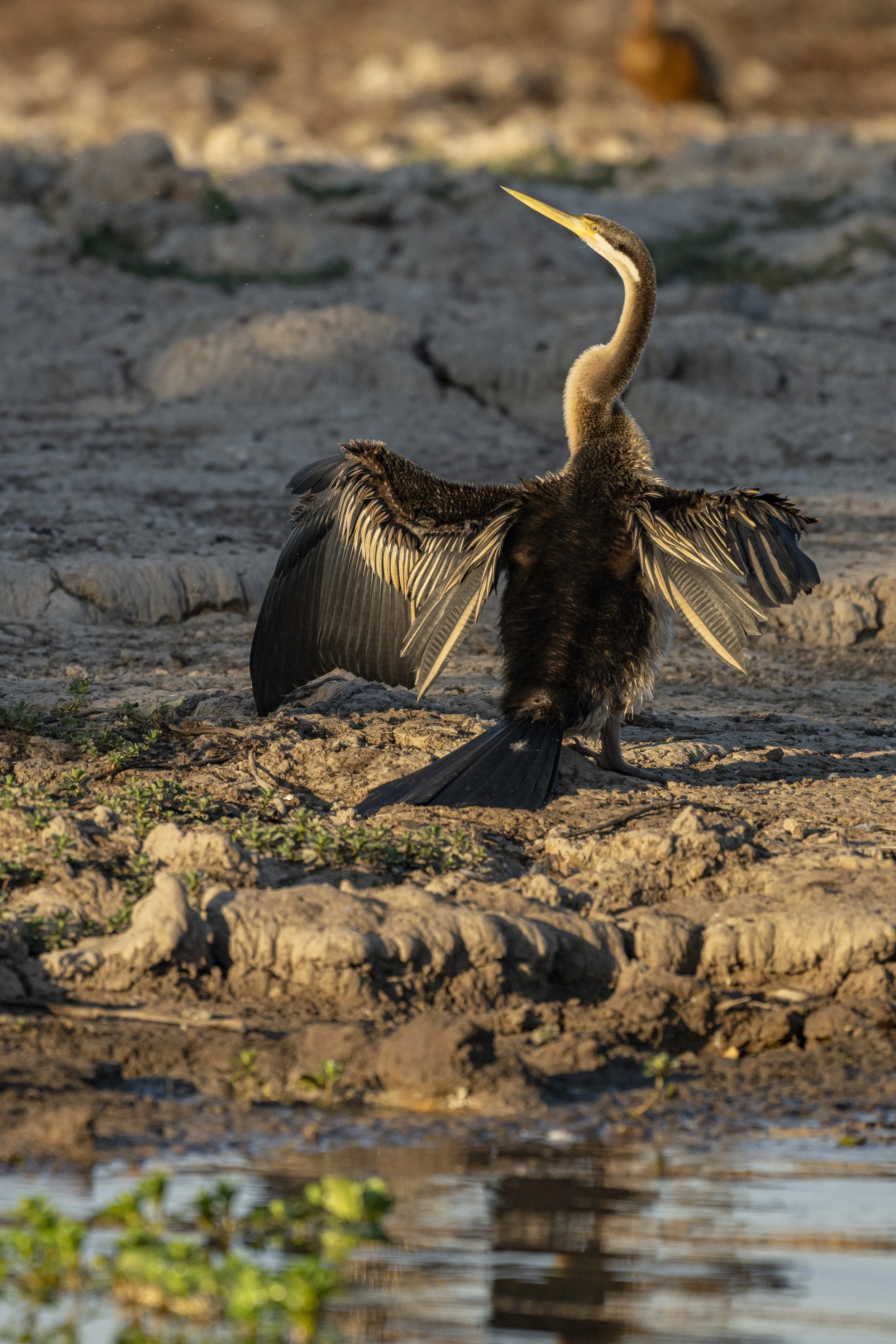
Kakadu: Yellow Water. Up early for a sunrise tour of Yellow Water
Kakadu: Yellow Water
Kakadu: Yellow Water
Kakadu: Yellow Water

Kakadu: Yellow Water

Kakadu: Yellow Water

Kakadu: Yellow Water. That's a crocodile hiding in there

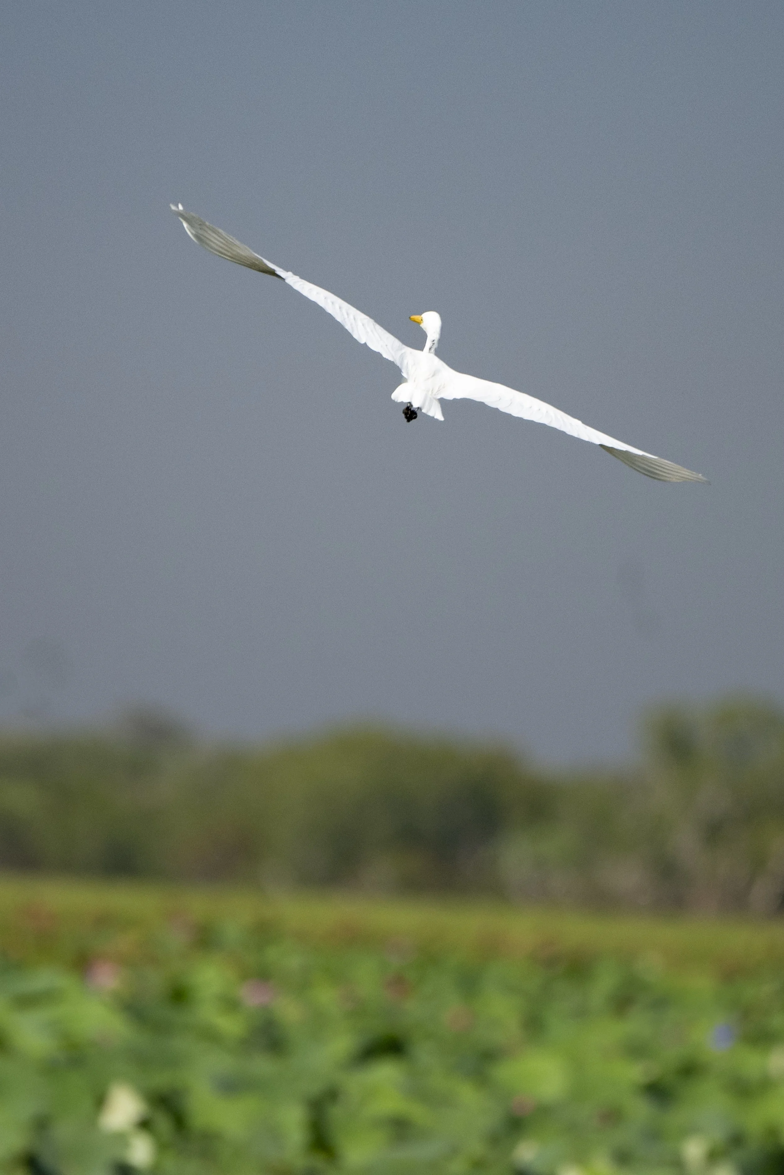
Kakadu: Yellow Water. The birds kept a weary eye on the crocodile and then moved on

Kakadu: Yellow Water

Kakadu: Yellow Water. Diving in for some fish

Kakadu: Yellow Water

Kakadu: Norlangie Ranger Tour. Sumy is listening and enjoying the talk (the young ranger was very good)

Kakadu: Norlangie Ranger Tour. Millie is not as captivated
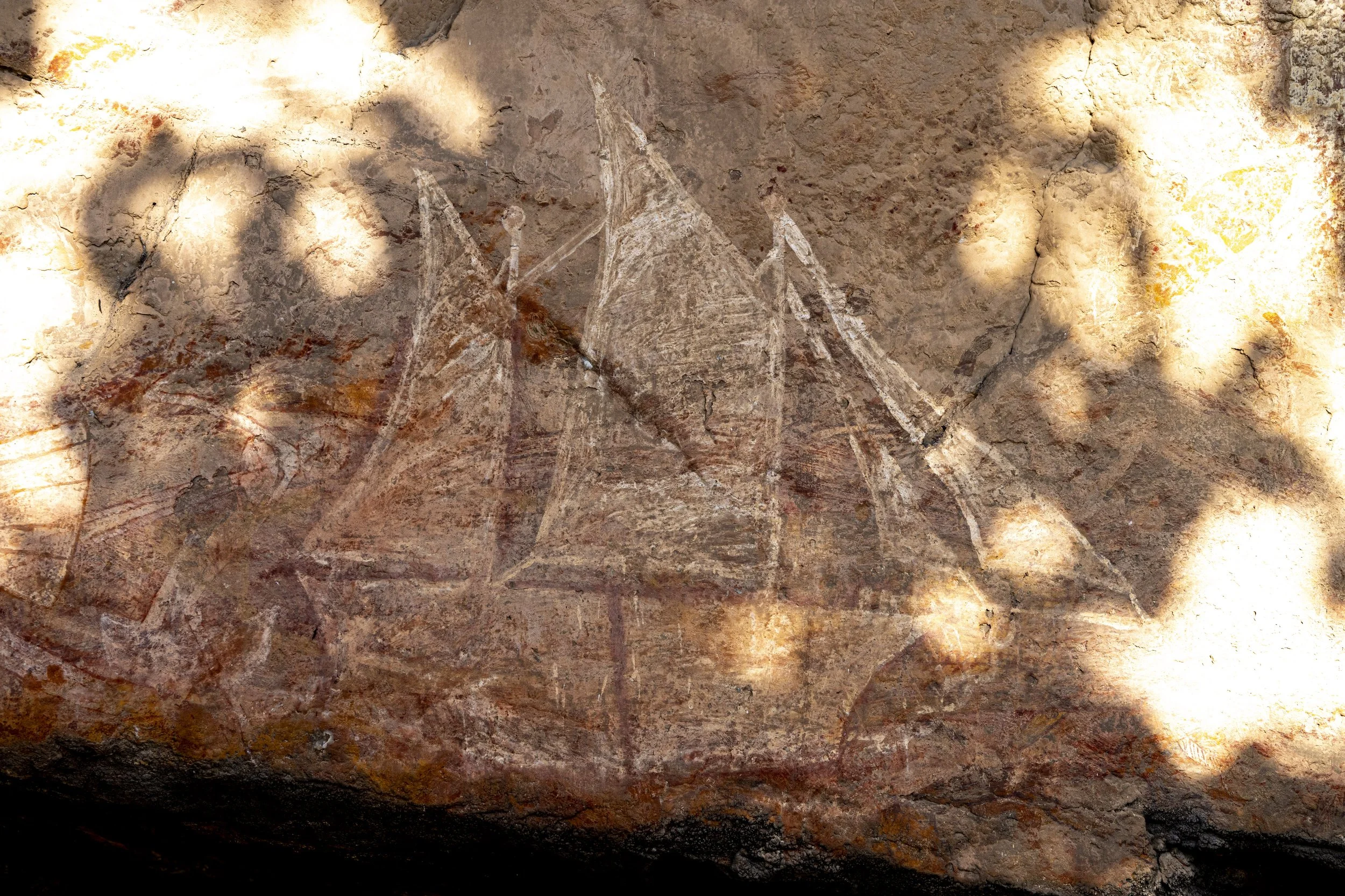
Kakadu: Norlangie. Final piece of rock art. The ships are coming...

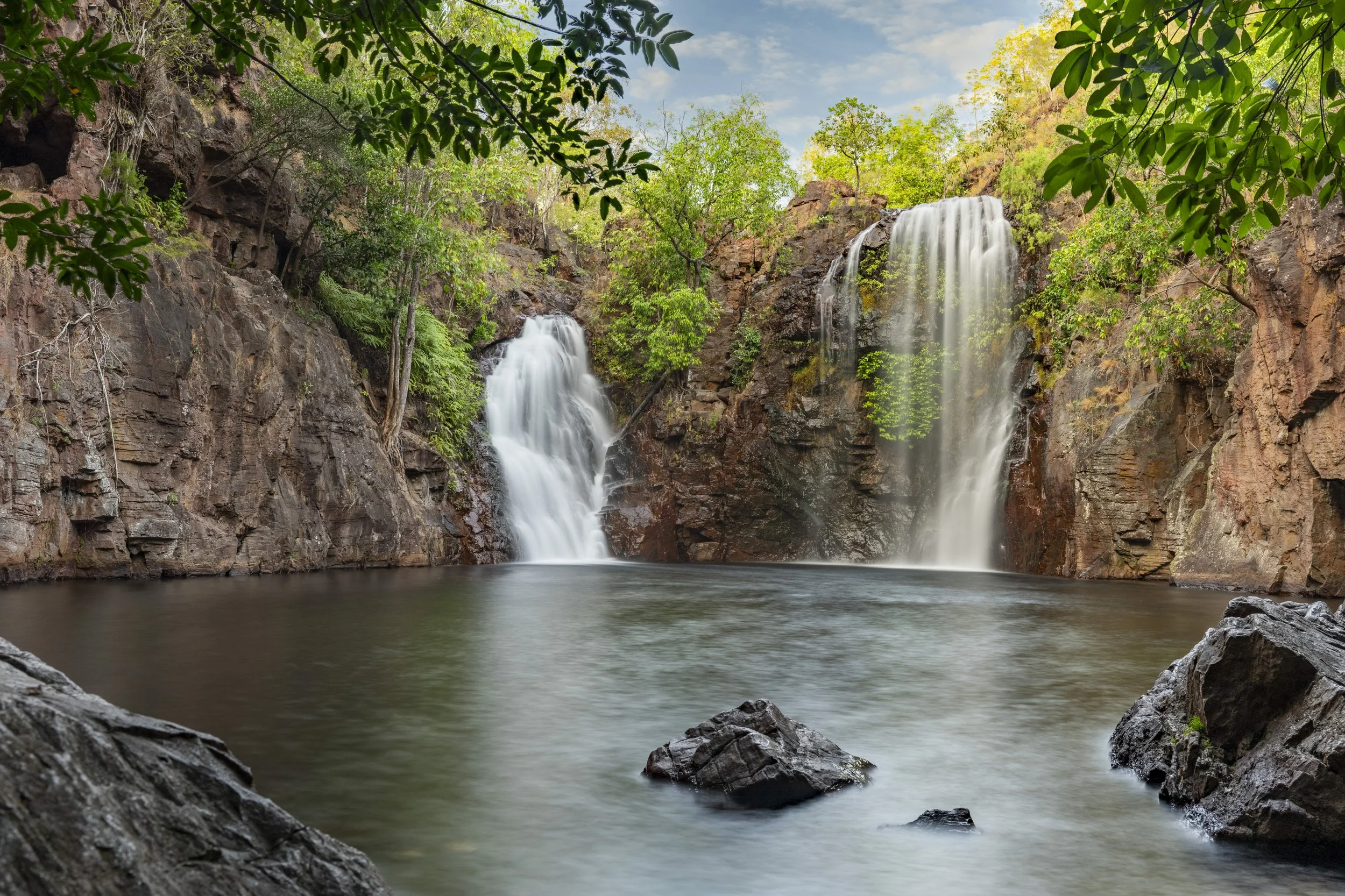
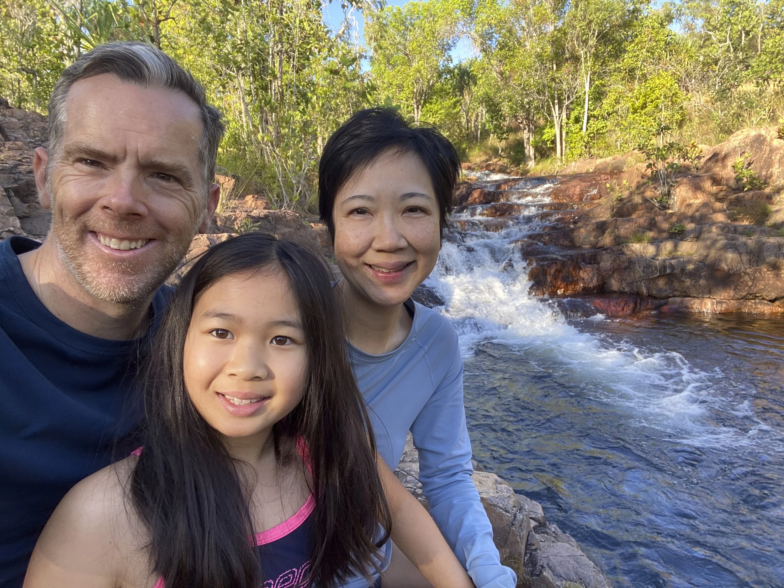
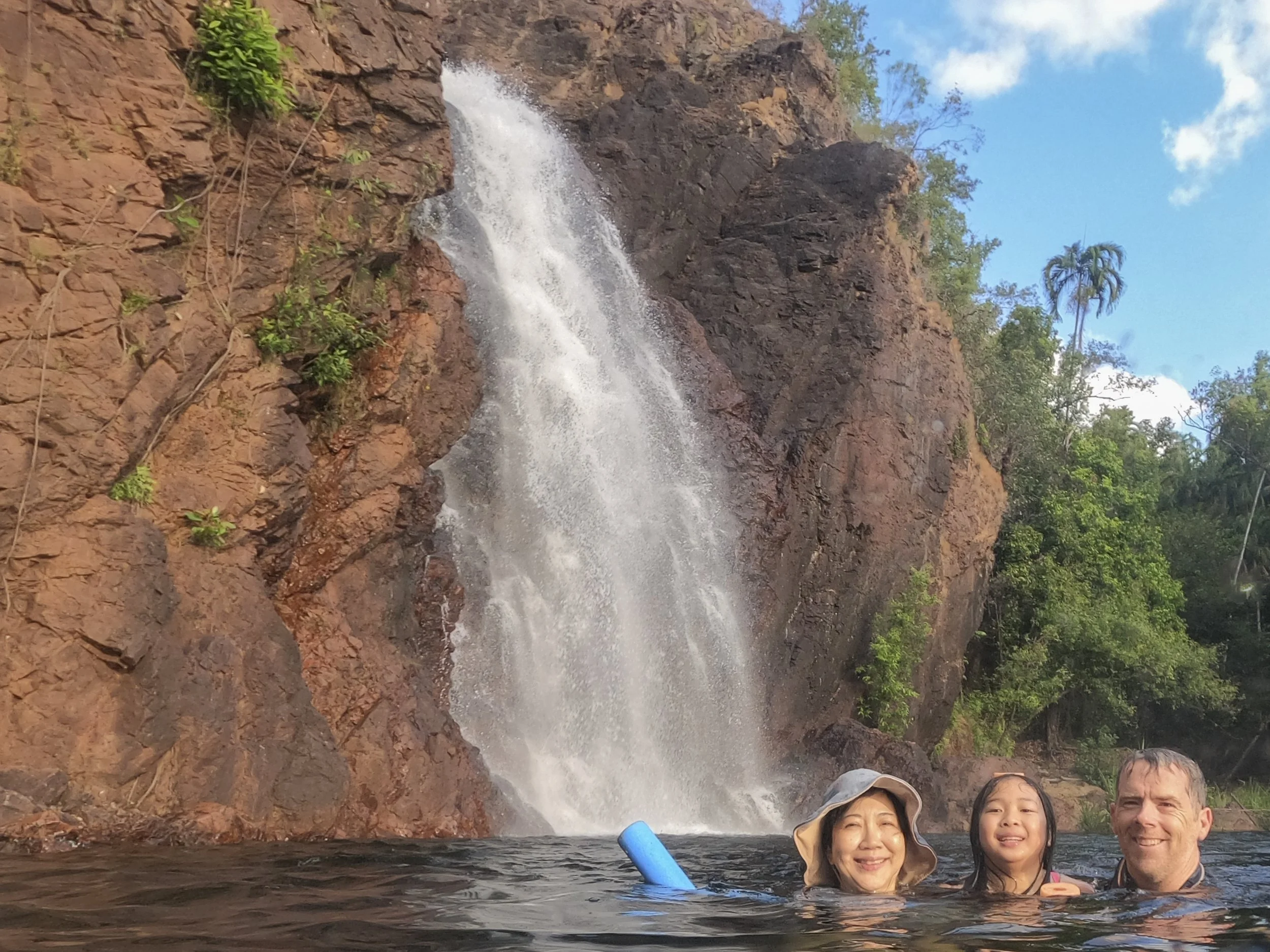
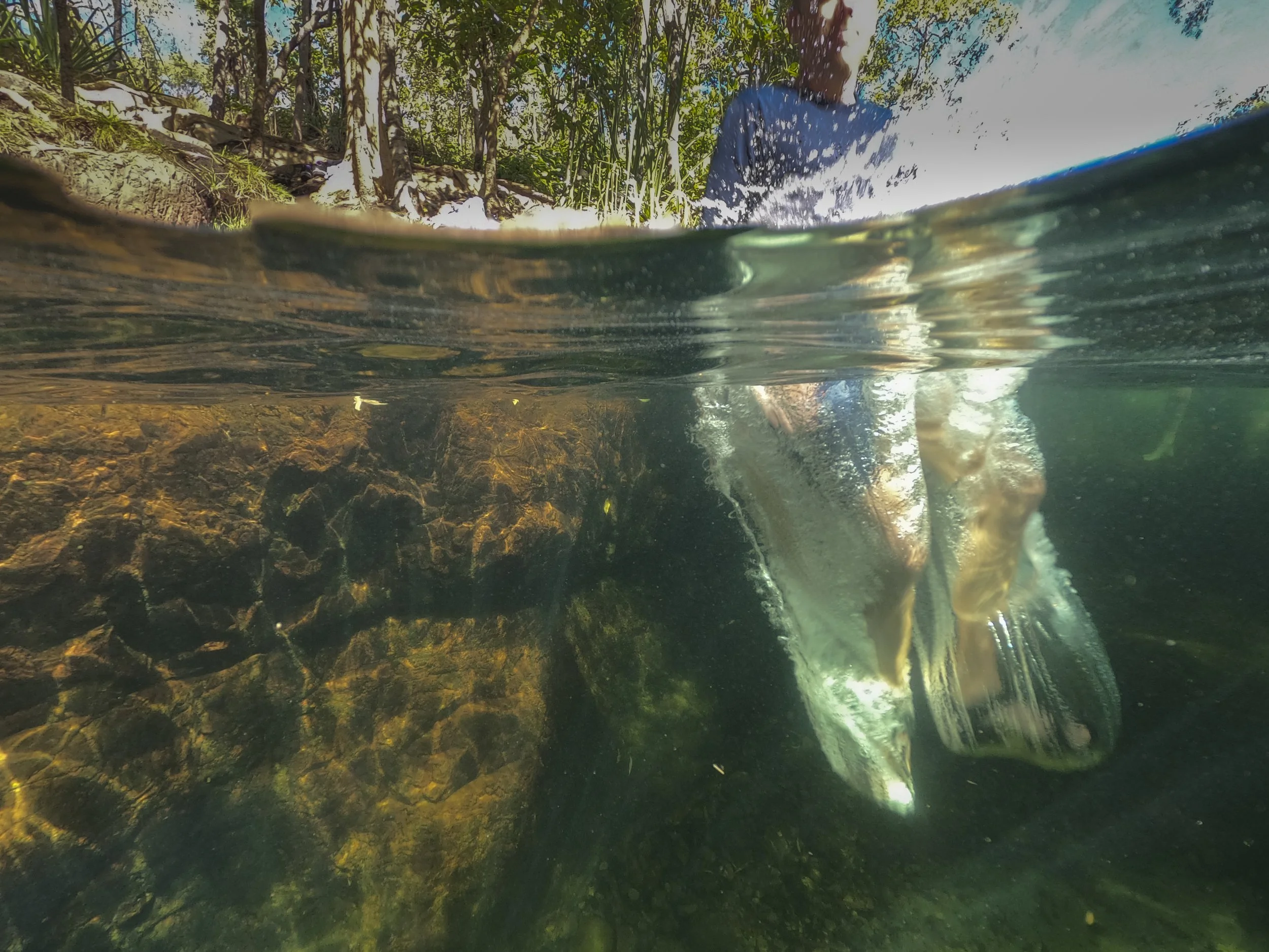
10. Litchfield National Park
We spent six nights at Litchfield National Park. It is like a resort - just a series of waterholes where you can swim. We swam at Wangi Falls five times… And we sampled many other waterholes. Sumy’s cousin Grace had just joined us on our trip for about four weeks.

Wangi Falls: An early morning photo before the crowds descended (including us)
Florence Falls: An early photo before the crowds. It was not a favourite location as it is quite small and so there is just not enough space for everyone

Buley Rockhole: It is a series of shallow and deep pools stretching along a stream with multiple small waterfalls. With Wangi, this was our favourite place
Buley Rockhole

Buley Rockhole: We swam here twice

Buley Rockhole: Millie enjoyed swimming up to the waterfall and then being pushed along by the current

Wangi Falls: A definite favourite. Litchfield is very popular and very crowded. Wangi has the advantage of being a large swimming space and so it can take the crowds without being crowded

Tjaetaba Falls: We were advised that this was great for sunset. Not quite as the sun does not set here. But, it had a lovely infinity pool at the top of the waterfall. It looks like I am sitting on the edge of the waterfall, but I am back quite a bit from the edge

Walker Creek: We had this swimming spot all to ourselves

Walker Creek: We had this swimming spot all to ourselves

Walker Creek: A really lovely location
Wangi Falls: Family favourite
Buley Rockhole: Jumping into the water with my sandals on
Buley Rockhole: Millie enjoying her swim

Buley Rockhole: Millie enjoying her swim
Buley Rockhole: Under one of the small waterfalls

Wangi Falls
Buley Rockhole
Buley Rockhole

Wangi Falls: There is a small (but deep) rock pool next to one of the two waterfalls

Magnetic Termite Mounds: The termites are blind but manage to build their mounds aligned with magnetic north / south
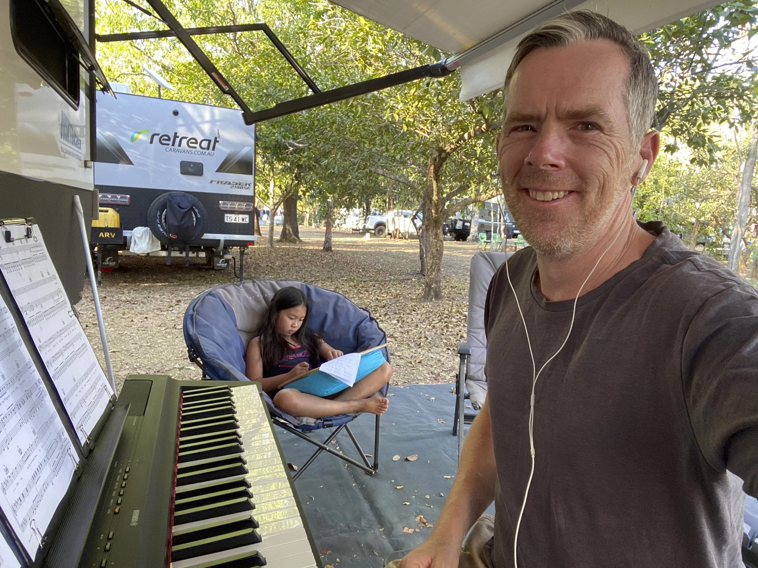
Litchfield: Practising piano while Millie does some school work

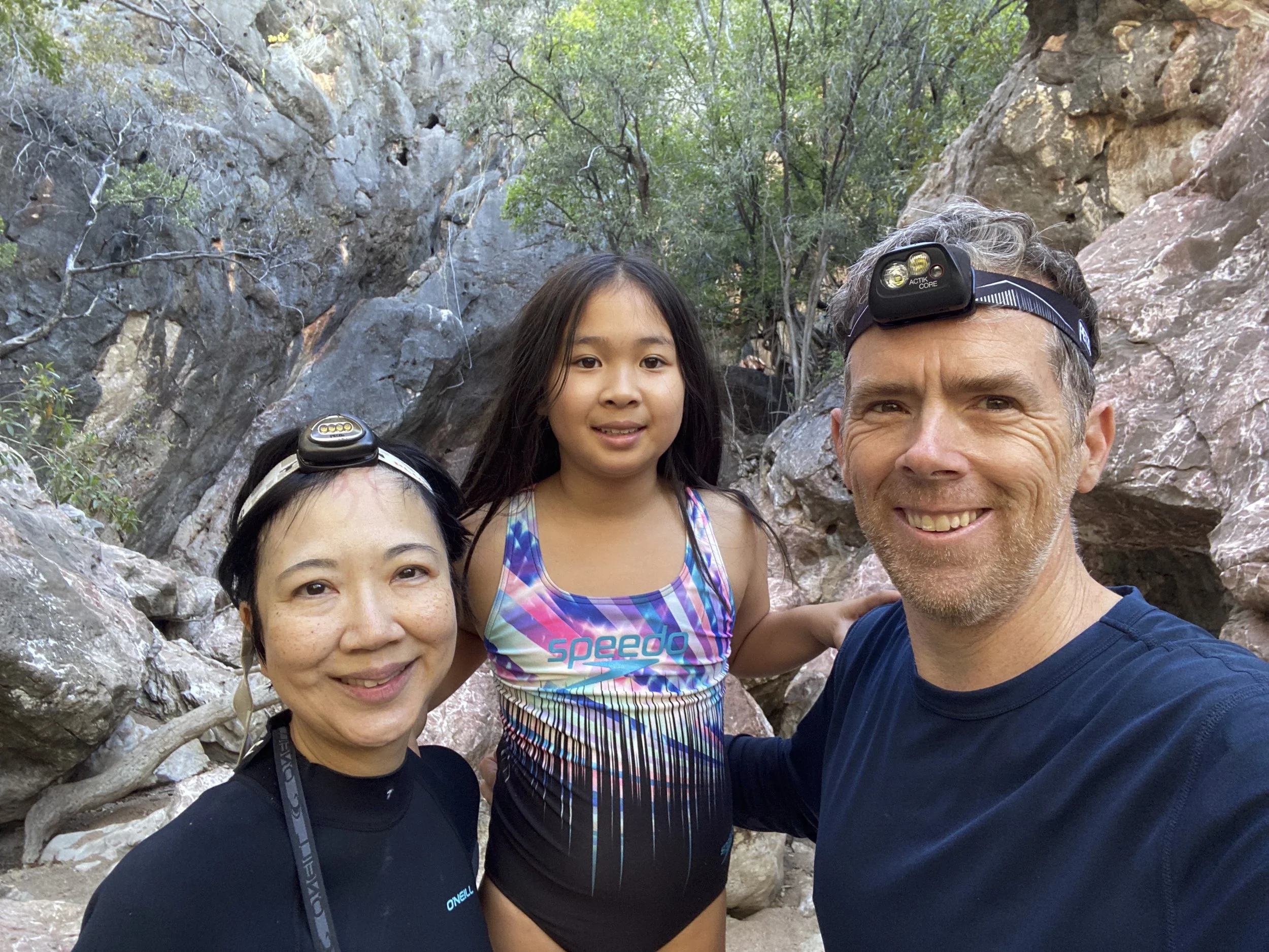
9. Lake Argyle, Mitchell Falls and Katherine
We have come to the end of our time in Western Australia - which in total was more than three months and nearly half our overall trip in the state. We pivoted out of Kununurra into the Bungle Bungles (last post), Lake Argyle and Mitchell Falls. From Kununurra we left WA and went over the border to Katherine (Nitmiluk National Park) in Northern Territory. The caravan had some issues resulting from the Gibb River Road which we had worked on in Kununurra.
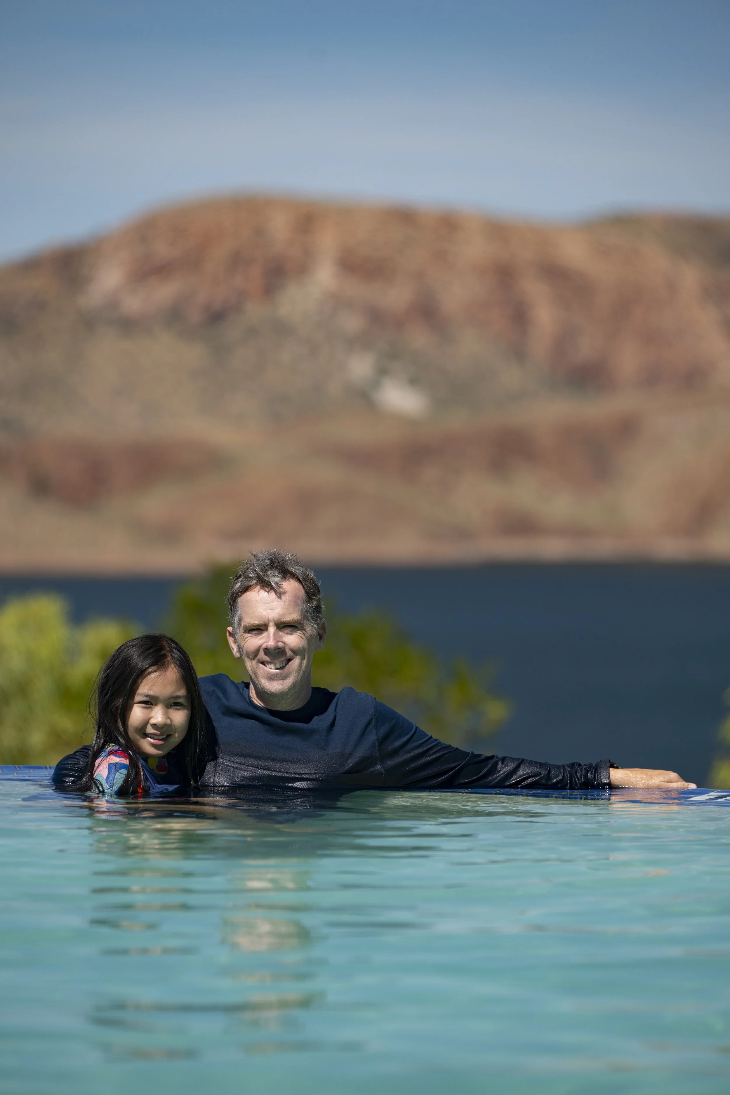
Lake Argyle: The caravan park has a famous infinity pool, which is infamous for how cold it is. We constantly heard along the way about how cold it would be. Millie was not bothered by the cold, which meant we swam in it each day, while most people just jump in for a selfie and then get out.

Lake Argyle: Jumping into the water
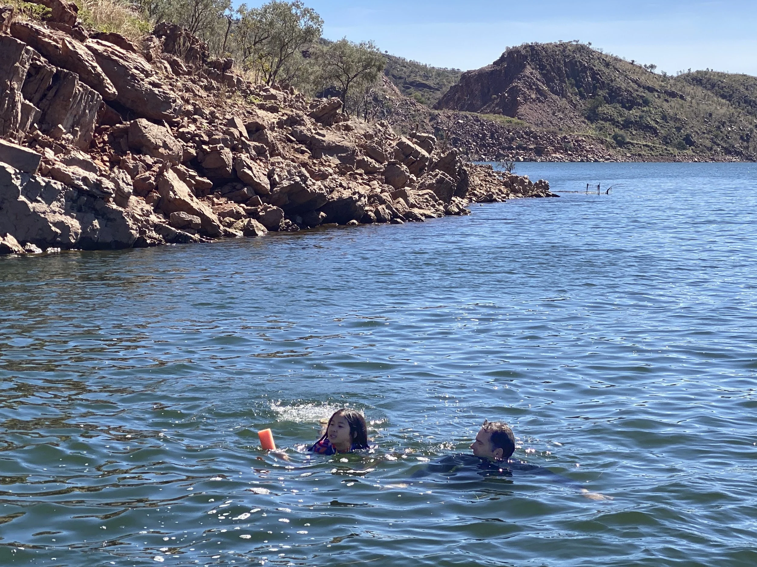
Lake Argyle: Millie and Justin going for a swim. Ther’re estimated to be 35,000 fresh water crocodiles in Lake Argyle

Lake Argyle: One of the 35,000 crocodiles heading in for a swim

Lake Argyle: There is a lot of bird life

Mitchell Falls: When we lost the car wheel on the Gibb River Road (GRR), it took six days to courier a new wheel / tyre to Derby. We had to remove some time from our plan because we had places booked - this was especially necessary because it was during the school holidays. We cut out the drive north of the GRR to Mitchell Falls which I had allowed five days for in our plan. I was still keen to see Mitchell Falls. So, I did a day trip out of Kununurra to see Mitchell Falls. Sumy chose not to join, so I went on my own. The tour flew out of Kununurra to a small airstrip near Mitchell Falls, and from there it was a drive and a hike. I was pleased to get the chance to see it.

Mitchell Falls: From the top

Mitchell Falls: The airstrip near Mitchell Falls

Mitchell Fall: The walking trail is marked with the Wandjina spirit. You see this spirit image a lot in rock art and contemporary art in the Kimberley

Mitchell Falls: Rock art along the walk

Mitchell Falls
Mitchell Falls: Swimming at the top of the falls

Goodbye WA: We spent three and a half months in Western Australia (105 days to be precise). Nearly half our trip

Hello NT: And now we are in the Northern Territory

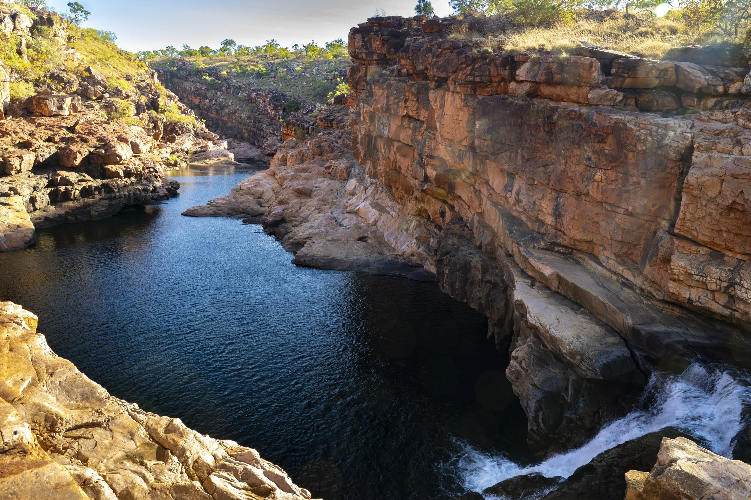
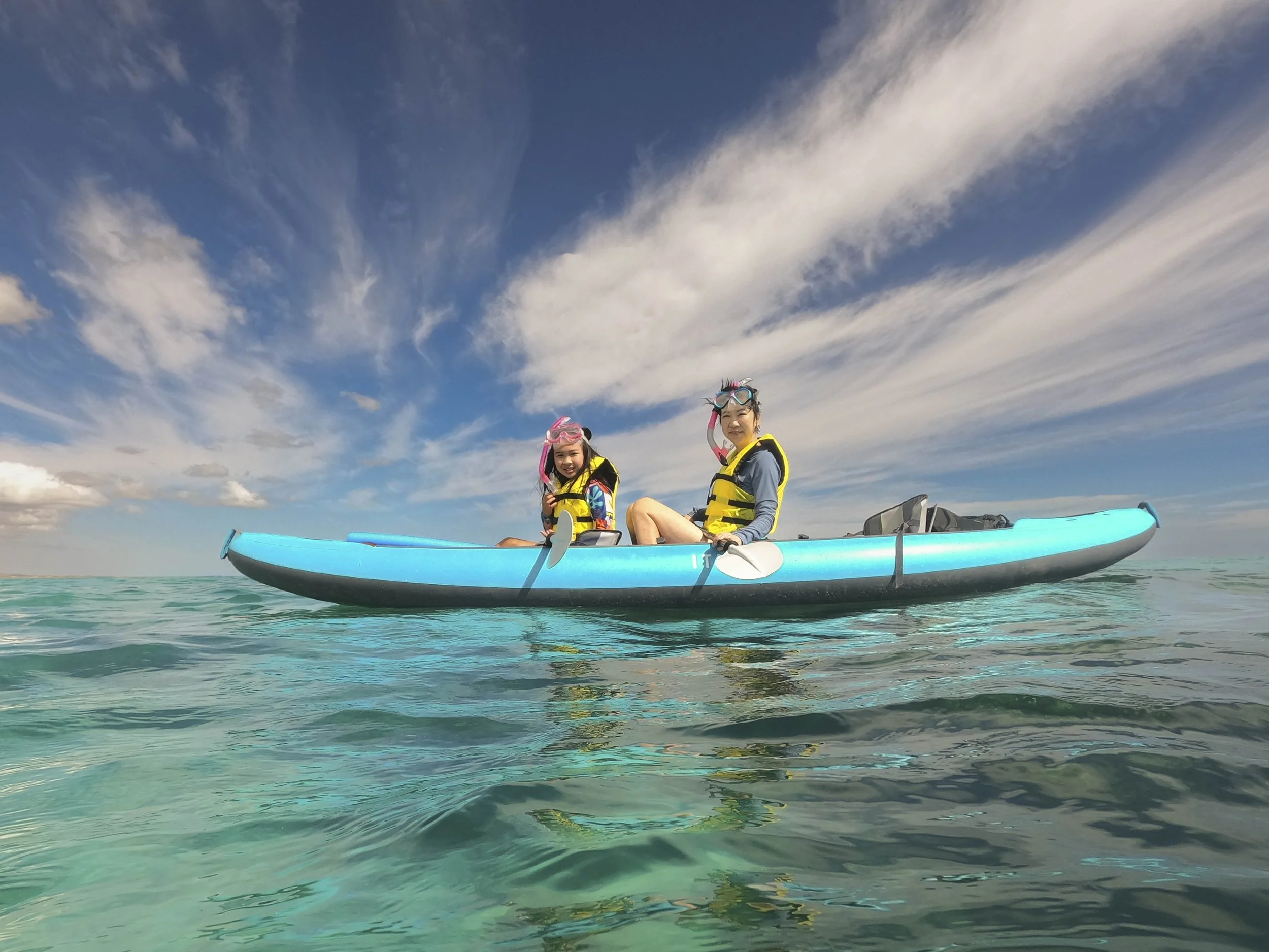
Nitmiluk National Park: Katherine Gorge is amazing. We took a boat trip up the gorge. You then transfer to a kayak and paddle further up the gorge. Part of the paddle includes getting out and dragging the kayak over rocks to access the further upstream part of the gorge.

Nitmiluk National Park: Katherine Gorge

Nitmiluk National Park: Katherine Gorge

Nitmiluk National Park: Katherine Gorge

Nitmiluk National Park: Katherine Gorge
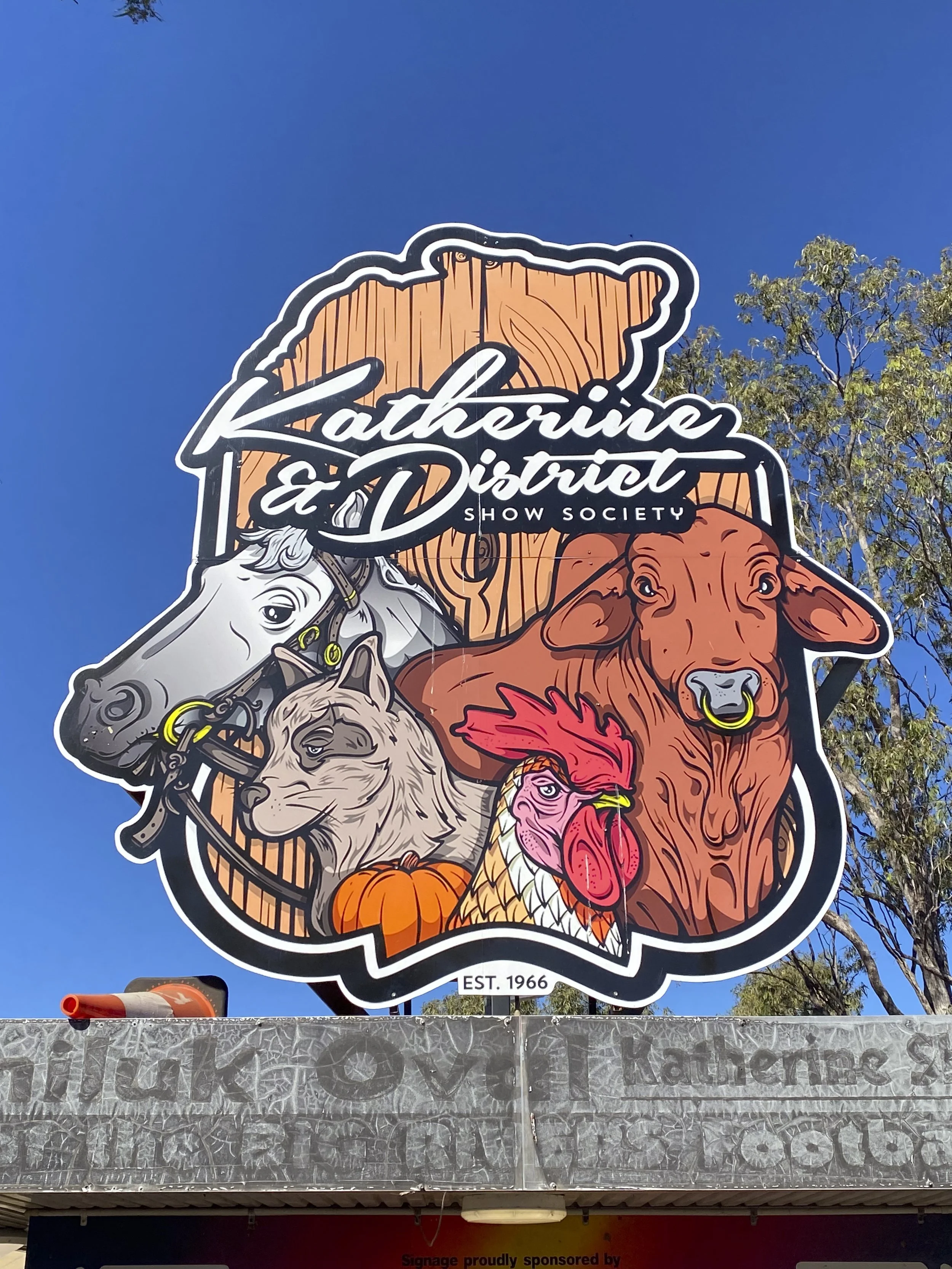
Katherine: The Katherine Show was on while we were in town. Millie and I went along
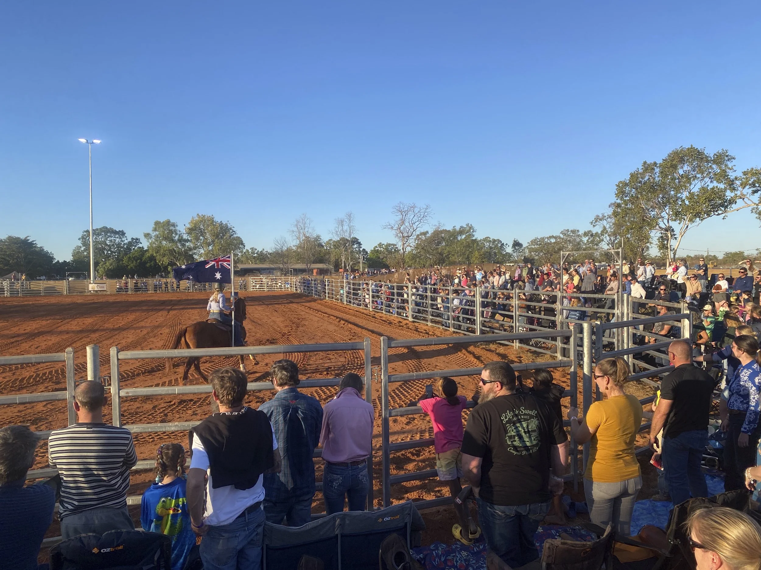
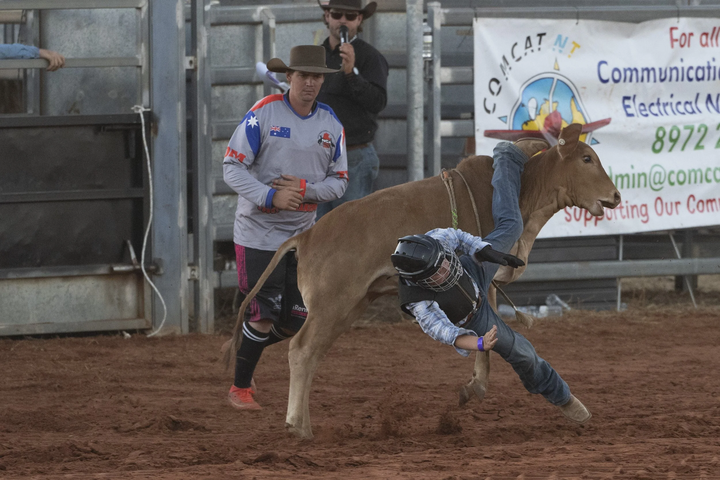
Katherine Show: The highlight of the show was the rodeo. Here everyone is standing for the national anthem

Katherine Show

Katherine Show: He managed to stay on the bull

Katherine Show: Most do not manage to stay on the bull
Katherine Show: They start young… If you have read or listened to Jonathan Haidt discuss the protected lives of our children then you would know that he would be very pleased with this rough play

Katherine Show

Katherine Show: This rider came off but his hand was caught under the rope tied to the bull. They all rushed in to help before he was injured

Katherine Show

Katherine Show: The bucking horse ride

Katherine Show: For the bucking horse ride it looks like they tie something near the saddle to irritate the horse (and as well the rider constantly cracks a whip). If the rider stays on the horse for the duration, then they end their ride by transferring to the back of another rider / horse. Whether the rider has fallen off or completed the ride, one of the stewards will then ride up next to the bucking horse and release the strap that has been irritating the horse so as it will then settle down

Katherine Show: Millie watching the rodeo

Katherine Show: The clowns

Katherine Show: Millie enjoys a side show

8. Bungle Bungles
We spent three nights at the Bungle Bungles in Purnululu National Park. The park is famous, or infamous, for the rough road into the park and then the roads around the park. The road into the park is 53km and is often heavily corrugated with many river crossings. It took one hour and forty-five minutes to drive into the park. Fortunately, we made it into and around the park without suffering a flat tire. The beehive-like rock formations are the signature site in the park. It was fantastic to visit the park, and it was a nice break from the caravan as we stayed in a glamping tent (you cannot bring sizeable caravans like ours into the park).
Bungle Bungles: The road into the park has a lot of water crossings. These can be problematic because you do not know if you are driving over sharp rocks which can puncture the car tires

Bungle Bungles

Bungle Bungles

Bungle Bungles: From the air

Bungle Bungles: From the air

Bungle Bungles: From the air

Bungle Bungles: The helicopter ride has no doors. Millie was a little concerned when she heard this would be the case. The operators assured me that they had not lost any children out the door

Bungle Bungles: Cathedral Gorge
Bungle Bungles: Mini Palms was a lovely walk

Bungle Bungles: Mini Palms walk

Bungle Bungles: Our glamping tent (with en-suite)

Bungle Bungles: At the northern end of the park are some different rock formations, including Echnida Chasm where the light comes into the narrow space in the late morning

Bungle Bungles: Echidna Chasm

7. Gibb River Road
The Gibb River Road is a mostly unsealed road from Derby to Kununurra in the North-West of Australia. The road was built to transport livestock and supplies to/from the cattle stations in the Kimberly region. While it was once a remote road, it is now a very busy tourist thoroughfare. Though it is still quite a rough road with a number of river crossings. The road is known for passing near several picturesque gorges and large cattle stations (which nowadays also cater to tourists). The road is only open in the dry season and has become a key part of the ‘lap’ of Australia.
We had some challenges with our car and caravan along the way.
Our first challenge was losing our spare tyre off the back of the car. I do not know if the tyre fell off while we were driving back from a day trip (not towing the caravan) or if it was stolen overnight. We had got back from our day trip as the sun was going down and I rushed off to get a photo, and so it was only the next day that I noticed the tyre was missing. If it fell off on our day trip then we actually got lucky because if it had fallen off when we were towing the caravan then it could have gone under the caravan and caused a serious incident. If it was stolen overnight, then so be it. The net result was that we had to back track 200 km along the Gibb River Road to Derby and wait for a new spare wheel and tyre - it is not possible to drive such a road without a spare as the chance of having a flat tyre is not remote. We got lucky in ordering a new wheel up from Perth to Derby. However, while the company invoiced for the new wheel immediately, they did not bother putting it on the courier truck for five days. As a result, we had to wait around six days in Derby for the new wheel. This was unecessarily frustrating.
The caravan also had issues. While it is an ‘off road’ van and apparently designed for harsh roads, there were drawers that flew out, many screws rattled loose or free and the wheels developed an alarming noise (the van went in for repairs at the end of the road in Kununurra).
Nonetheless, it was a great experience. The scenery is amazing. We did some of our favourite walks on our trip so far. Without making plans, we met up with friends that we had previously met along the way which made our time on the Gibb ever more special.

Derby: The sign outside of Derby which signals the start of the Gibb River Road

Derby: Public art in Derby

Windjana Gorge: First stop on the Gibb River Road

Windjana Gorge

Windjana Gorge

Windjana Gorge

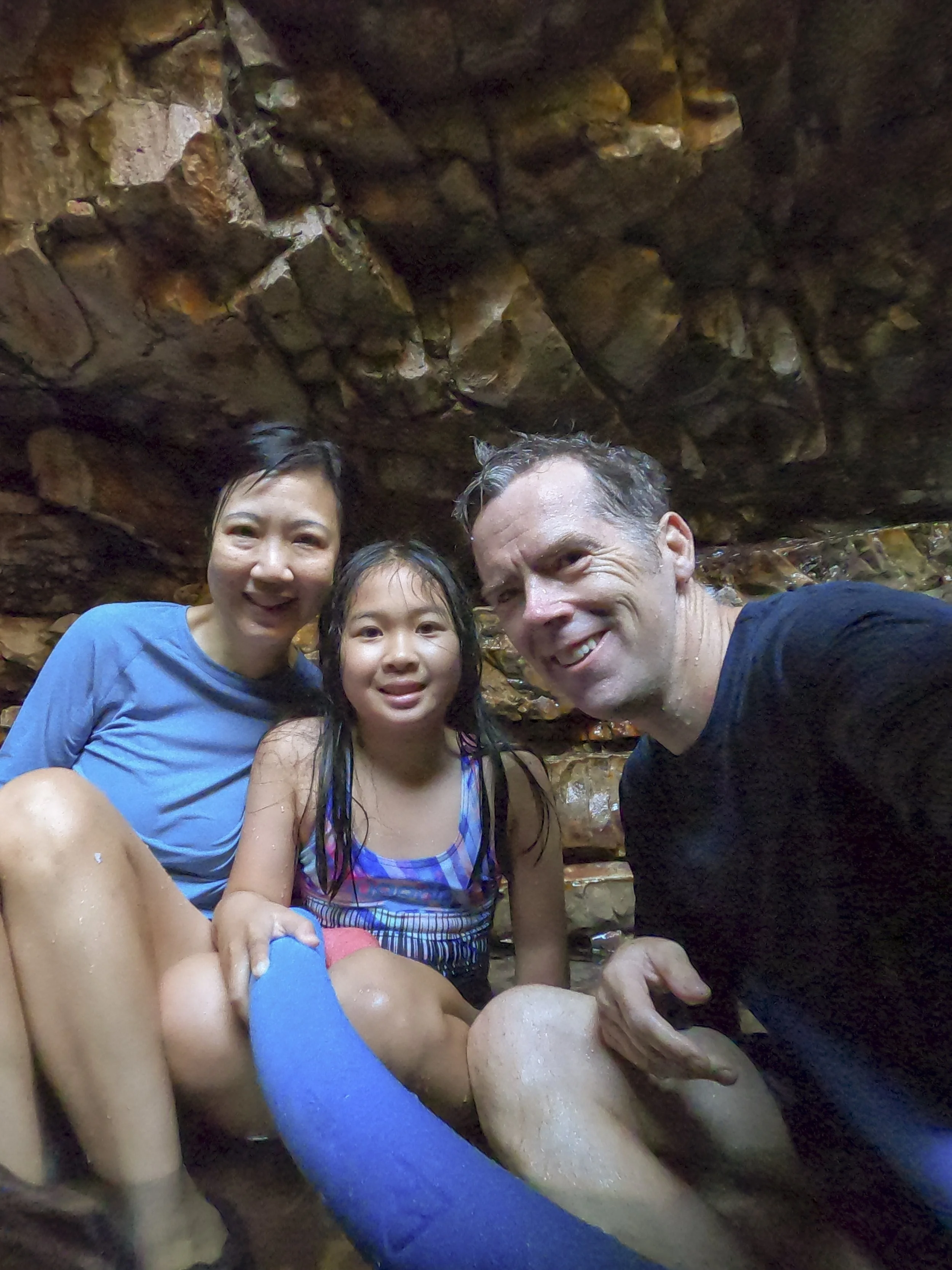
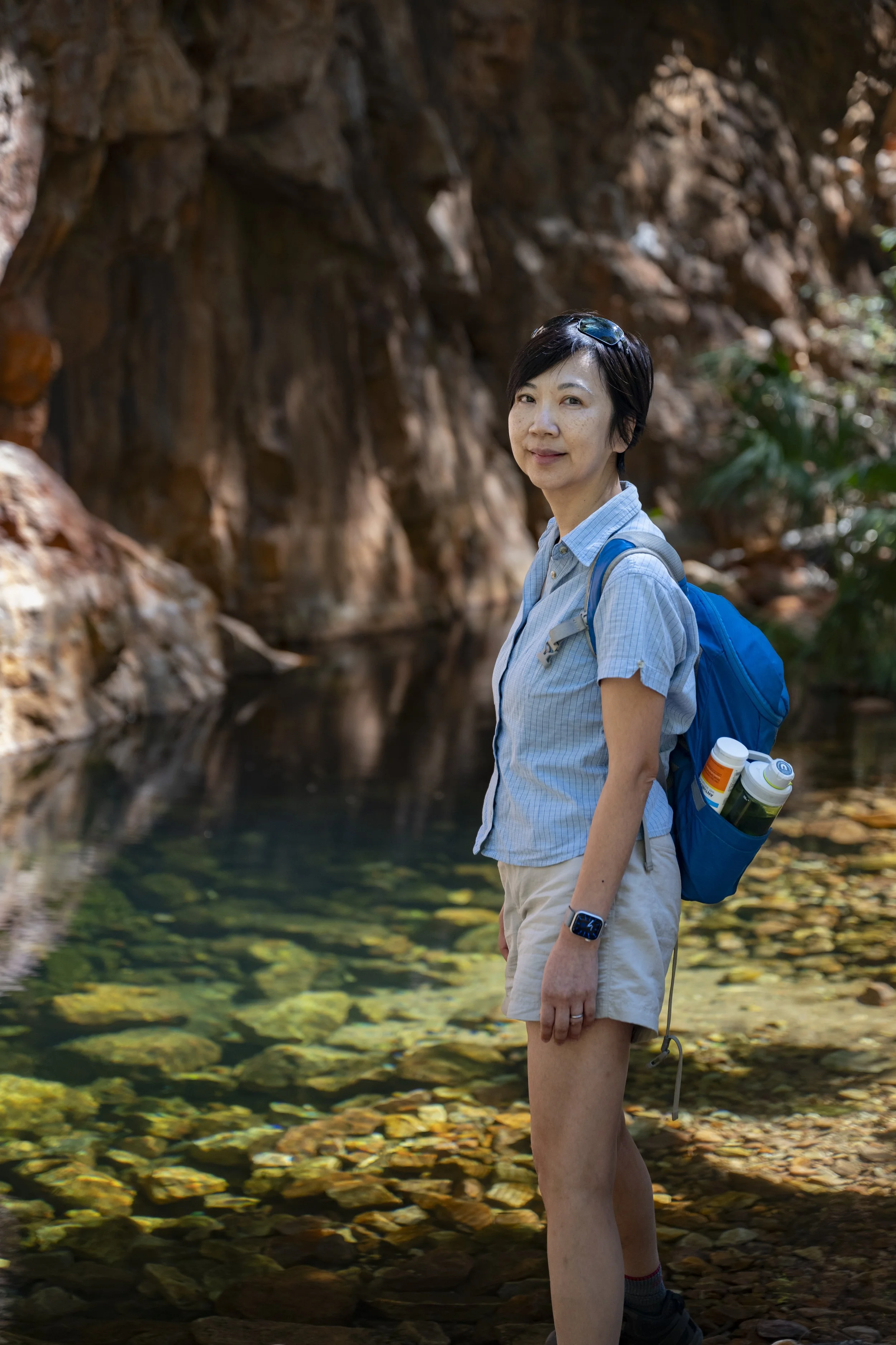
Tunnel Creek: This is a cave which is probably about 500 metres long. Going through the cave you must both walk and swim through water. The cave is also home to fresh water crocodiles… This photo is at the entrance

Tunnel Creek: Near the entrance. On the look out for crocodiles

Tunnel Creek: Just inside the entrance

Tunnel Creek: About half way along there is an opening with some natural light

Tunnel Creek: The far end of the cave
Tunnel Creek: When you exit there is some indigenous rock art
Tunnel Creek: Millie was a little concerned about the crocodiles and so chose not to join for the walk. She waited at the entrance for mum and dad to return
Bell Gorge

Bell Gorge

Bell Gorge: We had a lovely swim in the bottom pool

Bell Gorge: That is where the spare wheel used to be… The whole bracket and wheel is missing

On the road again: There are a lot of river crossings along the way

Manning Gorge: The first part of the walk from the campground to Manning Gorge is a river crossing. There are some barrels provided to get your gear across the river

Manning Gorge

Manning Gorge

Manning Gorge: I was just doing some recon and who was there? Guy and Adam… the fifth time we have met up with them. We saw them later that day at Manning Gorge. I sat in the running water at the top of the water fall with Millie (who did not want to do that). When I got out of the water it looked like I had green moss on my legs. In fact, it was hundreds and hundreds of tiny worms. And they would not come off… Guy was sure they were leeches. (Millie had only a very small number on her because she had been sitting on me). Poor old Guy spent a lot of time picking leeches from my legs, and Adam had a spare pair of shorts which I changed into because I could not get them out of my bathers.

Another water crossing
Galvans Gorge
Galvans Gorge

Galvans Gorge

Crossing the Pentecost River to El Questro

El Questro: Emma Gorge
El Questro: Emma Gorge. The water in the main pool was very cold. There is a natural thermal spring off to one side. Here we are enjoying the warm water

El Questro: Emma Gorge

El Questro: Emma Gorge. Millie has become quite keen on swimming under waterfalls

El Questro: El Questro Gorge. This was one of the nicest walks we have done on our trip

El Questro: El Questro Gorge
El Questro: El Questro Gorge

El Questro: Zebedee Springs. This is a naturally occurring warm water spring

El Questro: We met Nick and Kristy (centre) at Cape Leveque and they turned up opposite us at El Questro. Millie really enjoyed playing with their boys (here in the photo at right are also their friends Rachel and Bruce). We went up to high ground at El Questro to watch the sunset

El Questro: Just as we were leaving, Guy and Adam turned up. We cannot go anywhere without seeing them. At least Guy did not have to pick leeches off my legs this time

Gibb River Road: It is hard to really show how much dust and dirt there has been through the Gibb River Road.

6. Broome and Cape Leveque
After leaving the amazing Karajini National Park, we headed back to the coast. We stopped at Eighty Mile Beach for two days to break up the drive to Broome. This worked out to be a great stop as Millie’s travel friend (Poppy) from Exmouth turned up at the caravan park. They could not have been more excited to see each other and had a great time together. We then went on to Broome to relax a little, get the car serviced and have some issues addressed with both the car and caravan. Poppy and her family were also in Broome for a couple of days which gave them more time together. We enjoyed our overnight trip out to Horizontal Falls, and also explored Cape Leveque which is the peninsular north of Broome.

Eighty Mile Beach: We drove 10 km down on the beach with Poppy's family to play on the beach and collect shells (Our two cars are the black dots on the bottom right corner)

Eighty Mile Beach: The caravan park has a Saturday market to raise money for the RFDS. Millie wanted to have a stand to sell some of the bracelets she had made. I was just there for support - it was Millie who talked to her customers and did a great job selling her bracelets

Eighty Mile Beach: Millie counting her takings from the market stall. She was thrilled with the $25 she made in 90 minutes

Broome: Watching the camels

Broome: Po Po flew home when we arrived into Broome. She is actually smiling in this photo. She really enjoyed Ningaloo and Karijini. I have not seen her enjoy any travel so much as this

Broome: Malcom Douglas Crocodile Park

Broome: Malcom Douglas Crocodile Park

Broome: Malcom Douglas Crocodile Park

Broome: Malcom Douglas Crocodile Park

Broome: Malcom Douglas Crocodile Park

Broome: Malcom Douglas Crocodile Park

Broome: Watching the camels with Poppy

Broome: Sunset with Poppy and Benji

Broome: We went to the indoor / outdoor cinema with Poppy and her brother Benji

Broome: Justin and Millie did a camel ride. Sumy walked along side taking lots of photos

Broome: Justin and Millie did a camel ride (on front camel). Sumy walked along side taking lots of photos

Broome: Justin and Millie on the camel

Broome: The caravan park had about 400 sites. And, who were we put next to? Guy and Adam who we met in Geraldton and were with again in Karijini
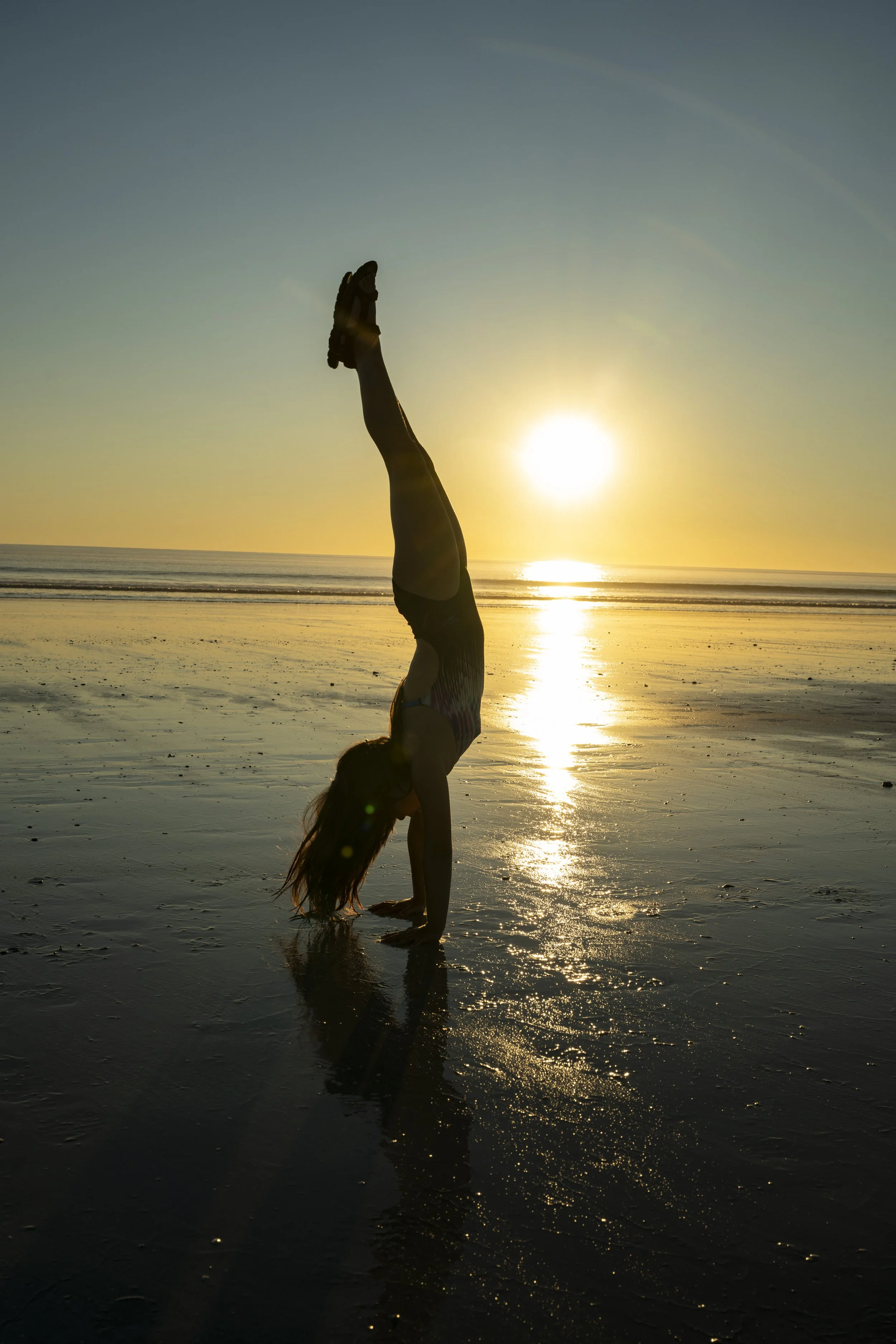
Broome: More handstands on the beach. But, quite scenic

Broome: Adam had never done handstands. But, as a recently retired professional dancer I suppose it was not going to be hard for him

Broome: Really enjoyed swimming at Cable Beach
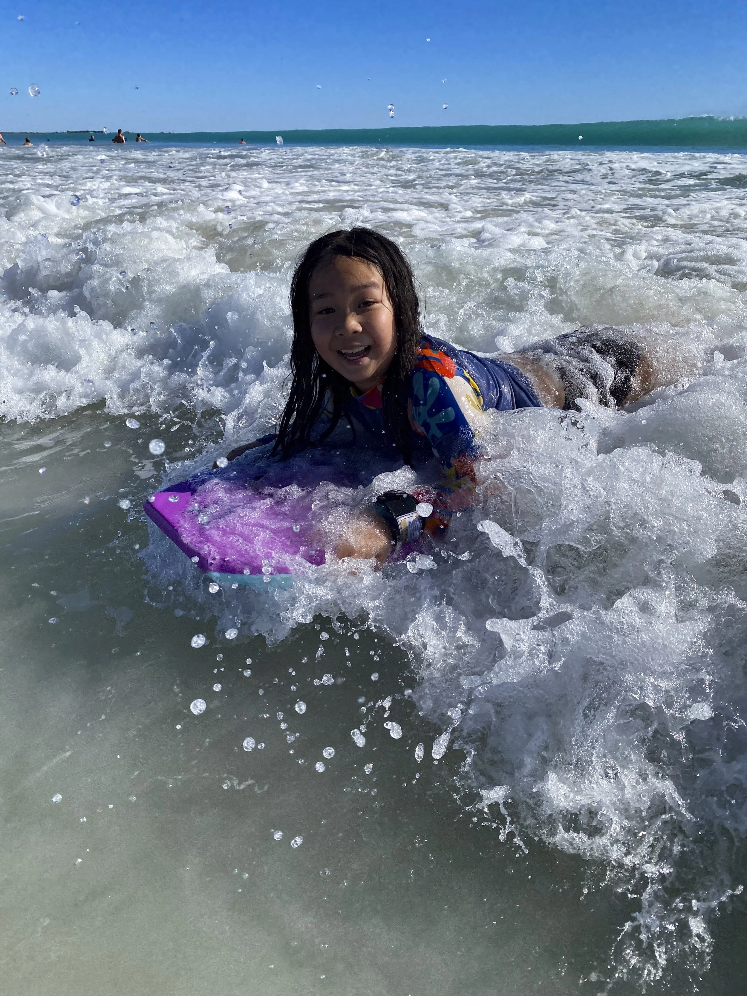
Broome: Really enjoyed swimming at Cable Beach
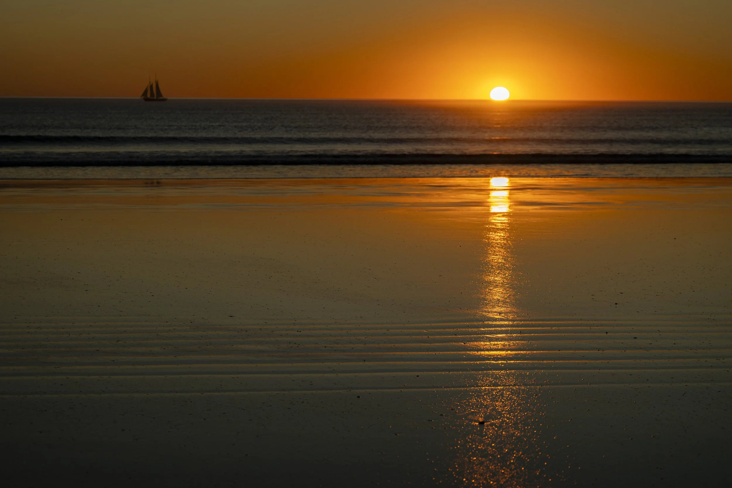
Broome: One last sunset picture

James Price Point: Just north of Broome is the iconic James Price Point

James Price Point: Sitting on the car on the beach

James Price Point

James Price Point
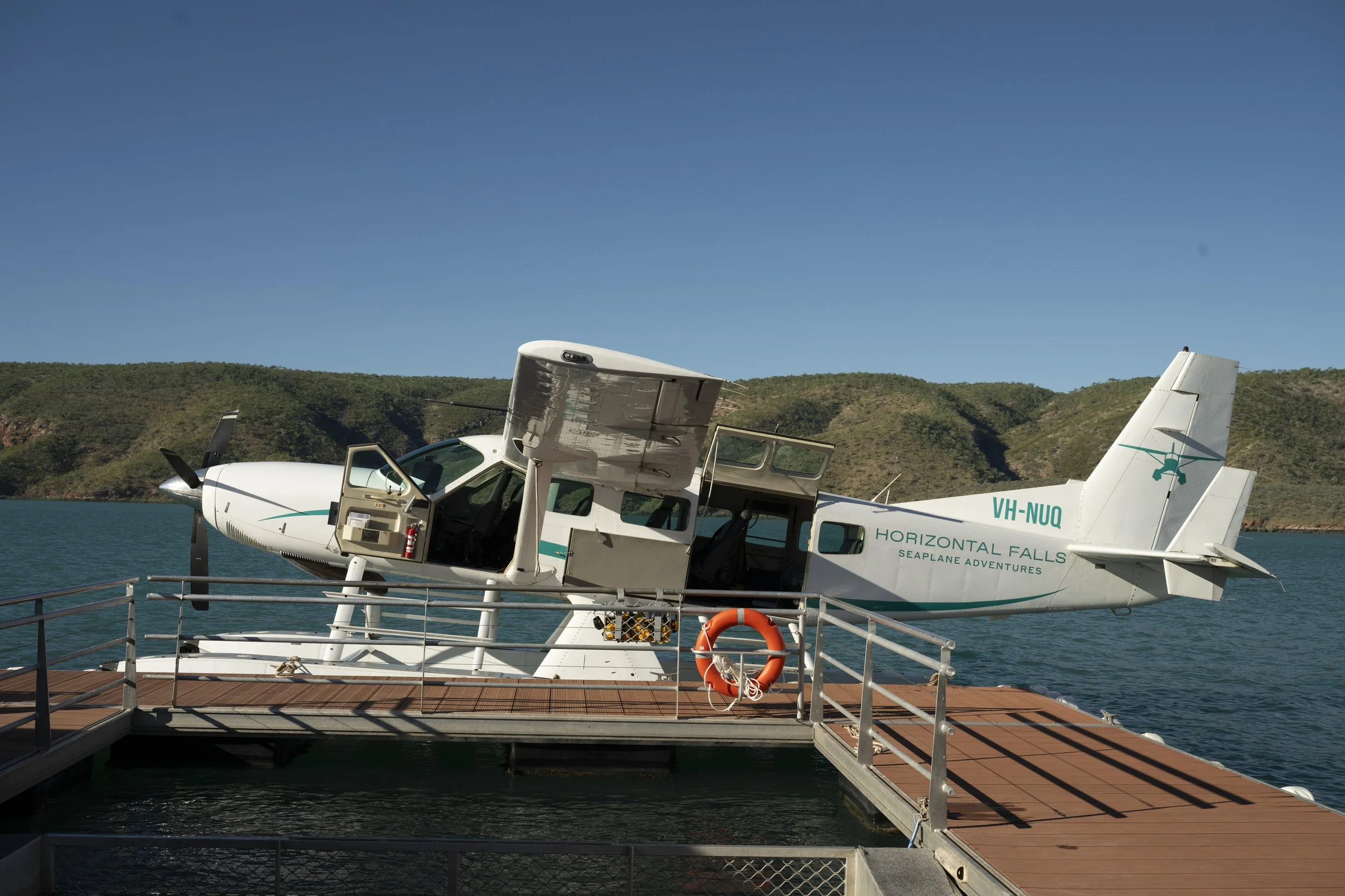
Horizontal Falls: We did the overnight tour to Horizontal Falls in the Kimberley. You fly to their floating base from Derby on a sea plane

Horizontal Falls: The view on the way to their base

Horizontal Falls: The view on the way to their base
Horizontal Falls: The view on the way to their base

Horizontal Falls: The boat is heading towards the first ‘fall’. The second channel at the top of the photo is where one of their boats capsized a couple of years ago. They do not take you through that channel any more… But, they do take the boat up near it

Horizontal Falls

Horizontal Falls: A lot of water rushes through the channel as the tide changes, and hence creates the ‘horizontal fall’, apparently named by Malcolm Douglas when he visited the area in his tin boat

Horizontal Falls: On the boat

Horizontal Falls: The moon over the hills

Cape Leveque (Beagle Bay): Sacred Heart church with its famous shell decorations

Cape Leveque (Beagle Bay): Sacred Heart church with its famous shell decorations (on the alter and around the walls)

Cape Leveque: Lombadina community

Cape Leveque: The church in the community. The christian missionaries had a large presence in Cape Leveque

Cape Leveque: The church in the community. The original bark roof is still evident on the interior of the roof

Cape Leveque (Southern Cross Tour): We did a walking tour with Bolo, who is a local Bardi-Jawi man. He took us around for more than four hours, talking about his culture and how people lived on the land
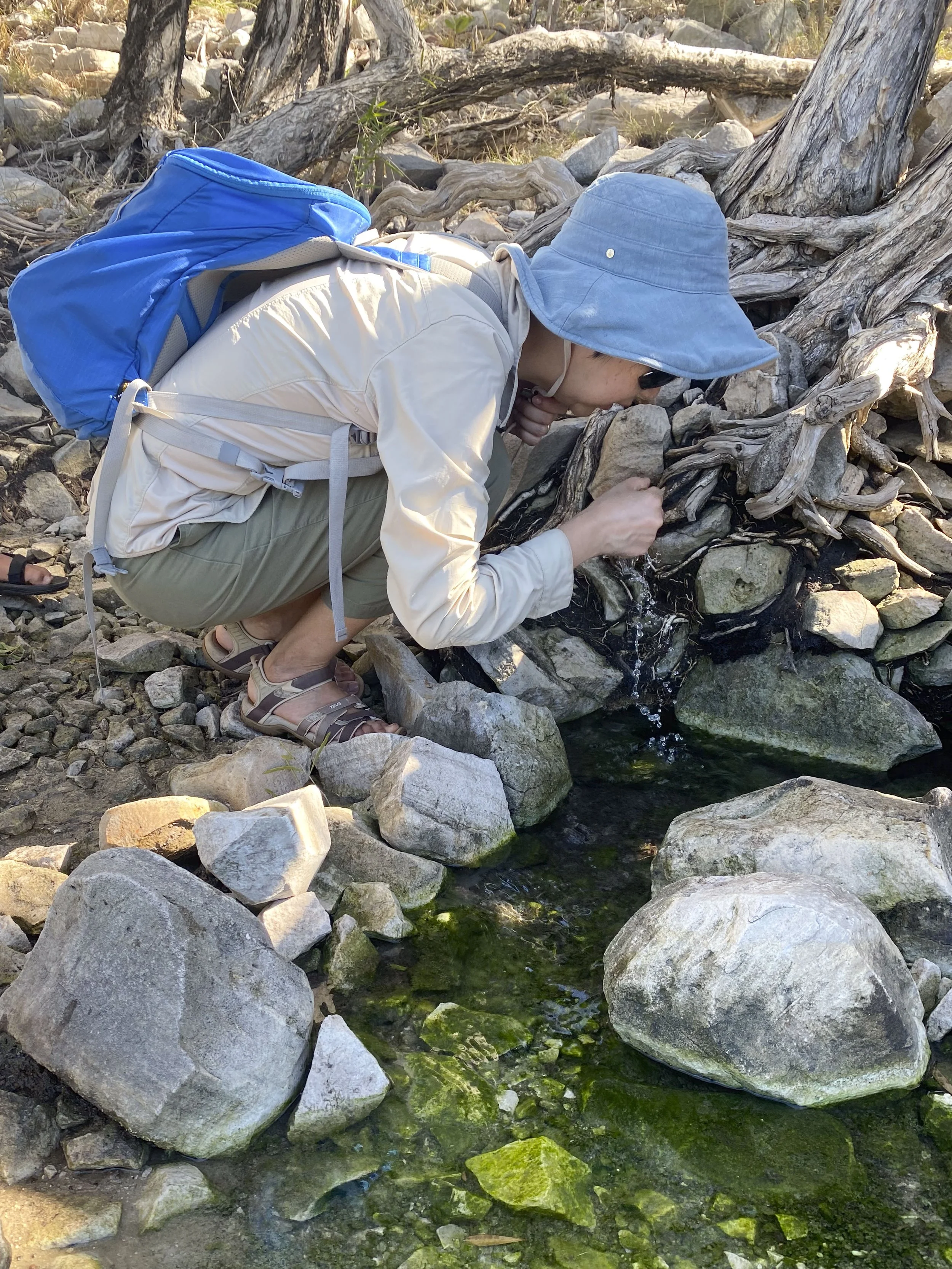
Cape Leveque (Southern Cross Tour): Bolo took us to the source of a natural spring and gave us a welcome to country. We crushed some leaves and then filtered the spring water through the leaves and drank that

Cape Leveque (Southern Cross Tour): Collecting food
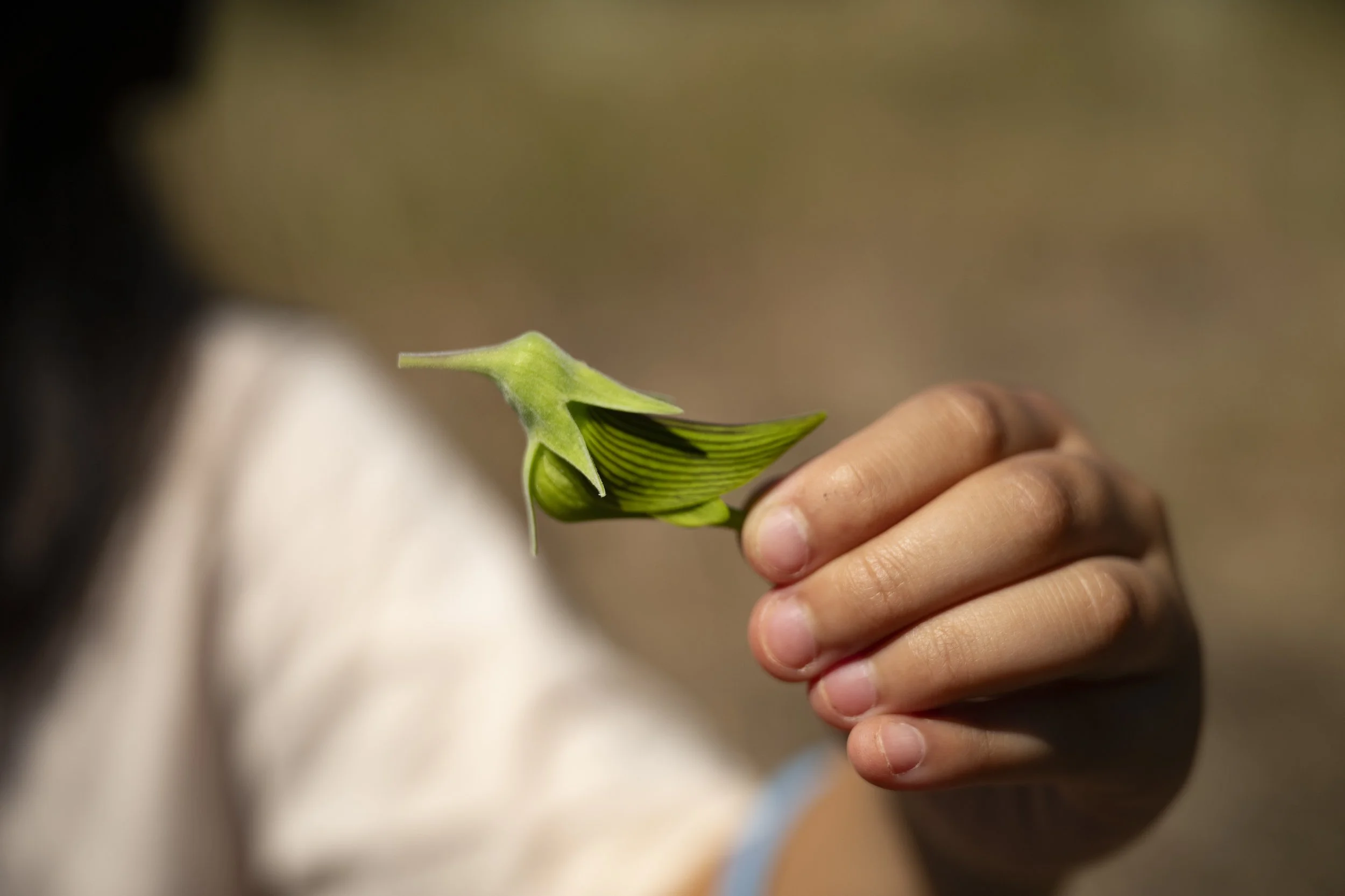
Cape Leveque (Southern Cross Tour): We pulled the head off this flower and licked the sweet nectar and then ate the flower

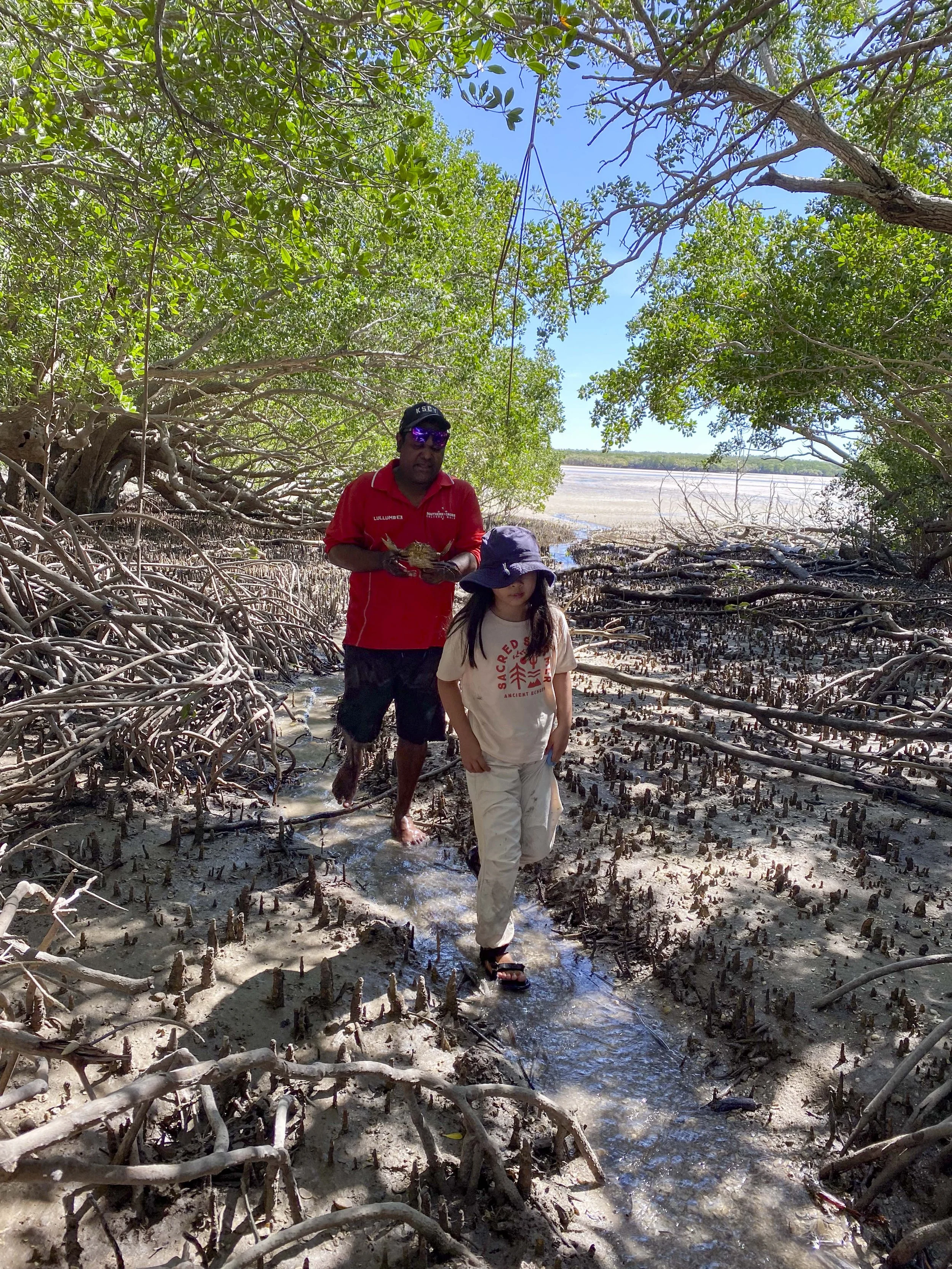
Cape Leveque (Southern Cross Tour): So Bolo found the crab and not Sumy, but still she learned how to pick it up
Cape Leveque (Southern Cross Tour)

Cape Leveque (Southern Cross Tour): Finding salty water in the tree
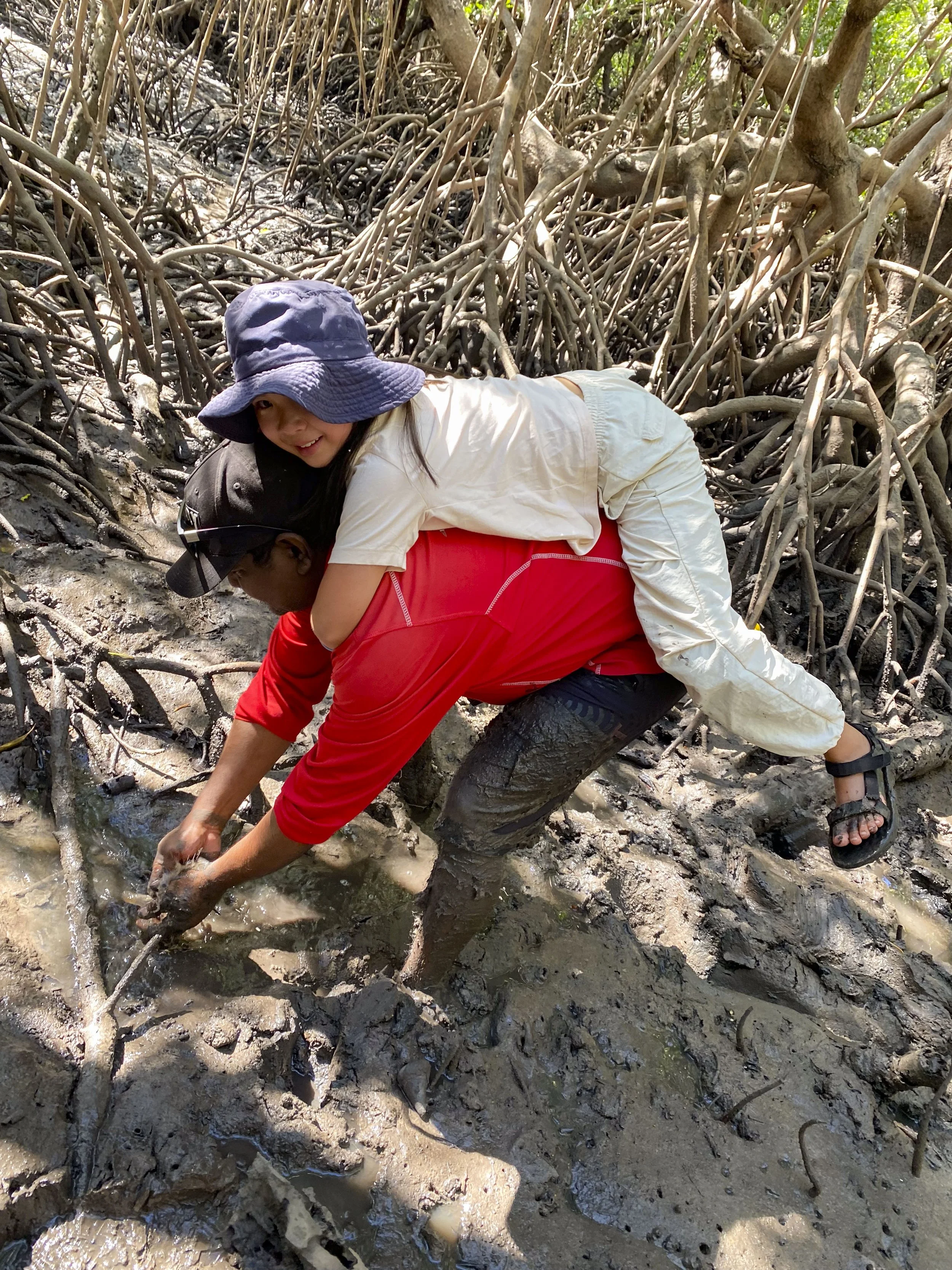
Cape Leveque (Southern Cross Tour): Millie was very apprehensive about the deep mud in the mangroves. I was trying to encourage Millie to keep walking when Bolo offered her a piggyback. Millie is reluctant to even give an adult she has known for years a high five, but she quickly accepted Bolo’s offer

Cape Leveque (Southern Cross Tour): Going through the mangrove

Cape Leveque (Southern Cross Tour): Using a leaf and water to lather and wash our hands. After this we returned to Bolo’s property and he cooked up the food that had been caught during the walk
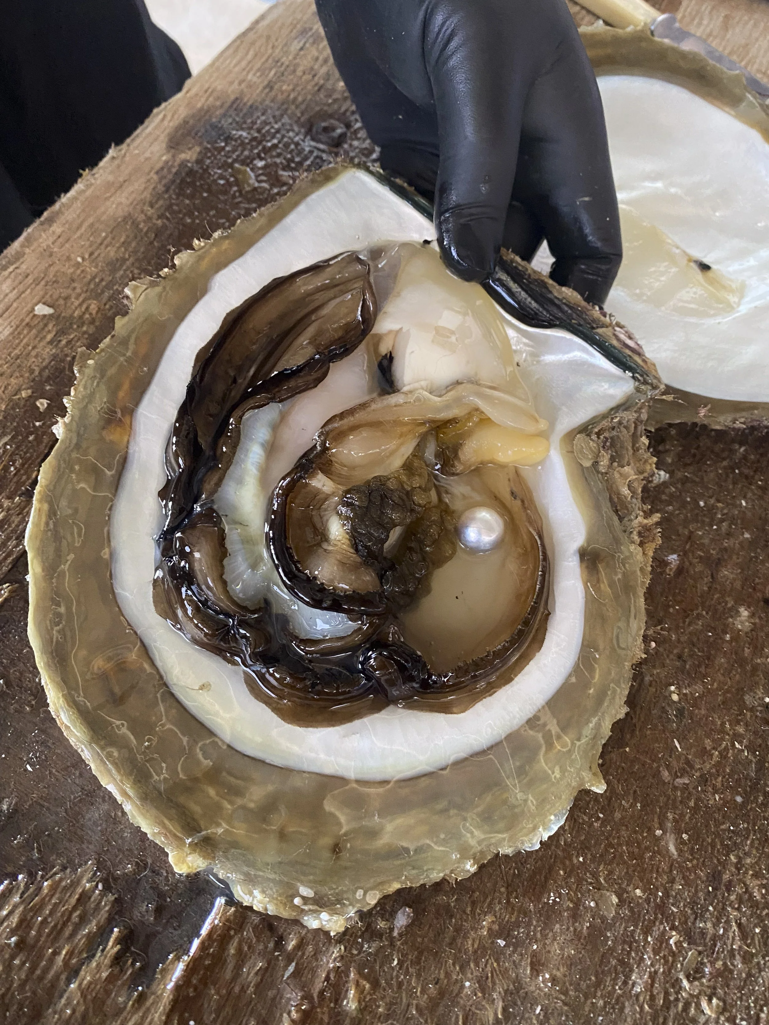
Cape Leveque: Cygnet Bay Pearl Farm. they opened up an oyster in front of us to see the cultured pearl
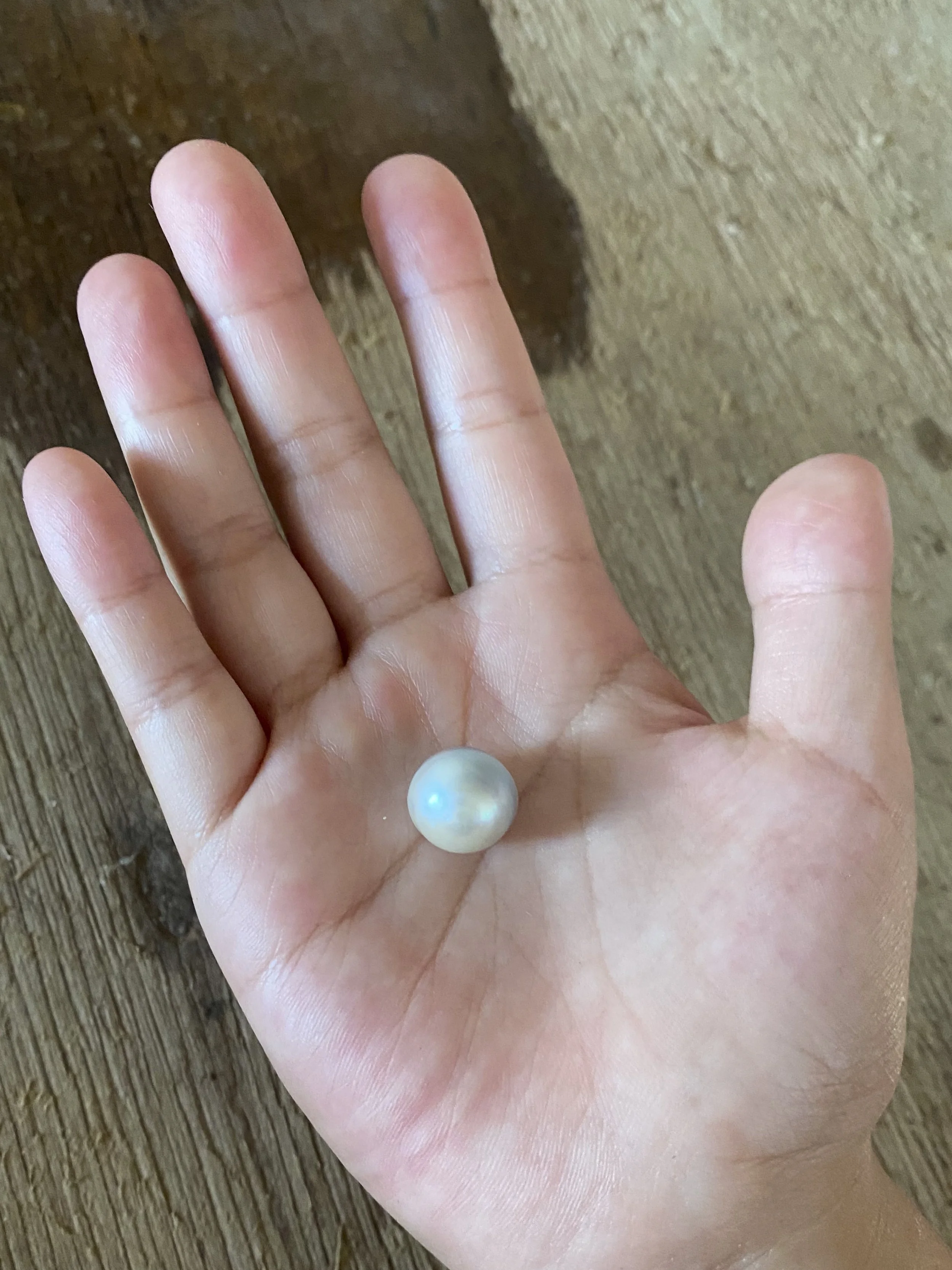
Cape Leveque: Cygnet Bay Pearl Farm. The pearl in Millie’s hand

Cape Leveque: Playing some backgammon

5. Karijini National Park
We have just spent seven days at Karijini National Park, which I would say is the minimum amount of time required to explore the highlights. We had a little bit of trouble on our way to the park - I was shifting the car & caravan at the service station (they had run out of fuel at our bowser) in Tom Price and someone called out that the wheels of the caravan were locked and dragging. I moved the van back and forwards and unlocked the wheels. We stayed at Tom Price the night to get the van looked at in the morning by a mechanic. Again, people were very kind - the man next to us at the caravan park in Tom Price came over and identified the underlying issue that locked the brakes, and then the mechanic in the morning did not charge us to check over the brakes. Our luck extended when we arrived at Karijini. One of their most famous gorges had been closed and was expected to be closed until mid-June. However, it was opened early on the day we arrived. We again had nice neighbours at the park, and also some fellow travellers we met in Geraldton were there at the same time. While it was a busy week, it was a special week.

Hamersley George - The ‘poster shot’ of Karijini National Park. This is a small spa pool at the end of Hamersley Gorge. It was quite a juggle with my gear to get the photo. Again, people were so nice - they put off getting in so that I could get a photo. When I suggested that I will wait, each time (I went there twice) people were insistent that I just take my time and they would wait.

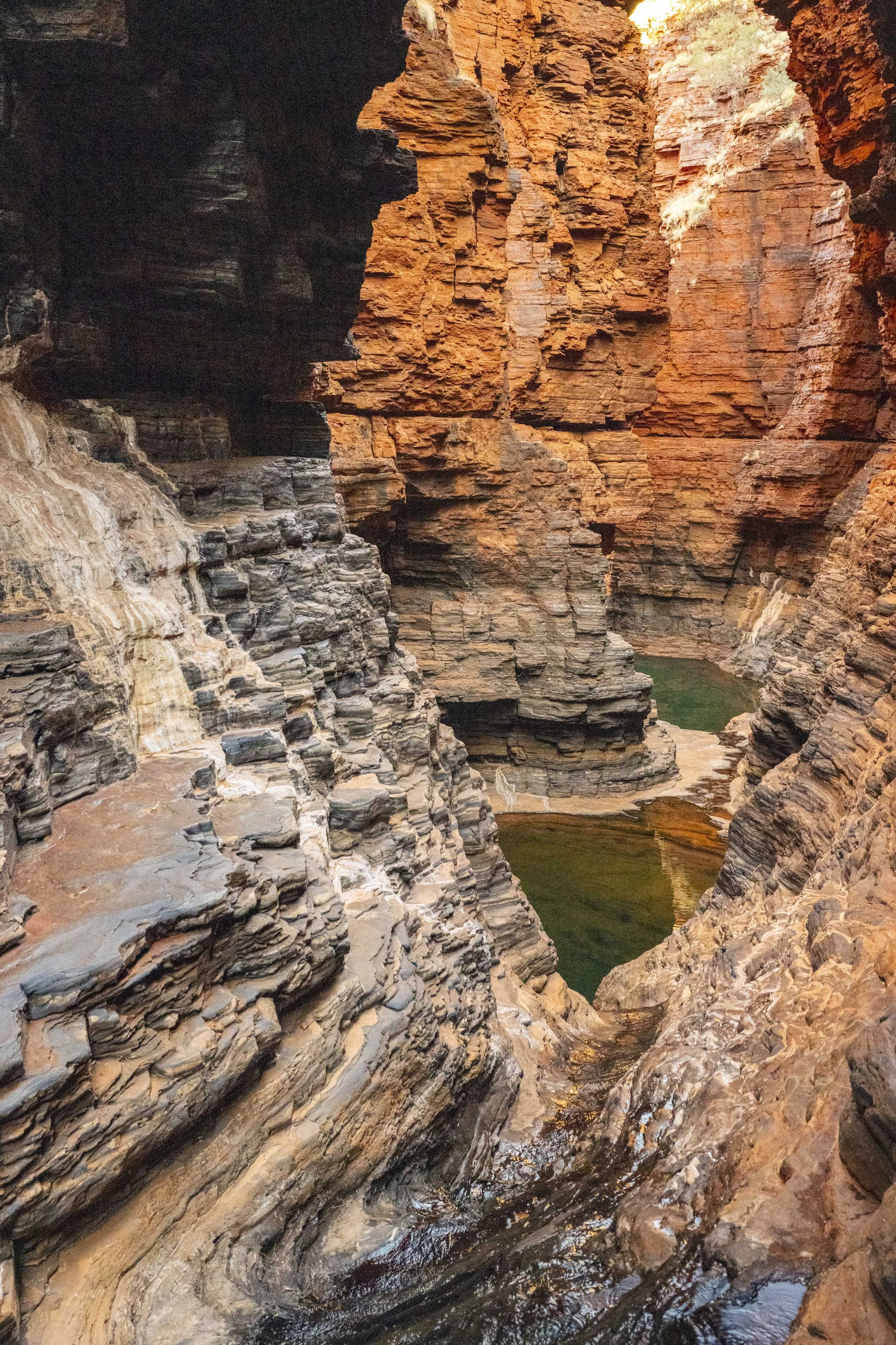
Joffre Gorge - There is a waterfall here sometimes (where the white mark is on the rock). Still lovely without the waterfall

Joffre Gorge - Millie did not bring her water shoes to Joffre and so needed a little help

Joffre Gorge - Millie and Po Po. Po Po loved Karijini, and did a great job getting down to many of the gorges

Joffre Gorge - The layers of rock in every gorge were really interesting

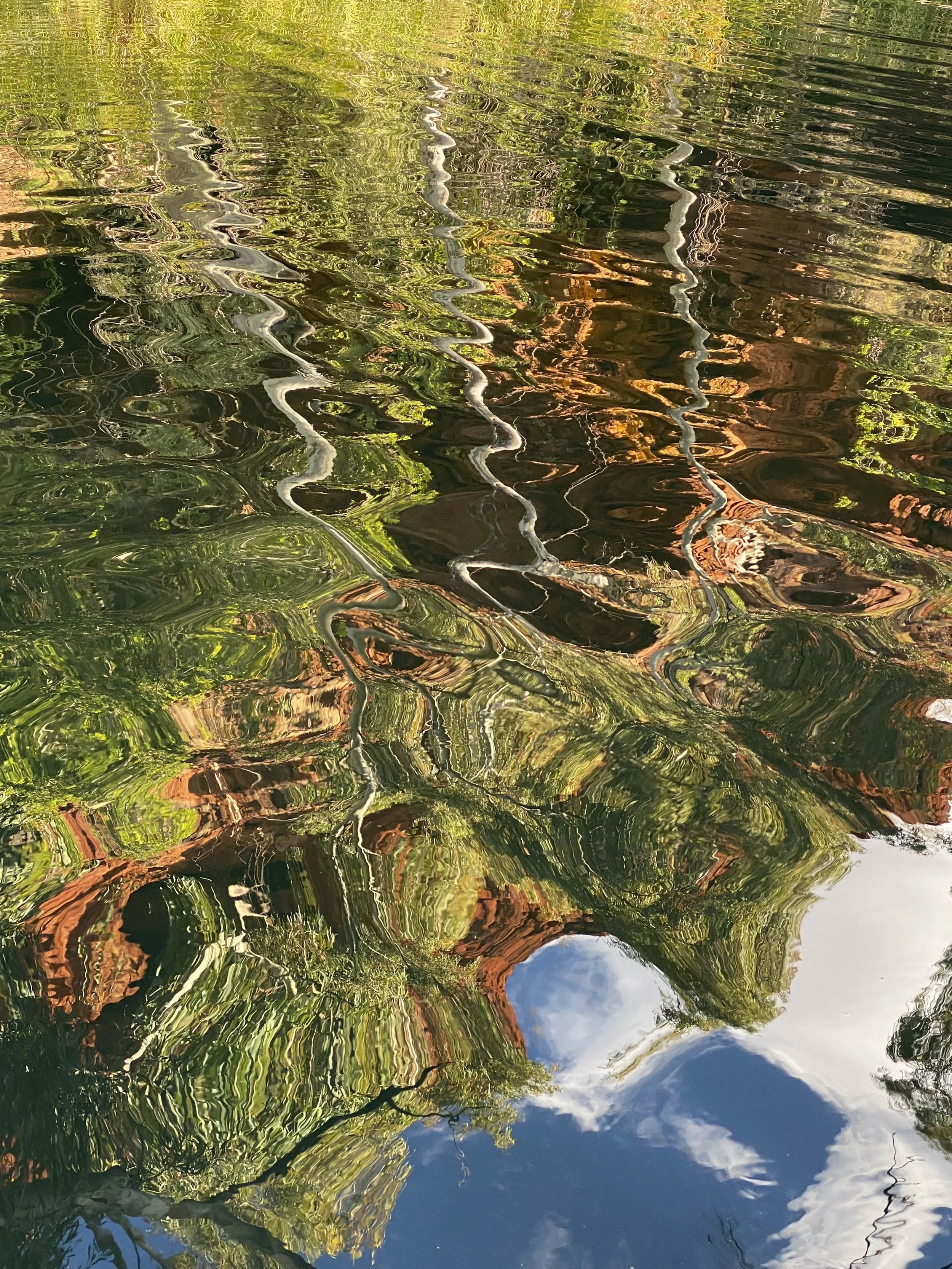
Knox Gorge - Reflection in the water

Hancock Gorge - Millie in the ‘spider walk’
Hancock Gorge

Hancock Gorge - Kermit’s Pool

Knox Gorge

Knox Gorge

Hancock Gorge

Hancock Gorge

Hamersley Gorge - Justin and Millie swimming in the waterhole

Karijini - With Adam and Guy, whom we met in Geraldton and then ran into again in Tom Price (here at dinner in Karijini). Adam was a principal dancer with the Australian Ballet for many years. He has just retired, and he and Guy are travelling around the country.

Knox Gorge
Knox Gorge
Hancock Gorge

Dales Gorge - Fern Pool
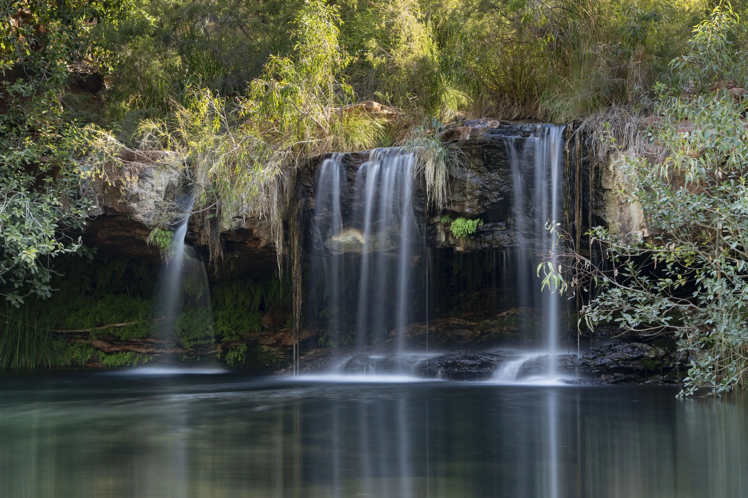
Dales Gorge - Fern Pool

Dales Gorge
Dales Gorge - Millie happy that I have come back from taking some photos

Hamersley Gorge
Knox Gorge

I have been reading ‘Great Expectations’ with Millie. She was very pleased that Pip’s benefactor was finally revealed

Karijini: Kayleen is a Banyjima & Kurrama lady from Karijini. She sets homework for the children to get their ‘junior ranger’ badge. Here is Millie being presented with her certificate and badge from Kayleen

Last picture - I met Alim at a roadhouse on the way to Karijini. Alim is from Turkey and is riding his motorbike to the North/South/East/West points of each continent. I greatly enjoyed our chat. As Alim hugged when we parted, Millie said I make a BFF even when we just get fuel

4. Ningaloo
After leaving Kalbarri, we headed north to Ningaloo Reef. We stayed at three places over two-and-a-half weeks along the reef to get a full experience - Cape Range National Park, Coral Bay and Exmouth. Sumy’s mother joined us from Coral Bay (she will be with us for Karijini National Park and will leave when we arrive into Broome). We all really enjoyed our experience here. There was a lot of swimming and snorkelling. We also did the famous ‘swim with the whale sharks’ and Justin did a microlight flight.

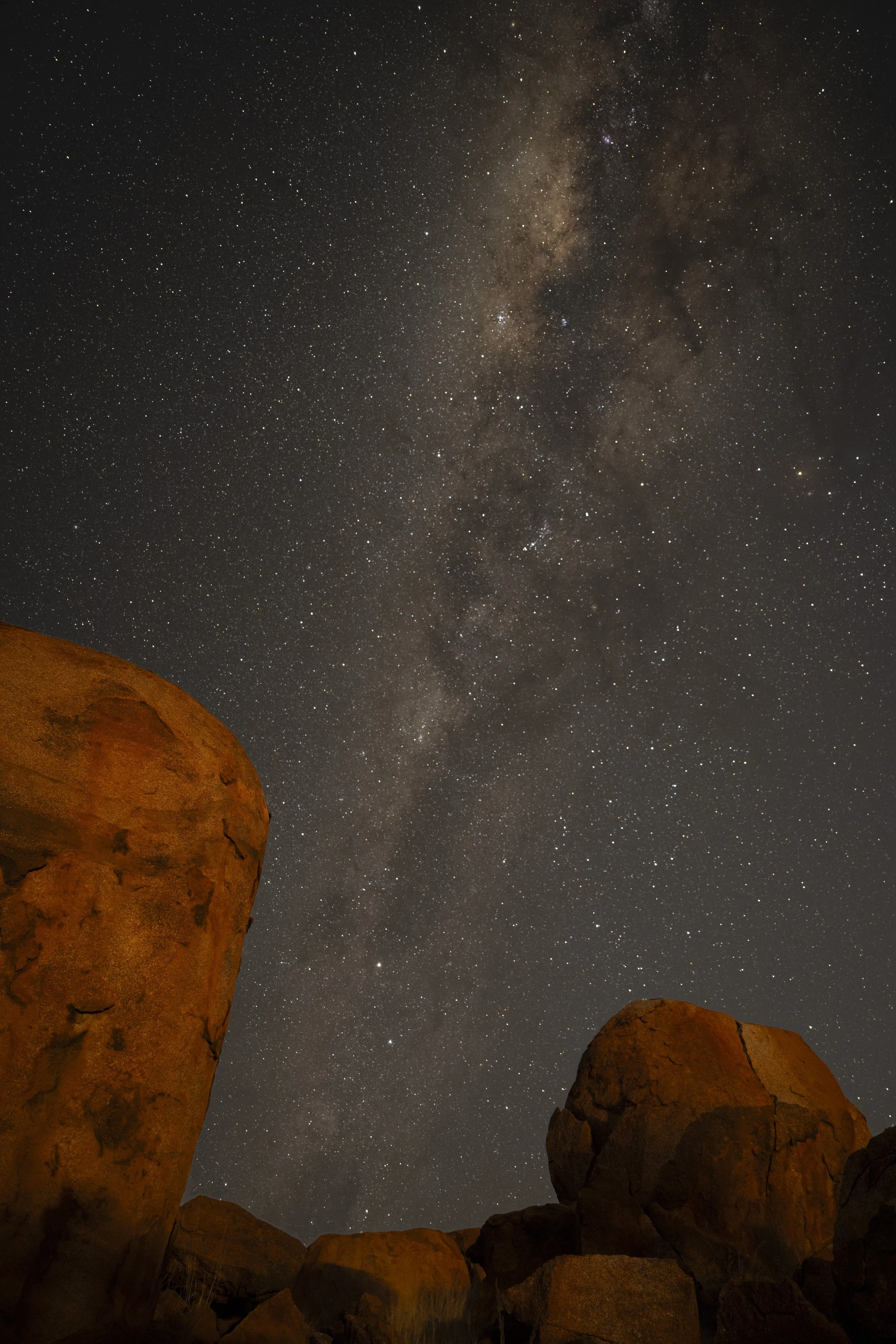
Cape Range National Park - Our campsite under the Milky Way at Tulki Beach
Cape Range National Park - There were drinks each night with the guests from the 12 sites at Tulki Beach

Cape Range National Park - Greater Crested Tern (with breakfast)

Cape Range National Park - Osprey near the camp site
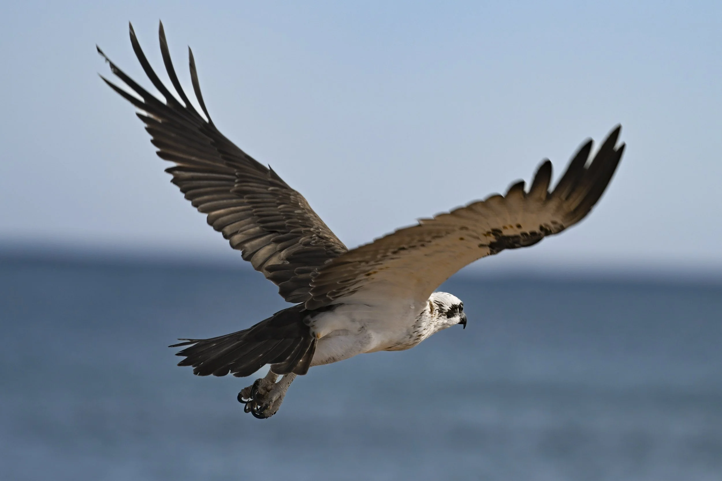
Cape Range National Park - Osprey near the camp site

Cape Range National Park - The reef out from Tulki Beach

Cape Range National Park - The reef out from Tulki Beach

Cape Range National Park - The reef out from Tulki Beach
Cape Range National Park - We brought along an inflatable kayak to access the reef further from the beach

Cape Range National Park - Lots of snorkelling

Cape Range National Park - Lots of turtles and fish
Cape Range National Park - Yardie Creek

Cape Range National Park
Cape Range National Park - Seeking shelter under our car from the heat

Cape Range National Park - Our car has its own solar power and battery to run appliances (here the fridge and compressor to pump up the kayak)

Cape Range National Park - One of our favourite beaches (Osprey)
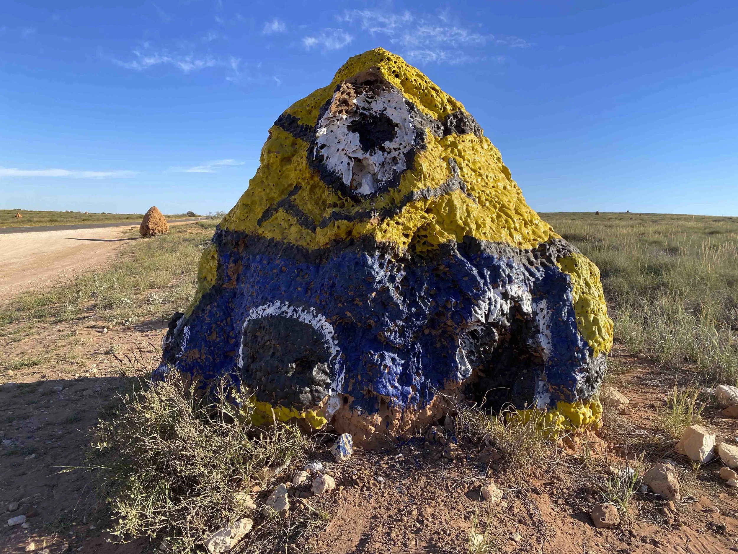
En-route from Cape Range National Park to Coral Bay - Someone painted a termite mound as a Minion

Coral Bay - Five Fingers Beach (Our car is second from the left, with the drone operator out front…)

Coral Bay - Just walk off the beach and this is what you can see

Coral Bay - Playing ‘Dutch Blitz’ with our neighbours at the caravan park (Kyle and Kara). Everyone at the caravan parks has been very friendly (Millie says I make BFFs every day at the caravan parks)

Exmouth - Swimming with the whale sharks

Exmouth - Swimming with the whale sharks

Exmouth - Swimming with the whale sharks

Exmouth - Swimming with the whale sharks
Exmouth - Swimming with the whale sharks

Exmouth - Swimming with the whale sharks

Exmouth - Swimming with the whale sharks
Exmouth / Cape Range

Exmouth / Cape Range

Exmouth / Cape Range

Exmouth / Cape Range
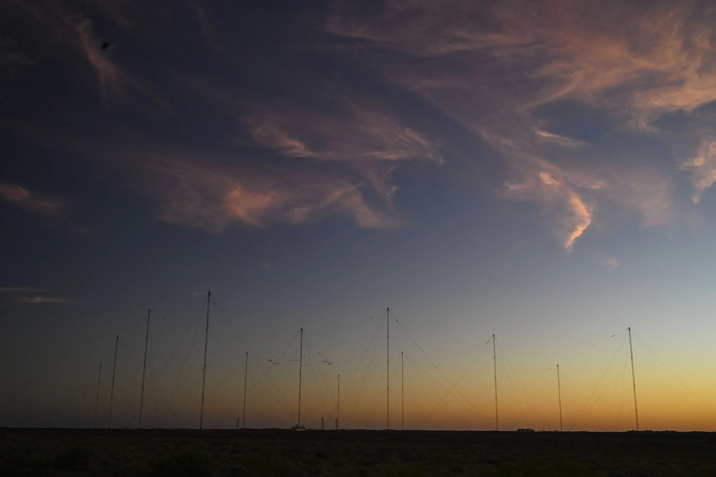
Exmouth - Harold E. Holt Very Low Frequency (VLF) communication towers for submarines. I had put away the camera, when all of a sudden the morning clouds turned pink. Also, presumably, this facility makes Exmouth a priority target in a nuclear conflict
Exmouth - Wreck of the Mildura

Exmouth - Charles Knife Canyon just before sunrise

Exmouth - Charles Knife Canyon just after sunrise

Exmouth - Charles Knife Canyon just after sunrise (using the drone now to get myself into the photo)
Exmouth - Last day and last visit to Cape Range National Park (Turquoise Bay)

Exmouth - Last day and a final paddle in the kayak (Millie was over swimming & kayaking by now and so stayed on the beach with Po Po)

Exmouth - Millie met Poppy on the whale shark swim, and they had fun playing at the caravan park, including setting up a bracelet store

Exmouth - End of the last day and I took a joy flight in a microlight

Exmouth - Looking down Cape Range and the reef from the microlight
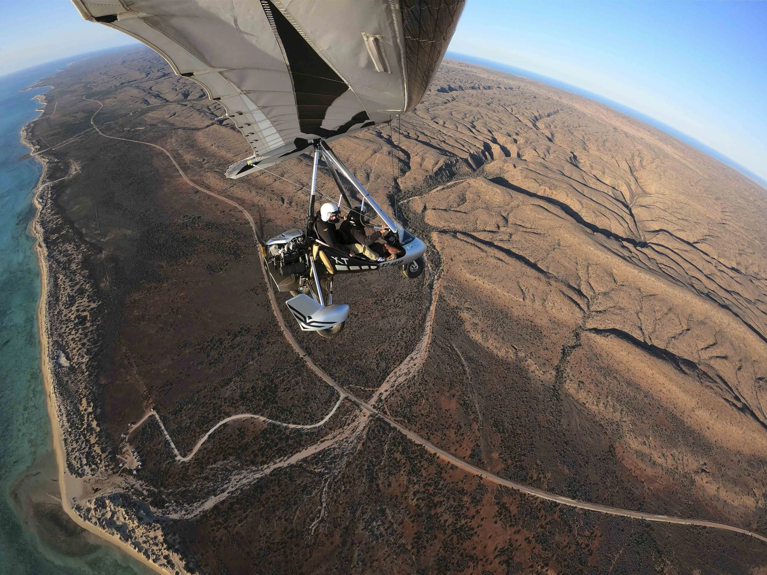
Exmouth - Flying over our camp site (Tulki Beach)

Exmouth - I was allowed to steer us back home

Exmouth - I have enjoyed riding my bike in the morning at many of our stays. Here is a bike path in Exmouth which was frequented by emus (which I saw a number of) and dingos (which I did not see)
Goodbye from Ningaloo… (Millie’s photo)

3. Geraldton and Kalbarri
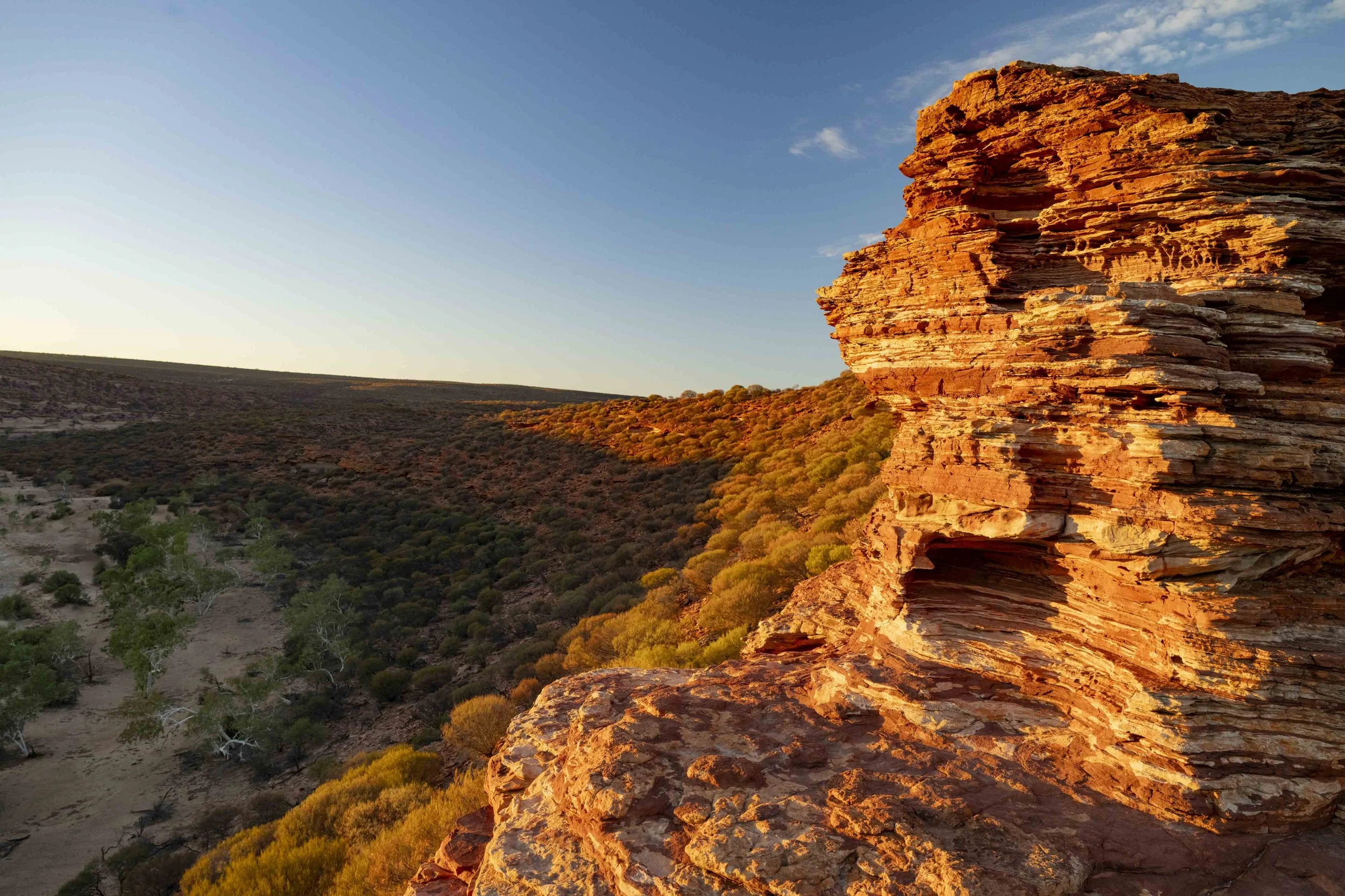
We spent a week in Geraldton so that I could windsurf. I was keen to return to Coronation Beach, where I had last been windsurfing in 1992… Back then there was no infrastructure, just an 8 km gravel road which led directly on to the beach where you parked. Now there is a caravan park, kiosk, toilets, and demarcated areas of the beach for windsurfers and kite boards. Time changes. It was a disappointing week for wind, but I nonetheless managed to get out on the water four times, three of those at Coronation Beach. Millie made a friend in Geraldton. Layla had been travelling with her parents and three siblings around Australia, and had decided to stop and buy a house in Geraldton. We also enjoyed Kalbarri a lot - seeing Nature’s Window, touring some of the coastline on quad bikes and doing a walk down to the Z bend.

Sunset Beach at the caravan park in Geraldton

Sunset Beach (Caravan Park)

Sunset Beach (Caravan Park) - Fearless
Millie and her friend Layla

Millie and her friend Layla

Millie and her friend Layla

Millie and her friend Layla

Millie and her friend Layla

Millie and her friend Layla (Layla’s brother)

Coronation Beach

Coronation Beach

Coronation Beach

Coronation Beach
Hutt Lagoon (between Geraldton and Kalbarri)

Hutt Lagoon (between Geraldton and Kalbarri)

Hutt Lagoon (between Geraldton and Kalbarri)
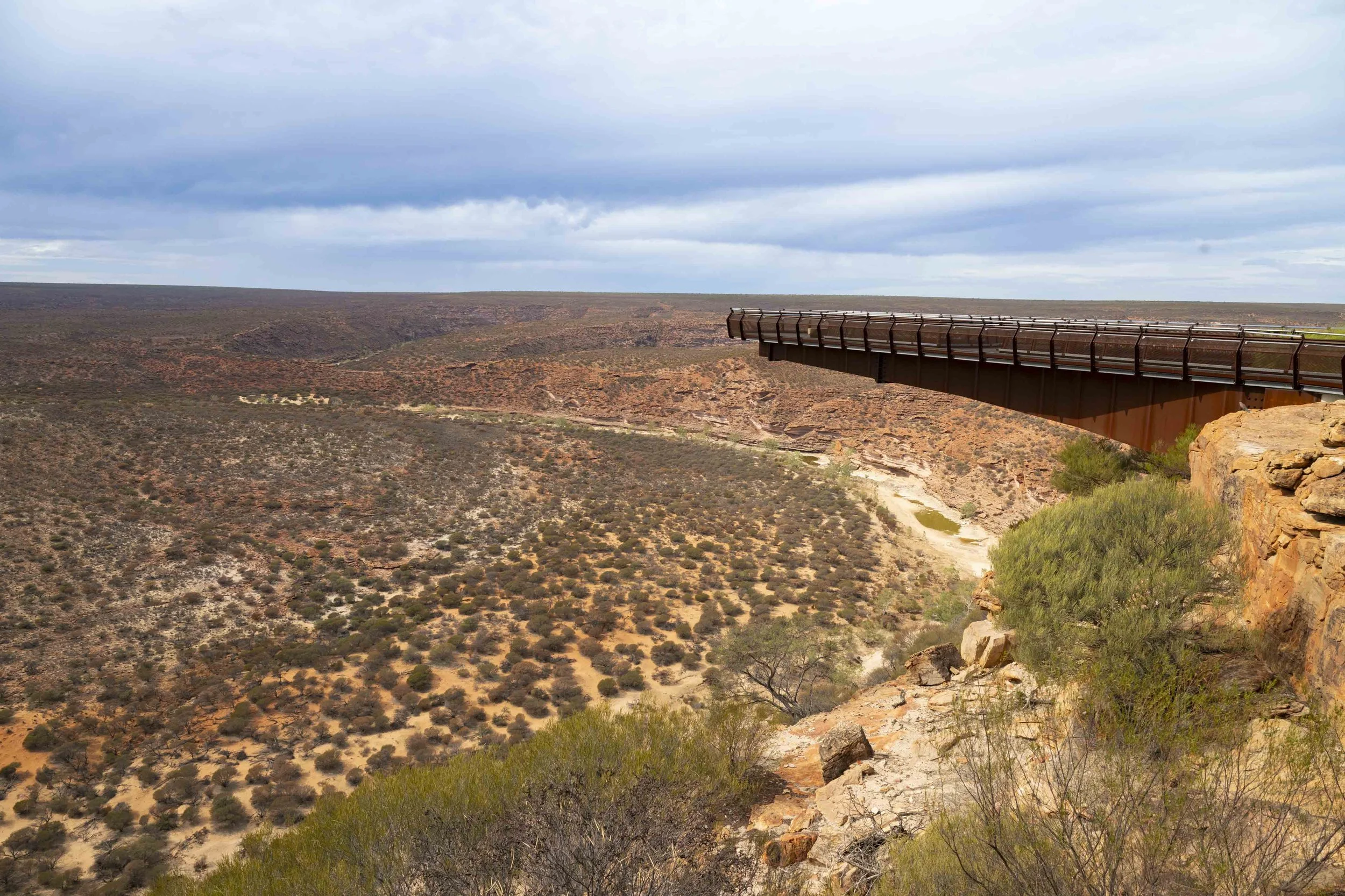
Kalbarri Skywalk

Kalbarri - Nature’s Window

Kalbarri - Nature’s Window

Kalbarri - Nature’s Window
Kalbarri - Nature’s Window
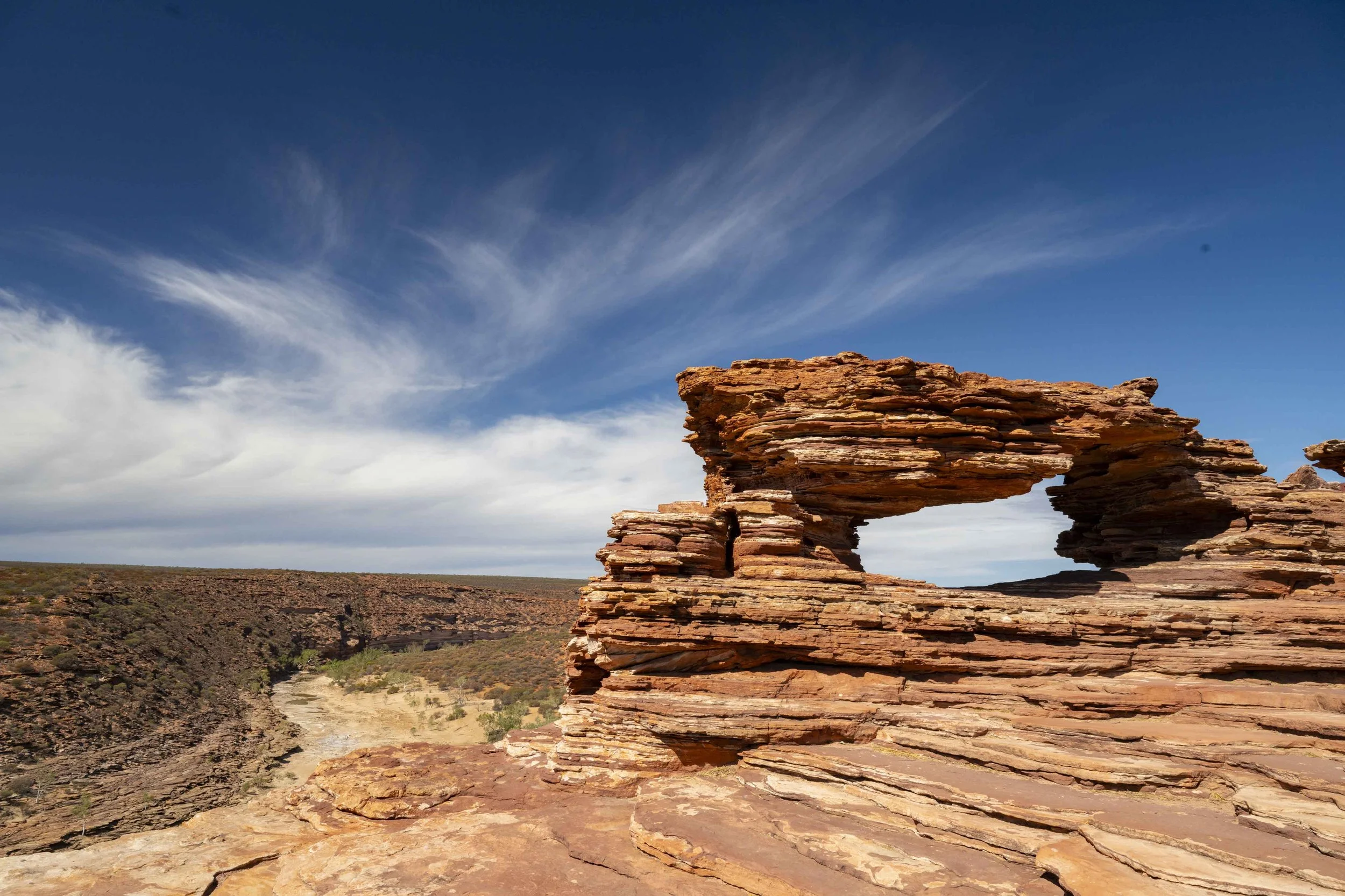
Kalbarri - Nature’s Window

Kalbarri - Z Bend
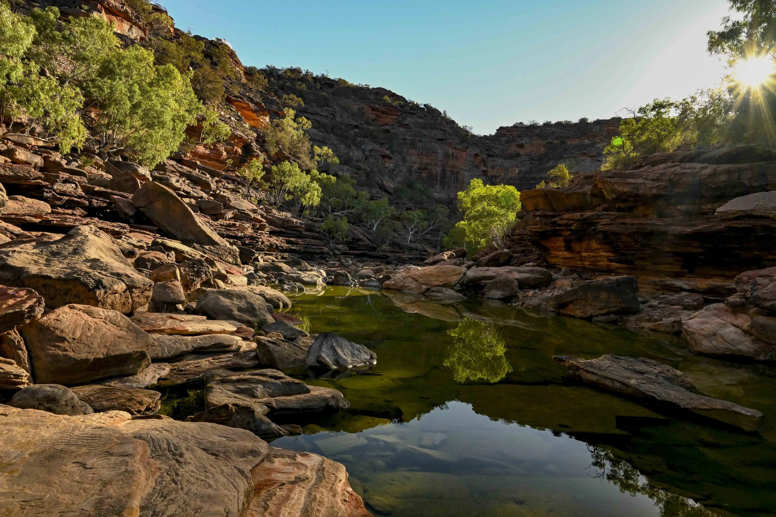
Kalbarri - Z Bend

Kalbarri - Z Bend
Kalbarri - Z Bend - Millie and Sumy walking down to the river
Kalbarri - Quad Bike Tour

Kalbarri - Quad Bike Tour

Kalbarri - Quad Bike Tour

Kalbarri - Quad Bike Tour
Kalbarri - Saw this person with a make-shift fly net… a bag from KFC

Kalbarri - We see many blue trees from the blue tree project along the way
Kalbarri - We do allow time for rest

2. Esperance to Menzies
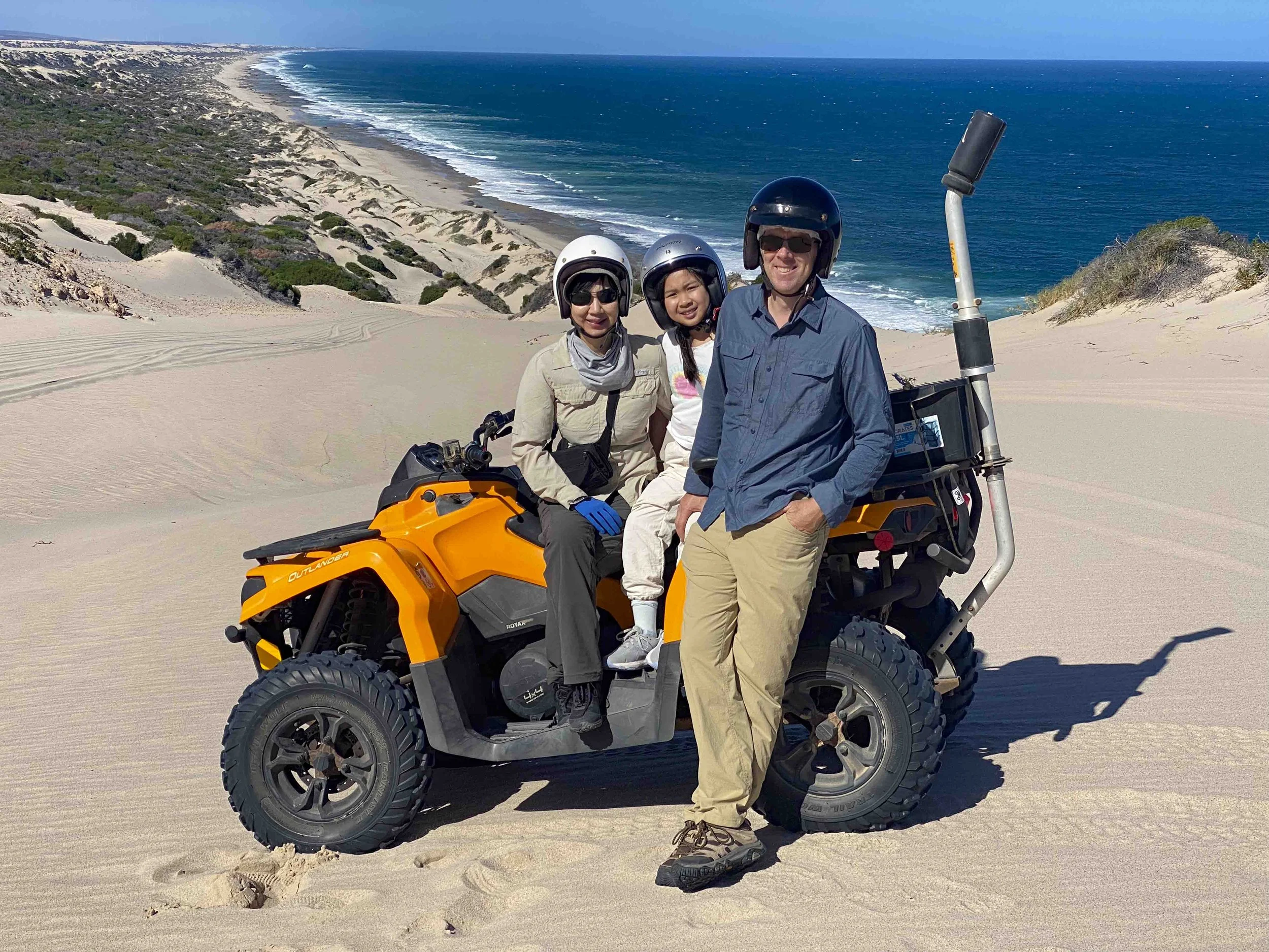
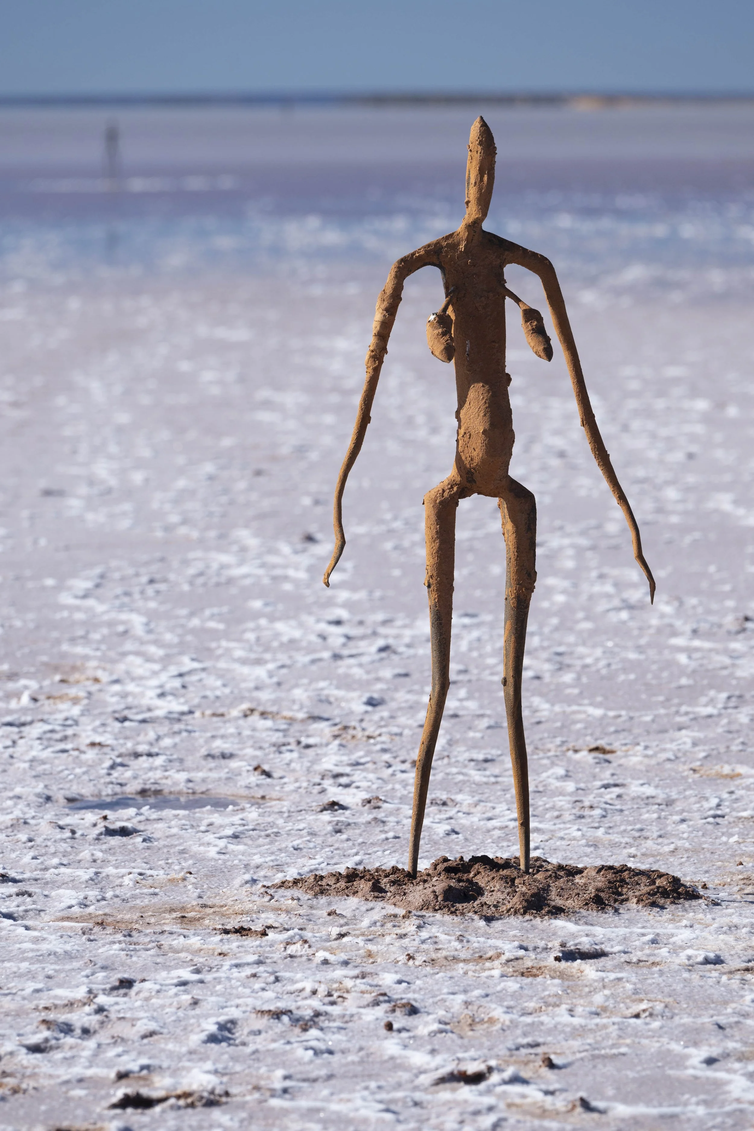
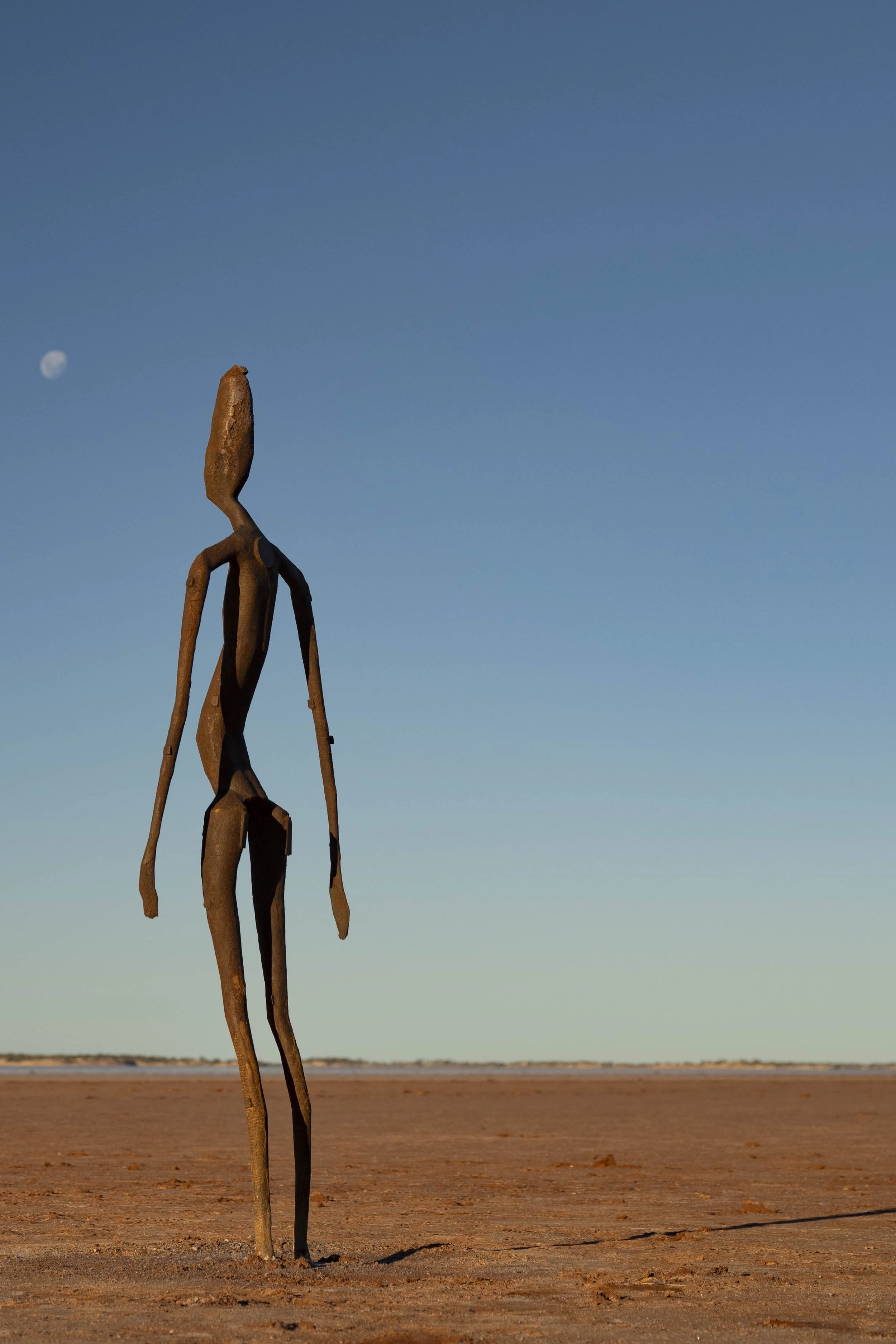
We were blessed with good weather in Esperance and Albany, and enjoyed visiting the beach and surrounding areas. When we left the southern coast, we headed inland to Lake Ballard via an overnight stop at Wave Rock. A lot of the photos here are from Lake Ballard, which is near Menzies (which in turn is about 130 kilometres north of Kalgoorlie). In 2003, the British sculptor Antony Gormley created 51 individual statues on the salt Lake Ballard. The figures are based on each of the people in the nearby town of Menzies. The participants posed naked for Antony Gormley to create their likenesses on the lake.
Esperance: Twilight Beach

Esperance: Twilight Beach
Esperance: Bike ride

Cape Le Grand National Park - Lucky Bay: Our caravan is the white van with the solar panels in the foeground
Cape Le Grand National Park - Lucky Bay: Lucky Bay is known for kangaroos coming down to the beach

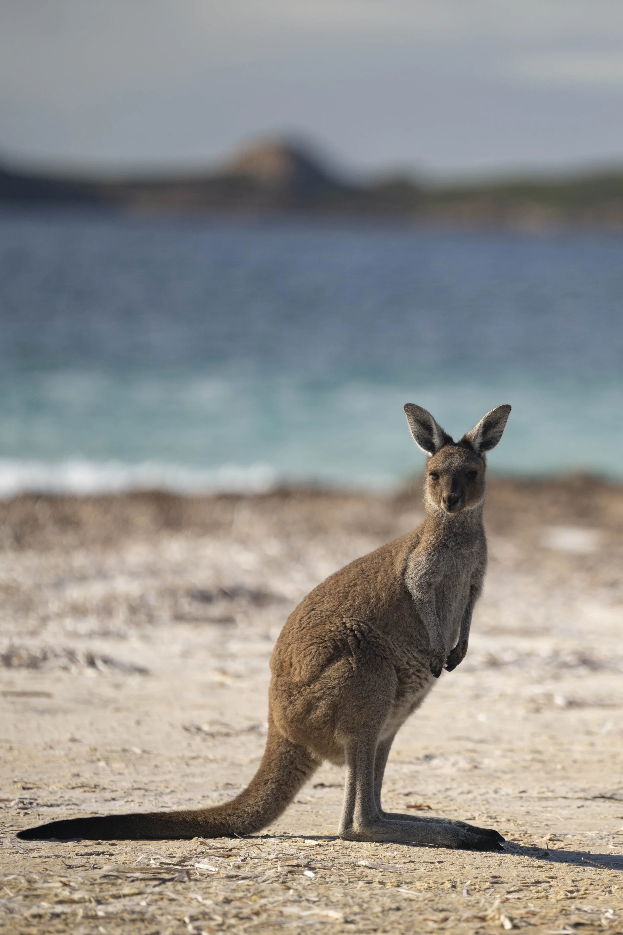
Cape Le Grand National Park - Lucky Bay: Lucky Bay is known for kangaroos coming down to the beach

Cape Le Grand National Park: Frenchman’s Peak

Cape Le Grand National Park - Lucky Bay

Cape Le Grand National Park: Hellfire Bay
Cape Le Grand National Park: Little Hellfire Bay

Cape Le Grand National Park: Hellfire Bay

Cape Le Grand National Park - Lucky Bay: Climbed up the rocks overlooking Lucky Bay before dawn for a mens chat with our campsite neighbour Wez

Porongurup National Park: Castle Rock walk

Porongurup National Park: Castle Rock walk

Porongurup National Park: Castle Rock walk

Porongurup National Park: Castle Rock walk

Porongurup National Park: Castle Rock walk

Porongurup National Park: Castle Rock walk

William Bay National Park: Greens Pool

William Bay National Park: Greens Pool

William Bay National Park: Greens Pool
William Bay National Park: Greens Pool

William Bay National Park: Greens Pool

Albany: Historic Whaling Station (Closed down in 1978)

Albany: Historic Whaling Station

Albany: Historic Whaling Station

Wave Rock

Wave Rock

Wave Rock

Wave Rock

Wave Rock

Lake Ballard: Site of Antony Gormley sculptures
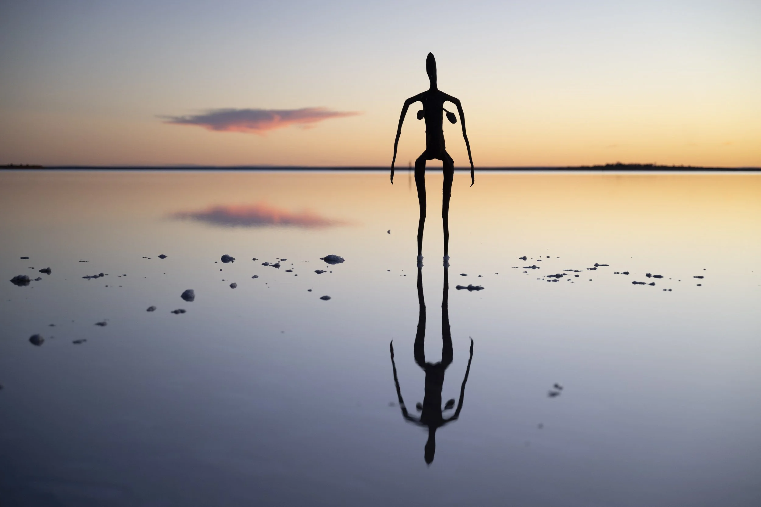
Lake Ballard: Antony Gormley sculptures
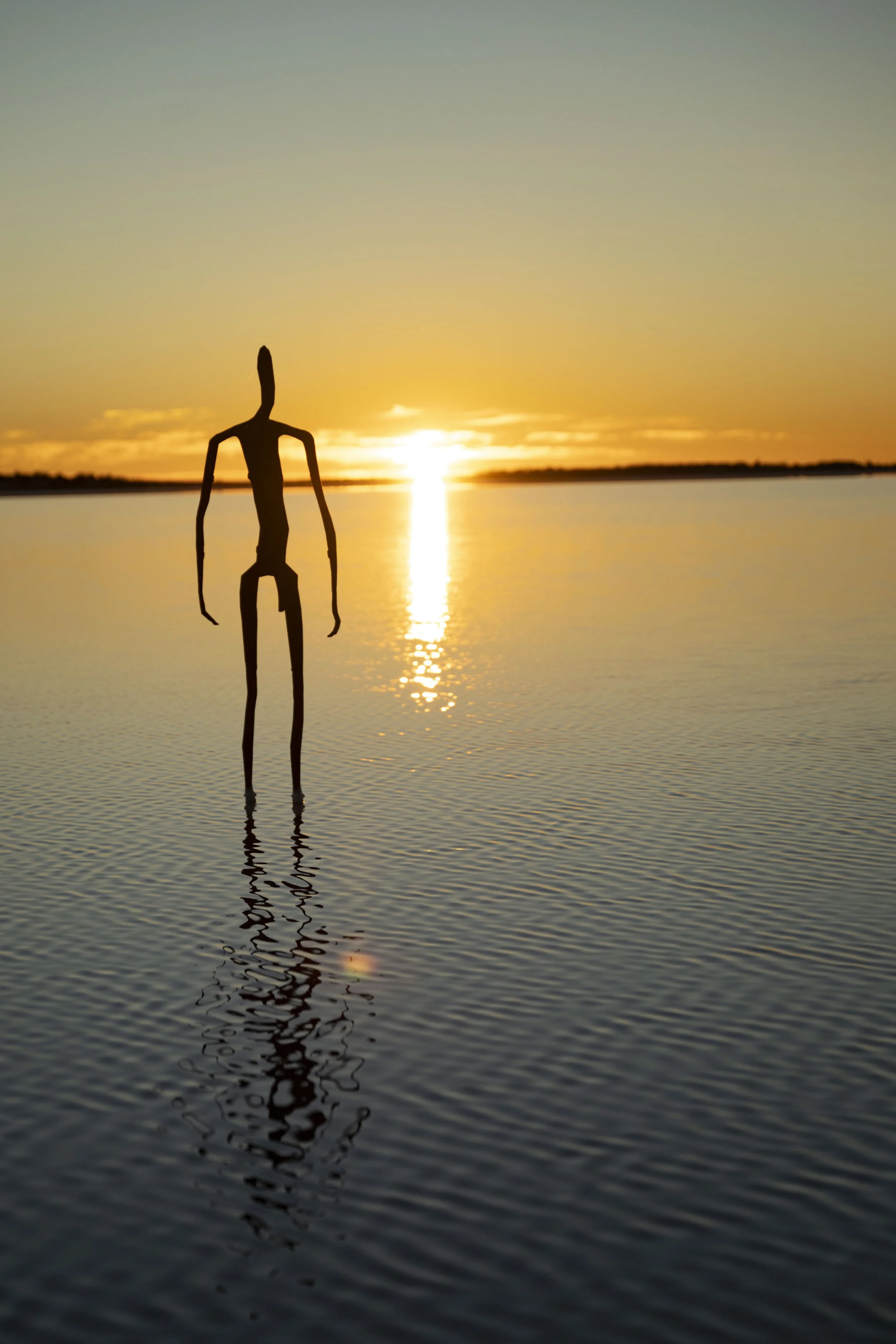
Lake Ballard: Antony Gormley sculptures

Lake Ballard: Antony Gormley sculptures

Lake Ballard: Antony Gormley sculptures

Lake Ballard: Antony Gormley sculptures

Lake Ballard: Antony Gormley sculptures
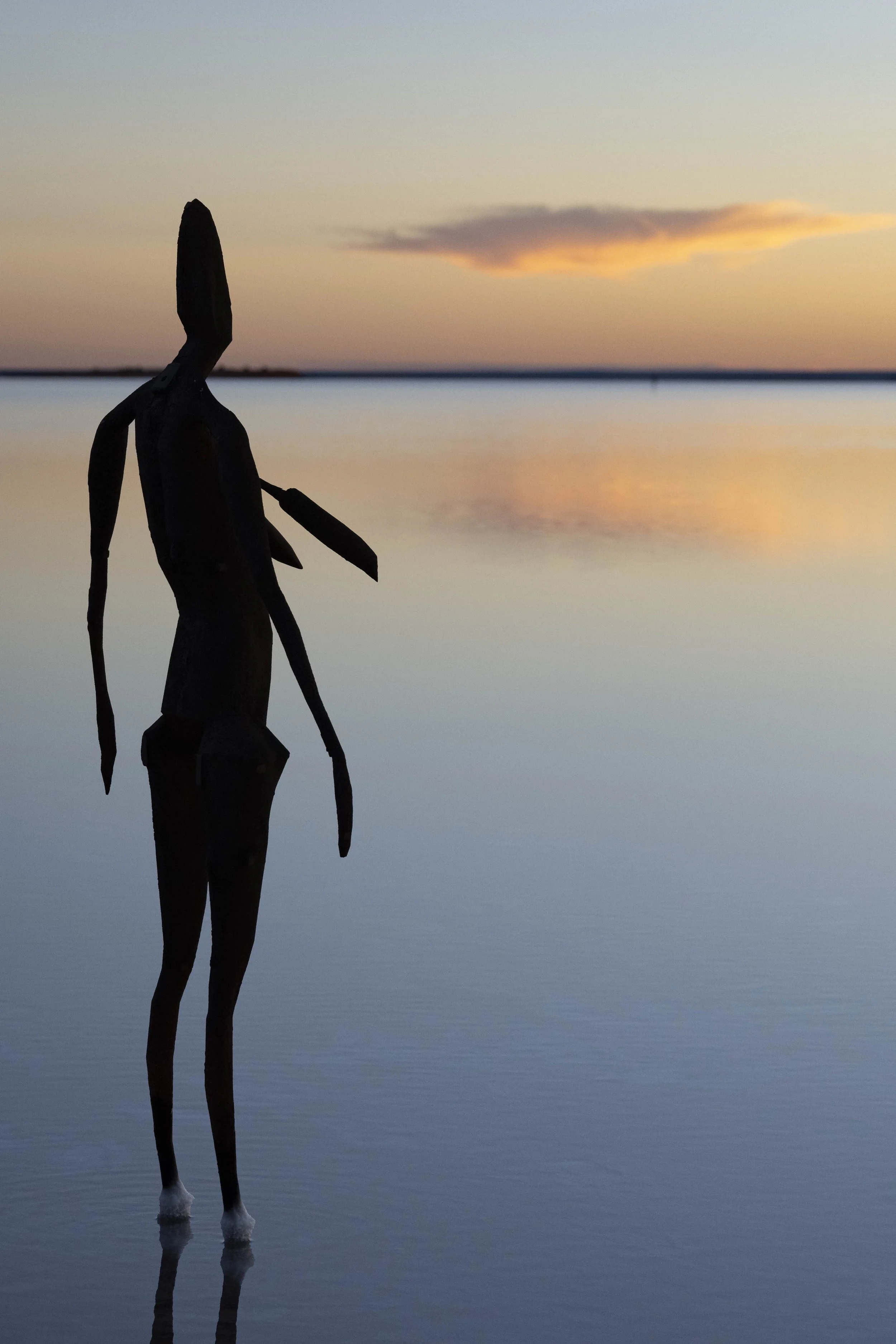
Lake Ballard: Antony Gormley sculptures

Lake Ballard: Antony Gormley sculptures
Lake Ballard: Antony Gormley sculptures

Lake Ballard: Antony Gormley sculptures
Lake Ballard: Antony Gormley sculptures

Lake Ballard: Antony Gormley sculptures

Lake Ballard: See the tracks of people walking between sculptures

Lake Ballard: Walking around viewing and taking photos of the sculptures

Lake Ballard: Walking around viewing and taking photos of the sculptures

Lake Ballard: Walking around viewing and taking photos of the sculptures

Lake Ballard: Footprints in the water

Lake Ballard: Looking back at my footsteps returning from taking photos
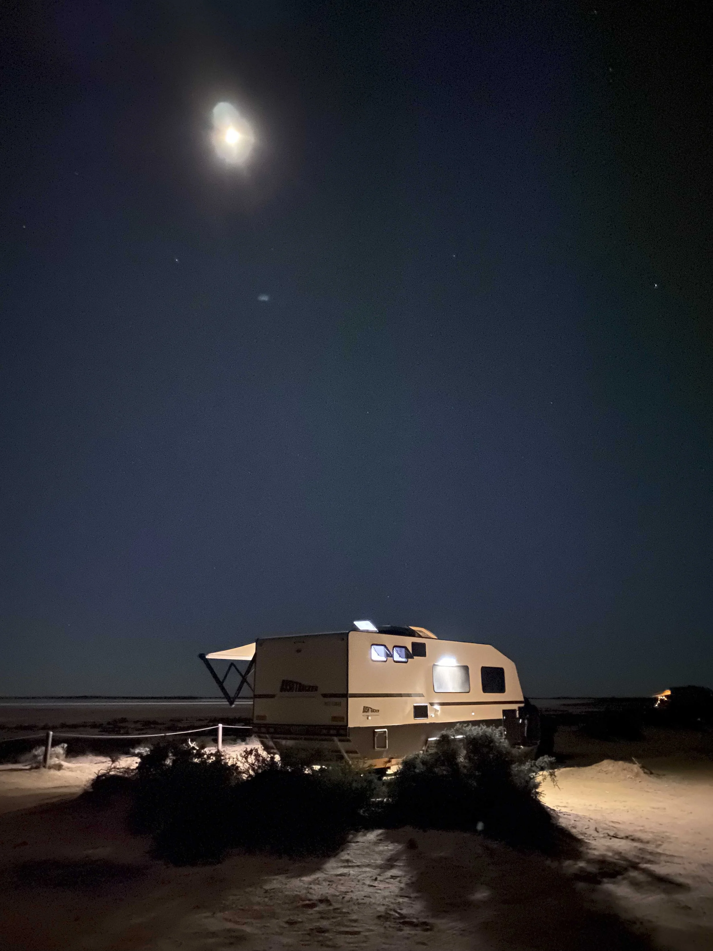
Lake Ballard: Our caravan next to the lake

Lake Ballard: The toilet… photo taken while accompanying Millie to the toilet at night

Gwalia: A ghost town north of Menzies

Gwalia: A ghost town north of Menzies

Gwalia: A ghost town north of Menzies

Gwalia: A ghost town north of Menzies
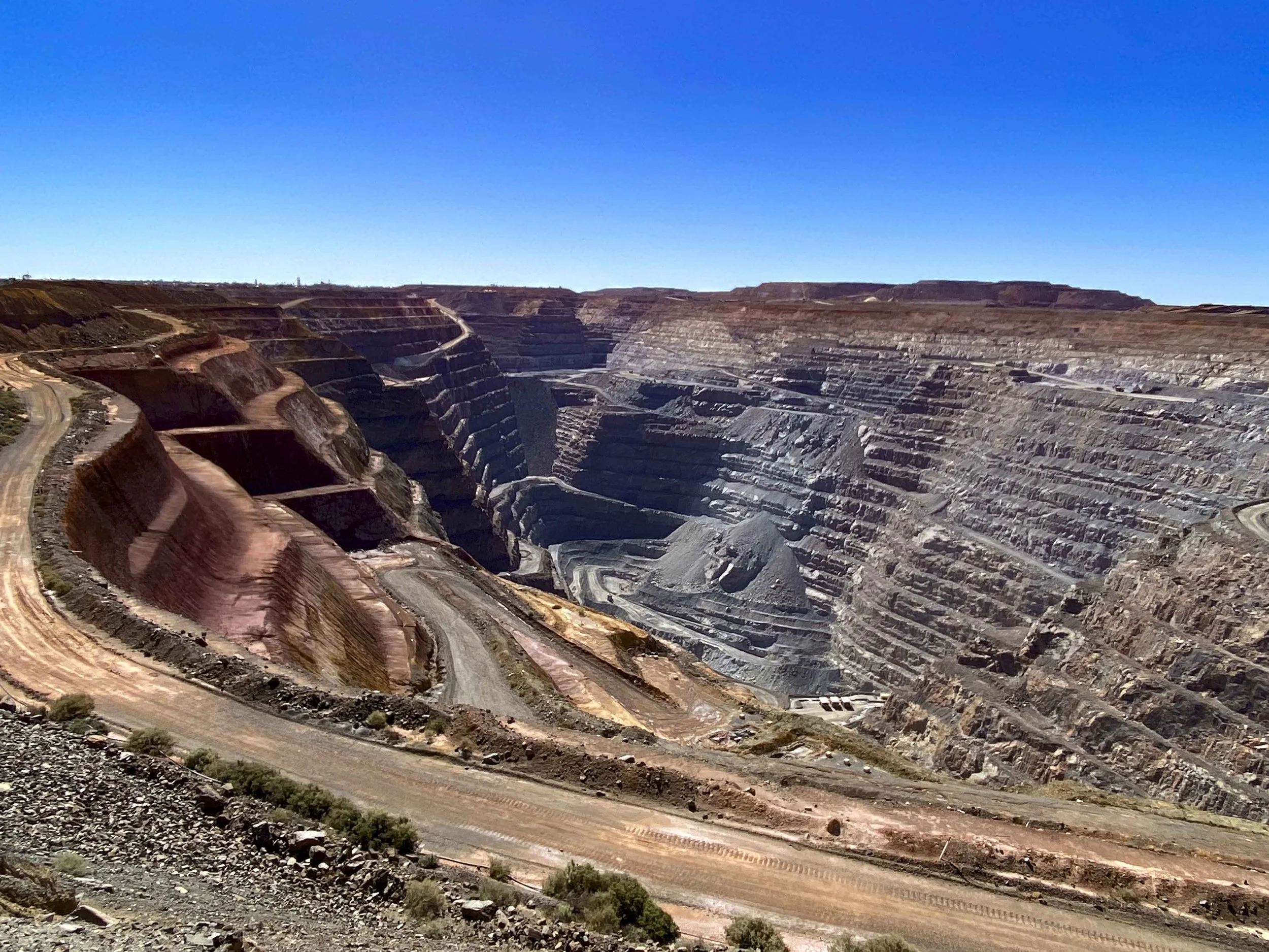
Kalgoorlie: The ‘super pit’
On the road: We were asked over the UHF to move off the road for this monster to pass by

Leinster: A small town owned by BHP

On the road: A nice mail box for a property

On the road: You need your fly net

On the road: Drone at work taking photos

On the road: We play a lot of games at night (here we are playing Wingspan)

1. Melbourne to Ceduna
We left home in late March and headed towards the heart of our travels which will be in Western Australia. On the way, we stopped in Sea Lake, Adelaide to see friends and Maralinga to tour the former British nuclear test site.

Leaving home (well, the caravan storage facility) to start our journey

Sea Lake Lake Tyrrell

Sea Lake: Lake Tyrrell
Sea Lake: Lake Tyrrell
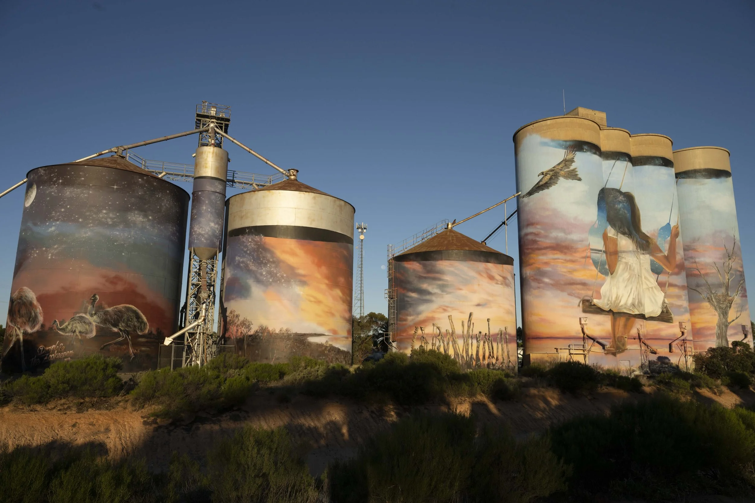
Sea Lake: Silo Art

Sea Lake: Street art
Adelaide: Max and Nanette… Two of my favourite people

Visiting Adrian and his family

Burra: House from cover of Midnight Oil’s album ‘Diesel and Dust’
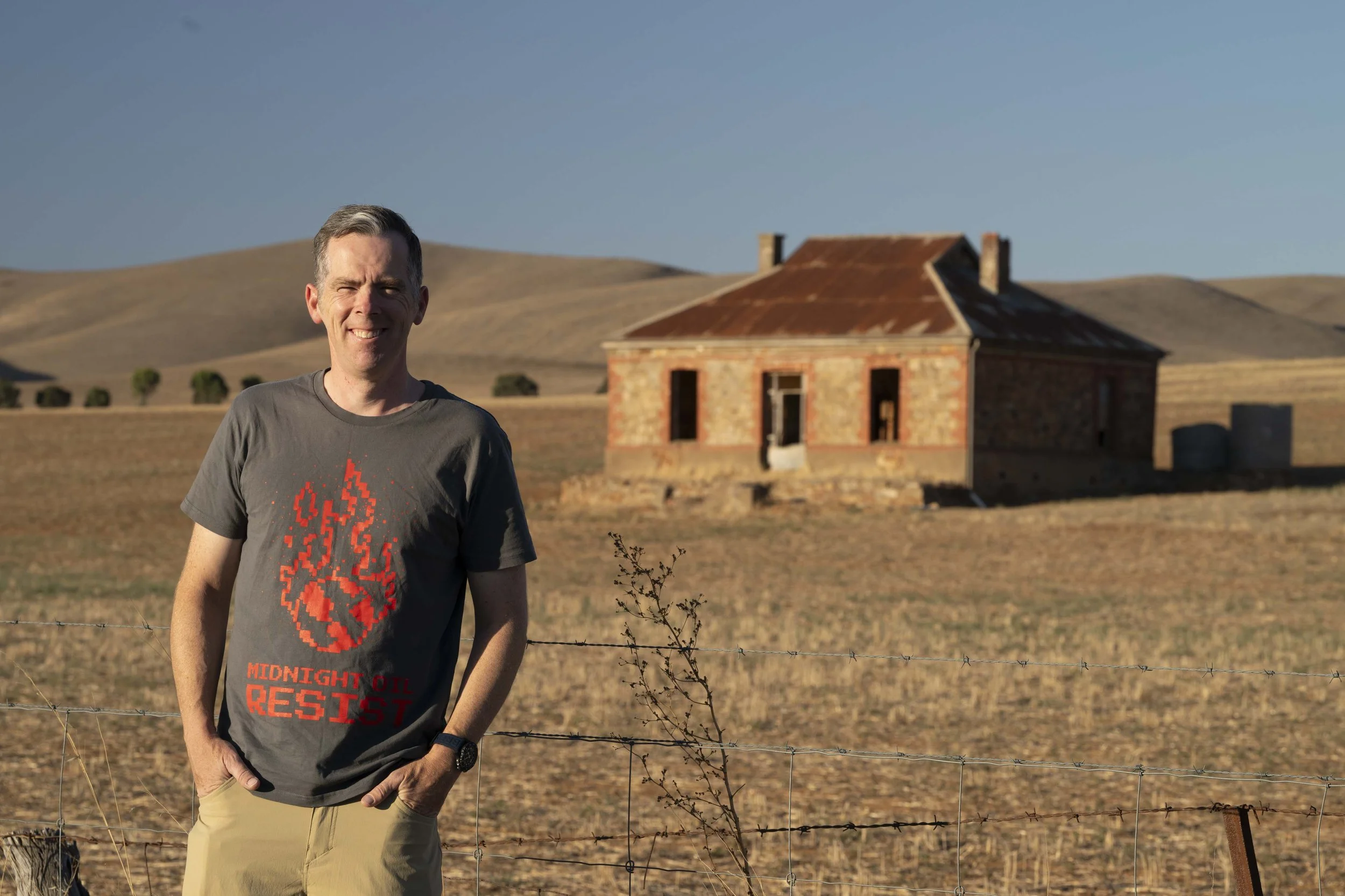
Burra: Wearing my t-shirt from Midnight Oil’s last tour

Driving past Lake MacDonnell

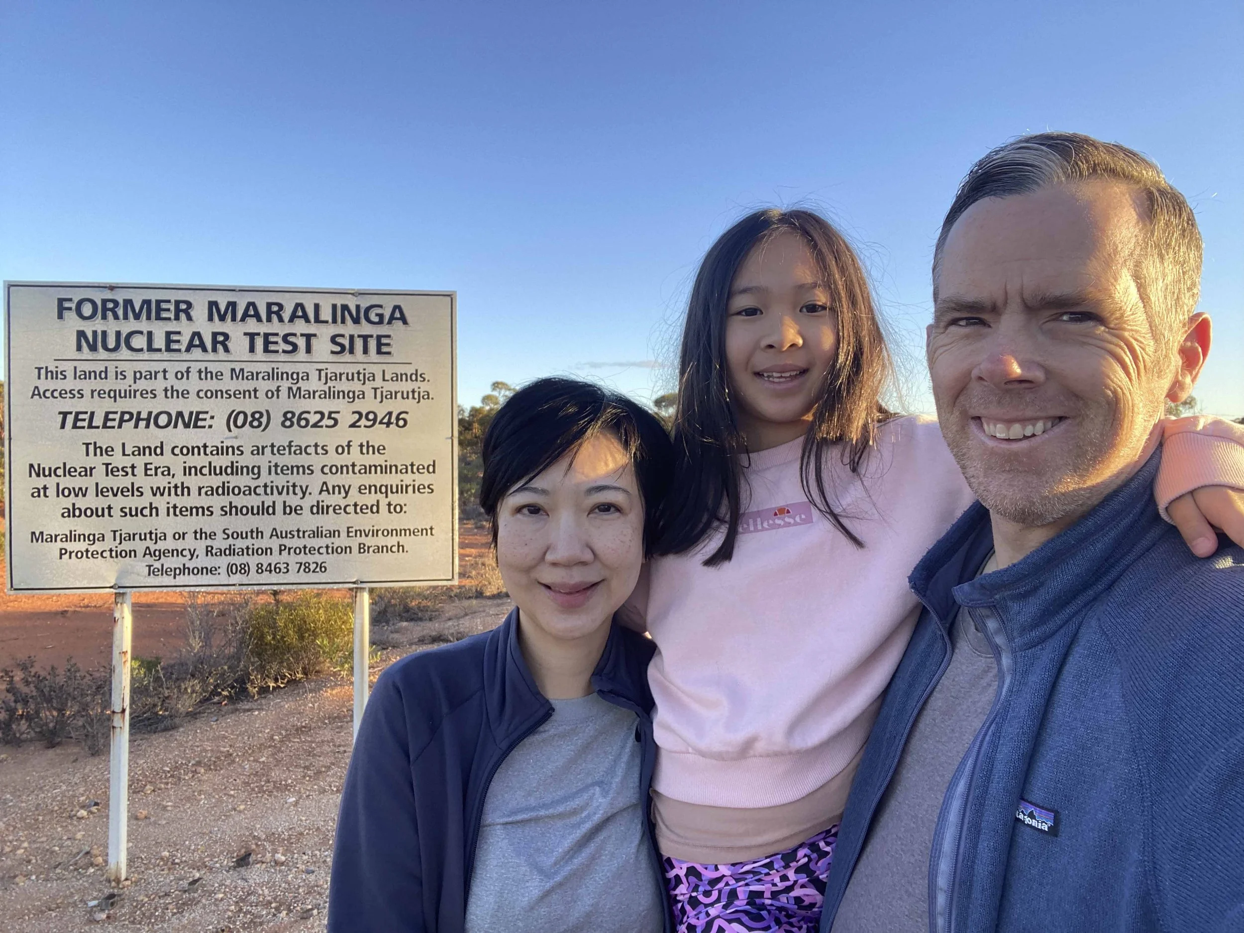
Driving off the Eyre Highway to Maralinga

Maralinga

Maralinga: Our guide, Rob, is a legend of Maralinga. He has been living and working on the land there for 50 years

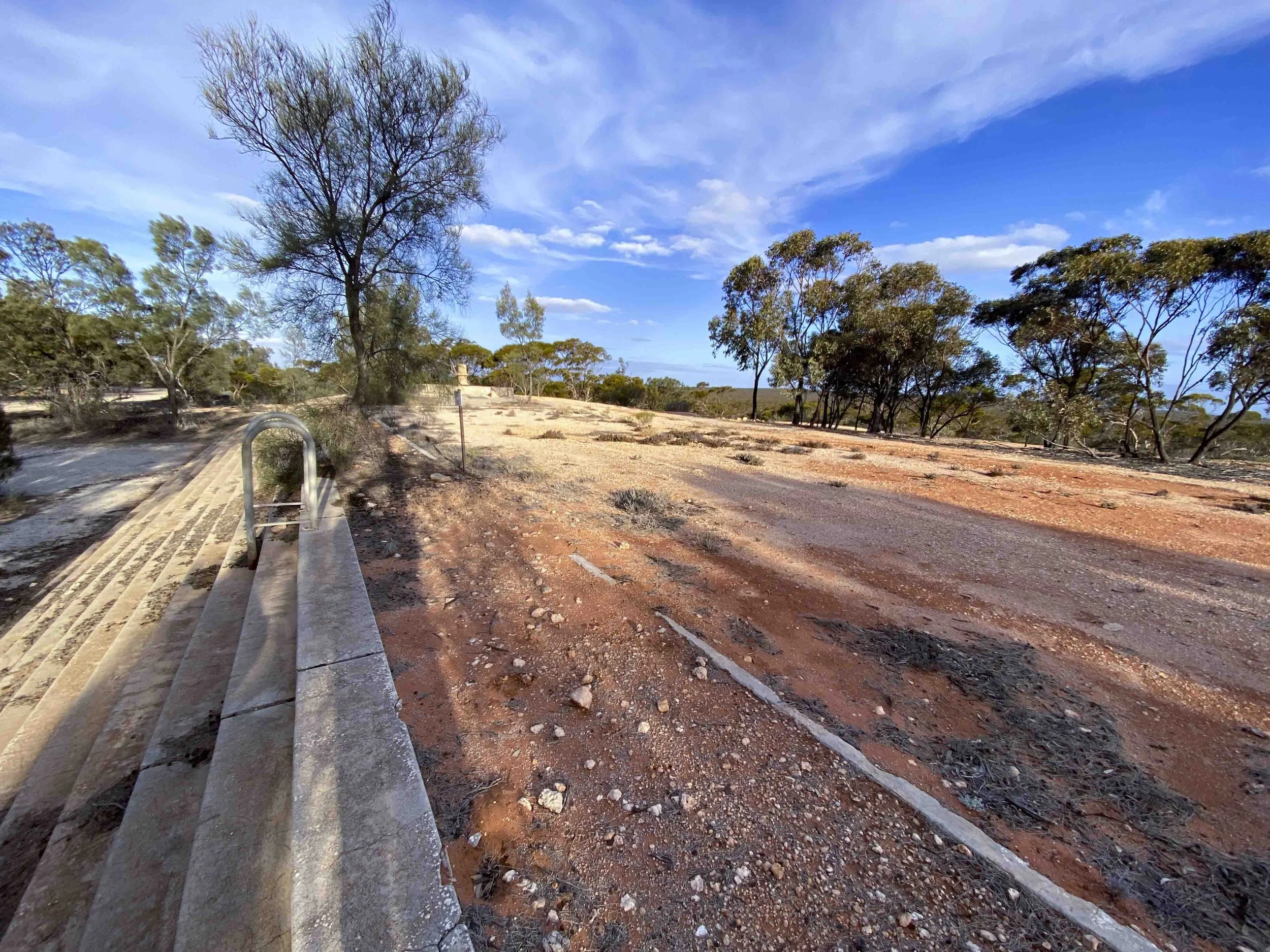
Maralinga: The airport. The runway is 5 metres deep concrete at the landing end

Maralinga: Battery powered lights which were lined along the runway
Maralinga village: The old swimming pool is now filled in with dirt

Maralinga village: The old tennis courts have gone to ruin
Maralinga: Remnants of the Australian military

Maralinga: Remnants of the Australian military

Maralinga: One of the many test sites

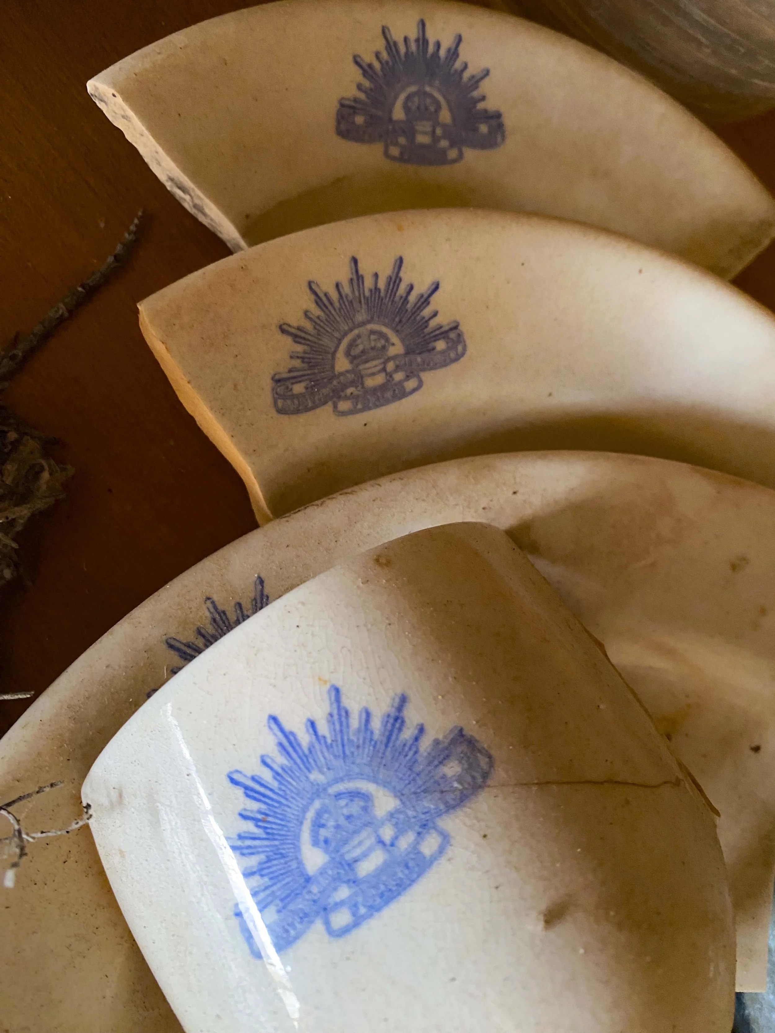
Maralinga: Metal boxes which contained measuring instruments.

Maralinga: The ground around the test sites has a lot of glass. The sand would be sucked up into the mushroom cloud and be deposited back to earth as glass

Maralinga: The ground around the test sites has a lot of glass. The sand would be sucked up into the mushroom cloud and be deposited back to earth as glass

Maralinga: The sign is a warning for indigenous people. In advance of the actual tests, the government sent out one man to cover 2,000 square kilometres of land in 10 days. The challenge was he could not speak any indigenous language. No one knows how many people were affected by the tests

Maralinga: To clean up the site, the government dug up the top layers of the earth and buried it

Maralinga: To clean up the site, the government dug up the top layers of the earth and buried it

Maralinga: The final test site prepared. Before it was used there was agreed a ban of above ground nuclear testing
Maralinga: Leaving Maralinga

Great Australian Bight: Bunda Cliffs

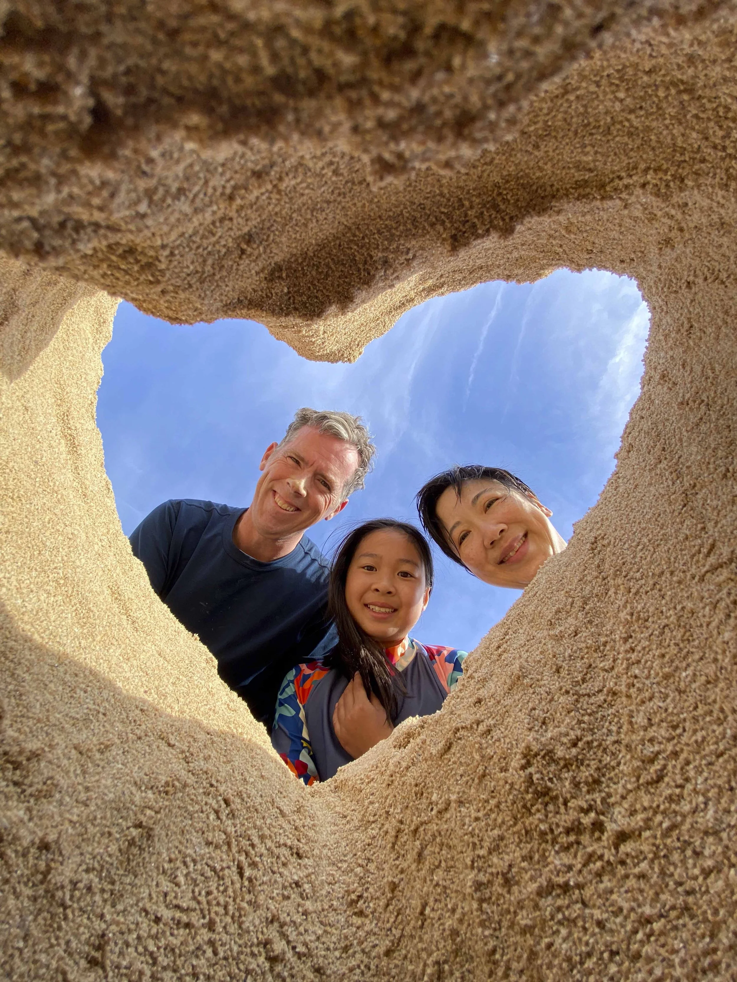
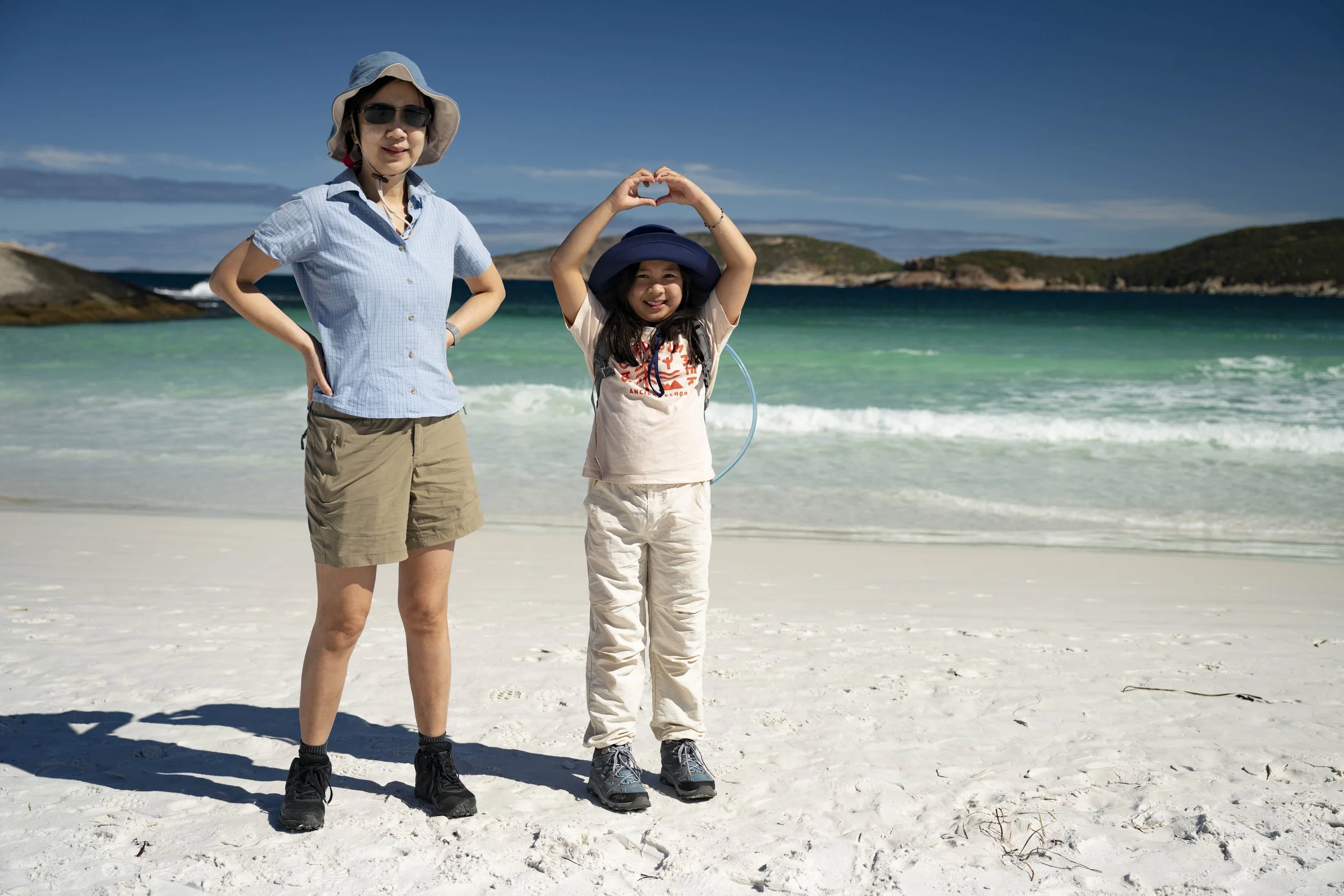
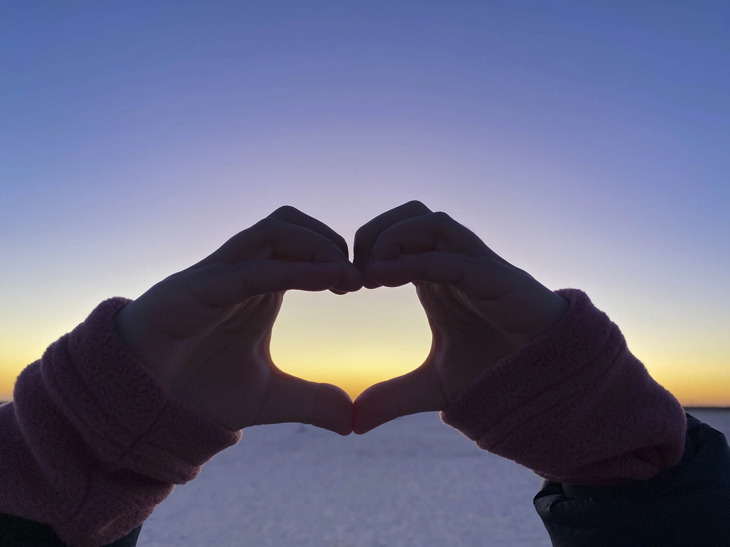
Great Australian Bight: Millie showing her ‘heart’ sign on the Bunda Cliffs

Great Australian Bight: Bunda Cliffs

Great Australian Bight: Bunda Cliffs

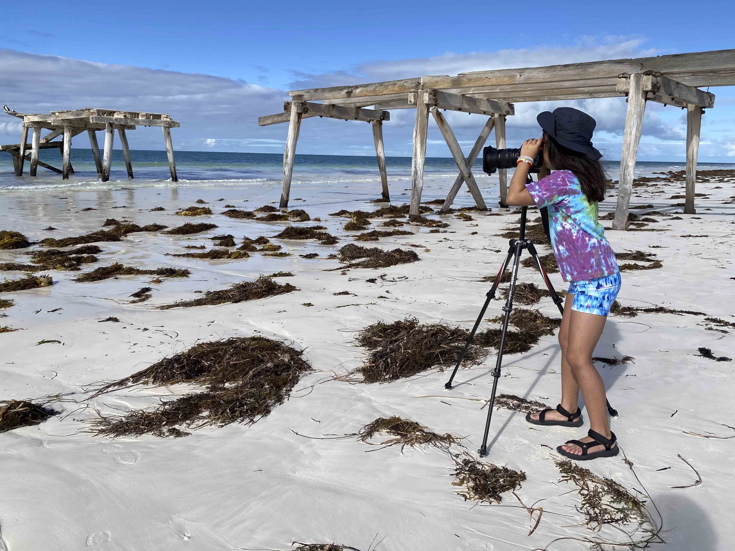
Eucla: The old jetty

Eucla: The old jetty

Eucla: The old jetty
Eucla: The old jetty

Eucla: The old telegraph station